September 19, 2012

Porto

As I was climbing out of St. Florent, a fighter jet swooshed overhead. That confirmed it—we did hear a sonic boom yesterday in Nonza!

I met the first raindrops twelve miles into the ride. I donned my rain jacket and did the only thing I could do: keep moving forward. I prefer not to ride in the rain, but today it was necessary.

When the rain became steady, I took shelter under a tree and pulled a shower cap over my helmet. As soon as I got back on the road, the cap slipped and flew off.

Water pooled in my shoes, as I had regrettably elected not to bring my shoe covers along. On the outskirts of L'Île-Rousse, I found an overhang for another break from the rain. I poured the water out of my shoes, squeezed what I could out of my socks, and ate the demi-baguette I had saved from breakfast.

Oddly, I did not feel miserable—cycling makes you wet, rain makes you wetter. If the weather injects "cold" into the equation, that adds up to a different result.

As the traffic in L'Île-Rousse inched along, I considered dismounting and walking on the sidewalk—it would have been faster. As I approached the far edge of town, traffic began to flow and I pulled aside to let the vehicles pass.

Then, just as I reached the end of town, I heard a voice ... the voice of a guardian angel, calling my name! Our host knew that I would call if I got into trouble; his wife was more pragmatic. She also knew to utter the magic words: that she had already sagged two of my friends forward. (No need for me to be stoic and ride the whole distance.) We loaded the bicycle into the car, and she boosted me forward 16 miles.

The Up Side: I was out of the rain for a while, and now ahead of the rest of the group.

The Down Side: I was transported forward along the flattest part of the route, through the only towns where I could have found lunch.

The rain let up, and I soon entered a wide, beautiful valley. The Corsican countryside is a very quiet place. Miles later, when I reached the summit of the pass, I paused for some photos. Just as I prepared to descend, the first riders from our group came around the bend.

Continuing ahead of them was a lucky move; a few miles down the road, the silence was suddenly broken. Pffft...BAM! Fortunately, I was not on a curve. Fortunately, I was not moving all that fast. I came safely to a stop; my front tire was flat. I edged it off the rim and started searching for the cause; my pit crew caught up to me in no time.
Did you find the hole?
Where's your tube?
Forget the pump, here's a CO2 cartridge.
The tube had poked through a slice in the tire and blown out; I had clipped a rock miles earlier but thought no harm had been done. I supplied a tire boot and we were soon on our way.

Opinions on the repair ran the gamut from "you need a new tire" to "looks completely rideable, don't worry about it." Now that we were heading downhill, I backed off on aggressive cornering, and speed. I lagged behind the group, but arrived in town to find them backtracking in search of our hotel.

For the day: 4900 ft of climbing and 69 miles (16 in the rain). No regrets about the additional 16 (rainy) miles I skipped.

September 18, 2012

Nonza

For most of us, it was time for a day off the bike. We decided to return to the town of Nonza, which we had seen briefly on yesterday's journey up the coast.

We visited the historic Tower of Nonza and the church of Sainte-Julie before descending the ancient stone steps and rocky path to the beach. Deceived by the distance, we had expected to find a black sand beach. The town is perched on a cliff more than 300 feet above sea level; the beach is a wide expanse of smooth black stones.

The road traversing the hills was fresh in our minds from yesterday's ride; from the beach, it looked quite daunting. Yes, we climbed that! We celebrated with a picnic lunch and a dip in the Mediterranean, relishing the chance to relax.

Tomorrow morning we would move on from St. Florent to the town that would serve as our next home base; tonight there would be much plotting and planning. I had agreed to accept a ride forward (over the first climb), to avoid falling too far behind the rest of the group. During a quiet discussion at dinner, I recognized the need to abandon this plan. Although we now had two cars, only one carried bikes. Unlike some of my fellow riders, I was in good health—merely slow. The rack, and the cars, would already be full.

Our route would take us into the mountains, and the weather forecast showed a 20% chance of thundershowers.

A long, challenging day on the bicycle loomed large.

September 17, 2012

Pino

I could have asked our host to intervene with the hotel staff; instead, I asked Google Translate.
Le lavabo de ma chambre est bouché.
My accent must have been passable, for they not only understood me—they assumed I could understand them. I imagine they apologized, and context helped me recognize that they needed my room number. [Of course.] Luckily, it was a number I knew: onze. Best of all, when I returned to my room at the end of the day, my sink was no longer clogged!

The plan for today was to ride north along the west coast to Baragogna, cut across the island and ride south along the east coast to Santa Severa, then head back to the west coast to return to St. Florent.

Our group of riders was shrinking day by day; two guys were sick, one with a frighteningly severe case of (suspected) food poisoning that would ultimately require an antibiotic.

When we reached the town of Pino, we had already traveled 30 miles. The planned loop would add another 30. Reality set in for two of us: we were not up for a 90-mile day, without even factoring in the additional climbing this loop would entail. We declared victory over lunch and headed south. Would the other four riders get back in time for dinner at eight?

The rugged coastline reminded me of the views along our own Pacific Coast Highway, and I was more than content to gaze out at the Mediterranean for a couple of hours as I returned to St. Florent.

The roads are often narrow, with tight blind curves hugging the cliffs. As a rule, I found motorists had the skills to drive safely and were also courteous to cyclists. Twice, I heard a driver accelerating to pass me when I could see an oncoming car; in both cases, the driver understood and immediately backed off when I thrust out my left arm to hold him off.

Along the way, I stopped at a boulanger et patisserie for the treat I had earned by climbing some 4200 feet over 59 miles. Our four intrepid explorers climbed more than 7,000 feet over 93 miles, and they did make it back in time for dinner.

I made it back in time for two scoops of ice cream before dinner (praline and Nutella).

September 16, 2012

St. Florent

Shortly after dawn, the ferry docked at Bastia, on the northeastern shore of Corsica. Geared up for the day's ride, we pedaled off the ship and found breakfast at an open-air café on the edge of a park. Workers were busy setting up canopies for a sports festival; cycling did not seem to be represented.

We had ample time to reach our destination on the other side of the island, our hotel in St. Florent. Once we were on the route, I relaxed and slipped behind the group to enjoy the spectacular views. Armed with data (a paper map, and Google Maps on my GPS-savvy smartphone), I was not concerned about getting lost.

I caught up with the group at a roundabout, where they had stopped at a salon de thé. I chose a juicy pear galette, and surprised myself by requesting une serviette. With my pathetically limited vocabulary, how did I remember that word?

At this crossroads, the group was divided. Some wished to follow the planned route, along D62; others wanted to cut it short, following the more direct D82. One rider pointed authoritatively toward another road (D5), saying that was the way to follow the long route. A glance at the map showed a turn from D5 onto D62.

I exited the roundabout straight onto D62. Thinking I had mistakenly followed the "direct route" riders, I turned back and chose D5. I should have (but did not) study my map.

Merrily I rolled along, stopping to admire the distinctive 12th-century Église Saint-Michel in Murato (currently under restoration). Had I studied my map, I would have turned here to return to D62.

I did not study my map.

D5 followed the ridge line, heading ever-so-gently toward a summit. The wide vistas were stunning. I paused to let a small herd of shaggy sheep pass, as they headed for an opening in the fence along the road. The large and vocal males were in charge; the rest trotted dutifully along. Unlike me, they knew where they were going.

At the top, I found an elderly couple enjoying a picnic—complete with table and chairs. They were eager to offer me some water, and happily snapped a photo of me when I asked. They heralded the descent ahead; I replied that I loved descents.

The road on the other side of the summit was a bit steeper, and in poor condition; I descended cautiously. I passed a cluster of houses at a crossroads, continued along D5, and (finally) thought it might be a good idea to look at my map.

At this point, I was about seven miles off-course. And downhill, having summited at the Col de Bigorno.

Uh-oh.

I returned to the summit and retraced my path to Murato. On the climb, some passing motorcyclists saluted me with a thumbs-up. I was not concerned about being alone, or being lost; but I was concerned that the rest of the group would fret about my whereabouts, since I was now lagging more than an hour behind any expected arrival time.

According to my excellent IGN map (No. 175), I was looking for D162. Back at the church, I was convinced I was standing at the intersection—but there were no signs.

There was, however, a middle-aged French couple picnicking (you guessed it, with table and chairs) under a tree. "Bonjour, excusez-moi," I approached them. I pointed to the map, and to the various roads. "Ici?" They confirmed my hunch. "Merci, merci beaucoup!"

Having learned my lesson, at each subsequent intersection I studied the map for good measure. I rolled into St. Florent before anyone got seriously worried. My route covered about 52 miles, with some 4,720 feet of climbing.

A day to practice orienteering, to be forced to communicate in French (however primitively), to be self-reliant.

I am glad I got lost.

September 15, 2012

Aix-en-Provence

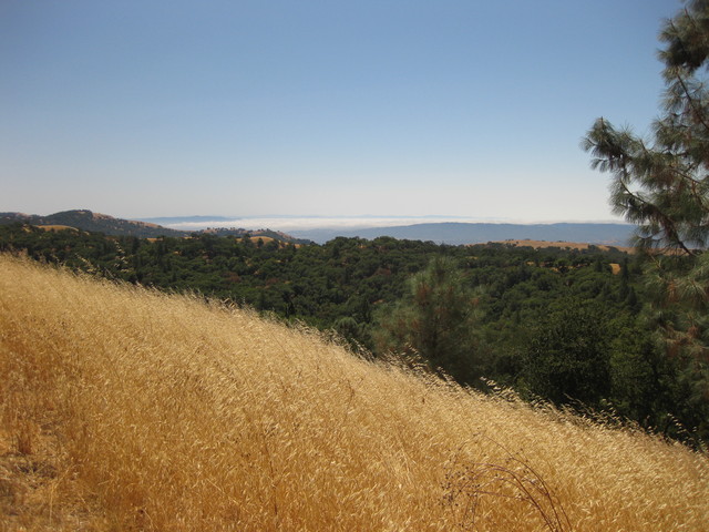
Our journey today would take us from the heart of Provence to the harbor in Marseille, where we would board the ship to ferry us to our next destination: Corsica.

For this there was a plan, and the plan was this: By the time we load the luggage into the trailer and get going, it will be 9:30 or 10:00. We will bike to Aix-en-Provence, where we will catch the train to Marseille. There is no reason to hurry; it is only 40 miles, and trains run all day. We can take four hours to get to Gare D'Aix-en-Provence. Pack a small bag for the overnight ferry; we will not have access to our luggage.

Plan? Was there a plan?

Suddenly, everyone rushes to load their luggage before breakfast. After scarfing down the usual croissants and yogurt, everyone rushes away from the table. Expecting to carry my small bag all day, I learn that it should go into the car. Now. The car is ready to leave. Away it goes, taking with it my passport, money, documents for the ferry. Anxiety is mounting.

Next we rush to get on the road, and we are on our way before 9:00—earlier than we leave on a normal day. The group takes off at a brisk pace; I am rolling at 16-17 mph and they are pulling away from me. We need to stay together; we are taking a fairly direct route to Aix-en-Provence, but it strings together a series of tiny roads and bike paths that are loaded into the lead rider's GPS.

I appreciate the anxiety about not missing our transit connections. But I am working so hard to keep up I can't even grab a sip of water.

I realize that I should probably give up the idea of future trips with this group. It is not fair to expect them to wait for me if I can't match their pace, and struggling to keep up is not fun for me. I wanted a cycling holiday, not a stage race.

On the narrow exit from a roundabout, the group heads onto an adjacent path. In my haste to follow, my front wheel catches the side of the low curb and I go down. Of course, the main impact hits the same spot that took the hit two weeks ago. The bandage on the still-raw spot on my right elbow (mostly) contains the bleeding from this fresh impact, and now I have a skinned knee.

A concerned motorist stops. "Ça va," I wave him off.

We make it to the train station in 3.5 hours. And I am really not happy.

Bored with sitting around after lunch but feeling too dejected to do any real exploring, I head off to La Poste for stamps.

Returning to the café, across the street from the train station, I find only two guys waiting for me. "Hurry, we have to catch the 14:30 train!" [It turns out they don't leave every half hour, and the next train will leave at 16:00.] But it's already 14:31?! "No, it arrives at 14:30, it leaves at 14:50."

We dash onto the train, then move forward to find the right car (with hooks to hang our bikes).

The ferry terminal is less than a mile from the train station in Marseille. Piece of cake?

Marseille is the second-largest city in France, and the harbor is a major international port. in the best of circumstances, this gritty neighborhood would not be a place for cyclists. At present, a long section of the road is torn up for construction, reducing access to one-way traffic.

We arrive at the specified gate; they direct us to continue down the road to a passenger terminal. With our bicycles, we are not foot passengers; they send us back to the original gate. And so it goes, a group of semi-frantic, non-French-speaking cyclists, bouncing from gate to gate and mixing it up with port traffic in search of the right gate to board our ferry.

At last, a kind security guard drives slowly ahead of us to lead us to the right place—which involves briefly entering (and immediately exiting) the freeway.

We arrive at the ferry with 1.5 hours to spare. The 16:00 train would have spelled doom. Everyone is completely stressed out.

The ferry is more like a cruise ship. We follow the motorcycles, riding our bicycles up the ramp. Locked together, a crew member ropes them to the wall.

We proceed to our cabins to shower and change our clothes for dinner.

In the morning, we will wake up in sight of Corsica.

September 14, 2012

Mont Ventoux

A few hardy souls in our group had tackled Mont Ventoux on Wednesday; although they escaped serious rain, they rode in the clouds and saw nothing at the summit.

If the rest of us were to ride this legendary climb, today was the day. After yesterday's winds in the valley, we were prepared to be denied. The wind speeds on Ventoux reportedly exceed 56 mph on 240 days of the year.

Our hosts delivered us to Bédoin; the pass was open. I settled in for a long ascent. It was not particularly windy ... at the bottom.

Some Dutch cyclists on mountain bikes gave me an enthusiastic thumbs up as they passed. There are always cyclists on this route, and I received plenty of encouragement from fellow riders, their support vehicles, and everyone else.
Bonjour!
Allez, allez, allez!
Along the way, pedestals indicate the distance remaining to the summit and the average gradient over the next kilometer. "Reminiscent of gravestones," I thought, and then pushed that out of my mind. These road markers are common in France, absent the gradient details.

Taking a break in the last few kilometers, I was passed by an older Frenchman whose wife was leapfrogging him in their car. After my brief rest, I soon passed him effortlessly. Despite my limited vocabulary, I got the gist of his reaction: Not good for his morale!

I passed a weary couple who were walking their bikes. "Fini," they called out.

I paused by the memorial to Tom Simpson; 45 years later, people are still leaving mementos.

About one kilometer from the top, I rounded a bend and met the full force of the wind. On the barren upper mountain, it had been blowing steadily at 20+ mph, with gusts in excess of 50 mph. Here, I was blown to a complete stop. Stunned, I unclipped from my pedals and gripped the brakes to avoid sailing backward.

The only possible way forward was to walk, and that alone was a challenge. Approaching my French friend's car, I shook my head to express my amazement with the wind. "Col de Tempêtes," his wife explained, pointing to the sign on the stone wall.

After about a tenth of a mile, the mountain offered some shelter from the gale and I remounted the bicycle. The final few meters to the top are steep and chaotic: pedestrians, cyclists, and vehicles moving in both directions along a narrow driveway. To be safe, I dismounted and walked up.

I expected to reach the summit in three hours; excluding breaks, I exceeded that by four minutes, penalized by walking into the wind. From our starting point, I recorded 13.3 miles and some 5,180 feet of climbing.

I descended with abundant care, reaching town in about 38 minutes. Tucked into an aggressively aerodynamic position on the bike, I was mightily buffeted by the gale near the top but managed to compensate for the wobble it induced.

The fastest pro rider has summited Le Géant de Provence in less than 56 minutes; that is, a mere 18 minutes longer than it took me to descend it. Just to keep things in perspective.

September 13, 2012

Les Ocres en Vélo

Allons-y!

The rest of the group has been here for a few days and tell me that I have brought sunshine and cooler weather.

Our plan for the day was to follow one of the local cycling circuits, Les Ocres en Vélo, in the clockwise direction. We collected some brochures at the tourist office in Cavaillon yesterday; if you are planning a visit here, you will find the same helpful information at the Vélo Loisir en Luberon website.

Riding from the hotel lengthened our loop. Not long after we merged with the published route, we began to pass other (American) cyclotourists (Backroads, Trek Travel). Think of our style as akin to a loosely organized club ride; their ambience is more like an orchestrated cycling event. We have the freedom to stray and get lost; they are shadowed by support vehicles that keep them on track.

We started in the heart of lavender (and wine) country; the fields must be spectacular in the spring, in full bloom. Continuing on to Roussillon, we admired the ochre cliffs, explored the town, and studied the distant contours of Mont Ventoux across the wide valley.

Diverting from the official route onto some real backroads, we headed down a rutted dirt and gravel track before turning back to find lunch in Rustrel. Facing winds blowing steadily at 25 mph, with stronger gusts, we opted for a more direct route back to Coustellet—a route that included cycling over the Pont Julien, a Roman bridge dating back to 3 BC. That is not a typo: the bridge is more than 2,000 years old.

Having climbed some 2,445 feet over 51 miles, a few of us headed straight for La Vie en Rose—a pink palace of a patisserie, improbably situated in the local strip mall.

September 12, 2012

Coustellet

Reunited with my luggage, I was ready for my next challenge: acquiring a French SIM card for my smartphone, and activating data service. The problem with knowing even a little bit of a foreign language is that you may have enough words to ask a question, but not to understand the answer. When the vocabulary is specialized ... well, good luck with that.

Having done my homework in advance, I visited a local Orange Boutique and muddled through the process. I needed to reassure them that the phone would work (unlocked, at the right frequency); they must have seen their fair share of unhappy foreign customers.

I was anxious about the French reputation for being rude to those who do not speak the language, or who do not speak it well. I was relieved (and pleased) to find little evidence of that. The Orange staff were patient and helpful. And, when I understood that my service was prepaid for un mois, they were clearly delighted.

The final challenge of the day: Reassemble the bicycle. For me, pulling the bike apart is easier than setting it up again. With the skies threatening (and delivering) some rain, I was not sorry to give up the chance for an afternoon ride.

Bonjour, Provence!

September 10, 2012

Le Grand Départ

Bike disassembled and packed, bags packed ... less than 24 hours after returning home from the Best Buddies century, I was on my way to the airport. Destination: France.

I caught a shuttle to the Millbrae BART station. After hauling everything up and down two elevators to cross platforms, I learned that there was no direct service to SFO. To reach the airport, one must board a northbound train to the next station, then transfer to a southbound train headed for the airport.

You can see the airport from here. Bay Area Rapid Transit? Not.

I hailed a cab.

Later the next day, I was surprised to see my oversized bike bag pop off the conveyor belt onto the luggage carousel in Marseille. I was equally surprised not to see my tiny suitcase, despite both bags having been tagged with red "priority" labels by the airline.

My decision to spend the first night near the airport had been a fortuitous one.

The hotel took good care of me, from the brilliant design of the air conditioner in my room to the pain au chocolat for breakfast.

September 8, 2012

The Coast is Clear

Four out of five runs down the coast have been foggy. For my sixth return to the Best Buddies Hearst Castle Challenge, my reward was a crystal-blue-sky day. Oh, the splendor of the central California coast!

Strategically positioned at the front of the pack, I did my best to hang with the group for as long as I possibly could. On this "neutral" roll-out from Carmel Valley to the coast, I averaged slightly over 19 mph for the first 10 miles. Surprise!

Ostensibly, I am a member of a small team of co-workers for this event; we managed to assemble for a group photo at the first rest stop before they sped south. I am in less of a hurry to get to the finish line, especially on such a picture-perfect day. [Not that I could match their pace.]

Shortly after the second rest stop, a few large birds circled overhead. Turkey vultures are a common sight, though usually not along this stretch of the coast. There was something different about these birds. After I spotted a photographer with a very big lens, a fellow cyclist excitedly confirmed my hunch: California Condors!

This being my first ride since last week's big wipe out, I was feeling a little tentative on the bike. I was not trying for a personal best this year, but still managed a faster pace than last year's jet-lagged excursion.

Nonetheless, the late climbs seemed particularly interminable this year. For the first time, there were no cyclists walking up. At the third rest stop, SAG vehicles were running at capacity: many riders know what is ahead and are not shy about hitching a ride over the top.

At the finish line, an announcer provides a running commentary to entertain the crowd. Straggling solo across the line, he nabbed me. "Here is one of our top fund-raisers!" he called out, thrusting a microphone in front of me.
What time did you leave? [With everyone else.]
Do you know what time it is now?
"Yes, I have been sitting on the saddle for 7 hours and 24 minutes," I explained.

I scored a much-needed massage this year, but was still feeling stressed by the time I got cleaned up for the evening. For the slow, there is no margin for down time: head straight to the barbecue and concert (Blues Traveler, this year). Unexpectedly, I ran into a friend who apologized for not donating this year. "Get a picture with one of those hunky lifeguards at the pool," she teased, "and I'll double my donation next year."

Thanks to the generous friends who supported my fund-raising, I enjoyed the special post-barbecue party again this year. For some, this is an opportunity to mix with celebrities and movers-and-shakers. For me, it is a glorious night under the stars in a legendary pool. I chatted with an amiable fellow swimmer/cyclist who recognized me from the road. He introduced himself, modestly responding that he worked for the legislature when I asked.

Later, I looked him up. Legislature, indeed: a State Senator. Movers and shakers, in the Neptune Pool. And me.

September 1, 2012

Slip Slidin' Away

Warning: loose gravel.

There is always loose gravel on this road, of the natural variety (shed from the hillside). The signs were posted because Mt. Hamilton Road has been freshly chip-sealed, from mile marker 9.0 to a level just above the Twin Gates trailhead (Joseph Grant County Park). The surface is rough, but there was scant loose gravel after the first few turns.

With September promising to be a busy month, I decided it would be best to climb Mt. Hamilton today. My usual ride buddies had other plans, but a cyclist is never alone on this route. For that, I am grateful.

I was strong on the climb, and cautious descending on the rough road. Taking a tumble on that would be, in a word, gruesome.

As the saying goes, there are cyclists who have crashed and there are cyclists who haven't crashed yet. [Can you guess where this story is headed?]

With less than a mile and a half to the end of the road, I rounded the final hairpin bend. The bike slid out beneath me. In the instant that the wheels lost traction, I knew this one was not recoverable. The road was smooth and dry; perhaps I braked too aggressively and locked the rear wheel.

The stats: My speed dropped from 30.4 mph to 0.9 mph in five seconds. My heart rate accelerated from 125 bpm to 147 bpm in those same five seconds.

Miraculously, the bicycle and I are intact. We slid together, and nothing came unhinged. Water bottles stayed in their cages. My sunglasses did not fly off. Most importantly, my head did not hit the pavement. Once I stopped sliding, I sat up and thought "Huh. That wasn't so bad." I thought back to my favorite Jonathan Vaughters quote:
Next time you're in your car at 50 mph, strip down to your underwear and jump out the door. And that's what it's like to crash in a professional bike race.
My right outer thigh took the brunt of the impact (a fine hematoma, there), and my right arm got most of the road rash. Toward the end of the slide, the edge of my helmet visor grazed the pavement. My bike jersey and shorts? Grimy, but not torn.

Being only somewhat the worse for wear, I declined a ride from the kind motorist behind me. I found a safe spot to collect my wits, pulled out my first aid kit and cleaned up the messiest bits.

The bike seemed rideable, until I noticed that the brake hoods were askew and the stem was not aligned with the fork. As I hiked down the hill, the first ascending cyclist stopped to help. He tugged the hoods into place, realigned the stem, and checked the bike over. Worried, after watching me get off to a wobbly start, he turned around and generously accompanied me back to my car.

Thank you, Monta Vista Velo guy. I apologize for being too rattled to ask your name.

August 29, 2012

High on a Hill

The climb was steep, but the view across the valley was worth the effort invested. Following the group on a route new to me, I paused for a brief recovery when my heart rate reached 180 bpm and the end was not in sight. [The end of the road, that is.]

Curiously, the path to the left in the photo appears to be part of the Novitiate Trail on a map, but it traverses private land before entering St. Joseph's Hill Open Space Preserve and was clearly marked "No Trespassing." That was okay, though; hiking, we were not.

My legs protested this after-work foray, but I managed not to fall too far behind the rest of the group. Our route was long enough to press against the limits of daylight; our evening ride series will soon close as summer drifts into fall. On this particular night, it was a treat to slip home through the back streets after dinner in the light of the (almost) full moon.

August 27, 2012

Detoured to Distraction

Some detours are lovely (A Ride in the Park).

And some detours are good for you, like a gratuitous hill climb (not to mention the view).

But some detours are downright treacherous, as I learned today.
New principle of safe bicycle commuting:
Beware the impromptu detour.
A public works crew has been layering a new surface on one of the roads I frequent. Never mind that the new surface is annoyingly irregular, making for a most unpleasant ride. That, alone, is a temptation to shift my route by a block or two.

This morning, temporary detour signs were posted during the morning commute hours as they prepared to work on the next section. Should I just ride through? They were not far along, a bicycle would not be a problem. Should I veer onto the sidewalk and slip past? Or should I do the right thing, behave like a vehicle and follow the detour?

I chose Door Number Three, and I feel lucky to tell the tale. There is a fourth option, which I highly recommend:
Steer clear of the official detour and improvise your own.
The problem with the official detour, even in a low-traffic area, is that the motorists are discombobulated. They are befuddled. Their routine has been disrupted, they are not familiar with the adjacent streets, and they are running late for work.

And thus I was nearly mowed down (twice) by a driver who (1) disregarded my right of way, (2) appeared to be proceeding straight but was not, (3) made a sudden u-turn in the middle of an intersection, and then (4) abruptly decided to parallel-park.

Had I chosen to tap on his window, he would have jumped out of his skin. I am sure he never saw the cyclist [that would be me] in the neon-yellow jacket with the flashing white light on her bike's handlebar and the flashing red light atop her helmet.

I shall not pass that way again.

August 25, 2012

Goats Gotta Eat

And girls gotta ride.

On paper, the road to Henry Coe State Park looks no more difficult than climbing Mt. Hamilton—and it is shorter. Why does it feel so much tougher on the bicycle?

To avoid the unpleasantly busy stretch of the lower climb, we prefer to wend our way along Thomas Grade. From there, the next mile averages a grade of about 4.1%. Here is why the next three miles are so trying: the gradient is about 7.2%. This time, I was mentally prepared for the final challenge, the painfully steep-but-short segment that rises after a cattle guard in the last mile.

Although this was a club ride, I spent most of the day riding solo. After the group pulled away from me on the Coyote Creek trail, my pace was good enough to keep them in sight but not good enough to catch them. When I reached the herd of brush-clearing goats, I threw in the towel. I would rather fend for myself and enjoy the sights.

Before he left me in the dust, I had a chance to chat with a club member who is lucky to be alive after suffering a heart attack out on the road a few months ago and undergoing bypass surgery. This is no average unhealthy American: he has completed the Furnace Creek 508 (look it up) more than once. Then, as today, he was riding his fixed-gear bicycle. "You could ride one too," he encouraged me. "Only if it were geared as low as my lowest gear," I replied. "But then you would spin out here [on the flats]," he explained. Exactly. Later, he gave me a cheerful wave on his way back down the hill; I, of course, was still climbing.

After lunch, I considered my options for returning to the start. Direct-but-congested ride on busy roads? Flat-but-dull route along the Coyote Creek trail? Hilly-but-scenic return past the reservoirs? Oh, why not.

When asked how I was doing by a younger couple on the gentle climb, I responded without hesitation: "Tired." "You don't look as tired as we do," they offered. Once I passed them, they had a target to chase and picked up their pace. As I pushed up the last little hill, they ran out of gas and slipped out of sight. The reward for my hard work was to have the final curvy descent to myself. For the day, some 59 miles and 4,085 feet of climbing.

August 24, 2012

A Ride in the Park

Friday is here, bringing with it the opportunity to join another group commute. Six riders today; alas, we will never rival SF2G in size, but we turn heads nonetheless. For most cyclists, commuting by bike is a lonely affair.

One of the guys probably wished he was alone today, after a rather spectacular crash. I think he took a turn too wide, clipping a pedal on the curb. His bike landed on the sidewalk; miraculously, he disengaged and stayed upright, carrying his momentum across some grass and into the shrubbery. (No bushes, bicycles, or bodies were harmed in the process.)
Now, that's a hand signal!
one of the guys exclaimed, after I stopped a Mercedes in its tracks. Approaching an intersection where we would follow the straight-through lane, this driver was accelerating to overtake us on the left—with his right turn signal flashing. Never mind that we were taking the lane. Never mind that the traffic light was red, anyway.

It is prudent to send a clear message to an errant motorist. I held my ground, firmly thrust out my left arm to telegraph "STOP," and twisted left to stare him down. The dark lenses in my sunglasses shielded him from the full force of my disdain, but he got the memo. He yielded, then took his proper place in the right lane.

Since the pre-dawn sky had treated me to a view of Venus rising, I was surprised when we rode into the fog zone. Blue skies reappeared, though, at the end of our route, and lingered through the day.

Having managed a respectable pace on my return route, I chose to deviate through a scenic county park instead of skirting along its border. As I dawdled on a bridge over the lake to watch some egrets and a black-crowned night heron, the resident flock of Canada geese took flight above me.

I am confident that the commuters idling in the Friday-evening freeway-jam had a less rewarding trip home.

August 18, 2012

The Following Leader

Unable to lure any of the usual suspects to Mt. Hamilton for the August Ascent, I decided to list it as a club ride. The schedule for today was light; I managed to attract a convivial group of 14, including a pair of Frenchmen and two riders who were climbing Hamilton for the first time. Not to mention the guy on the "three-speed" single-speed bike. (1: Sitting. 2: Standing. 3: Walking.)

I warned the group about my slow uphill / fast downhill pace, but another rider called dibs on being the last one to the top. (He won.)

There is always something new to discover on the mountain, even when you are biking up for the seventh time in eight months.

Surprise #1: Road construction signs. Some stretches have already been re-paved; most of the problem spots have been marked for repair, including my particular (least) favorite. This year, I finally figured out why I never miss it on the descent: it is a nasty little gully that extends diagonally across the entire lane, right past the apex of a sharp switchback. Now it is labeled "3A." Hurray!

Surprise #2: Fire damage. A large grass fire had blackened the hills about halfway up, near a ranch. Closer to the summit, a smaller fire claimed trees and brush on a steep drop right next to the road. A survey marker has been driven into a small boulder at this spot.

Surprise #3: Lick Observatory has kindly modified their public drinking fountain: It now includes a spigot that is the perfect height for re-filling our water bottles. Less fuss, no muss!

For me, the tricky part about leading this ride is the descent. I need to look after my riders, which means I should really be the last one down the hill. The solution? Give them a generous head start. The last three riders included a couple who would stay together, and a very capable guy who insisted that I need not wait.

The couple left first. I lingered, chatting with the last rider until he left. I refilled my water bottles. I had a pleasant conversation with a couple enjoying a picnic on their way to Livermore (for his 40th high school reunion). Despite growing up in the Bay Area, she had never been to the top of Mount Hamilton until today.

On my way down, I passed an ambulance and a paramedic hurrying up the hill. At that moment, it was a huge relief to know that all of my riders were ahead of me. I did not see any incidents along the way, so the emergency must have been on the back side of the mountain.

About halfway down the hill, I caught up with my last rider. I was convinced that I would not catch the other couple ... until I did. They were stunned to find me back at the starting point; they had not seen me pass. Now, that's fast!

August 15, 2012

Sleepy Ride

I confess that I felt more like taking a nap than climbing on my bicycle at the end of the day (which explains why I felt even more sluggish than usual). Or was there something in the air? A glance in my rear view mirror at one point caught a fellow cyclist in mid-yawn.

A short and moderate route attracted a large and varied group; several of the more capable riders graciously backtracked on the hills to look after our stragglers.

Daylight fades faster now, and the sun slips earlier behind the hills. We visited the century-old estate of a former senator, given for all of us to enjoy as a public park. With more hills to climb before sunset, though, we could not linger at Villa Montalvo tonight.

We were tired and we were slow, but we were out there on our bicycles.

August 12, 2012

Perspirate, Evaporate

Eons ago in Biology class, I learned that the human body produces perspiration to cool off; at the time, that seemed like nothing more than a puzzling theory. In the summertime, this east coast empiricist observed that perspiration dripped off her face and ran in a river down the center of her back; it drenched her clothing and made her feel sticky and miserable.

When the humidity is 90%, there is not much evaporating going on.

For the west coast empiricist, perspiration is a textbook experience. There were no water boys on Metcalf today, but a slight breeze on the exposed climb helped lift the moisture off my glistening skin. Despite the blazing sun, the core of my body felt cooler as an underlayer wicked the wetness away. Coasting down a stretch of road at 44 mph felt like a veritable blast of air conditioning. Theory in practice!

The southernmost segments of the Coyote Creek Trail (officially designated COY14 and COY15) were new to me, and I was glad to follow the leaders. Without local knowledge, good luck staying on the trail: intersections, spurs, and road crossings are unmarked.

Our ride leaders, training for an upcoming excursion, bracketed our small group on their low-geared touring bikes—complete with fenders, racks, and loaded panniers. The rest of us were just riding for the fun of it. [Really. Climbing Metcalf is fun. Really.]

Will I embark on a bicycle tour some day? Decidedly ... maybe.

August 10, 2012

Let Me Eat Cake

With back-to-back bike-to-work days, I earned it. [The cake.]

Today's jubilation was not related to biking, but one of the parties was conveniently located along my homeward-bound route. There were two county Paramedic vehicles standing by, and since the guys were not busy I finally satisfied my curiosity: Why are the Paramedic vehicles so large, closer to the size of a fire truck than to an ambulance?

It is simple, really. They are fire trucks. (Back on the east coast, the fire department and the first aid squad are typically separate organizations.)

With fire stations located to respond to calls within five minutes, they can get to the scene of an emergency faster than an ambulance might. First, they added EMTs to the fire crew; later, they switched to paramedics.

Speaking of the east coast, I recently returned from a short visit. I enjoyed the fireflies and thunderstorms; the mosquitoes and humidity ... not so much. When I stepped out of the air-conditioned car at the airport, my glasses fogged up.

Pleased to return to my regular routine, I was eager to get back on the bike. After a leisurely solo commute yesterday, this morning I fell in with the Friday crowd. Averaging 14.5 mph, I did my best to hang with the boys without pushing my limits. Two days, four rides: 80 miles, 1,725 feet of climbing, some 2100 Calories burned.

Happy 125th Birthday, Los Gatos! Thanks for the cake.

July 28, 2012

A Hard Day's Ride

The more I thought about joining today's hilly ride, the less sense it made. Get up early, load the bike into the car, drive to the starting point ... and then bike back toward home? A posse of renegades formed instead, with a plan to link up with the rest of the riders en route.

It was a day for ice cream (the hard stuff). And that, of course, calls for a hard ride.

The main group would be climbing the easier [cough, cough] side of Hicks, followed by a trek up Mt. Umunhum. To meet them, why not take the most direct route? In other words, the steeper side of Hicks. Then, descend the "easier" side and climb it with the group. On the face of it, this is a ridiculous plan. Climb both sides of Hicks on the same ride? I had no intention of following that with a spin up Mt. Umunhum.

Deer have no regard for right of way; as we approached, two scampered up the steep hillside while a third stared us down before turning tail and trotting up the road ahead of us. There was a kindred spirit, averse to a steep climb!

When I reached the top of Hicks for the second time, I felt ... fine?! Evidently the key to enjoying the "easy" side of Hicks is to suffer the steeper side first.

Mt. Umunhum beckoned. Three hard hills, three scoops?

The end of the public road is well-marked with No Trespassing signs. Today, we would find our own welcoming committee—one sour-looking guy glaring at us from the cab of his pick-up truck, parked in the DMZ between the signs and the colloquial "white line of death." What a sad way to pass the time on a beautiful summer day. What will he do in a few years when the public gets access to the summit?

Befitting the road surface on the upper portion of Mt. Umunhum, I celebrated with a double scoop of Rocky Road, topped with Cookies 'n Cream.

Up on Umunhum, one of the renegades had turned to me for confirmation of the distance we had traveled. When she heard my reply, her jaw dropped. Since our route included a few descents, we had just climbed some 3,660 feet in less than 15 miles.