December 31, 2009

White Christmas

As luck would have it, I flew east for the traditional family visit the day after a record-breaking snow dump. A powerful nor'easter deposited more than two feet of snow near the coast, and I spent the first night of my visit with my brother's family because my mom's was impassable.

There was more than the usual chaos outside the terminal at the airport, with nary a traffic cop in sight. This was not a surprise to my brother, who wryly observed that it was cold, and Sunday night. The cops were somewhere warm and dry, leaving the SUVs and taxis to create gridlock as they battled for position at the curb.

With low temperatures of 17F for several days, the snow lingered. I had ample opportunity to shovel it and to refresh my ice and snow driving skills. "Mom's car doesn't have anti-lock brakes," cautioned my brother. No traction control, either. A worrisome crunching sound in a parking lot was simply thick ice that snapped when I rolled over it, not the hallmark of some inexplicable low-speed collision. (Whew.)

Warm rain dissolved most of the snow before my stay was over, leaving nothing of a giant snowman other than his boots and his skeletal twig-arms. All too soon, the visit was over.

And it seems that all too soon, another year is over. A record-breaking year for me, too, having cycled some 3,762 miles and climbed more than 234,985 feet along the way. Not to mention the achievement of which I am most proud, completing all five passes of The Death Ride.

What is my next big goal? Stay tuned to see what 2010 will bring.

December 5, 2009

I Feel It in My Fingers

I feel it in my fingers,
I feel it in my toes.
Cold fog is all around me,
And so the tingling grows.
(Apologies to The Troggs.)

The Low-Key Hillclimb season is over, whatever will I do with myself on a chilly December Saturday morning? [If you have to ask ...]

With my regular ride partner, I led a small group uphill to Henry Coe State Park. I recall my first trip up this road (in a car). It looked steep at the time, and I was astonished to see cyclists.

That was then, this is now. We transitioned into the lower wisps of the marine layer at 1400 feet, but it would not burn off quickly enough to unveil the views we expected. As I climbed, some fellow Low-Keyers from Team Spike were descending. Someone recognized me and cheered me on!

When I reached the top, I had to hunt for the rest of my group. How can you not see a bunch of people clad in neon yellow jackets? Mystery solved: They had taken shelter in the gift shop, which (thankfully) was open and warm. We fortified ourselves with hot beverages (25 cents?!), and browsed. A thin book about ticks, a thick book about mushrooms, and some fine specimens of the local fauna. I am quite certain I have never before seen a badger, and let me tell you, those claws look pretty fierce.

The next dilemma: descend at speed (very cold), or more conservatively (prolonged and cold)? [If you have to ask ...] On the wide sweeping pavement leading into town, I was passed by a speeding pickup truck. Dude! The limit is 40 mph and I'm cruising at ... uh ... 43.

November 28, 2009

Mycological Wonderland

Having indulged in a deserved rest day after Thursday's climb, Saturday was reserved for a fresh hiking adventure.

Six of us set out from the Rancho del Oso trailhead at Big Basin Redwoods State Park. I have happy memories of many excursions to Big Basin's waterfalls along this less-traveled route, but today's group deemed that destination too ambitious. Our shorter "eight-mile" hike turned out to be even longer (13 miles). [Ahem.] Although we did not quite make it to the overlook we sought (the summit of Mt. McAbee at 1,730 feet), the ridge delivered impressive wind gusts and grand views of steep, tree-lined canyons all the way to the shimmering Pacific.

Undeterred by a sign warning that the bridge over Waddell Creek had been removed for the winter, we followed the scenic bypass rather than the wide, flat fire road that forms this end of the Skyline-to-the-Sea Trail. Now I understand why my regular hiking companion has always insisted that we stay on the fire road. Up, up, up goes the bypass, until it goes down, down, down to the creek. The water level was low in spite of Friday's rain showers, so it was straightforward to ford the rocky creek bed without getting more than the soles of our boots wet.

The base of the McCrary Ridge Trail is marked with this sign. Need I say more? We headed straight up. Overall elevation gain for the day was somewhere between 2,000 and 3,000 feet.

On the trails, we crossed paths with only one fellow hiker. Along the way were banana slugs, a newt, and more varieties of mushroom than I have ever seen.


If there are any muscles in my legs, ankles, or feet that aren't sore now, I am not sure they have a purpose.

Okay, so what did you expect me to do? Go shopping?

November 26, 2009

Thanks for the Suffering

As we battled challenging conditions on a ride a year or two ago, one of my cycling buddies asked:
Do you have any children?
No, I replied, giving her a quizzical look.
Oh, I asked because I figure you would have declined the epidural.
Thanksgiving Day, chock-full of tradition. Parades, calorie-laden feasts, bicycling at maximum speed to the top of one of the highest peaks in the Bay Area. The finish line for the Low-Key Hillclimb season is at the top of Mt. Hamilton.

We are never alone on the mountain; plenty of cyclists climb it to offset those second helpings of stuffing later in the day, albeit at a more comfortable pace. Along the way, a helpful pair of them suggested that I should get a bike fitting (have had one) and try a shorter stem (he wanted to fit me with a longer one). They probably thought I was rude for barely responding to them, but I was not riding at a conversational pace. Another woman was impressed by my "fan club," as fellow Low-Keyers at the summit or on the descent recognized me and cheered me by name.

Thanks to an inversion layer, at 6:30 a.m. the temperature at the summit was already 10 degrees warmer than at my house, some 4000 feet below. No need for multiple layers or long-fingered gloves to keep my teeth from chattering on the long descent.

The conditions were ideal, but my power was not. Much to my dismay, I was a full 10 minutes slower this year than last. Did I go out too fast, drop into my lowest gear too often, or pay the price for cycling less over the past two months? I did manage to sustain an average heart rate of 174 beats per minute for two and a half hours, and burn more than 1900 calories overall to make room for the amazing six-course dinner (plus two desserts) that my friends served me later.

Will I give it another try in 2010? Less than a year before I decide to ride. No pressure.

November 22, 2009

Don't Steer Me Wrong

At the bottom of Metcalf Road, I met a racer who had become separated from the rest of his flock. Yes, they're at the top, I confirmed for him. I guess I overshot, he mused. There was a pained expression on his face as he looked back up the steep hill we had just descended. No problem for you, I thought. Have a good climb, I said, before taking off to rejoin the rest of my group.

We made a short loop through the east foothills of San Jose today, rapidly leaving the suburbs behind. As we passed fields with grazing cattle, a curious conversation ensued. One fellow cyclist noted that he often sees bulls near the fence; another fellow said it was a steer, because bulls have horns. Goodness knows, I am no farm girl, but I am pretty sure that the defining characteristic of a steer is not his lack of horns. That bull may have lacked horns, but he was [shall we say] otherwise intact.

November 14, 2009

Top of the Mountain

Before the start of today's climb, a Low-Key regular from Team Spike asked what I thought my time would be. My guess?
About 100 minutes.
His reaction?
That's a long time to suffer!
Those words were echoing in my head at mile nine, 82 minutes and more than 2700 feet into the climb. I was working hard and my pace was slowing. Why was I doing this, again? I was not an athlete when I was young, and I am no longer young. Is it pure folly to push myself to the edge for a solid 100 minutes, or more? The final steep stretch to the finish loomed large in my mind's eye.

It was a trick of the hill that summoned such dark thoughts. Looking at my data post-climb, I can see that the gradient increased at that point. This was my fourth trip to the top of Mt. Diablo, so the nuances of the ascent are not familiar. The gradient of North Gate Road averaged a moderate 5.4%, but the road to the summit averaged 7.1% (with the penultimate mile at 8.3%).

When I reached the base of the final stretch, it didn't look as steep as I remembered. Steep? Yes. Difficult? Yes. Crazy steep? No! The biggest challenge was dodging a dad with a stroller and several errant children who should have been on the footpath, not on the road. The oldest child had noticed our "200 paces" sign and was counting them off.
Eighty-three, eighty-four ...
Would I reach the top before one of her siblings ran into me and toppled me over? Yes.

My results: 106 minutes, 42 seconds to climb 3,525 feet over 11 miles at an average heart rate of 173 beats per minute. My heart rate peaked at 185 on the final stretch, comfortably lower than my last assault on the summit (192 bpm).

November 1, 2009

Designed to Descend

Another first today: I had to brake for a motorcycle. That might seem unremarkable, but I was not traveling in a motorized vehicle at the time. I was bicycling downhill at about 32 mph on a curvy (but not steep) road with plenty of visibility. I have two wheels, he had two wheels plus a motor. There were a couple of other guys with me, and the motorcyclist motioned for us to back off. So, we did.

I consoled myself by experimenting with aerodynamics. My companions were good descenders and had a slight lead. One had dropped into his most aerodynamic position; I did the same. Immediately, I started gaining on him; I passed him and opened up a gap without turning a single pedal stroke. Some cyclists are born to climb, others to sprint. It seems I am designed to descend.

Today's route took us up (and sometimes down) four principal climbs, ascending 3,550 feet over 28.1 miles. I climbed the easier (east) side of Quimby Road for the first time, and then plummeted down the insanely steep and twisty west side (with abundant caution). I had not descended that on a bicycle before today; the pavement is poor and there is no room for error. There was some relatively straight stretch where I relaxed a bit and unintentionally reached my top speed for the day (37.6 mph). I also did something I never before imagined: I saw a slight uphill ahead and I braked before heading up. The road also curved at that point; without knowing the topography ahead, I calculated that I was carrying more speed than the hill would take back.

It felt great to get out on a longer ride. Before yesterday's Montevina climb, I headed over to the rollers around the Lexington Reservoir to warm up. Imagine my surprise, later, to discover that my 7-mile warm-up had included 765 feet of climbing. This hill-climbing thing is getting to be a habit.

October 31, 2009

Uphill Finish

If you have watched any professional bike races, you have likely seen those dramatic mountain-top finishes where the cyclist is forced to run the gantlet through crowds pressing along both sides of the road. The heart is pounding, lungs are burning, legs are screaming, pedals are barely turning ... any clueless bystander could topple the racer onto the pavement.

That is what it felt like at the top of Montevina this morning on today's Low-Key Hillclimb, though of course there were fewer people and I had much more room to maneuver than the pros do. For the first 3.3 miles, Montevina presents a challenging gradient of 8.3%. When it gets steep, it is a sign that the end of the road is near. Not nearly near enough, however, as you face a stretch more than a quarter mile long at an ever-increasing gradient that averages 13.1%.

My ever-increasing heart rate averaged 180 beats per minute on that segment, for close to five minutes. At that rate, there is little blood flow allocated to the higher cognitive functions. With people and bicycles everywhere, I had no confidence that I could pedal across the line and bring my bicycle to an uphill stop without toppling over.

I dismounted and walked the last 50 yards. My speed had already dropped to 3.5 mph, so it was not as though I would lose much time. A throng of fellow Death Riders cheered me on, shouting:
This is harder than the Death Ride!
No argument there, though I had been similarly unnerved by the Brownian motion of cyclists at the top of Ebbetts Pass.

On the climb, I worked hard not to be distracted by the incredible views of the Santa Clara Valley and Monterey Bay, blanketed by fog. Even at my pace, the marine layer lingered long enough to collect some nice photos on the trip back down. I should climb this hill more often.

October 25, 2009

The Sunday Drive

When I was growing up, the Sunday drive was a major family treat. We would head out of the city, to the shore or into the countryside, and enjoy an early dinner at one of our favorite restaurants. I have happy memories of feeding the swans and watching the water wheel turn at the Old Mill Inn, of hot popovers at Patricia Murphy's. The places are long gone, but the tradition lives again.

For today's Sunday drive, I was invited to share a meandering excursion through the countryside on our way (of course) to dinner. As it turned out, I was behind the wheel on a lusciously curvy road when we spied flashing lights through the trees, around a bend. I slowed to a crawl. An officer waved me into the opposite lane, and I rolled cautiously past the line of emergency vehicles.

Being in a car that looks fast, and is fast, it is advisable not to attract any extra attention. An officer got into his car just as we passed and soon was following us. If I could have conveniently retreated to the passenger seat, I would have gladly handed back the wheel; but the road was narrow, with no place to pull aside to swap places or let the officer pass. He trailed us for miles as I [now hyper-alert] drove at or below the posted speed limit, to the stop sign at the end of the road. Needless to say, I slowed with great deliberation to an unquestionably full stop.

What's that? Is he saying something over his loudspeaker? He pulls up next to us. Is he turning left? It is a gorgeous, warm fall day, and our windows are down. I turn to face him; he has lowered his window to speak to me. With an ironic smile, he said:
You don't have to drive the speed limit.
I'm just trying to get home, too.
Yes, that's right. In a vehicle capable of traveling at more than a quarter the speed of sound, I was chided for not exceeding the speed limit.

October 24, 2009

Relentless

When you reach the private gate marking the end of Soda Springs Road, you can only imagine the views hidden behind the trees at this altitude of some 3,010 feet. Lower on the mountain, you can catch the occasional sweeping vista that extends to the hills beyond San Francisco Bay.

Before you have traveled the first tenth of a mile along Soda Springs, gaze down at Alma Bridge Road more than 30 feet below. How is it possible that you have already risen so high? Prepare to suffer for the next 5.2 miles, as the gradient is remarkably steady (averaging 8.4%). To reach the top, you will ascend more than 2,300 feet.

Given that I climbed Old La Honda at the rate of 2,426 feet per hour, you can see what was in store for me on today's Low-Key Hillclimb. Soda Springs is longer and steeper - steep enough to tax my legs in addition to my cardiovascular system.

How did I do, mile by mile?
  1. 10:00 minutes, swept up in the excitement of chasing the pack.
  2. 11:20. The rider ahead of me has passed out of view.
  3. 12:25. So much for that early 10-minute pace.
  4. 12:45. Holding my own, more or less.
  5. 11:40. With descending riders cheering me on, I pick up the pace.
Sixty-two minutes and 42 seconds to cross the line. This is the price of laziness. For the past month, I have only gotten on the bike once a week. Not to discount last Sunday's cross-training expedition through the forest, I must get more exercise. The days are short, but I know how to set up the lights on my commuter bike. The mornings are cool, but I know how to dress for success. Next Saturday's climb is steeper.

October 18, 2009

Don't Fall in the Creek

Do you suppose they call it Fall Creek for the trees that fall into the creek?

Or is it named for the trees that fall across the trails?

Maybe the name celebrates the small falls cascading over rocks and logs.

It might be that Fall is the most colorful season to visit.

I cannot remember when I last ventured out on a proper hike, which means that too much time has passed. Or that I am getting forgetful. Too much time, that must be it.

Today I set out to enjoy my favorite hike in the Bay Area, a loop through the Fall Creek area of Henry Cowell Redwoods State Park. Normally, I would not hike alone, but I have gone too long without a hike to sit at home. I figured the two cardinal rules of hiking alone must be:
  1. Don't get lost.
  2. Don't get hurt.
As you have surmised by now, I made it safely home.

What's this, a day outdoors with no biking involved? True enough. But there were steep hills to climb.

There are no facilities in this part of the park; no trail map brochures, either. Fortunately, the map and description in my guidebook offered more detail than the park's online map. Despite some less-than-useful trail markings, I completed an estimated 8.2-mile loop with minimal back-tracking. Without locking onto a GPS signal for the first hour and a half (or longer), I captured only a partial track of my route. The critical moment was deducing that what appeared to be a rain gully was, in fact, the Lost Empire trail that would lead me to the high point of the hike (literally and figuratively): the Big Ben tree, a virgin redwood.

In the aftermath of last week's storm, I did what the state budget currently does not: minor trail clean-up.

This park seems to be most popular with the locals, and few hikers venture away from the Fall Creek Trail. For most of the day, I saw and heard nothing more than splashing water, chirping birds, falling acorns, and my own footfalls as I trudged through the damp forest.

Don't get lost. Or hurt.

October 17, 2009

First Impressions

At the end of my first day of skiing, I wanted nothing more than to soak my cold, wet, tired, bruised, sore, unathletic, out-of-shape body in a hot tub for the next day ... or two. Reasoning that skiing was popular, I knew there must be something I was missing. I gave the sport a second chance, and learned how much fun it can be.

The first time I tried a Low-Key Hillclimb, I was concerned that the racing types would look at me with a mixture of disdain and pity. Nothing could be further from reality. All cyclists truly are welcome, supported with shouts of encouragement along the way and cheers at the finish.

In 2007, I rode six of the nine climbs and learned what it was like to push myself to the limit. Last year, I approached each climb with a mixture of excitement and dread. I wanted to ride, but now I fully understood what it felt like to perform at the edge. Each Saturday morning was a struggle . . . why subject myself to an hour or more of lung-searing, leg-burning agony? Each week I won [or lost, depending on one's perspective] that battle; I rode five of the eight climbs.

The gracious folks at Potrero Nuevo Farm welcomed us to assemble at the Bike Hut this morning. The Bike Hut is a local treasure that Bay Area cyclists hope to enjoy for many rides to come. Hospitality, with a sense of humor.

I was not sure how long it would take me to reach the top this morning, but I figured it would be well over an hour. Today presented the longest climb of the series so far (7.6 miles), and I doubted that I could average any speed close to 7.6 mph going uphill.

Once the back of the pack sorted itself out, I found myself in an uncommon position: bracketed by two other riders. The distance between us was somewhat elastic, but our pace was pretty constant. Until, as in the immortal words of the legendary Phil Liggett, the elastic snapped. The guy ahead of me ran out of steam. It was one of those rare moments for me, as I passed him, to experience the sensation of being in a race (as opposed to a solo time trial). The guy behind would sometimes draw near, but I held him off. The only cyclists who passed me then were the mighty specimens with chiseled calves, including one guy on a shiny Cervélo who admired my Death Ride jersey.

From Tunitas Creek, we turned onto Star Hill to head for the rudest part of the climb, the aptly named Swett. I carried what speed I could into the turn and gave it my all. (I highly recommend this approach to avoid stalling out and toppling over.) Some say that the gradient is 19%. You can see the top of this segment from the bottom without having to tilt your head back too far, but with all the debris from last week's storm you had little choice other than to follow one of the two car tire tracks straight up.

If you had suggested that I would reach a top speed of 22.1 mph from a standing start, while heading up Tunitas Creek Road, I would have called you crazy. If you had suggested that I would find a place to shift into my largest gear while climbing Tunitas Creek Road, I would have given you a hearty laugh. Yet, today I did both of those things, averaging almost 7.5 mph to arrive at Skyline in 61:04.

This year, excitement has vanquished the dread. Each Saturday morning, I am eager for the challenge. I will never be fast, but I am having a blast.

October 15, 2009

On Thin Ice

I have pedaled more than 3,500 miles by bicycle this year. Recently, a stunned coworker said "I haven't driven that many miles."

My recreational rides may not be thoroughly green, as they often entail driving myself and my bicycle to some starting location, but a rough tally of my bicycle commutes surprised me: more than 1,200 miles so far in 2009.

I rarely drive to the office. When first presented with the option of taking a shuttle to work, I was unsure. Conform to a regular, rigid schedule? Not one of my strengths ... until I experienced how stress-free a rush hour commute is when you leave the driving to someone else. Not to mention the joy of a fast trip in the carpool lane, and fewer dollars converted to carbon monoxide in the process.

When it is not feasible to bike, I take advantage of the shuttle. The benefits of not driving are so substantial that I learned to schedule around this. Without a little forethought, it is easy to "need" your car every day.

I confess that I am not a purist; without apology, I indulge in some decidedly un-green activities. We all do. But whatever your feelings on the topic of climate change, it can't hurt to reduce your impact on the planet.

Blog Action Day 2009

October 10, 2009

Without Mercy

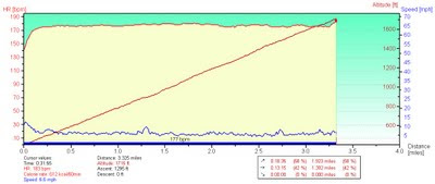
This graph expresses the highlight of my Low-Key day, setting a personal record on our renowned local benchmark climb, Old La Honda Road. My official time was 31:54.

The diagonal line represents the climb, with a gradient averaging 7.3%. The grade looks constant, but note the bumpy line at the bottom of the graph. That line represents my speed; for the most part, if my speed goes up, the slope has gotten flatter.

Finally, there is the relatively steady horizontal line at the top. That would be my heart rate, which climbed above 170 beats per minute after the first 35 seconds and averaged 177 for the duration of this exercise.

Like most Bay Area cyclists, I know this climb well. I know that I am stronger than the last time I charged up this hill. I knew that the rush of competition would make me go faster. I believed I could push myself very hard and make it to the top without fading. No mercy, today. I would glance at my heart rate monitor from time to time: 177, 180 beats per minute. Was my pace slowing? No. Well, no reason to back off, then.

When I reached the edge of the rough pavement near the top of the climb, I knew the end was near. I glanced down at my time ... I was close to finishing under 32 minutes! I accelerated ... I could hear the finish line ... the mailboxes were in sight. I crossed the line with six seconds to spare. Now you understand that final upward blip in speed (and heart rate) at the end of the graph.

Today I shaved two minutes, eleven seconds from my previous best time, and it was worth every heartbeat. All 5,646 of them (give or take).

October 3, 2009

Why I Climb

My top five reasons for bicycling up hills:
  1. The descent.
  2. The view.
  3. Chocolate.
  4. Fitness.
  5. The pain subsides at the top.
Today was the opening of the Low-Key Hillclimb season, which means that Reason #5 was necessarily promoted to Reason #1.

There is really nothing like charging up a hill in a pack of fast cyclists to test one's limits on a bicycle. Last year, many of us were caught in the rain; this year, the weather was sunny and cool. Last year, I was hurting and miserable; this year, well, I was just hurting.

I love the spirit of Low-Key: friendly, fun, full of good humor and encouragement. We are all out there mixing it up together: commuters, recreational riders, and racers from the local clubs. Road bikes, mountain bikes, an electrified recumbent, and a fixie (whose rider leaves most of us in the dust). Men and women of all ages. It's an open field.

When my Five-Pass Finisher jersey arrived yesterday, I took it as a sign. There could be no more fitting debut than this. I wore it with pride, and set a new personal best time on Montebello: 54:43, almost one minute faster than my best time in 2007, and at a lower average heart rate (173 vs. 177 bpm). Could I have pushed harder today? No, I am pretty confident that I gave it what I had.

I wasn't the last cyclist up the hill. Not ready to retire, just yet.

September 26, 2009

Who Knows?

My bike computer records the temperature, but since the sun is beating down on it, the readings are higher than the actual air temperature. I generally ignore anything other than the minimum temperature. Today's minimum was 70 degrees F, with a maximum of 114 degrees F; the average temperature was 100 degrees F. Who cares about the air temperature? The bike computer was baking in the direct sun, and so was I.

The last time I visited Paicines, I was helping with the Low-Key Mega Monster Enduro. It was so cold that my fingers were numb until well past sunrise. One thing I do know: the next time I climb Quien Sabe Road, the season will be winter (or maybe, early spring).

When I decided to do this ride earlier in the week, I said I would only do Quien Sabe if the weather was not blazingly hot. After refilling my water bottles at the Paicines General Store, I decided I would tackle the climb anyway. Yes, it was already hot, but I felt pretty good. I knew it was a long climb, and I had studied the terrain map. I had not studied the satellite view.

Quien Sabe Road is what one would call "an exposed climb." What does that mean? Great views, precious little shade. Another clue: to reach Quien Sabe, you pass through the town of Tres Pinos. I took my cues from the locals (cattle), and sought respite beneath any tree that cast an accessible shadow. There were, oh, at least a dozen patches of shade over the principal five and a half miles of the climb.

A first for me: I ran out of water. Around mile 45, I dropped to two mouthfuls at each mile mark. I knew I wasn't in trouble, but I knew I would run dry before I finished the ride. Shortly after mile 50, I passed a school. Must ... find ... drinking ... fountain. Sure enough, it was near the playground, and nicely shaded behind a building. About one liter and twenty minutes later, I comfortably finished the last two miles of the ride.

Conveniently, we had started our loop near a Foster's Freeze. Prescription: reduce core body temperature. One vanilla cone dipped in chocolate, taken by mouth.

Another milestone: Climbing 3,235 feet over 52 miles on today's route puts me at a new all-time high for a single year: 3,520 miles and 201,315 feet of uphill. The year isn't over yet ...

September 24, 2009

What to Wear

Such a complicated piece of machinery, the modern automobile. Some months ago (I confess), a helpful indicator lit up to alert me to some minor tail light issue. My local mechanic explained that replacing the bulb involved a substantial amount of disassembly and I should not wait for the car. I returned the next morning to furrowed brows, lots of dangling wires, and the news that it would require more troubleshooting. Needing the car, I drove off and procrastinated.

This morning I wanted to wear my newest cycling jersey, from my recent Best Buddies ride. Audi is a generous sponsor of that event, and their logo is emblazoned front and center. It seemed imprudent to show up for service sporting the colors of a rival German automaker, so I opted for a more neutral choice. Given the raised eyebrows I get, I suspect that few service customers pull up to this dealership, lift a bicycle out of the car, and pedal away. Works for me.

Tuesday was a Spare the Air Day, with the forecast for high temperatures and no onshore breeze. Such conditions conspire to trap stagnant air in the valley, and we are encouraged to drive less (preferably, not at all). My daily tally of fellow cyclists topped 100 that day, but as I pedaled over Highway 280 that evening, I looked down at a veritable parking lot.

My sturdy commute bike being too awkward and heavy to load into the car, today's ride entailed advance planning. Without a rack and bag on my featherweight road bike, I left a change of clothes at the office. The morning ride was so effortless, I felt guilty enjoying my second breakfast.

Of course, I understand that weight matters - but how much? What would happen if I traveled my normal commute route on my road bike? Today, I would find out. The tail light repair, involving wiring harnesses that twist and snake through tight places, was still more complicated than expected. The car would not be ready until tomorrow.

This could mean only one thing: in addition to the two small gratuitous hills that provide an occasional diversion on the way home, there was no reason not to explore the final short steep bit to the Rinconada Water Treatment plant. What a view of the Santa Clara Valley! (No camera, so you will have to take my word for it.) Despite the added distance and climbing, I made it home in record time. Stats: 20.9 miles, 810 feet of climbing.

Good thing I didn't wear that Audi jersey this morning, or I would be convinced that they had kept the car overnight as payback.

September 19, 2009

Down a Pint

When you donate blood, they caution you to avoid strenuous exercise for 24 hours. After that, well, it's back to your regularly scheduled program. Sixty hours having ticked away ... time to head for the hills!

Today's program: Climb a lot, descend a little, climb some more, descend a lot.

To reach Skyline Boulevard, we snaked our way through the little community of Redwood Estates. It was disconcerting to meet a pair of dogs on one of the arduous sections of this climb, but luckily they were friendly. Or perhaps it was just that we were much too slow to incite a chase. They escorted us until we passed safely out of their territory, repeatedly advancing up the hill and waiting patiently for us to catch up. What a relief when I felt the cool breeze that was a harbinger of the summit.

The level of traffic on Skyline this morning surprised even the locals we met along the way. It is officially California State Route 35, so you might expect some highway traffic? The segment we traveled, however, is barely wide enough for a single car in places. We ventured far enough to reach the southern terminus of the two-lane portion of the roadway, a stretch that has been freshly paved with creamy-smooth asphalt within the past two weeks. Federal stimulus dollars in action!

Yes, I missed the red blood cells I gave away this week; the steep climbs were especially hard, and overall I was more hungry and tired than usual after a 32.5 mile bike ride. (Okay, with 3,530 feet of climbing.) But I'll get over it. Weighed against the benefit of helping to save some lives, it is a price I will pay again and again.

September 13, 2009

Biking for Best Buddies

If you have driven in a hilly region, you are familiar with those "curvy road ahead" signs. The ones with an "S" shaped arrow and some advisory text, like Next 2 Miles. Just south of Carmel on the Pacific Coast Highway there is such a sign: Next 74 Miles.

At that point, we had completed our 9-mile warm-up on sunny Carmel Valley Road and entered the fog zone along the coast. Our starting location, the posh Quail Lodge, was a new treat this year. A truly continental breakfast: pain au chocolat and fresh strawberries.

When assembling for a mass start at a charity ride, where should you position yourself in the pack? Wisely, the pros (including Garmin-Slipstream's Lucas Euser) are at the front. Farther back than I would like, behind which of these would-be century riders should I position myself to maximize my chances of staying upright?
  1. The guy wearing tennis shoes, with platform pedals on his bike.
  2. The dude in the baggy athletic shorts, already sagging below the waistband of his designer underwear.
  3. The guy sporting an LA Triathlete Club jersey, with smooth, chiseled legs.
Once we took off, I moved up in the pack. Triathletes being somewhat allergic to hills, I pulled away from him after a few miles. I was pleasantly surprised to stay in contact with the main pack almost to the first rest stop, averaging 15.7 mph. Our cheering section directed us down a private driveway, explaining:
The food is in the garage.
I would wager that none of us had ever before seen a garage with floor-to-ceiling glass corner panels (overlooking the main house and, of course, the Pacific Ocean). Hoping to set a personal record on the ride to San Simeon, I abandoned my fantasy of moving into said garage and pedaled onward.

A new milestone for me was the realization that I could bide my time climbing behind a slower rider until traffic cleared, and then easily accelerate uphill to pass. I have the power in my legs to do this now, on a human scale not unlike the engine that rockets a shiny black car from 0 to 62 mph in 3.8 seconds. Just pull out, and go. Later, an impatient driver would floor his accelerator at his first opportunity to pass a string of riders. Oooo, I am sooo impressed by your raw display of power in that ... Kia.

The marine layer overhead kept us cool and damp as we made our way down the coast. With white-out conditions at Vista Point, the second rest stop, there was no vista to enjoy. But from the seat of a bicycle, you take your vistas wherever you find them - you are not limited to those designated roadside pull-outs. I snapped a few photos along the way.

At the third rest stop, a perky volunteer confirmed for a weary rider that there was "one more hill" ahead. Guessing that he was better off not knowing that there were really a pair of hills linked together, with the second climb being shorter but steeper, I said nothing. Ignorance is a sort of bliss, especially at mile 75 (and 80). The SAG vehicles are always busy on that stretch.

Momentum being useful for some uphill advantage, approaching the start of the second climb I flung myself aggressively (and gleefully) into the final hairpin. Grinding along, a rider caught up to admire my descending skill (wow, second time this year!). He was surprised at the speed I carried through the turns, and already understood that a big part of descending well is really about cornering. We chatted at the last rest stop; he wanted some tips. I learned from a pro rider, I explained.

Although this is the third time I have done this route, the Best Buddies Hearst Castle Challenge, there were still surprises. Booking along the final stretch into San Simeon with the traditional tailwind, I notice a patrol car at the side of the road with flashing lights. Just ahead of it ... was that a wave breaking onto the highway? Time to slow down and study the ocean. With ample caution, I rode through the seawater during a periodic lull. Next, a knot of tourists catches my eye. What's that on the beach? Elephant seals! This is the third time I have biked this stretch, and I had never before noticed the elephant seals? Translation: I am in much better shape this year.

Crossed the finish line to set a personal record, averaging 14.3 mph over 98.7 miles with 6,290 feet of climbing. Faster than last year by 0.5 mph - not bad. Ranked as the 15th top fund-raiser for this event, another personal record. Delighted to put my fitness to such good use, and grateful for the generosity of the many friends who responded to my appeal on behalf of Best Buddies.

Massaged and cleaned up, time for the evening festivities. First, the barbecue. Women in high heels step off the bus at the Hearst Ranch, oblivious to the fresh cow pies dotting the field. Hello, it is a working ranch. First priority: Food. My plate: Salmon, corn/green pea salad, garlic bread, grilled veggies, pork rib, broccoli salad, mashed potatoes, small rib of beef, half an ear of corn. Having burned over 3,000 calories to get there, I ate every last bit of it.

For me, as a top fundraiser, the day ended with a very special treat: a party at Hearst Castle. First priority: The Neptune Pool. Much to my surprise, my legs felt better after half an hour swimming around in the pool. Was it just the cool water, or was it that magical, mystical pool? Next priority: dessert (chocolate to finish the day, of course), followed by a private tour of some of the highlights of Casa del Sol and Casa Grande.

It was after midnight when I returned to the motel; you will appreciate how tired I was when I explain that I overlooked the 19 Porsches in the parking lot until the next morning.

September 11, 2009

Remembering Paul Joshua Friedman

There are places I'll remember
All my life, though some have changed
Some forever, not for better
- John Lennon, In My Life
Our lives intersected only for a couple of years; sometimes, that is the natural course of a friendship. Paul left Bell Labs to study for his MBA; the rest of us kept working. He was smart, and funny, and kind.

After so many years, only a few memories remain. Meeting for brunch at The Cupping Room Cafe. Learning to see with a photographer's eye. A day at the Bronx Zoo. Evita, with Patti LuPone and Mandy Patinkin. Admiring Manhattan from a table at Windows on the World.

I do not remember when I last saw Paul.

I do remember the visceral jolt I felt that sunny December morning when I found his profile in the Sunday New York Times.

What I remember now, I will never, ever, forget.

September 7, 2009

Laboring the Day Away

What better way to spend the Labor Day holiday than climbing a few hills? I will admit to a few doubts when the alarm went off, my night's sleep having been interrupted by unusual noises. Dishes? Why does it sound like someone is clattering dishes in the sink? 1:30 a.m. The cat was neither the culprit, nor concerned.

Mystery investigated and solved: My neighbors, for whom cleanliness is a virtue above all others, were still tidying up after having had some guests over. I knew they were prepping for company, as they had power-washed the house, the front walk, the back patio, the driveway, and their side of the fence. And I'm supposed to install a low-flow shower head? Don't get me started.

Lying abed, I pondered my options. I did a hard ride on Saturday, after all. The next day, I was rather a couch potato until I was invited for a Sunday drive (which was fabulous, but did involve more sitting). Dinner culminated in a decadent serving of chocolate fudge cake (oh, the flesh is weak). Get up, get out, get moving.

I managed to do more climbing (5,055 feet) over less distance (45.3 miles) than I did on Saturday. In the photo at the top, you can see the curves of Montebello Road to the right, Stevens Creek Reservoir below, and clear across the Santa Clara Valley to Mt. Hamilton and the peaks of the Diablo Range. The fall harvest is nigh at Ridge, a pair of deer paused to watch me on Montebello before splitting to sprint in opposite directions, and my tools rescued a mountain biker with a slipped cleat on Mt. Eden Road. Best of all, descending Highway 9 into Saratoga, I validated my hunch that I would be faster than the lumpy Prius that held us back on Sunday night. I wish more people understood how to drive ...

September 5, 2009

Santa Cruz Mountains Mini-Challenge

Today I co-led a ride for the club that we had previewed a few weeks ago. We had a surprisingly good turnout; fifteen riders signed in, with only one turning back after the first hill. I overheard one guy remark:
I tried to get my buddy to join me on this ride, but he said he wasn't doing anything that had “mountains” and “challenge” in the title.
Hey, what about the “mini” part? This wasn't the real Santa Cruz Mountains Challenge, which entails a serious amount of (steep) climbing. Our hills were much more mellow. Well, with the exception of a rather testosterone-fueled descent of San Jose-Soquel Road. Given no room to pass, I had to touch my brakes a few times to avoid running up the back of some of the guys (aerodynamic advantage). The speed limit is 40 mph, and I exceeded it by less than 1% - within the range of calibration error, wouldn't you say?

The ridge along Rodeo Gulch Road delivered a view of Monterey Bay that extended from Moss Landing to Pacific Grove. As we zigzagged up and down through the redwoods, our route came to resemble a three-fingered glove (for you GPS art-lovers out there). 4,445 feet of climbing over 49.4 miles (for the stats lovers among us).

Along the way I saw a juvenile California Mountain Kingsnake, sadly flattened in the middle of the road. The significant wildlife sighting of the day, though, occurred before I left the house: I was in my kitchen at just the right moment to see a very robust coyote dart across my neighbor's yard and head up the road. The road meanders a couple of miles uphill to an open space preserve, but it's all suburban lawns down here. Er, about that "lost pet" flyer ...

August 30, 2009

Able Was I

I have been fortunate to have had few encounters with aggressive drivers; today was not one of those days. Traveling south on Highway 9 in Ben Lomond to return to the park where we started our ride, I approached an intersection with deep sand and gravel in my path. What to do? With a steady flow of traffic in the narrow lane to my left and no room to maneuver, I calculated that I could ride through it. Just as I entered the intersection and the first patch of debris, the driver behind me gunned his engine and squealed into the right-hand turn in front of me, losing traction in the sand. The car was old, small, and yellow. A word describing the driver of said car starts with an "a" (hint: I'm not thinking "aggressive"). I stayed upright and lived to cycle another day. Peace and love to you too, bud, here in the harmonic center of hippie-dom in the Santa Cruz Mountains.

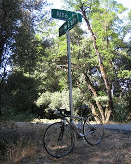
I have a fellow cyclist to thank for the high point of my day. Waiting at the base of Alba for the rest of our group to descend, a racer from the San Jose Bike Club rounded the corner to start the climb. As he did, he called out: "Going up?" I replied: "Already been." I knew he was talking to me, because there was nobody else around. And that means, despite being decked out in my recreational club jersey, I somehow looked not only capable of climbing Alba, but worthy of consideration as a climbing partner. Or maybe it means he was nearsighted.

A friendly driver paused at the stop sign to give me an update on the group. "They're a ways back, maybe two-thirds down." I'd had a lovely, somewhat conservative descent (being unfamiliar with the road, but knowing that it would end abruptly at this stop sign, after a blind curve). A small pickup truck had come into view behind me just as the road got twisty and technical. I dropped him in the blink of an eye; he caught up only after I'd stopped at the bottom. That's the way I like it.

Alba loomed large for me this morning. From Roads to Ride (South) by Petersen and Kluge:
This is one of the most difficult short climbs in the Santa Cruz Mountains. ... Descending Alba Rd. isn't great fun, but rather a matter of constantly arresting your speed and looking forward to the bottom.
It's number 76 on a list of the 100 Toughest USA Road Bike Climbs, according to John Summerson (The Complete Guide to Climbing by Bike).

On our club's scale of 3 to 6, Alba is a 6. Our group included five women, four of whom have mountain bike gearing on their road bikes. Uh, guess which one does not? And where were all our able, hard-bodied men this morning?

We arrived at the base of Alba together; our leader wanted to re-group before heading up. I needed not to stop, before I lost my nerve.

I learned a valuable life lesson years ago, the first time I stood at the top of the Cirque at Snowbird and looked down. More or less, straight down. Double Black Diamond. Free fall. I was balancing on a pair of skis between some jagged rocks on a ridge line at 11,000 feet and my heart was in my throat. I wasn't going first, no, not me, no way, no how. The longer I stood there watching the first woman in our group as she repeatedly toppled over below us, the higher my anxiety rose. Somehow, I had to point my skis down the hill. Terrified, I eased into the first turn, and stopped. I was upright. Okay, another turn. Still upright. Maybe I could link two turns together? Soon I was a third of the way down. Near the bottom, my skier extraordinaire friend Dave passed me. He knew there was only one way that I could be at that particular spot on the mountain. "No more blue trails for YOU," he shouted as he flew by.

I'd heard that Alba is really steep at the bottom, and the published profiles showed that it gets really steep again near the top. In the middle, it's merely steep. I made steady progress up the hill, waiting for it to get worse. When the grade relented after the first half mile, I realized it wasn't going to get worse. The grade is uneven, but the steeper bits are short. With apologies to Sheryl Crow, "This ain't no Country View." If Alba is a "6," Country View is, beyond a shadow of a doubt, a 6.

August 29, 2009

Low-Power Mode

You know it is going to be a hot day when, stopped at the first traffic light a few hundred yards from the start, a rivulet of sweat runs down your calf from the slight skin-on-skin contact in the crook of your knee, and it's only 9 a.m. After climbing some hills on the suburban fringes of San Jose with friends, I returned home to sprawl under a ceiling fan and switched myself into low-power mode. Not quite, but nearly, napping in the triple-digit heat.

My Saturday started with the most egregious telemarketing call yet. When telemarketers call, my habit is to answer the phone, set it down, and hang up after they eventually drop the call. This one, however, begged for some interaction.
Hello, may I speak with ...
Who's calling?
[My bank]
Is there a problem with my account?
Oh no, ma'am ...
It is 7:40 A.M.
And I am on the Do Not Call List.
Do Not Call Here. Ever. Again.
Yes, I suppose the Do-Not-Call-List does not apply when it is your bank calling. It is I who will be calling the bank, on Monday morning.

When I stopped to take the photo above, I didn't notice the hawk that must have been perched nearby until it took flight and scolded me with its distinctive, eerie cry. Given the heat, we scaled our ride back from five hills to three, 31 miles for the day. Top speed: 44.4 mph, on a wide thoroughfare with little traffic and creamy-smooth pavement. Well worth the climb.

August 22, 2009

Uncharted Territory

With so many intrepid cyclists exploring every possible uphill in the Bay Area, it seems improbable that one might discover a new climb. Imagine my surprise to be introduced to a challenging and apparently unfamiliar road last week. Impressions of a road's grade from the seat of a car can be misleading; the only sure way to know is to get on the bike and head for the top. It didn't look impossible.

Our club rates hills on a subjective scale from 3 to 6, where "3" is noticeably uphill and "6" means I need lower gears than I have. My sense was that this new hill could be a 6. Or a 5. Probably not a 4, but I certainly wouldn't complain if it turned out that way.

I persuaded some friends and my regular ride partner to go exploring with me. Our 40-mile menu included a few of the club's 3-rated hills along the way to today's featured special, Country View Drive. As soon as we rounded the corner, there were a few [unprintable] exclamations of, er, delight.
I am totally in the wrong gear!

This is definitely not a "3"!
Four out of the five of us made it to the summit. The fifth was running low on water and looks forward to returning on a cooler day.

The vote at the top: one hypoxic abstention, two for "6," and a "5" from the Canadian judge. The grade of the climb is uneven, and interrupted by two descents. Factoring out that half mile or so, we climbed 710 feet over about 1.3 miles. Including a brief scenic detour on a steep side street, and those two intervening climbs on the way down, we used less than two miles of pavement to climb 930 feet.

If you haven't done something like this on a bicycle, let me explain that this is hard. Really hard. It hurts. On the steepest section, I sustained an average heart rate of 182 beats per minute for more than five minutes to generate a forward pace of 4.1 mph (i.e., to stay upright).

At the end of the day, everyone was still talking to me. Even before we played in the fountain.

August 15, 2009

Social Climbing

Today was the club's annual Ice Cream Social, conveniently celebrated about five miles from home. Translation: Find some hills and earn those calories.

I have been itching to head up Hicks, the hard way, and eager to explore Mt. Umunhum Road. The latter is an out-and-back that I do not feel comfortable riding alone. The former is, well, just plain hard - physically and mentally. Before today I had only climbed it non-stop on one occasion.

The weather did not disappoint: hot enough to make Hicks harder. I am a seated climber, and the grade is steep enough that I lifted my front wheel off the pavement a few times as I pulled on the handlebars. When I started to feel sorry for myself, I pushed those thoughts out of my head and focused on turning the pedals instead of stopping for a break.
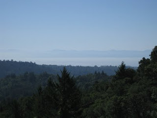
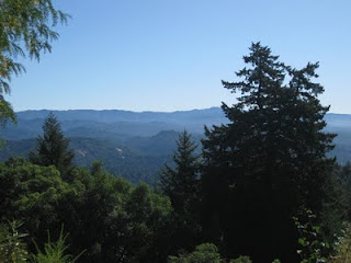
Non-stop, for the second time in my life. My power-to-weight ratio has clearly improved.

Mt. Umunhum Road is no picnic, but after Hicks it seems ... merely uphill. I continued for a stretch beyond the first gate, but turned around to re-join my ride partner before reaching gate number two.

Did I earn my chocolate ice cream? Beyond any doubt.

August 14, 2009

Driving Range

No offense, but I have to admit that I don't "get" golf. I did spend today on a golf course, and it did involve driving: in two fundamentally heretical ways. The first involved driving exotic cars onto the greens. The second involved driving exotic cars ... period. Our guess was that 10% or fewer of the owners actually drive their machines, which is the real heresy.

Nine Lamborghinis, all in a row ... you do the math. There were many more, including a tractor and an LM002. But not nearly as many as there were Ferarris, which overflowed their (larger) assigned area into two additional spillover sectors. To the early birds go the prime exhibition spots.

After strolling around at Concorso Italiano to check out hundreds of fabulous cars (you'd think they were a dime-a-dozen, or something), we found a shady spot where we could comfortably enjoy some people-watching. As we watched a guy entertaining two blondes near the shiny black car, I joked that he must be claiming the car as his own. This led instantly to a bet that I wouldn't stroll down the hill, key in hand, and nonchalantly raise the carbon-fiber rear panel to expose the engine. Guess who won that bet. [Admittedly, only after being goaded mercilessly for a solid 20 minutes. The release lever is where?]

A long day in the company of fine fast cars can have only one natural conclusion. Our drive passed through some areas dense with smoke from the Lockheed fire burning in the Santa Cruz Mountains, which had sent ash raining down far south onto the cars in Monterey. The drifting plume was visible above the Calero Reservoir, at sunset.