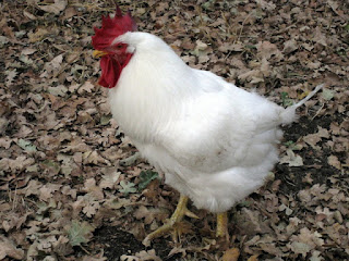
This handsome fella was coming straight at me.
I'm not the female you're looking for ...
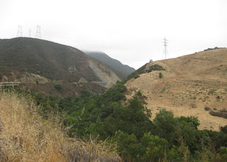
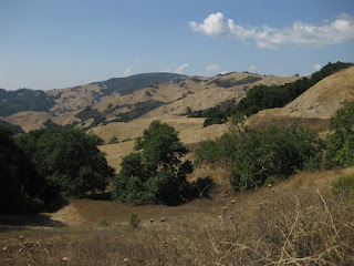
I was surprised to see a tarantula here, in the hills above the Lexington Reservoir. 'Tis the season, but until today I'd only seen them inland, farther east.
We'd climbed Black Road this morning, an exercise in pain (as always). A late-arriving rider caught up and chatted with me for a spell. I was surprised when he joined me in dismounting and walking the steep pitch on the upper section, as he's a very strong rider. Rather gentlemanly, to keep me company.
Most of the group carried on with the plan, descending to Scotts Valley and returning via Mountain Charlie Road. One guy decided to join my ride buddy and me, who had quite enough climbing after Black (thank you very much) and returned to circle Lexington Reservoir.
At the bottom of Black, a car honked at me as I walked across the intersection. We were chatting with a pair of guys in camo, who were there to train their (black!) Labrador Retriever pups in the art of retrieving. Clearly puzzled, one of them asked “Why'd he have to honk?” [Indeed.]
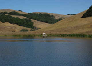
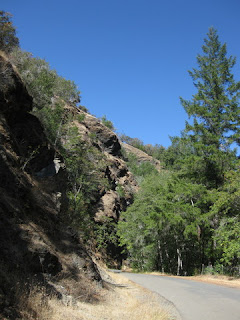
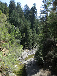
I was surprised by the (deliberately) low water level. Let's hope they're right about another rainy winter.
Enough of a workout for me: 18 miles, 2,495 feet of climbing. Is it bedtime yet?
September 30, 2017
September 22, 2017
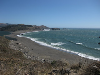
Bodega Head
Our cycling done for the day, my biking buddy and I headed for Bodega Bay, a town of some renown. It's not recognizable as the remote hamlet made famous by Alfred Hitchcock—homes blanket the surrounding hillsides now. Ominous clouds moved in from the northeast as the afternoon wore on.
The coastal state park at Bodega Head was light on signage. We skirted an enormous pothole and followed our noses up a narrow road to a parking area. These were the bluffs we were looking for.
We chose a path that went up (of course), despite our whiny legs. A hiker on his way down cautioned us: “There's nothing but beautiful views up there!”
“Did you use them all up?” I joked.
He assured me he'd left some for us.
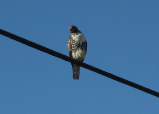
Fittingly, a flock of seagulls winged past, but I wasn't quick enough with the camera. I did catch a Red-shouldered Hawk in flight.
I have my biking (and hiking) buddy to thank for this excursion; I was not aware of this place. Despite having watched The Birds earlier this year, and biking past in years gone by, it never occurred to me to visit here.
A small group of folks gathered off-trail, excitedly studying something near some rocks. One wandered over to us, explaining that they were trackers. He pulled apart an owl pellet, revealing the skull of the unfortunate vole that fed the bird. He generously offered us the remains, but (fascinating as they were) we declined.
Our final bird sighting of the day was back in Sebastopol, on a trail where we met the rooster we'd been hearing most mornings. We learned his story (abandoned, and missing his tail feathers) from a local woman who came by to scatter grain for him. That explained why he was hanging around—he knew where, and when, he'd get fed.
And thus, our Sonoma Sojourn drew to a close.
Petaluma
By the time I finished yesterday's adventure, I figured that I was done for the week. My legs were cooked.
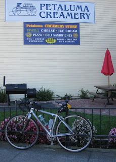
But how could I skip a ride that started at a creamery? A ride that promised little climbing?
Our ranks swelled with members of the local club, the Petaluma Wheelmen, and we headed out on Chileno Valley Road. I'd ridden this, in the opposite direction, on at least one organized ride in the distant past.
Little traffic, at last! Raptors above, egrets below.
Also as promised, the roads were in terrible condition.
In the spirit of this week's routes, I missed a turn—totally my fault, this time. Distracted by an Aermotor on my left, I failed to see the turn on my right as I considered whether it was photo-worthy. With wires overhead, I couldn't find an attractive angle for a shot.
When I first started pushing the pedals this morning, my legs protested. [What does she think she's doing? Enough, already! This is not happening.] I'd missed my evening recovery soak in the cool waters of the hotel's pool.
I channeled Jens Voigt: “Shut up, legs!” [They obeyed.]
Content to ride way off the back and admire the scenery, the occasional downhill would boost me to catch the rest of the group. Near the end of the ride, I saw some of them re-mount and push on ahead. Why had they stopped, I wondered?
I looked to my left, and right next to the fence was an emu. The bird, however, was having none of me. It ambled away and showed me its rump.
Today's ride was only 27 miles, with 1,525 feet of climbing; but after yesterday, I figured I'd earned some of the Petaluma Creamery's finest. Two scoops.
September 21, 2017
King Ridge
Today was the Queen Stage of our little getaway: King Ridge, of King Ridge GranFondo fame. It was out of reach for me at that event—I'm far too slow. I'd heard it was beautiful; this would be my best chance to find out. After reading the Santa Rosa Cycling Club's characterization of the route and studying the profile, I was intimidated. I don't do well with steep climbs. The weather forecast also included some strong winds (20+ mph). I could always dismount and walk uphill; that would cost time, as the steep pitches lasted a mile or more. If the wind was too strong, I could skip the loop and turn back.
The first problem was an epic wrong turn. Left onto Cazadero Highway, the route sheet said. The mileage at that point was spot on. I had caught up to the front of the pack; left we turned, and off they sped. I expected to see something of a town, including a general store; but there were just a few scattered buildings. When I reached the intersection of Highway 116, I knew I had, somehow, missed the turn onto King Ridge Road.
Because, we were meant to turn right (not left) onto Cazadero. All it took was this little glitch on the route mapped using “Ride with GPS.”
I studied the map and considered my options. Turn around, return to the start, and spend hours waiting for everyone else to return. Turn around, leave a note for my ride buddy, and ride back to the hotel.
Then the lead guys reappeared, having ridden farther before turning around. “This way to King Ridge,” they confirmed. The rest of the group was ahead of us now, having followed a GPS (not the route sheet). The mistake had put an extra six miles in my legs, and set me back more than half an hour. As we turned onto King Ridge, I told the guys I might not do the whole route; I would see how I felt when the going got steep.
I wouldn't see them again.
A guy drove past and encouraged me. “Good job!”
I thought I might turn around before the steep drop to Hauser Bridge (which demands a steep climb up the other side), but that was not an easy out: There was no clear summit, and the road meandered down as well as up. More climbing.
What if the group was waiting for me along the route? Maybe they took a break to eat their sandwiches.
This road is remote. There are no services. There is no cell signal. There are cattle, and cattle guards.
I reached the turn for Hauser Bridge Road. With no one in sight, I was now certain that I was on my own.
Turning back made no sense. The road was in poor condition, but the descent not as scary as described. The bridge is being replaced, and I was especially grateful to have heeded the warning signs and stopped early. Near the bottom, the pavement was buckled in a huge hump; any cyclist hitting that would crash.
I walked across the old bridge, which crosses the South Fork of the Gualala River. My legs were done; I knew I'd be walking up the other side for a mile or more. I pulled out my sandwich and ate half as I walked up the steep grade.
The reward, at some point, was a view clear to the glittering Pacific.
I reached the intersection with Fort Ross Road, which would take me directly back to Cazadero. With that shortcut, I could catch the rest of the group. But after suffering the worst of the climbing, I deserved my reward: reaching the coast.
I paused to admire the view before plummeting down Meyers Grade to Highway 1.
As soon as I turned south, I realized that I might have made a truly bad decision. Not only did I face a long and unexpected climb on Highway 1—I had found the wind. And ... it was ferocious.
You can see the wind whipping crests on the ocean. You can't see the gust that nearly blew me over into the path of a compact RV.
Terrified, I dismounted to continue on foot. A gust ripped the bike out of my hands and slammed it against the guard rail.
I couldn't walk all the way to Jenner. If i got back on the bike, would a gust blow me over the cliff?
When it seemed safe to ride, I rode. When it didn't, I walked. After turning inland onto Highway 116, a gust caught my route sheet and peeled the Cue Clip off my stem. Luckily, they landed in a ditch, within reach.
I scanned oncoming traffic for familiar faces. Surely the group would be worried about me. The logical thing would be to start driving the route in reverse, looking for me.
When I reached our starting point, the parking lot was empty.
The lead guys had convinced the rest of the group that I'd turned back.
But I hadn't. pep's epic ride: 61 miles and 4,985 feet of climbing.
After they fetched me, I wore my new dress to dinner.
September 20, 2017
Guerneville Loop
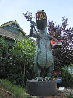
Eager to show us a little local color, our leaders strayed off-route at the start to take us up (yes, uphill) Florence Avenue, home to the artists Patrick Amiot and Brigitte Laurent. My ride buddy and I had toured the street, on foot, when we explored Sebastopol on Monday. Many front yards on Florence sport their quirky creations, but there is no mistaking where the artists live. (Look! It's an Aermotor!) Their work is popular all over town, and beyond.
Of course, this diversion entailed some calculating for the rest of the day, as the mileage on our route sheets was no longer valid. Work for the brain as well as the muscles ...
It has been quite windy so far, uncharacteristically so (according to the locals). Today's forecast showed a 20% chance of rain. Around these parts, this time of year, that means there are pockets of showers scattered about. Over 20% of the area, perhaps?
We paused atop a hill to admire a vineyard, and I felt the first sprinkles as we started rolling again. Mist became drizzle became downright rain. It was warm enough for vest-and-arm-warmers; I'd left my jacket behind.
Ah well, once you're wet, you're wet. At least it wasn't cold.
 We paused in Occidental to discuss whether to break there for coffee, or continue to the next town. The choice seemed obvious to me: our lunch stop in Guerneville would be only a few miles past Monte Rio—too close. No one seemed to want to make the decision, so ... I called it. While they enjoyed their coffee, I wandered over to the nearby shops.
A colorful summer dress caught my eye. Looked like my size. But how would I carry it? I wandered back.
I thought about my friend Pat, shopper extraordinaire, who manages to snap up a find like this whenever we're cycling in Europe—without anyone noticing that she vanished for a few minutes.
I returned to the shop. I slipped the dress on over my cycling gear; it fit. Figure out a way to carry it.
 As I scrunched it into a compact roll, to fit into the small plastic bag I carry in my saddle bag (expressly for an occasion like this), a woman seated in the cafe tapped on the window. She gave me an enthusiastic smile and a thumbs up. I was right not to pass up this dress! As I'd hoped, one of the riders in our group had a capacious saddle bag and graciously stuffed my package inside.
Much of today's route passed through the forest, deep in the redwoods, with lighter traffic. One guy in the group had been particularly helpful, doubling back to check on trailing riders and waiting at turns to be sure we didn't go astray. I stopped for a photo at a bridge over the Russian River, turned around and ... they were gone. I didn't think I'd miss the next turn, but my confidence was ebbing. “Is Martinelli ahead?” I asked a guy who happened to be walking down his driveway. “Yes, you'll love it!” he said. (Fellow cyclist!)
What I didn't love was the end. Signaling a left turn onto Highway 116, I was dismayed to see heavy tandem trucks rumbling past, in both directions. The kind with open trailers that haul rock. There must be a quarry ... sure enough, Canyon Rock's entrance was within sight. Loaded trucks were exiting the quarry in a steady parade; empty trucks were returning. We would have to share the (narrow) road. Uphill. [Gulp.]
Our next turn, onto a trail, couldn't come soon enough. [Whew.] We caught a whiff of apples cooking as we passed behind an industrial building. True to form, a couple of riders whizzed right past the next turn (we reeled them back). By managing to catch up to our leaders, I found the turn I missed yesterday, finishing with 43 miles and 1,870 feet of climbing.
Tomorrow is another day ...
Of course, this diversion entailed some calculating for the rest of the day, as the mileage on our route sheets was no longer valid. Work for the brain as well as the muscles ...
It has been quite windy so far, uncharacteristically so (according to the locals). Today's forecast showed a 20% chance of rain. Around these parts, this time of year, that means there are pockets of showers scattered about. Over 20% of the area, perhaps?
We paused atop a hill to admire a vineyard, and I felt the first sprinkles as we started rolling again. Mist became drizzle became downright rain. It was warm enough for vest-and-arm-warmers; I'd left my jacket behind.
Ah well, once you're wet, you're wet. At least it wasn't cold.
 We paused in Occidental to discuss whether to break there for coffee, or continue to the next town. The choice seemed obvious to me: our lunch stop in Guerneville would be only a few miles past Monte Rio—too close. No one seemed to want to make the decision, so ... I called it. While they enjoyed their coffee, I wandered over to the nearby shops.
A colorful summer dress caught my eye. Looked like my size. But how would I carry it? I wandered back.
I thought about my friend Pat, shopper extraordinaire, who manages to snap up a find like this whenever we're cycling in Europe—without anyone noticing that she vanished for a few minutes.
I returned to the shop. I slipped the dress on over my cycling gear; it fit. Figure out a way to carry it.
 As I scrunched it into a compact roll, to fit into the small plastic bag I carry in my saddle bag (expressly for an occasion like this), a woman seated in the cafe tapped on the window. She gave me an enthusiastic smile and a thumbs up. I was right not to pass up this dress! As I'd hoped, one of the riders in our group had a capacious saddle bag and graciously stuffed my package inside.
Much of today's route passed through the forest, deep in the redwoods, with lighter traffic. One guy in the group had been particularly helpful, doubling back to check on trailing riders and waiting at turns to be sure we didn't go astray. I stopped for a photo at a bridge over the Russian River, turned around and ... they were gone. I didn't think I'd miss the next turn, but my confidence was ebbing. “Is Martinelli ahead?” I asked a guy who happened to be walking down his driveway. “Yes, you'll love it!” he said. (Fellow cyclist!)
What I didn't love was the end. Signaling a left turn onto Highway 116, I was dismayed to see heavy tandem trucks rumbling past, in both directions. The kind with open trailers that haul rock. There must be a quarry ... sure enough, Canyon Rock's entrance was within sight. Loaded trucks were exiting the quarry in a steady parade; empty trucks were returning. We would have to share the (narrow) road. Uphill. [Gulp.]
Our next turn, onto a trail, couldn't come soon enough. [Whew.] We caught a whiff of apples cooking as we passed behind an industrial building. True to form, a couple of riders whizzed right past the next turn (we reeled them back). By managing to catch up to our leaders, I found the turn I missed yesterday, finishing with 43 miles and 1,870 feet of climbing.
Tomorrow is another day ...
September 19, 2017
Sonoma Sojourn
A couple of club members planned a series of rides near their new home turf in Sonoma County, inviting all who wished to join in. My ride buddy and I, both in need of a break from work, tacked on a couple of extra days for travel and (perish the thought!) non-cycling activities.
Like most people, I associate Napa and Sonoma counties with wine: acres and acres of grapevines, vineyards, tasting rooms, and tourists. Late in the season, mid-week with schools back in session, we envisioned a veritable paradise of empty rural roads through rolling hills. [Er, not so much ... lots more traffic in this region than I remember.]
I didn't associate Sonoma with apples; Gravenstein, to be precise. Locally celebrated, we wondered about this unfamiliar variety. Turns out it doesn't travel well; it's commonly used to make applesauce and apple cider. A month past the harvest, we didn't find any to sample.
We warmed up our legs for the week with a 44 mile loop, climbing a modest 1,295 feet. A couple of missed turns added to the challenge.
Not long after we'd started out, I compared the mileage on the route sheet with my bike computer and brought our posse to a stop. Somewhere, we'd missed the turn onto a trail; we backtracked to get back on course. This would complicate navigation for the rest of the day, as we needed to estimate the expected mark for each turn by factoring in the distance added by each missed connection.
The highlight of our loop was a late lunch at the Trail House, a welcoming stop for a bunch of hungry cyclists.
Followed by another lowlight, when some of us muffed our departure by missing the first turn. Separated from the ride's leaders, I suggested to another experienced leader that we take care not to drop anyone in our half of the group.
We were on the lookout for our next turn, onto the Santa Rosa Creek Trail through the Prince Memorial Greenway, when a local cyclist overheard us and helpfully chimed in: “two more traffic lights.” With the rest of the group in tow, I didn't pause to get a photo of the colorful sculpture of a leaping fish at the entrance plaza. As we made our way along the trail, alongside homeless men passed out in the shelter of every overpass and none-too-friendly-looking teenage boys loitering in the shadows, I was grateful not to be alone. I realized I'd been here before: this trail was part of the return route for Levi's King Ridge GranFondo.
I noticed a sign for the Joe Rodota Trail ... is this the other end of the trail that would lead us straight back to Sebastopol? [Yes, as it turns out.] Our route sheet didn't send us that way, and feeling responsible for the rest of our little group, I stayed the course. A diversity of paces splintered us, but we all found our way back, despite missing the penultimate term (for good measure).
September 9, 2017
A Challenged and Challenging Challenge
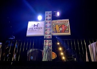
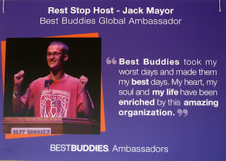
After riding down the Pacific Coast ten times for Best Buddies in the Hearst Castle Challenge, this year would be different.
That view never gets old, so why change the route?
Mother Nature, that's why. Last winter's storms first undermined a bridge over Pfeiffer Canyon; and then, as if knocking out a bridge wasn't enough, a massive chunk of hill slid down onto Highway 1 at Mud Creek. The road repairs may not be complete by this time next year.
Our destination (Hearst Castle) is a constant, but ... you can't get there from here. The ride must go on, and thus Plan B was hatched. All routes would start (as well as finish) in San Simeon, at Hearst Memorial Beach, instead of the traditional start in Carmel Valley.
I struggled mightily over which route to pick. Forego the 100 mile route and opt for the 100 km route instead? Yes? A more scenic climb up Old Creek Road (vs. Highway 41). No! I've always done the century; if I skipped this year, I wouldn't know whether I could have done it. Either way, late in the route (mile 37, or mile 78) I'd face a steep climb on Santa Rosa Creek Road. (Going rogue, following Highway 46 all the way to the coast, did cross my mind.)
But I stayed the course. All 101 miles of it. From San Simeon, through Cayucas, to Morro Bay.
Up Highway 41, into the Los Padres National Forest, to Templeton.
In keeping with this year's track record, my level of training was not where I needed it to be. A record-breaking heat wave, enhanced by bad air (from distant wildfires), kept me mostly off the bike over the preceding ten days.
The sun broke through and started baking us as we climbed inland; I started feeling a bit twitchy around mile 60; a bit of bonk was creeping up on me. [Uh oh.]
We would be tackling Santa Rosa Creek Road in the downhill direction, descending the wicked wall. I'd wager that a handful of participants (at best) had ridden this road before, in either direction. The climb from Highway 46 starts out gently. I knew it had to get steep, recalling my wild ride last year. “Is this the climb?” a nearby rider asked, clearly not impressed. “No, it gets steep.” (He thought an earlier climb today was steep.) “No no no, this gets steep.”
A rider walking up the hill came into view. It didn't look all that bad.
And it probably wasn't all that bad, at that point. But with 78 miles and more than 4,300 feet of climbing behind me, my legs simply gave out. For the first time, I considered what it might be like for pro riders in Grand Tours to finish a long stage at the top of a mountain. Sure, I've pedaled up some of those climbs. But not with 100+ miles in my legs. (By the way, our peloton today included Big George and Christian Vande Velde, so there just might be a new KOM on Strava's leaderboard.)
The pavement is in terrible condition, making the technical descent to the coast even more tricky. There were occasional signs cautioning “Rough Road,” but it would have been more honest to mark the few sections of smooth pavement, instead. The ever-vigilant Best Buddies staff must have emptied a full can of purple paint marking the cracks and potholes. In a couple of places, they had consistently sprayed “Very Steep Decent,” which made me laugh. There's nothing decent about a steep road.
There was no warning about the loose dog. He turned to face me, and of course decided to give chase. Having expected that, I dug deep and sprinted, hoping to outrun him. [I did.]
There was no warning about the loose head of cattle, either. He was walking up the road and bellowing. I slowed, glad that it wasn't one of the longhorns I'd seen earlier, but unsure how he'd react. He moved to the opposite side of the road, focusing on the herd on the other side of the fence and bellowing mournfully. [Whew.]
There were no bikes at the rest stop at the base of the road (even though I'm slow, that was a first). I knew there were riders behind me, and I knew that most of them would not have an easy time coming down the hill. Of course, they might have given up and hopped in a SAG wagon, but that didn't occur to me. [They hadn't.]
The next challenge was heading north on Highway 1. The name of that challenge was “Headwind”—payback for 10 years of tailwind. This year, we had a crew of domestiques (!), outfitted in yellow jerseys emblazoned with “Get on my wheel!” My guy pulled me for a few miles before swinging off to wait for others, and I relished every inch of that draft.
Mother Nature had one more surprise for us: Hurricane Irma. [Say what? We're in California.] This year's entertainment at the post-ride barbecue was to have been KC and the Sunshine Band ... but they were stuck in Florida. At the last minute, the organizers pulled an LA-based band out of a hat—Soulville California Band. And the dance floor was packed!
My internal soundtrack during the ride was the Hollies:
The road is longI love this charity, and I keep coming back—for the Buddies. He ain't heavy, he's my brother.
With many a winding turn
That leads us to who knows where
Who knows where
But I'm strong ...
Subscribe to:
Posts (Atom)


