July 25, 2015

The Wild Wild West

The locals are so welcoming on Bay Area backroads.

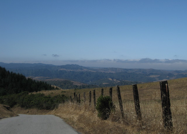
As we turned west onto Bear Gulch Road, there was one to greet us. With his faded brown sedan parked next to the cluster of mailboxes, he shouted:
You're not going through to the coast!
“No,” I replied; “we turn around at the bottom and ride back up.” (The public road is a dead end, with a well-marked gate demarcating private property.)

He continued:
If I find you on my ranch I'll fill you full of buckshot!
So noted.

View of fog-shrouded Pacific Ocean from Bear Gulch West Road, near Woodside, California
Here in the 21st century, we have plenty of detailed maps to guide us. It would be stupid not to consult them. And it would be even more stupid to trespass on private property.

I can only imagine that, to this paunchy redneck with his stringy hair grazing his shoulders, that the stupidest idea of all would be that two women on bicycles would coast effortlessly to the bottom of a really steep hill just to make a u-turn and pedal back up.

Nah, we're really cattle rustlers in disguise.

I half expected him to drive back down the hill and park at the end of the road. I picture him sitting on an old lawn chair somewhere on his property, his shotgun across his knees, still waiting for us to arrive. Disappointing, on so many levels.

White road marker with a yellow top, Old La Honda, alt. 1634 ft, near Woodside, California
I hadn't climbed Old La Honda Road in awhile. I wasn't trying for a personal best, but I will say that it took less effort to pedal the new bike up the hill. Reaching the summit on this penultimate day of Le Tour de France, it was fitting to discover that someone has created a traditional French-style road marker and planted it there.

Snacking at the top of Kings Mountain before starting our descent, we overheard a conversation between some nearby cyclists and a very lost motorist. When they told him to head down Kings, my ride buddy and I looked at each other. Go, now, before we get stuck behind this guy who has never seen Kings Mountain before.

I'd forgotten how long that descent is. There was only open road ahead of me, as I took care not to let the fast bike accelerate to warp speed. An SUV appeared behind me; I had a clear advantage on the curves, and there were no straights long enough for him to pass me safely. He'd just have to wait. Besides, I was doing the speed limit (or better).

For the day, 3,440 feet of climbing over about 26 miles. And no buckshot.

July 24, 2015

Change Up

One morning this week, the same cyclist passed me three times.

Wait ... how can that be?

Looking west along the channel where Stevens Creek meets San Francisco Bay, Mountain View, California
Of the two of us, he was the stronger cyclist. But I was the cyclist following an optimized route. He never said a word, but he must have wondered what was going on. I chuckled to myself.

The downside of my optimized route is that it can get dull—same old, same old.

I became familiar with “the regulars:” people whose routines overlap with mine. In the morning, the woman walking a pair of pit bulls (who make me nervous). The guy with the rambunctious puppy. The small elderly guy with long sideburns and a mustache who stood near the center of a bridge looking at ... what? Not necessarily the trains.

Evenings are less routine, though I would often see an elderly woman in a saffron-colored sari and her husband, out for a stroll. A large woman in a wheelchair near a convalescent center, parked on the sidewalk, reading a book. Sometimes a colleague might come along and chat before dashing away.

I've been wondering whether I should change the route to ease the boredom. But every time I study the map, I stick with my route. It's pretty safe, and quiet, and direct. Now and then, something unexpected spices it up.

This week a friend got up early, rode to my house, then returned with me along my commute route—just for fun. Two weeks ago my older road bike made for a fast trip; the Bike Doctor would be on campus, and it needed a little TLC. [New brake cables, as it turned out. So that's why it wasn't stopping very well ...]

One evening I passed a helmet-less guy in a long-sleeved white jersey, stopping irregularly to pick up trash. This week, a guy wearing an orange safety vest, a human face mask strapped to the back of his helmet. A woman struggling with a jammed chain, hands covered in grease. [I stopped to help.]

Late afternoon took me to the central part of the campus for an unexpected meeting. I had biked to work specifically to avoid the traffic meltdown that ensues when there's a major event at the nearby concert venue, but now I would land in the thick of it. I really didn't want to be on the road until I was well clear of the concert traffic.

The map confirmed my hunch: I could roll straight onto a different creek trail, follow it east to pick up the Bay Trail, loop around and catch the trail I needed to head home.

Variety is the spice of life.

July 18, 2015

C is for ...

C is for Colma and cemeteries, the Centennial Way Trail and the Cold War. And, of course, cycling.

I was most excited about today's route, which promised a bona-fide adventure: I was unfamiliar with much of the area we'd be exploring.

We rode up Sneath Lane to reach a trail leading to Sweeney Ridge. Bikes are permitted, but squeezing through the tight angular gate was a challenge. I was toodling along just fine, wondering why the climb was much easier than our club's rated difficulty level, when it got steep. Heart-rate-180-bpm-steep.

View of the Pacific Ocean from Sweeney Ridge above Pacifica, California
What remains of the abandoned Cold War-era Nike missile control site was less interesting than I expected. The walls are a magnet for graffiti vandals; perhaps it would be better to tear them down. The views of the Pacific and of our next destination (San Bruno Mountain) were beautiful on this clear day, however.

Our leader took care to keep us together as we navigated city streets to connect with the Centennial Way Trail. We made our way through Colma, which naturally included passing through a cemetery. (Colma is renowned for having more dead than living residents.) This one had it all: ornate private mausoleums the size of small chapels, headstones, simple flush-mounted plaques. Which started me wondering about why ordinary people erected such grand monuments to themselves.

View of the cemeteries of Colma from San Bruno Mountain, San Bruno, California
The view to the west from the top of San Bruno Mountain was more familiar now that I fully recognized the green fields of Colma dotted with marble and granite.

Restored railway depot, Colma, California
I had spent quality time with a map in advance, devising an alternate return route. Our leader's route back to Skyline was more direct, but followed some roads that I expected would be unpleasantly busy with traffic. The Colma Community Center turned out to be the perfect place for a rest stop. My ride buddy and I were quite happy with the route I devised; apart from the climbing, it was quite pleasant. But, well, getting back to Skyline unavoidably means going up.

Doe and fawn grazing near San Andrea Lake, near Millbrae, California
We paused at the south end of San Andreas Lake to watch some very relaxed deer on the slope below us. After rounding the bend to continue south on the trail, I spotted a doe and her still-spotted fawn at close range. I imagine they're feeling the stress of our long drought, and perhaps becoming too comfortable with people. I slowed as I approached another cyclist who was about to resume pedaling; only then did I see the buck (!) to my left, on the paved trail, munching away. He seemed completely indifferent to people passing by, in both directions.

Lower Crystal Springs Reservoir, near San Mateo, California
C is for the Crystal Springs Reservoir, where we began (and ended) today's journey: 48 miles, 4,440 feet of climbing.

July 12, 2015

Riding the Eastside

A simple club ride to ease back into normal life, to catch up with friends.

Puffy clouds over distant hills, parched landscape, San Jose, California
I hadn't visited these roads on the rural fringe of eastern San Jose in awhile; it was another warm day, when a short outing (with some shade) seemed just right.

The second climb was gradual, but longer than I'd remembered.

When we stopped for a snack, some of us were disappointed to find that the smoothie place was gone.

The GPS in my phone cut out, leaving me with a partial track to remember the 34 miles we covered. With only 2,080 feet of climbing, I was able to maintain a respectable pace. And a short ride left time to do other things in the afternoon.

Wait, there are other things to do besides cycling?

July 4, 2015

Don't Be Late

I almost missed the pancakes and fresh fruit salad at the club's annual July 4th breakfast. Note to self: Get moving earlier, next year.

pep decked out in red, white, and blue, with bike decorated for the Fourth of July, Stevens Canyon, California
The day was hot, and promising to get hotter. I convinced my ride buddies that we should skip the hard climbs we'd planned, substituting instead a leisurely trip into a well-shaded canyon alongside a creek. Feeling adventuresome, we continued into the Monte Bello Open Space Preserve at the end of the road, as far as our skinny-tire road bikes could sensibly carry us. By the end of the day, I had covered some 39 miles, climbing 1,840 feet to burn off those pancakes.

This year, I made it to my town's celebration in time to get a traditional burger for lunch. The party was in full swing at a local park: a wind symphony playing marches, kids running and playing in the fields, adults clustered in whatever small patches of shade they could find.

I learned that some famous marches were composed for newspapers. John Philip Sousa wrote one for the Chicago Tribune. He composed another, which I'll bet you've heard, for The Washington Post, for a ceremony celebrating award-winning essays by schoolchildren. ['Twas a different age, indeed.]

I found a spot along the fence next to the park's steam train, near the carousel. A family of four occupied a pair of benches, the two children oblivious to the festivities and attractions around them. They appeared to be about 7 or 8 years old, and were completely absorbed in playing games on their iPads. Completely. Absorbed.

Steam locomotive and train, Oak Meadow Park, Los Gatos, California
“There's a steam locomotive behind you,” I wanted to shout. “Look, they're spinning it around on a turntable.” What kid doesn't like trains?

The boy was so fixated he wouldn't even eat; his father repeatedly thrust a hot dog in his face and he'd swat it away. When he finally forced him to eat a few bites by taking away the iPad, the boy let forth an earsplitting wail.

I walked away. Why did you bother to come here, I wondered. Go home and play in your virtual world.

'Tis a different age, indeed.