September 30, 2015

Search Party

Green geocache container nestled in the fronds of a palm tree.
To celebrate a recent successful product launch, our organization rewarded the team with a little getaway.

Engineers love to play, so this would not be simply a party. There would be a “team-building exercise,” which we regarded with skepticism and some wariness.

It turned out to be a fun (and tiring!) afternoon, geocaching. Anticipating the usual “count off by ones” method of separating people from their buddies, I managed to land on a team with a co-worker who has some geocaching experience.

Nonetheless, it was surprisingly challenging. Each team needed to stick together, and they warned us that no team would be able to visit all the caches in the allotted time. Yes, we were working against the clock, in two one-hour sessions. “Now I know how to take all the fun out of geocaching,” my co-worker remarked as we huffed up steep trails and made sure to return to the check-in point on time.

There were a few organizational twists [team-building, remember?]. Teams needed to report their discoveries back to “headquarters” (as it were), and all teams needed to rendezvous at a central point on schedule. Those who were tardy paid a hefty penalty, losing half their points. By checking in with headquarters, we were also trying to ensure that every cache was found by a pre-ordained minimum number of teams.

Despite having the advantage of an experienced geo-cacher, we didn't do all that well. There was a premium for being the first to find any given cache, which we never managed to do. And the caches with the highest points value tended to be time-consuming: complete an additional activity after finding the cache, or solve a puzzle to discover the coordinates of the second part of the cache.

We got sweaty. We got sore. I think we managed to avoid contact with poison oak as we traipsed through thickets and looked for shortcuts.

When asked to share strategies that worked for us, I offered “Be opportunistic!” The organizer gave me a sly look. “Cheat, you mean?” Not exactly ... but with so many teams unleashed simultaneously, it would have been impossible not to notice the discovery of a nearby cache. Coopetition?

In the end, I scored a winner's ticket for a massage when another co-worker had no interest in using it. Go, team!

Sunset in shades of yellow, orange, pink, and purple, Santa Cruz, California

September 26, 2015

Three Threes

It seemed easy enough: three hillclimbs, all rated level three (least hilly, in our club's vernacular).

Dry hills with tall flowering stalks in the foreground, San Juan Grade, San Juan Bautista, California
By the time we were done, I had no motivation to follow some of our riders on a little side trip—no, not even for the view.

Yet, the climb to reach the entrance road for Royal Oaks Park was so undaunting that I was convinced (convinced!) that we must climb it from the other side, which is so much steeper, when we visit this park for lunch on the Strawberry Fields rides. [Bzzzt! Wrong!]

I was intrigued by today's route because it included a new, unfamiliar hill to climb. The name “Crazy Horse Canyon” was tantalizing. The reality, well ... was not.

I paused at the intersection after enjoying a smooth descent down the back side of San Juan Grade (the front side of which is more rut than road). I watched truck after huge truck turn onto Crazy Horse as I waited for the rest of the group to catch up. There are entrance (and exit) ramps where the road meets Highway 101, and therein lies the problem.

Thirty-one miles with some 2,320 feet of climbing. It wasn't the horses who were crazy, it was the cyclists.

September 19, 2015

Highs and Lows

High point along Loma Prieta Way, Los Gatos, California
With another wave of heat forecast to smother the Bay Area, a shorter (and shady) route was in order. After a refreshing climb through the redwoods, we headed up Mt. Bache for a view from the ridge below Loma Prieta. On the plus side, with no fog in sight we had a clear view of Monterey Bay. On the minus side, even though we tackled the climb early, we were baking. It seemed much harder than it should have been, but then some of the ever-so-patient riders in our group consoled me with reports that the grade hits 11%-13%.

Ghoul with glowing red eyes, holding a sign "I (heart) Meat Bonanza, Summit Store," Los Gatos, California
It's a bit early in the season for the ghouls to be out, but we did find a couple of meat-loving fiends at the Summit Store. Having survived the brutal climb along the ridge, we had no fear of looking these devils in the eye. We snacked and hydrated and clustered beneath the patio umbrellas before torturing ourselves with the next climb.

The group began to splinter, with some riders tackling more hills (extra credit), and some ending the day a bit earlier. Most of us coasted down to Los Gatos Creek at Wrights Station, just so we could climb back up. [Really, cyclists are a bit daft.] There was little water trickling beneath the bridge, but we were grateful for the towering redwoods. The cool shade was so tempting ... why am I not stretched out with a good book in one of these groves?

Aldercroft Heights Road passes through the redwood forest, Los Gatos, California
I continued with my original plan, following Los Gatos Creek from the other side, through Aldercroft Heights back upstream (and, of course, uphill). Oh, wouldn't it be swell if we could have simply biked back along the creek from Wrights Station? Just look at the map. But alas, it's private property, festooned with razor wire.

The ride was a couple of miles shorter than I had estimated, and [ahem] a bit hillier: 33 miles, with a stout 4,100 feet of climbing. I so wanted to spend the rest of the afternoon napping in the forest, but ... home I went.

September 12, 2015

Coastal Caravan

Misty coastline near Big Sur, California
The first couple of times I did this ride, the Best Buddies Hearst Castle Challenge, I was itching for a faster start. We were paced out at a leisurely 12 mph or so over the initial 10 miles, which was a penalty for me because that was terrain I could cover at a faster speed.

Oh, how times have changed. With former Olympians and pro riders at the front, including Christian Vande Velde and George Hincapie, this year I lost the wheels of the front of the pack before our u-turn at Robinson Canyon. I rode my heart out, averaging 18 mph for the first 30 minutes, but resigned myself to surrender. A local woman would cross the line first today, champion rider Christine Thorburn, in 4 hours, 46 minutes, 13 seconds—besting Christian and George by 3 seconds. [Well done, Christine!]

Kelp and turquoise water along the California coast, south of Big Sur
I, on the other hand, availed myself of rest stops along the way and stopped to snap the occasional photo. It wasn't a picture-perfect sort of day; it was warm, but there were only brief glimpses of blue skies to the east. The sun peeked out for all of about five minutes.

One factor that slowed me down this year was the traffic. More traffic than I've ever experienced on this ride. Along one stretch, I passed the same vehicles multiple times. Not only did I lose precious momentum on a key downhill, I had to pick my way gingerly alongside SUVs and motorhomes crawling up the hill. In one case, a few of us threaded our way through stopped traffic to the left of a Cruise America RV that left no room to ease past on the right.

Teal water in a cove along the California coast, south of Big Sur
It was quiet along the open road. The air was still; no tailwind for the final miles, but no headwind either. Between the layers of low clouds, the sky had a pinkish hue above the horizon. Pelicans, silhouetted against the gloom, glided past at eye level—some heading north, some south. I spied a juvenile snake in my path with little time to react; I think I managed not to clip it.

A volunteer at a rest stop looked out at the Pacific and asked me what was on the other side. I smiled. “Well, it's the open ocean, it's a long way to the other side.” Then I asked where she was from. “San José,” she replied. [Sigh.]

Even though I was slower this year, I found myself passing people. Quite a few people. I played leap frog with a couple of riders for much of the day, but dropped them for good as we headed toward the final pair of climbs. I didn't mind those so much this year; and as in prior years, I passed riders who were walking (or, sitting) on the penultimate climb. Over the years, some riders would sign up to ride the century, confident that they could rely on a SAG vehicle to carry them over these hills. The organizers had been especially complicit over the past two years, providing a full-on truck to carry bikes and vans to ferry people.

Not so, this year. I watched a guy try to flag down a regular SAG van as it rolled past, but it was full. He would have to wait a bit longer.

Victorious pep after riding 100 miles, at the finish line, San Simeon, California
Cresting that second summit means one thing: It's time to hammer on to the finish line. Even without a tailwind, I was gratified to pick off many riders along the way. I'd see one ahead, in the distance, and think it wouldn't be possible; but time and again, I'd reel them in. They were too spent to give chase.

Throughout the day, I reflected on how much each mile was worth in terms of the money I'd raised for Best Buddies, and I'd pedal strong and proud. I was determined to keep enough people behind me to stay clear of the well-meaning course marshals who sweep the route. Coming down off the final climb, I estimated that my on-bike time would be 7 hours, 40 minutes. I was thrilled to be wrong, crossing the line in 7 hours, 30 minutes. I wasn't last. I wasn't even the last woman. For the day, 100 miles with some 6,280 feet of climbing; average speed, 13.2 mph.

The Pointer Sisters entertained the crowd at the post-ride barbecue, which puzzled me because ... I went to a Pointer Sisters concert when I was a teenager. [That was some time ago.] Our generous host, Steve Hearst, shared the genesis of this event. Anthony Shriver had called him with a proposal for a ride that would start in Santa Barbara and end at Hearst Castle. “People will die,” Steve replied. “You need to start in Carmel.” And here we are again, 12 years later.

I was excited to have a chance to chat with Christian Vande Velde, who was a genuinely nice guy. I was looking for my buddy Cameron, to thank him for his help last fall. They'd announced his name at the start, but Christian explained that he was out with a broken foot (and, training for Kona).

Neptune Pool at Hearst Castle, still drought-dry, San Simeon, California
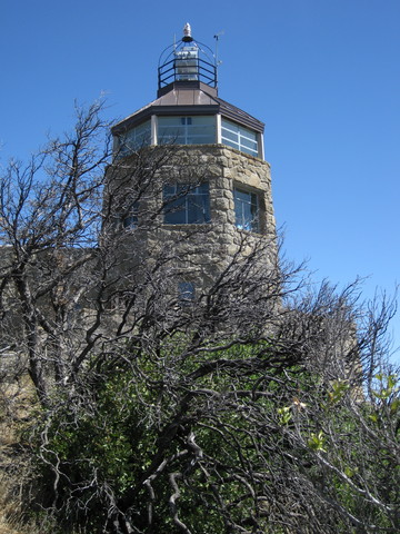
The post-party party up on the Enchanted Hill seemed smaller than usual. Being an early bird for a guided tour, I was treated to a one-on-one (!) visit to two of the cottages.


The famous pool is still drought-dry. Maybe, next year?

September 5, 2015

Top It Off

I haven't pedaled to the summit of Mt. Diablo in a while. It's a tall ask, that last 235 meters. Over about 0.15 of a mile, the road rises 105 feet.

Could I do it? I've done it before. But the last few times, anxious about having a car behind me, I've abandoned and walked.

Today seemed like an ideal day for an assault: Day one of a three-day weekend. With the crowds headed to the beach for summer's last hurrah, I expected few to choose a drive to the top of the mountain.

I was right.

With my heart rate more or less in check, I looked up at that final ramp and continued without a rest. It didn't look as steep as I remembered, but I knew it would hurt. A family hiking down encouraged me. “Good job!” they called out—even the kids.

My heart rate climbed by twos and threes, sampled every five seconds, topping out at 181 bpm for half a minute. Two and a half minutes of suffering, that's all it took. [That's plenty.] Average heart rate: 176 bpm.

A few years ago I had a cardiac stress test, running on a treadmill. They stopped the test at 173 bpm, which they considered 104% of my maximal heart rate. [Pffft.]

It was surprisingly windy, and the wind was surprisingly chilly. I watched other cyclists donning layers for the descent. Ah, well, the faster I go down, the less time spent feeling cold. We watched smoke rising from a fire to the west and fretted about the wind factor. It was a 10-acre grass fire in Sunnyvale, which they fought rapidly to contain. [Whew.] The mountain is recovering remarkably well from the fire that scorched it two years ago. Some evidence remains, like the blackened dead tree that virtually brushes up against the historic stone building at the top. That was a close call, up there.

I was most of the way down when a line of three cars came into view. A minivan, a pickup truck, and a mini-Cooper. Guess which one was in the “lead” (and I use that term loosely). I kept my distance, but I really don't like having to brake behind cars. I'm sympathetic; I'm sure the minivan doesn't handle particularly well, and maybe the driver doesn't enjoy the challenge. But, sheesh .... pull over and let the traffic pass. [Eventually, she did.]

There's a bit of an uphill near the bottom, and I could hear the minivan catching up to me. I was about to crest the hill; I took the lane, hoping to keep her behind me. Reassuring me of her poor judgment, she passed me nonetheless. And immediately slowed as she started going downhill. Slow enough that, when the opposite lane was clear, I pulled around and passed her. Unlike the (large) guy who coasted (!) past me on the way to the top, with his battery-powered electric bicycle, I don't have a motor. The minivan does.

A fine workout on a fine day: 31 miles with some 3,840 feet of climbing.