April 30, 2023

Checking Out Chico

Road trips for cycling events are welcome opportunities to explore new areas. Given the popularity of the Chico Wildflower, I was surprised that the city was so far off the beaten track.

There was a two-day festival at the fairgrounds, with the opportunity to test-ride a variety of cycling contraptions.

And there were adventure-types launching spins and flips. [This one didn't land it.]
Thanks to a lucky meeting with a Bay Area friend on Saturday, we learned that there was a cycling-inspired exhibit at the Museum of Northern California Art—and we had just enough time to seek it out.

Most of the artists were local, like Stevi Mittman. “Silver Streaker” was eye-catching (though not rideable).

Karen Mason's whimsical prints, like “Family Out for the Day,” made me smile.
But the show-stopper for me was Katelyn Fitzgerald's “The History of the Bicycle,” a black-and-white piece composed entirely of the written word. Study it closely and you'd find a description of the history of the bicycle, the Tour de France, the lyrics to Queen's “Bicycle Race” (and more).
We settled on the Sierra Nevada taproom for dinner, along with a contingent of young people in formal attire (prom night).

Sunday (post ride), we stretched our legs on a stroll through the lower section of Bidwell Park. A couple of frenetic butterflies caught our eyes (Black Swallowtails, I believe).

We saw a few cyclists cooling off in the swimming area of Big Chico Creek (if only we'd known ...), and watched a couple of teens clinging and swinging with a log teetering on the edge of a low waterfall. Plenty of flow, especially given the warm weather (we were lucky that it was cooler on ride-day than Saturday, when we arrived).
We wrapped up with a visit to the Chico State campus. I was mindful not to photo-bomb any of the soon-to-be-graduates (and their families) posing for photos. One friendly group invited me to be in their picture when they realized I was politely staying out of the frame! (I declined.)
I was surprised to find so many brick buildings throughout town—an uncommon sight in California (land of earthquakes). Evidentky Trinity Hall has been standing for 90 years, so perhaps this region is less susceptible to shaking than much of the state.

We didn't manage to explore the downtown area. Maybe next time?

Biking to Paradise

There are many beloved cycling events in the region, and one that I'd never explored was the Chico Wildflower. [Until now.] When my cycling buddy agreed to join me, the adventure was on.

We chose the metric (100km) route, though it turned out this was not the optimal route for seeing wildflowers.

The route included a bike path early on (the Steve Harrsion Memorial Bike Path), and I was charmed by the “sprocket arch” as we rolled onto the trail. After capturing a photo of my cycling buddy passing under the arch at the far end, a bystander offered to get a picture for me in a re-enactment. He was serious about his picture-taking—lingering at that very spot for the ideal shot (lighting, shadows).

We're in Butte County ... and there you have it: a butte.
I remembered hearing that a historic covered bridge was lost when the Camp Fire rampaged through this area in late 2018. I never imagined that I would visit the site. As I cycled up Honey Run Road almost four and a half years later, I was surprised at the extent to which the landscape is recovering. But it is not as it was; exploring with Google Streetview, for example, you can compare footage from 2012 and 2021 in some places. A home tucked in the woods (2012); a bare slab in a field in 2021. I expected that we would pass through the burn zone on the way to Paradise; it was sobering to experience this twisty, narrow backroad—so ill-suited for a quick escape. Lives were lost on this road.
My photo of the creek was taken from the modern bridge that that was built years ago to carry traffic over Butte Creek, just north of where the historic bridge stood.

A passing cyclist helpfully called out “Lake Oroville” when I stopped to admire the lake (a reservoir with its own recent drama).

Spinning along at a comfortable pace, another passing cyclist said “nice cadence!” [Words said to me ... never. Until now.]
Heading back through the agricultural fields of the Central Valley, there were snow-capped peaks in the distance and puddles of yellow wildflowers nearby. There were also piles of trees that had been felled; scuttled, perhaps, due to our extended period of drought.
There was a towering plume of smoke to the south; assuredly a controlled burn, perhaps reducing some of those trees to ash?
On a happier note, there was a party at the finish. Of course, I'd chosen to wear a jersey featuring a wildflower (a giant California poppy), and enlisted a fellow cyclist to help me commemorate my ride: 63 miles, with more than 2,400 feet of climbing.

April 23, 2023

Lisa's Lookout

What a difference a weekend makes.
The last time I started a hike from Calero's San Vicente entrance, I had the place to myself. Today? The (large) parking lot was nearly filled ... with mountain bikers.
A friend was co-leading a short group hike, which I realized I could extend to develop a better perspective on the area. My last (short) hike was ... uninspiring.
She and I quickly fell behind, stopping frequently to admire the views and snap photos of wildflowers. We have biked past this area countless times and were amazed at the how beautiful it is from the other side (the park's interior). Especially now, while the hills are still green.

Shortly after the group turned back, an approaching mountain biker slowed to let me know there was a snake ahead, on the trail.

First things first: Is a rattlesnake? (No—it was a harmless Pacific gopher snake.) It was in no hurry to cross the trail, busily flicking its tongue and inching along. Another mountain biker thanked me when I signaled that he should stop, and we waited together for the critter to finish crossing.
Water was cascading into Calero Reservoir; having studied some maps, the source might have been the Almaden-Calero Canal.
The trail turned away from the water, and I soon found myself in grassland studded with trees and wildflowers.
One rocky slope boasted an array of California poppies and buttercup, along with Chia sage.
I paused to watch an Acorn woodpecker, high above me, tapping on a long-dead branch.
And of course I stopped to check out Lisa's Lookout. I imagine that an interpretive sign was once mounted on an adjacent (empty) post, likely to educate us about the trail's namesake (Lisa Killough, whose obituary mentions her role in acquiring this land for the park).
I knew this would be a long hike, and as the trail zigged and zagged I wondered if I'd somehow gone astray. How was it that I had a view of Mt. Umunhum? I shouldn't be headed in that direction. I was reassured, though, to see mountain bikers continuing to stream toward me; I knew they were following the same trail, but in the counter-clockwise direction.
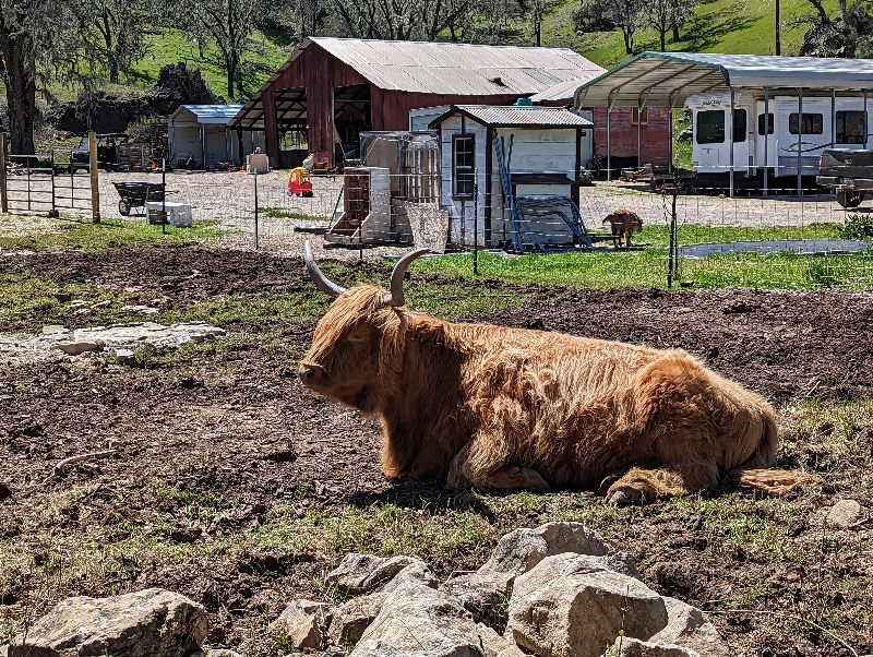
Cattle grazed in a meadow carpeted with yellow blossoms ... surely I would see signs of civilization (i.e., the parking lot) soon?
At last! I took an unintentional shortcut at the end, squeezing through tight gaps next to locked gates. [Evidently not the only one to do so.] I'm pretty sure a trail marker pointed me in that direction. Beautiful birdsong rang out from a treetop: a Western Meadowlark (thanks, Merlin!).

I covered about 9 miles, with maybe 1,400 feet of climbing along the way. More than I expected, in so many ways.

April 17, 2023

Wake Up, Walk Up

On last Monday's hike there was some appetite for tackling the Kennedy Trail today, and I offered to lead. A favorite grueling climb for mountain bikers, on a weekday we'd have the terrain to ourselves.
Then one by one, people recalled prior commitments and declined the the incline. [And we do know the incline: the trail heads prettty much straight up.]

I didn't expect much in the way of wildflowers, but evidently I haven't visited this trail in the spring—until now. A robust cluster of Paintbrush was one of the first sightings.

There were several shrubs with blue flowers along the trail, which I think were some form of “California lilac” (Ceanothus).
These isolated pink blossoms, going to seed, made me think of snapdragons; perhaps spread from a local garden?
And of course, some lovely bush lupine.
Distracted at the start, I didn't start recording my effort until our group of five had started up the hill. The hike is basically about 8 miles and 1,800 feet of climbing, give or take, from the trailhead to the junction with the Priest Rock Trail (and back).

Well acquainted with the steeepness of this trail, and having watched my companions steady themselves with two poles on prior hikes, I decided to invest in a pair. Helpful? Definitely. Upper-body workout? Hello, sore muscles ...

April 15, 2023

The Ride of Spring

It was that time of year. The time when cyclists converge on Calaveras Road while the hills are green and festooned with flowers.
When I proposed this route, a couple of friends shared that one of the local clubs would be out in force. [Plenty of road for all of us.]
It was a thrill to see so much water in the reservoir! Landslides that had blocked the road a few weeks ago had been cleared, allowing us to head for our planned stop at the Sunol Regional Wilderness Preserve. As luck would have it, we arrived just as a ranger began turning would-be visitors away. Alas, no more parking spaces ... for vehicles. We cruised right on in and settled at a picnic table in a grassy field near the ranger station. Knowing where to find us, two friends left their club crowd to join us.
Leapin' lupines!

Having dreaded the climb up the Wall this morning, I surprised myself by being a mere six seconds slower than my best (known) time. Not to mention a new personal best (by 25 seconds) on the steady 2.6 mile climb after leaving the park. I guess I'm in better shape than I thought? Though my legs were sore after finishing the ride with 30 miles and over 2,700 feet of climbing. (Sore, in a good way.)

April 10, 2023

Don't Look Back

So close, but yet so far. Getting to the El Sereno Preserve can be a challenge—access to the Aquinas Trail, for example, is at the end of a private road. We carpooled to a small clearing at the base of the road and walked up. Call it part of the hike.
It was easy to imagine that we were far from civilization as we climbed toward the sky. One glance over your shoulder confirmed otherwise, however.
But we had left the hustle and haze of Silicon Valley well below us. We made it not quite to the end of the trail before turning back; high enough to take in a view of the Lexington Reservoir, replenished by our rainy winter.
In all, we covered something short of 8 miles. It was a good day for this hike (before the heat of summer). A day to embrace new horizons.

April 6, 2023

Dive Right In

When I woke up this morning, my body was nagging me to take it easy. I decided to wait a while before telling my cycling buddy that I wouldn't ride, in case she'd feel obliged to back out in solidarity. I imagined sitting in a park, reading, while my compatriots cycled in and around San Miguel.
Then I looked at the route profile. The gradient on the big climb (~6 miles) was a whopping 2%, for the most part. Once I started moving around and ate some breakfast, I felt better. It's only 33 miles ...
The vintage warbird wasn't the only surprise of the day.

A “road closed” sign greeted us as we turned onto North River Road. With most of the group ahead of us (ebikes), we stayed the course. Until we met them, returning. Mud, they said. Can't get through, they said.

Many phones were pulled from pockets, alternate routes considered. Most of the group decided to revisit the closure, appealing to any passing pickup truck to carry them across. With almost 30 miles behind us, there was no enthusiasm for the detour I proposed. Three of us followed a rider who was confident about the route he had in mind, until I realized that we were heading south toward Paso Robles (rather than north, toward San Miguel).

After backtracking, our impromptu leader phoned one of the riders ahead. It was possible to cross, maybe even to ride; her shoes got wet.

There was no mud, simply the Estrella River crossing the road at a dip engineered for that purpose. Off with the shoes and socks, I was the first to wade across. The current was manageable, the textured concrete surface not slippery, and my lightweight bicycle easy to carry. At the far end, I pulled out a bandana and dried my feet. (I'd always figured it might come in handy, one day.)
Meanwhile, several SUVs nonchalantly drove right through—as did a bunch of guys on motorcycles. (We reassured them it wasn't slippery.)

In the end, that 33-mile ride turned into a 40 mile ride, with about 1,700 feet of climbing. I was glad I didn't sit this one out! Recovery day tomorrow, for sure ...

April 5, 2023

Sculpterra Loop

Day two. No recovery day, this. But there would be poppies!

Given my (un)fitness level, I knew it would be challenging to ride three days in a row; my body confirmed that this morning. Our social group was planning a 48-mile outing. [Ebikes.] I noticed that the route had an inner loop; skipping that (however beautiful it might be) made the day more manageable for me. Before we had GPS routes to preview, I would have soldiered on (and suffered).

I was glad that I'd previewed the route before we started, noting that we'd be taking the first left after crossing 101 (for a pit stop at Templeton Park). As happened yesterday, a couple of riders missed the turn and strayed off course.

One rider was glad to join me, and by the time we reached the Sculpterra Winery we were both more than ready to see it.
Our stray riders caught up to us, and after picnicking I led them back to town before the rest of the pack arrived. [No more wrong turns.]

Back at the Inn, I was surprised to see a couple of glum riders from the more aggressive group; their planned route had been thwarted by a road closure, and they didn't work out an alternative. For sure, I'd had more fun today: 40 miles and about 2,000 feet of climbing.

I don't mind being a slowpoke.

April 4, 2023

Sights to See

Back in Paso Robles for some spring biking. I clearly didn't explore enough of our lodging's grounds last year!

With plenty of free time in my life now, I could enjoy this multi-day excursion with old friends—and my chief cycling buddy was all in this year, too!
It just so happened that a red-tailed hawk was perched across from one of the places where we paused to regroup, and somehow someone spotted it.
We're here a month earlier than last year, with frost warnings (due to a cold spell). It didn't take much convincing to shift our planned start time from 9 a.m. to 10; other than the morning chill, conditions were just about ideal.
My cycling buddy and I cast our lot with the social (slower) group, but this year nearly everyone was on an ebike. (In fact, we were the only women in that group riding under our own power.) Although we biked through Peachy Canyon again, much of our route was new—with more elevation gain. With no turbo button for me to flick when the grade kicked up, I was thoroughly spent after 40 miles and more than 3,600 feet of climbing.