September 21, 2024

Ham for Lunch

Destination: Lick Observatory.
Having committed to do a multi-day tour (which is fast approaching), I've been upping my mileage (and hill climbing) for the past several weeks. And what better way to assess my endurance than to ascend Mt. Hamilton?

This time of year (mating season) brings out the tarantulas. Yes, they're big. And hairy. But benign.

A coyote crossed the road ahead of me, then eyed me from the nearby slope before moving along. The wild turkeys I'd passed miles earlier were out of range, I expect. I heard the usual mix of scrub jays, acorn woodpeckers, quail, and red-tailed hawks. I'm pretty sure it was a gray fox I spotted on my descent, scampering into the brush right next to the road.
I slogged my way to the top, slower than 
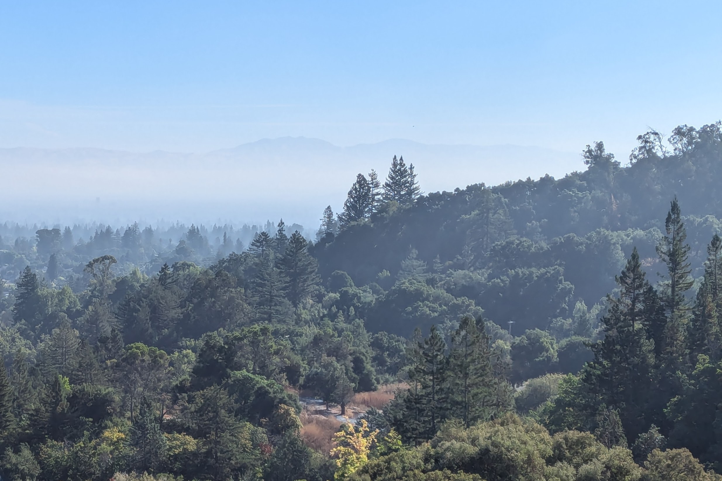
my last trip here. Skies were clear, but the temperature was just warm enough to be uncomfortable. I had paused to shed my jacket on the lower climb, then five more times on the upper climb for snacks, proper hydration (electrolytes), and the occasional photo. From the summit, I envied the fog layered over Monterey Bay.

First to the patio, I scored the best (shadiest!) table. My chief biking buddy had gamely joined me again, even though she's not particularly fond of this climb. We loitered and chatted with visitors; I ate everything I'd brought and refilled my water bottle before heading down. I was alarmed to see a fire burning near San Jose International Airport; a grass fire that was quickly contained, as it turned out.

I had my eyes peeled for a (possibly flattened) rattlesnake on the way down; a visitor mentioned seeing one across the center line on his drive up. I don't think about encountering them when I'm cycling, though ironically the only time I'd seen one was in this area.

Seemingly against the odds, there it was. Alive!

It was motionless, apart from flicking its tongue in and out a few times. I kept my distance, but the snake was not amused when I moved—stepping sideways to try for a better zoom angle on its rattle. It coiled, raised its head, hissed, rattled, and slithered off the road. Which probably saved it from being flattened by a vehicle today. [You're welcome.]

Mission accomplished: the traditional 39 miles with about 4,800 feet of elevation gain. For the month of September (so far), 311 miles and some 13,000 feet of elevation gain.

Next week ... ready or not, here I come.

September 10, 2024

Solace by the Bay

I've seen this movie before. Long-time homeowner sells; new owner moves in and suddenly notices the mature tree(s) on the property. Trees that are older than the new owners. First order of business? Cut 'em down!

Heartbroken that the neighborhood would be losing yet another towering giant, and not enthused about listening to chainsaws and chippers all day, I pedaled away. I had already been planning a long ride.

A preening white pelican perched near a napping cormorant.

A great egret hunted along the shoreline.
My habitual baylands ride is a counter-clockwise loop, heading northwest along the edge of San Francisco Bay. During one of my birdwatching pauses, I turned to cast my gaze behind me. The path aligned with Hangar 2 at Moffett Field; Hangar 3, to the left, has been deemed unsalvageable and demolition is underway. Hangar 1, largely restored, is on the right.
With a gratuitous climb on the way home, I completed my 45-mile loop with 1,100 feet of elevation gain. Wood dust and scrapes on the pavement were the only evidence of my new neighbors' once-mighty tree.

September 9, 2024

Quarrying Biodiversity

I'd been surprised when a friend suggested Saratoga's Quarry Park for a future hike. I've passed it many times, never giving it a closer look. I thought it was just a quirky historic town park.
I had no idea that there we'd find a trailhead for the “Saratoga to the Skyline Trail,” which aligns with the Skyline-to-the-Sea Trail: altogether, 36.6 miles to the Pacific Ocean, per the trail marker.
When my hiking companions charged up the hill at a pace I couldn't sustain, I settled into my own pace. A couple said they often hike here, and others were also familiar with the trail. The sights were new to me, and I was in no hurry.
There were explanatory placards along the way, but I skipped them to avoid falling even farther behind. Even then, one friend turned back to scout for me when they realized I'd been out of sight for a while. They likely assumed I was stopping often to take photos of whatever I fancied, playing amateur naturalist. And although that had not been my intent, that was how my trek turned out once I decided that I couldn't keep up with the group.
Consensus was that an open area with a trail fork to private property was a natural turnaound spot, for a total distance of nearly seven miles, with some 1,200 feet of elevation gain.

Alone with my thoughts, and the sights and sounds of the world around me (Was that a rattlesnake I heard?), I concluded that I'd found my limit. I'm more of a contemplative hiker than an aerobic one, and I need to factor that into future group-hike decisions.

September 3, 2024

A Trail Less Traveled

Two days ago, I'd introduced a few of my former teammates to an oft-visited section of Almaden Quicksilver County Park that offers a good mix of tree cover, open vistas, and a nice view of the Guadalupe Reservoir. This time of year, I'm less likely to be distracted by the flora and fauna (as the landscape grows ever more dry). We spotted a couple of deer almost immediately, much to everyone's delight.

Most plants bloom during springtime, but I'd learned that some have found an evolutionary edge by having less competition for pollinators in a later season. The hayfield tarweed is in full bloom now, but something else caught my eye that day. A tiny, delicate flower on spindly stems. Had I seen that before? From the blurry photo I managed to capture, I later learned it was a rare plant. One specimen. A veritable needle-in-a-haystack, for me.

And thus it was that I returned today for a closer look (and a better photo, which I won't share here in the best interests of the plant).

To shorten the loop and mix things up a bit, I decided to introduce myself to a different trail. For a while I thought I might not cross paths with other people; the trail seemed less trodden (and narrow).

Woodland skippers were having a (hay)field day with the tarweed; as usual, I was focused on what I could see nearby. When my gaze wandered uphill, I was surprised to find two pairs of eyes focused on me.
With an early start and having shortened the loop from five miles to two, I was done before the day heated up.
And despite having crossed this bridge on so many hikes, I finally noticed that it's a century old!

August 17, 2024

Picture Perfect

My first trip to the top of Mt. Hamilton by bicycle was in October, 2003 (on a recumbent tandem), followed by a repeat in 2004. My first solo trip was in 2005; the group started just above Joseph Grant County Park (midway) and biked out and back on Kincaid Road as well. After that, I pedaled to the top every year (mostly recorded here), from the bottom ... until last year. I was deterred by road closures, and later wasn't confident I was fit enough to make it to the top.
I wasn't so sure today, either. Then I thought about Remco Evenepoel visualizing victory at the Olympic road race in Paris two weeks ago, imagining what an iconic image it would make to cross the finish line solo at the Eiffel Tower. Then, he did it.
I planted an image in my head, standing in front of the main entrance at Lick Observatory atop Mt. Hamilton.
Much to my surprise, a good friend had driven up to meet me at the top—not only snapping photos, but bringing lunch!

I expected to see more cyclists on such a beautiful day.

Not my fastest time up the hill, but not my slowest either! On the way up, I'd thought about pausing for a quick snack, with a particular tree-shaded overlook in mind. Not finding it, I just kept going. On the way down, I saw why: Only a low stump remains, a casualty of the fire in 2020.

A couple of miles from the bottom, I caught up to a vehicle and slowed to keep a safe distance between us. With a bike rack on the rear (empty), the driver understood that I could outpace him and graciously waved me to pass when it was clear.

I'll be back. Soon.

August 14, 2024

Pedal Power

It's been ... a while.
I joined a club ride today, and one of the stronger riders captured a photo of me coming up a hill (trailed by a few others).

We had a friendly group of people, most of whom I knew. On a “regular” bike, I was in the minority; more than half of the riders were on e-bikes. Coasting on a downhill, I was surprised to pass two of them—but of course, they had every advantage on the climbs.

The group bifurcated, with the stronger cyclists and battery-powered cyclists waiting for the rest of us at various points. [Until they didn't.]

Despite taking it easy on the ride home, my overall pace was still faster than the expected pace for the ride ... and yet I trailed the pack. It brought back memories of the first club I'd joined, many years ago, which I left after being routinely dropped (and sometimes lost) on group rides where everyone rode faster than the advertised pace.

It was nice to see folks I hadn't seen in quite some time, and to catch up with those who lingered for lunch at the end of the ride. It was less nice to ride off the back, knowing that if I paused to snap a photo I would only fall farther behind. [Hence, no photos.]

I completed more than 47 miles with some 1,600 feet of elevation gain by riding to meet the group en route (and back). Would I join another club ride? (Maybe.)

Or maybe not.

August 13, 2024

A True Test

There were two ways to get a look at the recently-burned section of Almaden Quicksilver Park from Hicks Road. I chose the route less traveled.
The visible burn scar was open land, probably mostly grass; the nearby trees and shrubs appeared to have been spared. No official cause has been given, but nearby residents reported hearing fireworks that night.

Realizing that I need to spend more time on a road bike, and curious to test my new lower gears, I had decided to tackle the “easier” side of Hicks Road. [Which is not actually easy.] I told myself I could always abandon the climb and retrace my route, downhill, to return home.

Of course, I wouldn't surrender. I also wasn't strong enough to pedal up the steep section, even with more climbing-friendly gearing. [I walked.] A passing cyclist asked if I was okay. “Yes,” I replied. “For some definition of okay.”

Descending the steeper side was fast (and twisty); I was relieved when the familiar hairpin at Guadalupe Creek was in view. The rest of the ride would be tame.

Until I spotted a deer at the side of the road. Where there is one, there are often more. [Three, in this case.]

When you stop for a closer look, or to snap a picture, they typically flee. [Not these three.]

I opted for the flat route home, completing 29 miles with some 1,600 feet of elevation gain. Will I try that climb again? (Maybe.)

Or maybe not?