November 17, 2024

Fall Color

Expecting little color in the landscape this time of year, I was surprised to find something bright—a flower that was new to me.
I had explained to my hiking companions that today's trails are reliable for wildflower viewing in the spring; turned out that the serpentine sunflower is also at home in this soil, later in the year.

Cloud cover was building as the day wore on; there was little wildlife to see, perhaps due to the cool temperature. Cattle grazed nearby, separated from the trail by barbed wire. We were treated to the sight of a nursing calf—not a common thing, for us.

As we circled toward the end of our 4.6 mile loop, we passed through an area busy with birds: acorn woodpeckers, California quail, lesser goldfinches. As we climbed the trail that would return us to the parking area, a large bird swooped overhead toward a tree. I couldn't be sure that it perched, or that I could find it, but my camera zoomed and delivered: a red-shouldered hawk.
The presenters at Raptor Fest yesterday had suggested that the area was popular with local raptors, and here was one—reinforcing the importance of preserving contiguous (or near-contiguous) tracts of wild open space.

November 16, 2024

Raptor Fest

It was 37°F when I woke up; my neighbors' rooftops were frosted. Perhaps registering for the first session of “Raptor Fest” today wasn't the best idea? [Dress warmly.]

Hosted by the Peninsula Open Space Trust and Santa Clara County Parks, we would be treated to a presentation by a falconer.

Hillside seating ensured clear views for all.

Before the program started, local nature-related organizations had tables to visit. The Wildlife Education & Rehabilitation Center had brought along a few birds. Certainly the closest I've been to a turkey vulture!
When the falconer brought out his first bird, he asked the audience to identify it. A few voices rang out, including the guy sitting next to me: aplomado falcon. [Hmm, you've been here before, I take it?]
The falconer was a skilled entertainer as well as educator, telling stories and readily answering questions. It's not all for show—he's licensed for abatement, and noted that Sunnyvale's pesky crow population has been reduced from about 800 birds to 130 or so. Before releasing his Harris's hawk to fly over the crowd, he noted that if you duck because you're unsettled by the bird flying too low overhead, the bird will react by flying lower. Put a hand up instead, he advised.
We learned that the ears of the Western barn owl are not symmetrically opposite, and that the ring of feathers circling the bird's face also contributes to its sense of hearing.
We heard the last bird on the program before we saw it, a startling cry that sounded like a sea bird to my untrained ear.
We learned that the peregrine falcon's eyesight is so keen that it can see dust particles rising in a thermal updraft. On a hot day, they'll climb higher to reach cooler air.

With so many event calendars to follow, I would have missed this had I not spotted an announcement posted on a county park's sign after a recent hike. It pays to pay attention!

November 9, 2024

Reflections

Some months ago, my chief biking buddy observed that it had been a long time since we'd biked up Old Santa Cruz Highway. I noted that the road had been closed for quite some time (due to storm damage in multiple locations), but had reopened. (And I've explored it a few times since then.)
Today was our day. Post-summer-beach-traffic congestion. Pre-Christmas-tree-farm congestion. Neither too cold nor too hot. Lexington Reservoir's low water level surprised me; I expect they're preparing for winter rains, and I hope Mother Nature delivers.

Back in the day, it was permissible (and free) to park above the dam; that's been off-limits for many years. The local bike club prefers to start rides further south, where there is ample (and free) parking near the Lexington School, but that cuts out the scenic rolling hills on the east side of the reservoir—the route we chose today.

By now I've pedaled farther (and higher) than all of last year (or the year before that). I'd noticed that my enthusiasm for cycling waned significantly after I completed my recent three-day tour. Is this a trend? Cycling should be fun, not a chore.

We opted to return on the west side of the reservoir, which entails a short stretch on Highway 17 (at the edge of a lane that carries little traffic, leading to the reservoir). A motorist tapped his horn as he passed me, perhaps thinking that I shouldn't be there and didn't know what I was doing? Surprise! It is actually bicycle-legal (and not too scary).

We covered a little under 15 miles and 1,400 feet of elevation gain. But it's really about the camaraderie, not the stats.

November 4, 2024

Hints of History

Today's hike introduced me to a section of Almaden Quicksilver Park that I had not yet explored.

There are a few odd boulders that pop up around this area. Regrettably, I know nothing about geology. This specimen has an impressive fissure, though it didn't appear likely to split anytime soon.

The skies were clear, thanks to some recent windy weather. The trails gave us views of the Santa Cruz Mountains and Mt. Umunhum to the west, and
eastward across the valley to Mt. Hamilton and the Diablo Range.
Although some folks jumped ahead, the group mostly stayed together.

While it might seem obvious that you shouldn't stray off the trail to explore the crumbling remains of old cabins, warning signs were posted. One included a special note that hantavirus has been found in the park's rodents. That was a warning I'd never encountered, until now; all the more reason to stay clear of old buildings (and always read signs)!

The April Tunnel Trestle still stands, but the years have taken a toll. Without restoration, sections seem likely to collapse. It's an impressive relic, for now.
After hiking six miles I was ready for the sandwich I'd packed. This time of year, the picnic table's well-intentioned pergola cast a shadow on the ground, several feet away. It was surprisingly warm for a November day; four of us made like birds on a fence and perched side-by-side, our backs to the sun.

Now that the mining museum has reopened (though not daily), I should plan a visit. Some rainy day, this winter.

October 19, 2024

Pedal Pushers

Foxy's Fall Century is a popular one-day bike event that I'd never done, and this year my chief biking buddy and I signed up. Rides like these are great opportunities to see parts of California that we would otherwise likely not visit.

Davis is renowned as a big biking town, and we saw plenty of university students (and others) on the streets and trails.

We headed for the university's arboretum to stretch our legs after our long drive. Blooms are scarce this time of year, though we did pass some common yarrow and California fuschia. Nature's Gallery Court, with its colorful tiles featuring native plants and pollinators, was a lovely consolation.
The arboretum's waterway was dry (under renovation), much to the disappointment of my biking buddy, who was especially looking forward to seeing the lake.

A red flag warning (for gusty, dry winds) had been scheduled to expire on Friday night, but then was extended into Saturday evening. On the drive up we'd seen a grass fire from the freeway, to the east; that smoke wouldn't be a factor, but I did smell smoke (faintly) when we started biking on Saturday morning. That fire was closer, I learned, but contained.

Our route followed mostly rural roads, with very little traffic, past orchards and vast agricultural fields. The middle third of the ride brought us closer to some hills, with a welcome lunch stop at Lake Sonoma. Like many of our fellow riders, we perched on the curb with our sandwiches to enjoy the view.
The winds (headwinds, with occasional gusts) picked up as the day wore on. Despite that, I averaged 14 mph over the course's 62.6 miles. I'm pretty sure that's my fastest pace over such a distance (thanks to very little elevation gain—less than 1,200 feet).

Of course, several pacelines passed me like I was standing still ... but that's to be expected. Unlike so many rides these days, I wasn't passed by a single ebike—I saw only one, all day. What a joy it was to pedal with so many like-minded cyclists!

October 13, 2024

Can't You Read the Signs?

As I pulled on my hiking boots at Bear Creek Redwoods, a couple climbed out of their pickup truck with a small dog. Thinking that dogs weren't welcome at Midpeninsula's open spaces, I was surprised—and figured that I was mistaken.

Yes. And no. (They're welcome at some preserves, but not this one.)

Fog touched the treetops on the hills, but our trail wouldn't climb that high. I was glad when my former teammates suggested this preserve for our hike today; at this time of year, the forest is an especially welcome alternative to the dry hills. One of the guys was hiking with us for the first time ... along with his friendly dog.

Busy chatting, we passed the usual (brown) sign at the trailhead. Do this, don't do that ... Of the many icons and other text on the sign, what caught my eye was the hiker (permitted, of course) and weapons (not allowed). All of us focused on the bright yellow sign, beneath, about mountain lions. I also noticed a temporary sign announcing that the Madrone Knoll trail was closed, but we weren't planning to hike that anyway.

None of us noticed that dogs are, in fact, not permitted. None of the hikers we passed said a word.

But a ranger was lying in wait, his truck tucked into a spot just off the trail. And he was not pleased. Our colleague got a ticket (not a warning) and was sternly told to “leave immediately.” (We were on the return leg, at that point.) The ranger insisted that we had passed 11 “no dogs” signs. [Not really. Paying close attention, we found four or five that we had indeed overlooked; others are likely placed at paths we didn't follow.] Maybe a couple of the small, dog-specfic signs would be more eye-catching if they were, say, black and white?

Lesson learned. Read the signs, always.

September 28, 2024

In the Misty Morning Fog

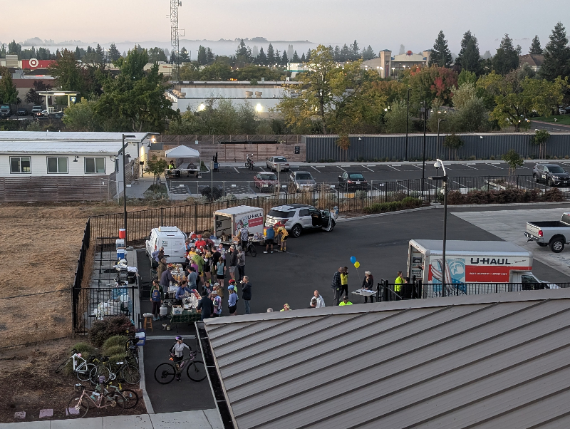
With breakfast done and luggage handed off, I managed to get rolling about 15 minutes earlier today. On my own, again.

We'd been cautioned about sharing the road with traffic as we climbed out of Pacifica, even so early on a Saturday morning. [Where are they all going?!]

Bright jacket. [Check.] Bright flashing white light on my handlebar. [Check.] Super bright flashing red light on my back. [Check.]

I found myself at Devil's Slide sooner than I expected. Vehicular traffic passes into a tunnel; cyclists follow the original road as it snakes along the slide-prone cliffs.

Not much of a view.

Visibility was so limited, even at bicycle speed, that I had to slow down. The white line at the edge of the road is your friend. (Now I get why it's called the “fog line!”)

The fog condensed on both sides of my lenses. I had to stop—often—to wipe them dry. Sometimes I just peered over the top, despite my profound nearsightedness.

Approaching Half Moon Bay, a few riders pulled out of a parking lot. [Unofficial rest stop at a Starbucks.] I. Am. So. Slow. I had been looking forward to the traditional tailwind, heading south; uncharacteristically, we were battling a headwind.

Then we saw red and blue flashing lights ahead. A lot of them. Emergency vehicles blocking most of the road. My heart dropped. I was relieved that I wasn't facing this scene alone. And even more relieved that no cyclists were involved; a large white SUV had smashed into another vehicle. Later I overhead that a couple of riders had been nearby and dodged a wheel that broke loose from one of the vehicles.

I spotted a paved trail running parallel to Highway 1 and wondered why we weren't on it. Eventually, I shifted over and enjoyed it while it lasted.

Sometimes a dry-my-lenses-and-refuel moment was at least somewhat photo-worthy.

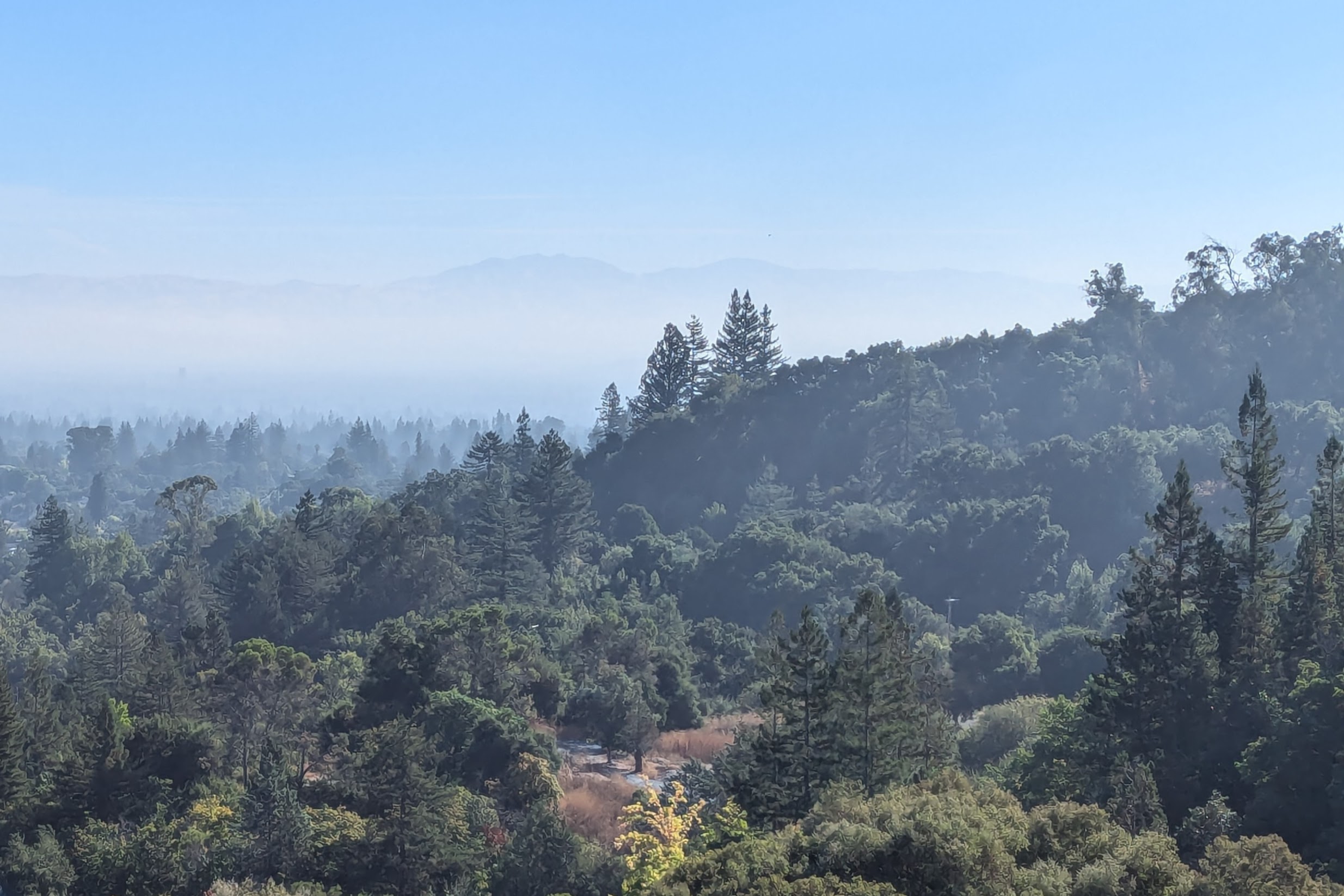
I knew that I would pass the burn zone from the CZU fire. It's been more than four years, and I hadn't yet mustered the courage to view the aftermath. Cycling rather than driving along the edge was probably best, anyway. You can't help but be distracted by what once was, and thinking of the man who lost his life on a remote road I'd biked past many times.

The fog layer lifted overhead around the halfway mark. I'd been grateful that a car club (Porsches, mainly) had been heading north when they passed us. Now, on the outskirts of Santa Cruz, a less well-behaved caravan of mostly Ferraris and Lambos sped by, heading south. I found a safe place to step off the road.

There was a plan for everyone to assemble at a spot in Santa Cruz and ride together to the finish in our matching jerseys. Gauging the timing, I knew I wouldn't make it. Lacking local knowledge to navigate through Santa Cruz more directly, I was further slowed by boardwalk traffic, unpredictable pedestrians, and detours. I arrived just as the group photo was being taken, and missed it when a well-intentioned bike valet stopped me. Ah, well.

As a newbie, long-time participants were curious how I came to join the ride. “Are you a Rotarian?” asked one of my dinner companions on the second night. “No,” I smiled. “That's okay, I forgive you.” he bantered.

Cast your memory back to episode one of this saga, where I mentioned the article that launched me on this journey. The author didn't ride this year, but she was there at the finish line celebration. I introduced myself: “You're the reason I'm here!” Her face lit up.

With today's 65 miles and some 3,400 feet of elevation gain, I managed to ride 175 miles over three days, approaching 9,950 feet of elevation gain. The best part? The people! The organizers, the cheerful and supportive volunteers, my fellow riders, a roommate who turned out to be very compatible. Over the course of three days, I didn't see a moment of negativity from anyone. [Imagine that!]

We formed a community to raise funds for a designated set of youth-related causes—and we raised enough to support the club's commitments to all of them. Hearing from leaders of the receiving organizations, and experiencing the dedication of the people hosting this ride, was inspirational. Seriously.

Same time, next year? Hmm ...

September 27, 2024

Missing the Middle in Marin

The organizers have a check-in protocol to assure that no one is left behind; I wasn't the last one to roll out, but I should have gotten an earlier start. Breakfast was officially available at 6:30 a.m.
I was amused when one of the words I formed in the NY Times Spelling Bee game this morning was R-O-T-A-R-Y. The Santa Cruz Sunrise Rotary Club has been hosting this event for some time (2024 is the 27th edition), and it wouldn't surprise me if they had a connection to pull that off.

If I could have afforded the time to stop for photos, I would have captured the mist rising above a field in the early morning light. And a perfect shadow of me on the bike, cast by the rising sun.

A large group stopped for a photo when the northern wetlands of Tomales Bay came into view, so I pulled over and played photographer for them. I'd been leapfrogging them for a few miles, and they suggested I join them. “I can't keep up, I need to ride at my own pace,” I explained. “Well, you seem to be keeping up just fine!” they said. [Only because I was faster going downhill.]

Soon enough the terrain flattened out, I lost my advantage, and they were ... gone. An hour later, I needed a break (and Tomales Bay was stunning).

The farther south I rode, the more concerned I became that I'd missed the official rest stop. I passed the “usual” spots (from past experience with rides along this road). Mile 23? Or mile 27? I pulled out my route sheet: Mile 31.

Shortly thereafter, the road turned east and the climb ramped up. The day was already warmer than I'd expected. I passed a SAG vehicle that had pulled over. “I'm not stalking you,” he joked. And then I knew: I was the last rider on the road. Sausalito (our lunch stop) was on the other side of Marin County, 30 (hilly) miles away. I'd noticed an odd little tent in the field at the rest stop. Not being a camper, it later dawned on me that it was probably a pop-up privacy potty.

When I next met the SAG truck, I pulled over. I really wanted to ride the post-lunch segment, from Sausalito to Pacifica, and I decided that wasn't realistic unless I skipped ahead. [Sigh.] We slowly cruised to Sausalito, stopping to check on or pick up other cyclists. I enjoyed both our conversations and the airconditioning, and really looked forward to reaching a restroom. With about 2,000 feet of elevation gain, I'd averaged 12.2 mph over those first 33.6 miles, which was pretty typical for me.

I saw a few familiar faces at lunch, just before they took off. I didn't linger, determined not to be last on the road.

It had been many years since I'd biked over the Golden Gate Bridge. Even on a weekday, outside of tourist season, it was busy—and now many visitors are on rented ebikes. Unlike yesterday, we had clear views.

The blind turns around the towers are always dicey, with pedestrians and cyclists traveling in both directions. I walked around the busier south tower and tucked out of the way for a photo. A yellow sign warns cyclists about the gusty winds I'd already braved.
Okay. It was worth it.
Our route headed through a ritzy neighborhood into Lands End and past the Legion of Honor before continuing south on the Great Highway. When people had mentioned the steep climb to the water tower in Daly City, I knew exactly where we would be. I've pedaled up that street from the other direction, and I can tell you that side is tougher. (The steepest part of today's route was on Alexander Avenue in Sausalito—climbing up to the bridge.)
Not being familiar with the area, I hadn't realized how close I was to the end of today's route in Pacifica (less than six miles). I covered about 22 miles on the second half of my ride, climbing some 1,700 feet along the way. My pace was slower, in part because I allowed myself to relax and in part due to the usual challenges crossing the bridge. For the day, about 3,700 feet of elevation gain over 56 miles (shy of the route's full 86 miles and 4,400 feet). It was the right call.
The view from my hotel room and the soothing sounds of the sea were my rewards.

Hopefully I can start pedaling earlier tomorrow, to complete the last leg of this journey!

September 26, 2024

On the Road Again

Late last year, browsing the website of one of the bicycle clubs in our region, I read an article about a multi-day cycling event that has been held annually for 26 years. Twenty-six years, and I'd never heard of it until then?
Here we are at 6:00 a.m., loading bikes into trucks, and cyclists and their bags onto a bus. This year's cadre was disciplined; the organizers were delighted that the bus actually pulled out more than 15 minutes ahead of schedule. Destination: Healdsburg.

We stretched our legs at the rest stop just north of the Golden Gate Bridge. I hoped that we'd have a view when we cross it on our bikes, tomorrow. But you never know.

We were so busy chatting on the bus that I was puzzled when we pulled off the freeway. Suddenly, it seemed, we were in Healdsburg.

After a group photo and a few verses of On the Road Again, we were on our way. I started with a small group of women (who pulled ahead within the first mile). I've never been a speedy rider. The day was warm, and with two more (hilly) riding days ahead, I also needed to pace myself.

Our lunch stop was hosted at a participant's cabin along the Russian River. [Top that!]
Our route followed many Sonoma County roads familiar to me from rides gone by: Waves to Wine, club rides, Best Buddies, Wine Country Centuries, and more.

Memorable moments: A truck hauling junk (uncovered) passed me early on; I hung back, imagining the absurdity of being flattened by a flying mattress. Unsurprisingly, a big boy in his big pickup truck found it necessary to blast us with clouds of sooty exhaust on a rural road. Had we put it to a vote, the one-mile stretch along Barlow Lane would come out on top as the worst road surface. Ever, according to some. Struggling to shift gears at one point, I glanced down at my rear wheel and discovered that a small branch had hitched a ride in line with my chain. [That's a first.]

When we reached Roblar Road, I knew Rohnert Park (and our hotel) was near. Of course, we had followed a scenic route to get there: 53 miles and some 2,800 feet of climbing. Somehow, I managed to roll in with a small group—headed by the guy who'd led the training ride I'd joined a few months ago.

Tomorrow will be a long day.

September 21, 2024

Ham for Lunch

Destination: Lick Observatory.
Having committed to do a multi-day tour (which is fast approaching), I've been upping my mileage (and hill climbing) for the past several weeks. And what better way to assess my endurance than to ascend Mt. Hamilton?

This time of year (mating season) brings out the tarantulas. Yes, they're big. And hairy. But benign.

A coyote crossed the road ahead of me, then eyed me from the nearby slope before moving along. The wild turkeys I'd passed miles earlier were out of range, I expect. I heard the usual mix of scrub jays, acorn woodpeckers, quail, and red-tailed hawks. I'm pretty sure it was a gray fox I spotted on my descent, scampering into the brush right next to the road.
I slogged my way to the top, slower than my last trip here. Skies were clear, but the temperature was just warm enough to be uncomfortable. I had paused to shed my jacket on the lower climb, then five more times on the upper climb for snacks, proper hydration (electrolytes), and the occasional photo. From the summit, I envied the fog layered over Monterey Bay.

First to the patio, I scored the best (shadiest!) table. My chief biking buddy had gamely joined me again, even though she's not particularly fond of this climb. We loitered and chatted with visitors; I ate everything I'd brought and refilled my water bottle before heading down. I was alarmed to see a fire burning near San Jose International Airport; a grass fire that was quickly contained, as it turned out.

I had my eyes peeled for a (possibly flattened) rattlesnake on the way down; a visitor mentioned seeing one across the center line on his drive up. I don't think about encountering them when I'm cycling, though ironically the only time I'd seen one was in this area.

Seemingly against the odds, there it was. Alive!

It was motionless, apart from flicking its tongue in and out a few times. I kept my distance, but the snake was not amused when I moved—stepping sideways to try for a better zoom angle on its rattle. It coiled, raised its head, hissed, rattled, and slithered off the road. Which probably saved it from being flattened by a vehicle today. [You're welcome.]

Mission accomplished: the traditional 39 miles with about 4,800 feet of elevation gain. For the month of September (so far), 311 miles and some 13,000 feet of elevation gain.

Next week ... ready or not, here I come.

September 10, 2024

Solace by the Bay

I've seen this movie before. Long-time homeowner sells; new owner moves in and suddenly notices the mature tree(s) on the property. Trees that are older than the new owners. First order of business? Cut 'em down!

Heartbroken that the neighborhood would be losing yet another towering giant, and not enthused about listening to chainsaws and chippers all day, I pedaled away. I had already been planning a long ride.

A preening white pelican perched near a napping cormorant.

A great egret hunted along the shoreline.
My habitual baylands ride is a counter-clockwise loop, heading northwest along the edge of San Francisco Bay. During one of my birdwatching pauses, I turned to cast my gaze behind me. The path aligned with Hangar 2 at Moffett Field; Hangar 3, to the left, has been deemed unsalvageable and demolition is underway. Hangar 1, largely restored, is on the right.
With a gratuitous climb on the way home, I completed my 45-mile loop with 1,100 feet of elevation gain. Wood dust and scrapes on the pavement were the only evidence of my new neighbors' once-mighty tree.

September 9, 2024

Quarrying Biodiversity

I'd been surprised when a friend suggested Saratoga's Quarry Park for a future hike. I've passed it many times, never giving it a closer look. I thought it was just a quirky historic town park.
I had no idea that there we'd find a trailhead for the “Saratoga to the Skyline Trail,” which aligns with the Skyline-to-the-Sea Trail: altogether, 36.6 miles to the Pacific Ocean, per the trail marker.
When my hiking companions charged up the hill at a pace I couldn't sustain, I settled into my own pace. A couple said they often hike here, and others were also familiar with the trail. The sights were new to me, and I was in no hurry.
There were explanatory placards along the way, but I skipped them to avoid falling even farther behind. Even then, one friend turned back to scout for me when they realized I'd been out of sight for a while. They likely assumed I was stopping often to take photos of whatever I fancied, playing amateur naturalist. And although that had not been my intent, that was how my trek turned out once I decided that I couldn't keep up with the group.
Consensus was that an open area with a trail fork to private property was a natural turnaound spot, for a total distance of nearly seven miles, with some 1,200 feet of elevation gain.

Alone with my thoughts, and the sights and sounds of the world around me (Was that a rattlesnake I heard?), I concluded that I'd found my limit. I'm more of a contemplative hiker than an aerobic one, and I need to factor that into future group-hike decisions.

September 3, 2024

A Trail Less Traveled

Two days ago, I'd introduced a few of my former teammates to an oft-visited section of Almaden Quicksilver County Park that offers a good mix of tree cover, open vistas, and a nice view of the Guadalupe Reservoir. This time of year, I'm less likely to be distracted by the flora and fauna (as the landscape grows ever more dry). We spotted a couple of deer almost immediately, much to everyone's delight.

Most plants bloom during springtime, but I'd learned that some have found an evolutionary edge by having less competition for pollinators in a later season. The hayfield tarweed is in full bloom now, but something else caught my eye that day. A tiny, delicate flower on spindly stems. Had I seen that before? From the blurry photo I managed to capture, I later learned it was a rare plant. One specimen. A veritable needle-in-a-haystack, for me.

And thus it was that I returned today for a closer look (and a better photo, which I won't share here in the best interests of the plant).

To shorten the loop and mix things up a bit, I decided to introduce myself to a different trail. For a while I thought I might not cross paths with other people; the trail seemed less trodden (and narrow).

Woodland skippers were having a (hay)field day with the tarweed; as usual, I was focused on what I could see nearby. When my gaze wandered uphill, I was surprised to find two pairs of eyes focused on me.
With an early start and having shortened the loop from five miles to two, I was done before the day heated up.
And despite having crossed this bridge on so many hikes, I finally noticed that it's a century old!