December 27, 2013

Raise High the Floor Boards

An overcast sky looms above the waters of Barnegat Bay
Many shades of gray, a winter's day along the bay.

Bay Head Yacht Club building supported on steel beams and stacks of wood.
This Old House has run a series on the rebuilding process at the Jersey Shore. After watching an episode where they ever-so-slowly used hydraulic jacks to lift a home above its foundation, I had the opportunity to take a close look at a similar (but grander) project.

Overall view of the Bay Head Yacht Club building, raised above ground.
The Bay Head Yacht Club building was built a long time ago, at the water's edge (naturally). Hurricane Sandy was not kind to the structure, which now must be raised. But wait, you say: that building is at least a hundred yards from the water.

Not only did they lift that massive building, with its two brick fireplaces and chimneys—they shifted it north, onto the (former) tennis courts.

Crane and drill installing pilings at the water's edge.
With an enormous crane and drill, engineers are driving helical piles into the ground to create a new (higher) footing for the clubhouse.

Man may win this battle, but one day the sea will prevail.

December 14, 2013

Hazy Shade of Winter

Pasture and distant hills viewed from top of Altamont Road
Leaves are brown, no patch of snow on the ground. No patches of ice, either, though we were on high alert—especially when crossing the occasional wet streak across the road. Some higher stretches of pavement were white, as if they had been salted. Could it be?

Atmospheric conditions have been unfavorable for air quality over the past week; today was our seventh consecutive Spare the Air Day. Wood burning is prohibited, to keep the airborne particulate count down.

A handful of riders turned out for today's adventure, which was designed to be short and not-too-challenging. My day was carefully orchestrated: bike, donate blood, and complete a bunch of holiday-related errands with adequate time to get spruced up for a holiday party in San Francisco.

The frosty air warmed quickly to a more hospitable temperature. Climbing Moody Road was less painful than I remembered, and my body did not balk when my heart rate hovered around 180 bpm for an extended spell. The real treat was Altamont, which afforded a sweeping view of a small valley from the top. Although it runs nearly parallel to Moody, the road is completely different in character.

For the day, a short 20 miles with some 2,100 feet of climbing. Just enough.

December 13, 2013

Red Letter Day

Bronze quail statues with red scarves at Mary Avenue bike/ped bridge
On some forgotten day this year, I decided that a goal for 2013 should be to beat my previous record for number of bicycle commutes (34, in 2007). In the past three years, I had gotten lazy; most days, it is oh-so-easy to find a reason not to get up early and climb on the bike.

The more often I rode, the easier it became. It was habit-forming. There were a few weeks when I managed to bicycle-commute four days out of five, which helped to offset three months of slothfulness (not even one ride to work during the months of January, February, and March).

The least palatable way to get to work is to drive. In heavy traffic, driving can take nearly as long (or longer) as biking it.

Most days, I rely on a commuter shuttle bus. Door-to-door, that trip also takes nearly as much time as biking it; but it allows me to extend my day by getting some work done en route.

Today was a special day, and not only because I discovered hand-made woolen scarves adorning the California Quail statues.

Today marked my 52nd bicycle commute of the year. Some 1,895 miles pedaling to (and usually, from) the office.

December 8, 2013

'Tis the Season

Brown hills, green trees, mossy fence posts
Winter in the Bay Area hardly conjures up visions of Frosty the Snowman. For the past week, however, we have been in the icy grip of an Alaskan air mass. Pipes are bursting, delicate plants are turning to mush, and self-generated wind chill on a bicycle holds little appeal.

With the thermometer registering below the freezing mark, it would be an ideal morning to snuggle under a warm comforter. Except that I had gamely volunteered to lead a ride for the club.

Who would show up on such a morning? Perhaps no one, in which case I might simply declare victory after the first hill, and skip the next four.

Stone bridge, palm tree, Mt. Hamilton in the distance
Oh, me of little faith. Six people turned out for my ride; two left home early enough to bike to the start. In the land of palm trees and surfboards, there are some hardy Californians. Okay, it's not Minnesota ... but the weather is freezing and we all dug into our stashes of cycling gear for the heavy-duty stuff.

It was a day not to head for the Santa Cruz mountains, where the Christmas tree farms are bustling. I chose to head across the valley to the eastern foothills, for roads that were mostly well-exposed to the sun. We tackled the steepest climb first, followed by a series of mellow (mostly short) hills.

I was apprehensive about the cold; I have to admit, though, that it was really a pleasant day to ride. I have certainly been colder, on the bike. Whenever we stopped to regroup, my dark side chilled down fast. (Nothing that couldn't be fixed by a judicious pivot toward the sun.)

The little hills added up. It did not feel like I had climbed 4,215 feet over 36 miles. Cold therapy is good for muscle recovery.

November 30, 2013

Welcome to Our World

Hills on the back side of Sierra Road, with Santa Cruz mountains rising above the mist in the valley
It was a day to escape the bustle of civilization, to climb out of the valley and connect with the natural world. Below the mist, downtown San Jose was less than 10 miles away. I spend my weekdays overconnecting with technology; this is how I spend my weekends.

We headed straight up Old Calaveras Road. [And I do mean straight up.] The chilly air burned our lungs and our hearts pumped hard to warm up our muscles. Instead of the traditional right turn at the road's end, we took a left to explore some new terrain. Everyone agreed that Sandy Wool Lake was a scenic reward for that tough climb, and a much nicer place to regroup. Alison taught us about the origin of hang gliders as we watched fliers hauling their wings up the slope. Challenge: find a paraglider in that photo.

There were three courses on today's menu, 4,400 feet of climbing (and descending) densely packed into 28 miles. One rider's appetite was sated by the appetizer, Old Calaveras. Four riders had their fill after the soup course, Felter. The rest completed the main course, Sierra; a few had time for salad (assorted sections of Calaveras). Still hungry, two riders tackled Welch Creek for dessert.

Assembling at the start, one rider remarked that there were no flat sections on today's ride. True, I admitted; but there are downhills. One rider was apprehensive about descending Sierra, and thought it was silly to turn right around and climb back up. Well, there you are, right in the neighborhood, I replied. How could you not climb Sierra?

As it happened, a few of us were in the right place at the right moment on Sierra. However compelling the view, it is rare [exceedingly rare] for me to stop on a descent. At 22 mph, something very special came into view with enough space for me to come safely to a stop.

The smallest calf I had ever seen was right next to the fence. Mom watched me, but was unconcerned. The newborn was as fascinated with me as I was with him. Mom had already cleaned him up, but he was clearly hours old—unsteady on his feet, with a trace of umbilical cord still dangling. Welcome to our world, little one.

November 22, 2013

Take a Peak

Anderson Lake, Morgan Hill, CA
On the long climb, I was passed by a cyclist with a catchy phrase on the back of his jersey. Emblazoned with the symbol for California State Route 89, the encouraging words were “Take a Peak.” That would make a fine slogan for next year's Low-Key Hillclimbs, I thought. Clear skies gave us clear views of three regional peaks: west to Mt. Umunhum, northwest to Mt. Hamilton, and south to Fremont Peak. Today's destination was Henry Coe State Park, a ridgetop undistinguished by name, near the Calaveras Fault. This is California's largest state park, but exploring it takes commitment: the Visitor Center is at the western edge. The rest is wild land.

The road to the park is wild enough. I spotted an acorn woodpecker inexplicably tapping at a cable splice case, a small covey of California quail, and a bevy of peafowl encircling a pickup truck in someone's driveway. Deer scampered away as I approached, but I nearly overlooked the sly young coyote trotting alongside the roadway. He rounded a bend ahead of me and vanished.

Bear balancing gifts on a ball, Fantasy of Lights
My evening was devoted to a different sort of peek: for the first time, the local Fantasy of Lights was opened for a one-night-only walking tour. People have requested this access for years, and the county parks department decided to give it a try. As a volunteer, my role was to keep people safe: on the paved road, off the dark trails, and away from the lighting displays. Bundled up for the chilly five-and-a-half hour shift, I began to regret my decision to help.

The parks department had no idea what to expect, though some 500 people had purchased tickets in advance.

There were couples strolling hand-in-hand. Multi-generational families. Children in strollers and wagons, including one three-car Choo Choo Wagon, complete with lights. A couple spontaneously waltzing to a Christmas song.

“Hi, sweetie. I know it's really hard, the lights are so pretty, but please don't touch them, okay?” That line worked well. The dad looked at his toddler and laughed. “Busted!” he told her. “She's going to tell you that you can't go that way,” another dad told his son. I smiled, “Right, you can't take the trail tonight.” [Parenting by proxy is popular.]

I chose one of the less glamorous zones; only two of us volunteered to staff it. One hour in, I thought “this is going to be a lo-o-ong night.”

Fantasy of Lights, American flag display
The bridge was a busy spot for photos. It reminded some of fireworks; others, of a counter filled with colorful bins of candy. What surprised me most was the popularity of another display: The American Flag. Here I am, stationed next to a symbol unrelated to the holidays. There are tunnels of light, trains and snowmen, animated gingerbread cookies jumping rope, toy soldiers and elves and penguins, even dinosaurs. The flag seemed out of place.

I was wrong.

“The American flag!” kids squealed as they ran toward it. At least two of them put their hands over their hearts and launched into the Pledge of Allegiance. “Take a picture of the flag with grandpa!”

We are a nation of immigrants. Tonight I was reminded that this symbol has a deep significance to many. Five and a half hours well-spent.

November 2, 2013

The Old Stage Road

Five minutes. Five minutes till the next loaf of Artichoke Garlic Herb bread comes out of Arcangeli's oven. My fellow rider and I finished our PB&J sandwiches. He looked at me. “I think it's been five minutes, now?” and returned with a steaming loaf for all of us to share.

Bliss.

Several riders were tentative. They had ordered big sandwiches. “Try some,” we insisted. [I was not disappointed to eat more than my fair share.]

Among the notices posted in the picnic area behind the market was a thank-you to their customers: bicyclists, motorcyclists, and whale watchers—all are welcome.

The San Gregorio House
The ride had been colder than I expected, and the marine layer seemed too stubborn to burn off. For the first time, I had noticed the historic plaque (courtesy of the Clampers) next to a ramshackle building across from the General Store in San Gregorio. As we were traveling along a portion of the old Stage Road, it was not surprising to find that this had been a stage coach stop. Formerly an inn, built in 1865 and rebuilt in 1902, it is now private.

The marine layer finally retreated as we headed for Haskins Hill. Earlier, a rider had asked whether the climb would be steep. “No,” I said. Then I thought to ask what she considered steep. Some shot ahead on the flats, later to dismount and walk up the last stretch of Haskins (average grade of 7% over 2 1/4 miles). I thought back to the first time I had climbed this hill, with a different club. Abandoned by the leaders, a few of us had retraced our path to the start when we learned that the planned route was blocked by downed wires. The climb was a struggle for me, that day.

It was easier than I remembered. Thirty-one miles with some 2,300 feet of climbing. I should ride this loop more often—for the bread, alone.

October 30, 2013

How Cold?

It was 42F (5.5C) degrees when I left home this morning. I could see my breath, exhaled in great billowing clouds, with the effort to climb the first hills. The most uncomfortable body parts were my fingers, which started to warm up after 4 miles or so. Maybe preheating my gloves would help? Sometimes I miss steam radiators.

Great Egret perched above Stevens Creek
Egrets, herons, and ducks are a common sight near the bay. When they are close to the trail along Stevens Creek, they quickly take flight as people approach.

I rounded a bend and stopped. I was no more than 15 feet away from a Great Egret. The bird was nonplussed. I fished my phone out of my bag. The bird looked away. I felt lucky to capture a single photo. The bird did not move. I dared to draw its attention, hoping for a nice profile. Other cyclists passed. I snapped more photos, stashed the phone and continued on my way. The bird remained still, conserving energy on a chilly morning, watching the creek for breakfast.

“How cold does it have to get for you not to ride in?” asked a co-worker this week.

In the Bay Area, not cold enough.

October 26, 2013

Leaves Are Falling

Dry leaves crunched under my skinny tires. I felt strong enough to add Kincaid to my Mt. Hamilton ascent, and the diversion was well worth it. This should be a staple of fall climbing for the colors alone. No match for New England, but better than I thought possible without traveling to the Sierras.

Fall colors on the hillside, orange, yellow, and green leaves along Kincaid Road.
There were fewer cars than bicycles on Mt. Hamilton today (once the Mini Cooper club buzzed by). Perhaps the valley haze discouraged people from making the trek. Perhaps they were out hunting pumpkins. No complaints from this cyclist.

Two cycling clubs chose this route today. I overheard a conversation about two crashes on the other club's ride last weekend, which bolstered my resolve to avoid their rides. A mile after making the u-turn at the end of Kincaid, I found a lone rider fixing a flat. The rest of their group was long gone. We were five miles from the main road, ten miles from the summit. I was out there alone, too, but that was my choice. My ride partners would not have deserted me. In fact, on the way up a fellow club member had stopped to show me a better way to get my dropped chain back into place—a perfect demonstration of the difference between these two clubs.

I know myself well enough to tackle Kincaid on the way to the summit. On the way down, I would never convince myself to turn off the main road for an extra dozen miles worth of climbing. After finishing Kincaid, there is always the option to turn right and head down the mountain.

I turned left. Five more miles to the top.

The people who shout encouragement crack me up. I have lost track of how many times I have climbed Mt. Hamilton. (Ten and a half times, last year alone.) One of these riders was making his annual trip up the mountain. The story gets better: He lives near the base of the climb and bought the house specifically for the hill.

I stretched out on Jeanne's bench to enjoy my lunch (and the view) in the warm sunshine.

View of tree-studded hills from the summit of Mt. Hamilton.
Fifty-one miles, 6800 feet of climbing. If I lived at the base of this hill, you couldn't keep me off it.

October 23, 2013

Low Ceiling

My saddle is wet before I finish loading up the bike. I can see the tiny pinpoints of moisture in the beam of my headlight. I will climb farther into the base of the marine layer before descending below it.

I remember to watch for the car of a club member who often sees me on her way to work, but my attention naturally shifts to the drivers who can potentially cut me off. One resident retracts into his driveway, clearing the bike lane for me to pass. The neon green jacket, along with the bright headlight and the bright white blinking light on my collar, combine to make me noticeable. [Not to mention the blinking red rear lights, one on my helmet and one on the bike.]

The fog condenses on my glasses and helmet, dripping onto my cheeks. No need to tap into the water bottle this morning; just breathe it in. My brakes squeal on wet rims. With little to see, I make good time to the office. Warmed by an hour and 25 minutes of biking, I overheat the instant I step inside the building—it's that time of year, now.

Bronze California Quail statues near the Mary Avenue bicycle / pedestrian bridge
The fog lingered all day in the valley. On the way home, I can barely see the Diablo Range, but I find a splash of sunshine on the California Quail statues. (Their topknots have long since been lost to vandals.) I pass a black Bentley Continental GT once, and miss catching it a second time by a car length. Bicycle trumps V8 in stop-and-go traffic.

I time my uphill approach to a red light to arrive as it turns green. I draw even with a Prius, wondering why the car is not moving. The passenger window is rolled down. They greet me with “Hi, pep!” and pull away. [Co-workers.]

Motivated to arrive home before the sky is truly dark, I make good time—averaging 12 mph over 20 miles, with 620 feet of climbing. Good time for me, that is, at the end of the day.

October 20, 2013

Fall Food Fest

After donating blood, some recommendations for the first 24 hours include:
  • Drink plenty of fluids.
  • No strenuous activity or exercise.
  • Do not skip any meals.
That last one is my favorite part.

Pond with ducks, clear blue sky, and distant hills.
The second point is less clear. No exercise, or no strenuous exercise? How about a (relatively) flat bike ride after 21 hours, at a leisurely pace?

The purpose of said ride was to EAT: our club's annual progressive dinner. Each rider brings a dish; fellow club members transport them to our hosts along the route.

Appetizers at mile 8, salads at mile 19, main course at mile 27, desserts at mile 35.

Although fewer people turned out this year, we did a better job of staying together. Good friends, good food, good conversations, and a spectacular day to meander through some new neighborhoods.

Thanks to my fellow club members for sharing their beautiful backyards with us and volunteering their help with this signature event.

October 17, 2013

Full Moon Rising

Almost full moon rising in the east in a sunset pink sky
Technically, not-quite-full moon rising. The timing would not work out as well on Friday.

It is mighty hard (for me) to get up in the dark and onto the bike. Rooting around for toe covers delayed my morning departure enough to align conveniently with sunrise, without also making me tardy for my first meeting.

It is chilly enough in the morning for a jacket, warm enough in the evening for a short-sleeved jersey. As the end of daylight savings time approaches, darkness closes in before I finish the ride home.

That ride home? Well, just look at that view—and appreciate that the photo doesn't do it justice.

October 12, 2013

No View for You

View of Mt. Tamalpais and fog obscuring the Golden Gate
The top of Sutro Tower poked through the fog layered over San Francisco. The Golden Gate Bridge did not.

We made our way above Oakland and Berkeley, perched on the ridge above the Hayward Fault. The next time that ruptures, I would not want to be here. Fortunately, today was not that day.

Today was a day to ride with friends, to be led along this route by a club member who has more than two decades on me, to make new discoveries.

Summit Reservoir, Berkeley, CA
Our turnaround point was the Summit Reservoir, originally built in the 1890s. The water is not visible, and although the area is completely covered, it was designed with layers and textures to suggest a natural surface—complete with stylized birds taking flight. It will look very different next year, when construction gets underway to replace the reservoir with a large tank.

The highlight of the day was Pinehurst Road, an unfamiliar gem that I look forward to visiting again. In the late afternoon, it was chilly and dark. This is the type of road that often leaves me wondering why it exists; the map shows a route to the neighboring town of Moraga. Pinehurst passes through an eclectic little community, aptly named Canyon, complete with its own Post Office.

A long day, with a healthy dose of climbing: some 4,700 feet over 51 miles.

October 9, 2013

The High Point

Sun rays scattered above the clouds at dawn.
I was uncharacteristically awake early this morning. Early enough to start my wheels rolling some 13 minutes before sunrise.

My timing was fortunate indeed, because a major intersection was still shut down; the utility company that was supposed to wrap up their overnight construction work by 5:00 a.m. did not. Traffic chaos would surely ensue within the next half-hour, with frazzled and impatient motorists forced on a circuitous tour of the neighborhood. The workers were disinclined to let even a bicycle pass through, so I headed for an alternate route.

I kept an eye on the sky as it grew lighter. There were low clouds along the Diablo Range ... I just might have a shot. I raced the rising sun to the high point of my morning commute, a well-placed gratuitous hill, and won.

A serene start to a busy day.

October 6, 2013

Expect the Unexpected

Colorful road cyclist flag along Skyline Road
Checking your bike the day before you plan to ride is a good habit—one that I have mostly followed. It paid off on Saturday, when I discovered my rear tire was completely flat. In the comfort of my backyard, it was not hard to find the thorn I must have picked up late on last week's ride, replace the tube and pump it up.

I parked about a mile from our starting point. And then discovered that my front derailleur would not budge, up or down. I considered my options. With the chain in place on the middle ring, I could climb most of the hills on today's menu and make it to the annual Cider Party. The steepest hill, I could skip.

Having settled on that plan, my front derailleur woke up and operated normally again.

Our next challenge was a call from our (trailing) ride leader. She was ill; could we take over? [Of course!] Of the four remaining cyclists, two were newcomers to the club and two were seasoned ride leaders.

Children at the party wanted to splash in the pool, but shrieked at the sight of a large bee struggling on the surface. When I was their age, I would have shrieked, too. [One morning my mother found me, famously, sleeping on the living room couch—having ceded my bedroom to a buzzing mosquito.] The fat black bee was within reach; I coaxed it into a paper cup and then onto a shrub, its wings too wet for flight. Happy bee, happy children.

And happy me, with my share of fresh-pressed apple cider. Our roundabout route involved a tad more climbing than strictly necessary (some 3,745 feet over 29 miles), not counting another 40 feet on the 7-mile return downhill.

We arrived too late to help with the apple prep this year. A direct route and an earlier start will set that right, next year.

September 29, 2013

Beauty Sleep

One tree, one head of cattle, golden hills
Why is the ride called “Sleeping Beauty Sunday?” asked a curious cyclist. “Because we're lazy,” someone replied.

Lazy ... yes ... if you think a 44-mile bike ride with some 2,315 feet of climbing is for slackers. We are a bunch of lazy cyclists who sleep in on Sundays and start riding at the decadent hour of 10:00 a.m.

We stretched out like the proverbial elastic band, snapping back together at the top of each hill. At the final summit, I parted ways with the group. Choices, choices ... headwind, or hills?

Along the way, I found a long feather shed by a hawk; I tucked it alongside my saddle bag, but it took flight somewhere on Uvas Road and sadly was lost.

I came upon a motorcyclist, stopped at the side of the road. As I would for a fellow bicyclist, I asked if everything was okay. He had removed his helmet, and was rooting around in a rear compartment. He smiled and confirmed that all was well; he passed me later, with a friendly wave.

Why take a straight, flat route along a busy road (into the wind), when a curvy, scenic route with rolling hills is nearby?

September 21, 2013

Short and Steep

Puffs and streaks of white clouds in a blue sky above the trees
With a 50% chance of rain today, I was glad that the ride I planned to lead was short and local. We picked up riders along the way, heading out with an atypically tiny group (three) and ending up with six. Our starting point made it easy for the other riders to predict where they would find us: we tackled the hardest hill first.

I explained the first climb to a strong newcomer this way: At any junction, go up. Less than halfway to the top of Harwood, she joked “Can I turn around, now?” Ah, but then you will miss the view, I smiled.

Overcast sky, with huge puffy clouds above the Diablo Range
And what a view, today! The skies were dramatic. When I first moved to the Bay Area, I knew that the summer would be dry. What I did not expect was that the skies would be cloudless for months. Uninterrupted blue can be ... well ... monotonous. Not much chance for Bay Area children to lie in a field of green grass, to let their imaginations drift to find whales and dragons in the sky.

Looking at the route we followed, you might think we were repeatedly thwarted in our efforts to find a through way over the hill. But that was not the case—our Sisyphean route was deliberately chosen. Our goal was to climb four little-traveled, dead-end roads, and we took the steepest way to get there. [Of course.]

Our guest rider noted that she could think of a word that aptly rhymes with Arnerich ... I was reminded how steep it gets when I pulled my front wheel off the pavement a couple of times.

The toughest climbs were first, the longest climb was last. After riding through a field of green glass left by some miscreant, one of our riders gallantly posted himself above it to warn the rest of us to steer clear. [A great bike club is the sum of its members.]

As we descended the last hill, the winds were swirling and the clouds were beginning to spit on us. A block from home, raindrops were sprinkling in earnest. The downpour held off, though, until I was comfortably indoors. A perfect day for a short ride.

September 13, 2013

Losing the Light

Moon above Vasona Lake as dusk approaches
The autumnal equinox is nearly upon us; in a few weeks, my round-trip commutes will go on hiatus.

Dark mornings are less stressful than dark evenings; the sky will grow lighter on the way to the office. Dark evenings slow me down—it is too difficult to see, and avoid, rocks, potholes, and sharp pointy things on the road. It is also impossible to establish eye contact with motorists and negotiate the right-of-way. Being lit up like a blinking Christmas tree is still not good enough to prevent a driver from misjudging my speed and cutting me off.

For me, traveling a few local miles in the dark is tolerable; the full 20 miles from the office ... not so much.

This week, I packed in four days of commuting, including today's group ride with six co-workers. They promised to take it easy. “Easy” turned out to be my fastest pace of the week, averaging 14 mph.

I really should push myself harder.

September 7, 2013

Shadows and Fog

Some years ago, the time had come for my mom to downsize. The house was sold, and the utility company sent a representative to shut off the water and record a final meter reading. Looking at the name on his work order, he asked “Do you have a daughter named ... ?”

Bicycle next to ice plant on a Pacific coast cliff at Granite Canyon
Flash back to [a long time ago]. There was a student in our 8th grade class, “M,” who was old enough to drive. He had some sort of learning disability; there was no place for him in our high school, nor did he belong in the special education classroom. He was mainstreamed with us, though the age difference must have made it awkward for him.

There was another student in our class who was ... bored. Insufficiently challenged. Our teachers understood this, and so it came to pass that I tutored M. My best friend and I developed lesson plans, and part of our education was teaching M.

That same M who now stood before my mom, with a decent job and a family. I had made a difference in his life, and he remembered.

Light fog above a rocky cove along the Pacific Coast Highway
There was no organization called Best Buddies then, but that is who we tried to be. That summer, I did more tutoring and worked with special needs children. I would choose a different path for my career, but with the indulgent support of my friends I now ride each year to support the work of Best Buddies.

This year marked the tenth anniversary of the Best Buddies Hearst Castle Challenge—the seventh ride for me. With some racers and former Olympians at the front, the century riders set off at a blistering pace. I lost contact with the lead group by mile five, despite sustaining an average speed of 18.6 mph over the first ten miles. At the one-hour mark, I had covered 17 miles and climbed some 580 feet. Only 83 miles and 5,750 feet of climbing to go ...

Distant hill pokes through the fog along the Pacifc coast
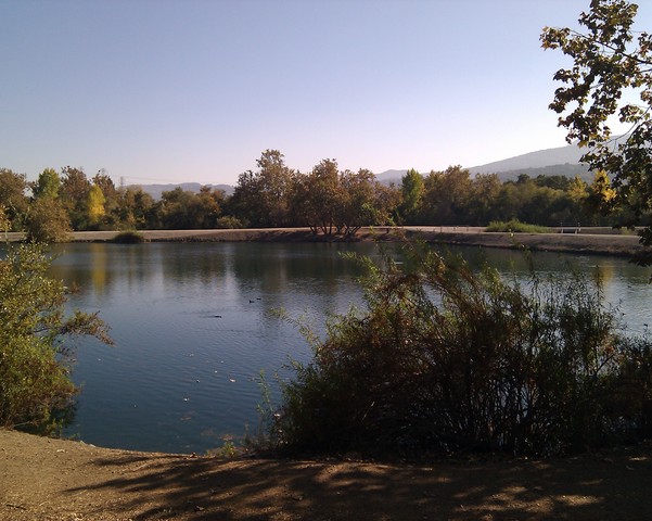
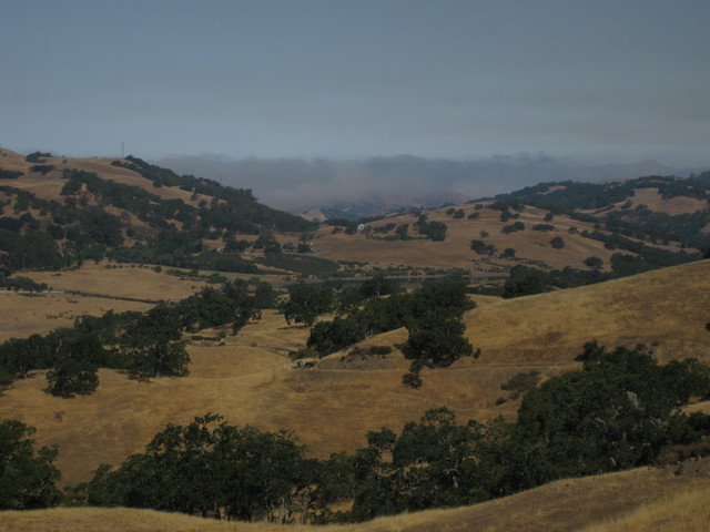
The fog toyed with us as we approached Big Sur, casting shadows as it drifted across the road. It filled the canyon at Bixby Creek, obscuring the iconic bridge. By mile 60, it hugged the coast and swallowed the view. For the last 13 miles, I regretted two things equally: the lack of a taillight and the lack of a tailwind. I hammered that stretch as best I could, averaging 15 mph and sweeping past four very tired guys. As I closed in on the fourth, he rose out of the saddle in a vain attempt to defend his position; the other three never gave chase. [You know a guy is spent when he lets a woman pass, unchallenged.]

Nighttime swimmers in the Neptune Pool at Hearst Castle
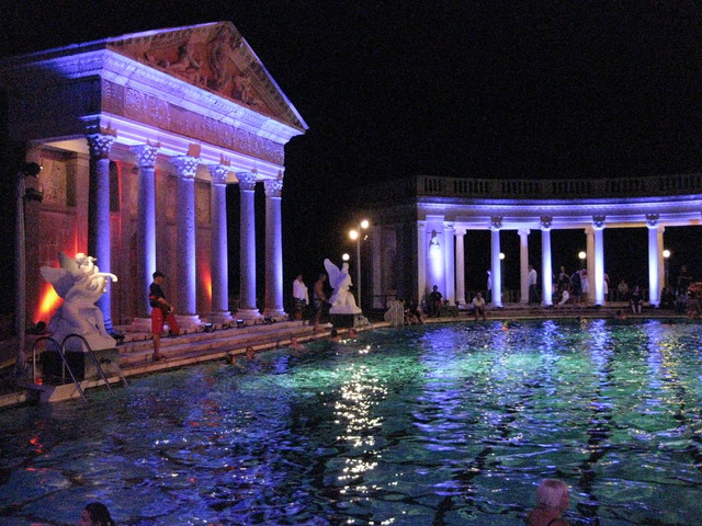
Yet, I was speedy only in my own mind—I was a full mile per hour slower than last year, and well off my best pace (14.3 mph in 2009). I managed to roll across the finish line in time to claim a quick massage before getting cleaned up and heading for the traditional barbecue at Piedra Blanca Rancho. I was fortunate again to close out the night partying on the patio behind Casa del Monte. And of course, frolicking in the Neptune Pool. One of the Castle's resident bats circled overhead before dropping down for a quick sip of the pool's fresh spring water.

There is no better way to see the California coastline than from the seat of a bicycle. Next year, I'll be back: same charity, same coast.

September 5, 2013

A Day on the Bay

A day away, a day to play, a day on San Francisco Bay.

Winged road bike atop the Bike Hut.
We boarded our boat near the Bike Hut.

Sailing toward the Marin Headlands
For some, the first time on a sailboat.

The Sea Wolf, a Santa Cruz 50
For many, a first visit to Angel Island.

Team New Zealand's America's Cup catamaran
For most, the first close encounter with a crazy hi-tech
America's Cup boat.

Original eastern span of the Bay Bridge (left), replacement span (right)
For all, the first passage beneath the newly-completed eastern span
of the San Francisco-Oakland Bay Bridge.

A day to unwind with a team that works (and plays) well together.

August 31, 2013

Classic California

View of the valley above a switchback on San Juan Canyon Road
Southbound traffic on the highway was backed up for miles. [Luckily, I was traveling north.] The likely cause was the uphill grade—drivers fail to maintain their speed as they climb and the effects slowly ripple backward. I was grateful not to be sitting in that jam, and felt sorry for the drivers who would soon meet the tail end of it.

I saw flashing lights at the head of the next southbound jam. Alongside the patrol car ... a pair of horses? Yet there was no horse trailer in sight.

I would later learn those were not horses, but mules (with their eccentric human companion). If I were trapped in that miles-long traffic jam on this holiday weekend, I would not be amused. Definitely. Not. Amused.

Northbound traffic was moving apace, and I was sailing comfortably in the left lane when a bull slipped into the gap ahead of me. Even with the windows sealed tight and music playing, there was no mistaking the distinctive sound of those twelve cylinders. Trailing that gleaming silver Diablo VT made for rather a quicker trip on the freeway than I had anticipated.

Radio towers atop Fremont Peak
I had spent the morning making my way to the top of Fremont Peak, while one of my ride buddies narrated the history of Captain Frémont and his men. The local market might as well have been in Mexico, I thought, as I was tempted by an array of indecipherable frozen treats. The ascent had been less arduous than I remembered, but the State Park was just as confounding. We were determined to get as close to the summit as we could (without hiking), and after a few wrong turns, we found our way. With all the radio towers up there, though, it is not a place to linger.

Some 3,715 feet of climbing over 31 miles ... but half of those were downhill. [Think about it.]

August 26, 2013

The Trouble with Trails

S curve north of bridge over Hwy 237, Stevens Creek Trail
Two cyclists collided last week on the Stevens Creek Trail, with injuries serious enough to be carted away to a hospital. The story according to a near witness, who called 911 on their behalf, was that he heard someone shout “STOP!” One cyclist was heading north on the trail, just having descended the bridge over Moffett Blvd. The other, apparently, was entering the trail at street level.

I had passed through this intersection about 30 minutes before the accident. I suspect that both cyclists had a role in this crash. The cyclist at street level is supposed to join the trail at a T-intersection, but it may be possible to merge (at a dangerous angle) by slipping through some posts meant to block the way. Whatever his approach, the street-level cyclist entered the trail without regard for oncoming traffic. The oncoming cyclist, with a view from above, should have been able to see him. Should have been moving slowly enough to stop or yield.

Approaching the T-intersection entrance from Sleeper Avenue one morning, a cyclist flew onto the trail without a glance in either direction, then slowed as he proceeded to ride no-hands. I saw him before he made the turn. I slowed down. We did not collide.

If the trail ahead of me is clear and straight, I will cruise along at 15 mph—and every single day, other cyclists fly past me. They pass me without regard for the solid line. [Tip of the day: Dashed line—OK to pass. Solid line—Do not pass.] They pass me on tight curves, like the one pictured above on the north side of the bridge over Hwy 237.

This morning I slowed behind four people walking two abreast. Two cyclists were approaching on the opposite side of the trail. And yes, another cyclist chose to pass me, over the solid yellow line, threading his way through the narrowing gap between the oncoming cyclists and the pedestrians.

Some hazards are common: people oblivious to their surroundings, earbuds blocking the sounds around them, fiddling with their smartphones, stopping in the center of a trail intersection.

Some hazards are unusual, like the staggering drunk I approached from behind. To ring my bell, or not to ring my bell, that was the question. I darted past him without advance warning, calculating that I was in more danger of being knocked over if I startled him.

Or the woman who emerged from the dark underpass below Hwy 101, pushing a stroller up the wrong side of the trail. Had I been a few seconds earlier, I might have run straight into them.

Just another typical day on a popular multi-use trail. Be careful out there.

August 24, 2013

Up Grade

Street, road, avenue ... what's in a name? Nothing dramatic.

Boulevard? Expansive, with lots of trees.

Big Basin Redwoods State Park sign at the top of China Grade
Grade? This one is not uncommon in the western U.S. It means ... prepare to suffer. Uphill climb that is long or steep. Or both.

I have been (bicycle) commuting to work more often, and my legs are feeling stronger. It was time for a test—a torture test, some would say.

First up, China Grade. Climb more than 1,000 feet in 2.2 miles. My heart rate peaked at 180 bpm, my speed dropped as low as 3.1 mph, but I reached the top without pausing.

Old wooden building decorated with vehicle license plates and other signs
Next, pass through Big Basin Redwoods State Park (California's oldest). I slowed for a caravan of backpackers crossing the road, and later for some campers tossing a Frisbee back and forth in the middle of CA 236. Deep in the redwoods, I guess it is easy to forget that a state highway passes through the park.

pep with bicycle on Empire Grade at the top of Jamison Creek Road
Last up, Jamison Creek Road: Climb more than 1,400 feet in 3 miles. This one is intimidating; like China Grade, I had never before attempted it. My legs still felt strong, but having already completed 3,200 feet of climbing I had no reservations about pausing. My heart rate peaked at 179 bpm, my speed dropped to 3.1 mph, and I stopped three times to recover. When four motorcycles came flying down the hill, recklessly over the double yellow line in the center of my lane, I congratulated myself for a well-placed recovery break. I was off the road.

41 miles, 4,620 feet of climbing. I chose not to join the rest of the group on Empire Grade. Enough is enough.

August 18, 2013

Simmering Sunday

The summer heat finally cranked up this weekend. What better time for a hard climb?

Fog layered over Monterey Bay in the distance
Loma Prieta did not seem as difficult as I remembered. Then I reached the steep part that I remembered. Five people turned out to join me for today's challenge, and it was eventful (in a good way). Four of them had no prior experience climbing Loma Prieta or Highland Way. My description of the summit was misleading, which sent me chasing down the riders who overshot it. (No one seemed to mind.) We had a clear view of the distant strawberry fields and the fog hanging over Monterey Bay.

On Highland Way, we were flagged down by a couple who had pulled their car to the side. “How do we get to the freeway?” they asked. First question: Which freeway? I explained that they were indeed headed in the right direction (improbable as that can seem, up there). When they overheard me offer to share some of my water with my ride buddy, they gave us two (chilled!) bottles.

Our club keeps track of various statistics for our rides, and today was a big milestone for one of our riders: Adding two new hills to his tally for this year tipped him over the 100 mark. We were astonished to learn how much weight he had dropped in the past year (75 pounds). Cycling is great for that, provided you restrict your intake at the same time. [Note to self ...]

On the return, I found a few riders clustered at the base of Mt. Bache. Surely they did not want to climb it again? [No.] A couple on a tandem were seeking advice on returning to Mt. Madonna via Loma Prieta. Not just any tandem, but a handsome Calfee bamboo tandem. We had heard that the road is public, but there are gates with signs that suggest otherwise (and much of it is dirt). The stoker seemed less enthusiastic when we added that it was an exposed climb, but they headed on up. “We can always turn back,” the captain reassured her. [Right.]

For the day, a bit more climbing than I had estimated—3,670 feet over 40 miles. Some day I will manage to climb Loma Prieta when the temperature is moderate. Today was not that day.

August 10, 2013

Over the Top

Golden hills studded with trees, fog layer in the distance.
“Are you training for something?” the visitor asked.

I might have said that I was training for Best Buddies, but mostly I was at the top of Mt. Hamilton for the sheer joy of it. With a plan to visit the back side for the sheer challenge.

We reached the floor of the marine layer at an elevation of 1600 feet, give or take, and quickly left it behind. This summer has been unusually cool, which meant that the temperature was just about perfect for a sunny day of climbing.

It also meant that a summertime descent to the valley at Isabel Creek was conceivable. [Strictly speaking, the descent is always conceivable. Climbing the exposed back side of the mountain is the challenging part.]

Though to be fair, that descent is rarely without drama. There was a rider at the summit with road rash from the back side, making it sound more treacherous than usual. Would I find fresh chip seal, or fresh tar? [No.] It is just a tricky descent, with sharp curves and enough steepness to give you more speed than you need.

The core of our group continued to the Junction, but I knew that was more than I could handle. Still, I was tempted ... What if I went just a little bit farther? Across the bridge, around the bend ... Uphill, of course. After half a mile, I regained my common sense and made a u-turn. Hauling myself back up to the summit would be enough.

Tree covered mountainsides northeast of Mt. Hamilton.
With a bit of a breeze and more strength in my legs, I found the climb less arduous than in the past. Oh, and the view! Apart from one ranch, there is no sign of civilization as far as the eye can see—unlike the other side of the hill, which overlooks the urban/suburban sprawl of the Santa Clara valley.

Back at the observatory, I ran into the same visitors again. “I could never do what you just did,” one remarked. I assured them that there was a time when I could not do it, either.

Fifty-one miles, 6,960 feet of climbing. Next time, I do believe I will venture ... just a little bit farther.

August 7, 2013

The Ruination of Bay Area Roads

Contrast between smooth pavement and coarse chip seal.
N.B. A slurry seal has since been applied to the packed gravel described in this post. While still unpleasant, these local roads are rideable again.
Why is it so difficult to maintain the roads in the Bay Area? The problem is not the weather.

Some roads that have been the mainstay of my homeward-bound commute have been rendered nearly unrideable this week.

That rocky surface in the upper half of my photo? It looks like a base layer, ready for paving—but it is not. That is the fresh road surface. The grainy surface in the lower half of my photo? That is what is left of the old, smooth surface (near the curb).

The new surface feels like packed gravel. [It is packed gravel, essentially.] It is wretched. Abominable. Appallingly bad. Pity the local residents who now endure the din from the tires on passing cars and trucks.

Does the town blindly accept the lowest bid? Are there no specifications? Why is this material being used, when the problem is well known? The coarser the rock, the longer it takes for weighty vehicles to wear it down. Lightweight bicycles, with skinny tires will never wear it down.
Smooth bicycle lane on a road outside Aix-en-Provence, France
The French understand this. I enjoyed the best road cycling surface, ever, outside Aix-en-Provence last fall.

Like the pros avoiding cobblestones in Europe, tonight I headed straight for the (smooth) gutter, next to the curb. Where feasible (and not prohibited), I chose to ride on the sidewalk. I explored some unfamiliar neighborhoods, seeking a new twist on my time-tested route that will keep me off the rocks without adding much distance.

Unfortunately, there will be no alternate route to avoid this legendary mess in a few weeks on Highway 1, on my way to San Simeon.