Our team had an overnight getaway to a most familiar area, Monterey. I passed on stand-up paddleboarding or biking; although I have paddled around in kayaks, I had never kayaked in the bay.
My partner had no experience, but he did have one valuable qualification: upper body strength. The outfitter set us up with waterproof pants and life vests; I had chosen the right shirt (quick-drying, long-sleeved) but was reluctant about going barefoot. It was a gloomy day; luckily my feet didn't get too cold.
The skies were ominous, but the rain held off until just after we returned to shore.
It was also a windy day. Two people managed to tip their kayak; unable to climb back on, they clung to it and were towed back to the beach.
Our guides tried to keep us near the shore; the wind was determined to push us out to sea. We got rather close to the pair of yellow buoys that mark the seawater intake for the Monterey Bay Aquarium—which, when viewed from land ... are quite a ways out there.
We saw an otter with her pup, lots of seagulls and cormorants, the occasional pelican, seals and sea lions both curious and indifferent. Like otters, we used the kelp to anchor oursselves.
On Friday morning, I persuaded a couple of co-workers to take a stroll before the group would head back to the (other) Bay Area. I spotted a curlew and an otter, and we peered from above at the sea lions we'd observed from the water yesterday. Eager to get back to the hotel on time, an Uber driver was summoned. Not only did he give us a ride, he dispensed souvenirs: original labels from the Hovden Cannery (site of the Monterey Bay Aquarium). I was tagging along on my first Uber ride, and they told me this souvenir thing is not typical. Not at all. But it was sweet.
My plan was to stay one more night. How should I spend the rest of my day?
I could bike, having brought my bike along.
The whale-watching boats were enticing.
Another colleague planned to hike at Point Lobos.
The afternoon, however, was more wet than not. I decided to drive over to Carmel Valley, to scout the unfamiliar part of the route I planned to ride tomorrow (weather permitting). The terrain was steeper and more remote than I had anticipated. Perhaps the rainy forecast was doing me a favor ...
I finished the day with a short visit to the Aquarium, bustling on this weekday with students on field trips and tourists alike. Nonetheless, at the end of the day it was possible to find a few quiet galleries for peaceful reflection.
May 6, 2016
May 2, 2016
A Golden Ticket
Last week, when I had the privilege to see the Solar Impulse 2 up close, I was thrilled. Absolutely, thrilled.
Maybe, just maybe, I could see it fly. There would be a good view, I expected, from the Stevens Creek Trail. With enough advance warning, it seemed possible. Not likely, perhaps, but possible.
The best view? From the tarmac.
And that is just where I was, from about 2:40 a.m. until shortly 5 a.m.
You see, somehow, I scored a golden ticket.
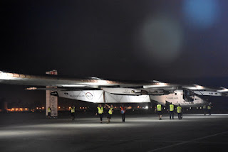
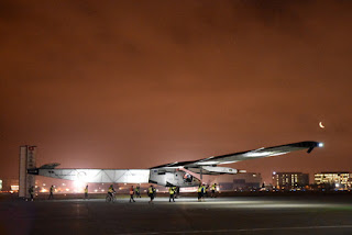
The air was still, the sky was dark, the plane was lit. A crescent moon glowed orange as it rose above the horizon.
The invitation welcomed us starting at 2 a.m., with take-off planned for 5 a.m. I pulled up at Moffett's main gate at 1:57 a.m., right behind the satellite van for KPIX, San Francisco's CBS affiliate.
It would be a while before they led us out to the viewing area, but I strode ahead of most of the pack and planted myself in a prime position. From which I would not budge for the next few hours.
I had a front-row ticket that money couldn't buy.
Ground crew members were stationed beneath each wing, to support it with a pole until the plane lifts off the ground. The cockpit door was loaded onto a pickup truck, to be affixed later, after the plane was positioned on the runway.
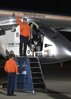
Human handlers “taxi” the plane. Most of the inflatable hangar had already been taken down. The ground crew pulled the plane out, turned it around, and brought it close. The pilots spoke to us, then took questions from the media before getting on with flight preparations.
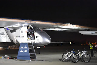
Electric bicycles are used to keep pace with the plane, especially during landings. One was strategically parked to prevent anyone from damaging (or being damaged by) the spear-like projection on the plane's nose. (Antenna? Sensors?)
The plane would not take off any earlier than 5 a.m.; its batteries were fully charged, but it would be important to maximize solar exposure during the next leg of its journey (to Phoenix, Arizona). The inflatable hangar is made of a special material that allows the solar panels to charge, and sunshine had been abundant during its sojourn at Moffett. The plan was to land with fully-charged batteries, as the panels would not be exposed to the sun in Phoenix.
Little had I understood, when I originally hoped to watch the plane from the nearby trail, that it would take off before dawn.
The tower at Moffett crackled alive at 4 a.m. Precisely. We were able to follow along, thanks to a spectator near me who tuned in to the tower's radio frequency. Solar Impulse 2 would head straight out over the bay, turn toward the east and climb to 3,000 feet.
And so we waited. We could see a strip of lights down the runway; the wings remained lit. The pilot was ready at 5 a.m., but air traffic control announced a hold.
Once cleared for take-off, there was no more waiting. The wings went dark, then lit up like a bright string of pearls and started advancing. Even in the darkness, it was evident that the plane started lifting almost immediately. The propellers whirred softly as it passed us, aloft, and the crowd sent if off with a cheer.
Pilot André Borschberg thanked the tower for Moffett's hospitality, and the pearls vanished into the morning fog.
Bravo!
May 1, 2016
Onegin
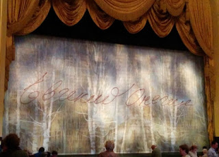
The first time I saw Onegin performed by the San Francisco Ballet, a few years ago, I recognized that his full name (Евге́ний Оне́гин) was featured on an inner curtain in script, as if he had signed it. I didn't notice, then, the faint writing that covered the whole panel. Pushkin's verse, no doubt.
It was “show-and-tell” at the ballet today, with tutus and footwear in the lobby for all to admire (and, touch). The bodices are sewn with rows of hook-and-eye fasteners to make them easy to fit to different bodies. How anyone can balance, leap, and twirl in toe shoes baffles (and awes) me.
 I feel a kinship with the young Tatiana, more interested in reading than in the shallow distractions around her. How often was I admonished, growing up: “Get your nose out of that book!” [More times than I can count.]
Onegin was so imperious, it was hard to see her smitten with him and to watch her struggle with her feelings when he returns. After she spurns him in the end, as harshly as he had treated her, the crowd roared—as much for Tatiana, I think, as for Yuan Yuan Tan's performance.
Another magical season drew to a close, and we stepped out into the reality of 2016.
To crazy street people in tatters, getting by somehow. Why do we treat stray animals with more care than stray people?
To a mass transit system that's rapidly deteriorating. I'm sure there are older subway cars in service in Manhattan than BART cars in San Francisco. A 10-car train pulled into the station, fully packed with riders gripping straps and bars to stay upright. Then came the announcement that they were taking it out of service for “mechanical issues;” everyone had to exit the train and join us in waiting for the next train. Which would need to accommodate three trains' worth of passengers.
One of the wealthiest cities in the U.S. Seriously.
It was “show-and-tell” at the ballet today, with tutus and footwear in the lobby for all to admire (and, touch). The bodices are sewn with rows of hook-and-eye fasteners to make them easy to fit to different bodies. How anyone can balance, leap, and twirl in toe shoes baffles (and awes) me.
 I feel a kinship with the young Tatiana, more interested in reading than in the shallow distractions around her. How often was I admonished, growing up: “Get your nose out of that book!” [More times than I can count.]
Onegin was so imperious, it was hard to see her smitten with him and to watch her struggle with her feelings when he returns. After she spurns him in the end, as harshly as he had treated her, the crowd roared—as much for Tatiana, I think, as for Yuan Yuan Tan's performance.
Another magical season drew to a close, and we stepped out into the reality of 2016.
To crazy street people in tatters, getting by somehow. Why do we treat stray animals with more care than stray people?
To a mass transit system that's rapidly deteriorating. I'm sure there are older subway cars in service in Manhattan than BART cars in San Francisco. A 10-car train pulled into the station, fully packed with riders gripping straps and bars to stay upright. Then came the announcement that they were taking it out of service for “mechanical issues;” everyone had to exit the train and join us in waiting for the next train. Which would need to accommodate three trains' worth of passengers.
One of the wealthiest cities in the U.S. Seriously.
April 26, 2016
That Solar Impulse
What have we here?
A fancy party tent? [No.]
A cocoon of sorts, for a rare winged creature.
One of a kind, in fact.
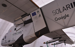
Through a stroke of good fortune, I had the privilege of a close encounter with the Solar Impulse 2, which landed at Moffett Field three days ago on the ninth leg of its planned circumnavigation of the globe. Powered by the sun.
The point is not to shift the future of aviation to solar power. Rather, to inspire the world to do more with the sun down here on Earth.
That planes fly, at all, is a wonderment to me. That this plane can take off under its own power seems inconceivable. Yes, it's exceedingly lightweight. Four small electric engines, that's all.
Nearly translucent wings, spanning an astonishing 236 feet—longer than the wingspan of a Boeing 777.
It just looks so ... fragile.
A masterpiece of engineering, a piece of history, and a thing of beauty.
When it takes to the air again, later this week perhaps, I may miss the chance to see it fly. It was a thrill, nonetheless, to meet it today.
April 23, 2016
Blowin' in the Wind
Next week is our club's big event, when we host hundreds of cyclists on a tour along some of our favorite roads. We'll be working hard then, so today we ride (and raise an alert if we see any potential problems along the way).
It was a sunny cloudy kind of day. Chilly.
Windy, too. Oh, look! It's another Aermotor.
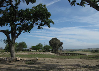
Rolling (still green) hills, ranches, farms, suburban sprawl ... we have it all.
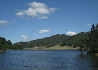
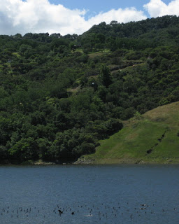
The wildflowers peaked a week or two ago, but this year the reservoirs along the loop are nearly full. What a welcome sight!
I am now so accustomed to low water levels, sad to say, that I thought I saw a bunch of sticks poking through the surface of Chesbro Reservoir. (Wrong! Waterfowl.)
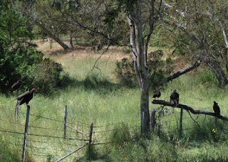
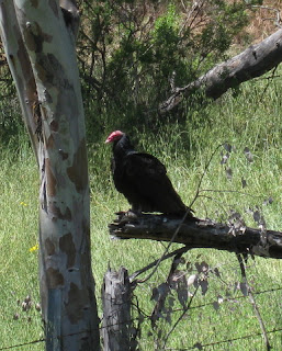
I was motoring along with the tailwind I (finally) deserved when I was startled by loud wingbeats at close range. Not one, not two ... five turkey vultures perched near the side of the road. I made no move toward their prize—a carcass in the ditch—so they paid me little mind.
They are not the most attractive creatures ... unless you're one of them, I suppose.
A healthy 55 miles, with 2,160 feet uphill and into the wind.
I reported three patches of broken glass, which I hope will be swept away before next weekend. The biggest problem is one we can't fix: Starting last year, the Santa Clara County Board of Health got carried away. Safe food handling is not enough. Whole fruit only! (Which means: lots of waste.) Snacks must be bagged! (Which means: lots of waste.) No homemade nut breads—our signature and popular treat. (Which means: disappointed riders, and fewer of them.)
April 14, 2016
Santa Rosa Creek
Given the choice, would you rather bike on a road named Green Valley or California State Highway 46? [Let me guess ...]
But that's a trick question, because they're the same road.
I've admired these very hills from the comfort of a tour bus each September, returning from the Best Buddies Hearst Castle Challenge. I didn't expect that I might ride my bicycle here. Ever.
Today was the queen stage of our little getaway, the route with the most climbing and the longest distance. I decided I was up for it. Then I checked the forecast.
We were headed for the coastal town of Cambria, and the weather service had posted a wind advisory. Strong winds in the afternoon, gusting to 35 mph, from the northwest. That would present crosswinds on the return trip; so far this week, I'd wobbled twice in crosswinds that were far weaker.
Time for Plan B.
My wise roommate had been planning all along to drive to the end point for today's climb. I joined her. When I saw that the return to Paso Robles on Highway 46 would have involved more climbing, I was ever-so-glad that I would not be biking it today.
As we parked, we met a couple of guys setting up a rest stop of sorts. They said they had about 20 riders coming through and asked where we were headed. “Oh, you're coming up the wall,” they said. I asked them about the steep bits on Santa Rosa Creek Road. 20% grade, one explained; a steep section, followed by a steep switchback. [I see some uphill walking in my future.]
Heading west entailed a bit of climbing to earn a creamy downhill to the coast. We turned right onto Highway 1 ... right into the wind.
It was too early for lunch. But it was not too early for a warm slice of olallieberry pie at Linn's. (Thanks, Ms. C., for the recommendation.)
Santa Rosa Creek Road was spectacular. See the tree trunk heralding a bend in the road?
Segments reminded me of some Bay Area favorites: Tunitas Creek (though without the redwoods). Lobitos Creek. Bear Gulch West. After several miles, the steady gentle climb ticked up. And then ...
There were two steep (but short) ramps in succession, each affording a (more or less) flat bit for recovery. Was that it, or would it get worse? Where's that nasty switchback?
The road took a bend to the left, and ... [gulp]. Unclip, unclip now! My left cleat would not release. I'm going to topple over. Rotate the pedals, steady, steady, unclip. [Whew.] Turkeys, unseen, cackled nearby. [Funny, very funny.]
The support van had relocated to (effectively) the top of the climb, and the racers were arriving as I got there. As I prepared to roll on, a bunch of them clipped in to do the same. Should I wait, let them pass? [Nah.]
And, we're off! Downhill, curvy, one lane, through the woods. One guy was ahead of me, and I wasn't losing ground. [Hmm.] Thoughts buzzed through my head. You don't know this road. The guy ahead of you does, follow him. We're really moving. Don't give chase. But he knows the road. Chill out. A couple more guys joined the first one, but the gap between us did not expand. When there was enough of a straight stretch, I checked my mirror. Maybe I should sit up and let the rest of the group come together.
They were nowhere in sight. Nowhere.
I could see the road ahead tilt up. Ah, that must be the “one more climb” a rider had foretold. I didn't want to crawl uphill. Aerodynamics and some mad pedaling paid off: not only did I make it up the hill with little effort, I actually closed the gap to the racer guys! [Thank you, Cervélo, thank you.]
The road leveled out and a spread of lupines called for a photo. I sat up and slowed. As they passed, one of the women called out “You did a great job descending back there!” I smiled. “That's why I climb.”
Our ride leaders for this trip were clever indeed. With each day's loop out of Paso Robles, we explored a new direction: southwest, southeast, northeast, saving the best for last: 32 miles, 2,795 feet of climbing west, to the coast (and back).
April 13, 2016
Santa Margarita Express
I've come to believe that there are two varieties of hillsides in this area: those that are covered with grapevines, and those that will be covered with grapevines in the future.
With today's route, we left the vineyards behind and passed through ranch lands. Horses and cattle, mostly. A few goats.
We paused to admire an impressive private narrow-gauge railway along the way, complete with a trestle and working signals. Not surprisingly, this being a weekday, the train wasn't running.
We stopped for a snack (freshly baked cookies!) at the Creston General Store.
Over the years, I've developed something of an affinity for Aermotor windmills. I just have to stop and take a picture. It's a thing, I guess. A harmless thing. Today was a four-Aermotor day (though I skipped photographing the fourth one, which was planted in the parking lot of a farm supply business).
This little eccentricity of mine paid an unexpected dividend. Just as I climbed back on the bike after admiring my third Aermotor, a bald eagle glided just overhead. A few moments earlier and I would have had my camera at the ready. I kept my eye on the soaring bird as I pedaled on, hoping for another chance but expecting it to fly out of sight.
Then I got lucky.
The bird circled back. I stopped and pulled out my camera, just in case it would pass nearby. I pointed and shot, hoping for the best: one shot in flight, the second with tail feathers fanned out as it prepared to land in a tree. For much of my life, these birds were nearly extinct; seeing one in the wild will always make my heart race. I've never been closer to one than I was today.
We rode into Santa Margarita looking for lunch at the Mercantile, but it's apparently out of business. We invaded the Southern Station instead, where they accommodated our crowd with grace and good humor. Their outdoor seating was perfect for our small herd of cyclists.
The general profile of our return route was downhill, but along the way we gained 600 feet in elevation as the hills rolled up (and down).
The locals were mostly tolerant, though I wondered at two signs along one rural road: a picture of bicycle, with the words “PASS 3 FT MIN.” It is the law, but it left me curious about what led to those signs [which I'd never seen before] being posted on this road. Then there was the pea-brained troglodyte in an oversized pickup truck, backed up in traffic in some small town, who deliberately belched a huge cloud of black exhaust as he passed the core of our group. I'll bet he doesn't give bicycles three feet on any backroad.
At the end of the day, we'd covered 53 miles and climbed some 2,230 feet along some beautiful back roads. It was the bald eagle, though, that made my day.
Subscribe to:
Posts (Atom)
