June 9, 2014

The Valley Formerly Known As

Apricots on an old treeOnce upon a time, the fertile acres of the Santa Clara Valley were dubbed the Valley of Heart's Delight. But like so many others, it was Silicon Valley that drew me here. Our industry has transformed the world, leaving scant traces of the valley's rural past.

My bicycle has taken me through the less developed land of nearby counties: Santa Clara, Santa Cruz, Monterey, San Mateo, Alameda, Marin, Napa, Sonoma, Stanislaus, San Benito, San Luis Obispo. [I get around.]

The back roads meander through wild land, with deer and coyotes, turkeys and towering redwoods. They also cross farmland, with horses and cattle, fields of berries and grapes, lettuce and cabbage. There aren't many orchards left.
They took all the trees
Put 'em in a tree museum
Schoolchildren make field trips to plots that are kept for historical purposes. A few plots remain in family hands, barely enough to sustain the occasional roadside stand. Much of the “local” produce at our farmers' markets travels here from California's Central Valley.

Single Matilija poppy flower
My bike route to (and from) work varies little; for the past two years, the final stretch to the office is a 4-mile segment of a multi-use trail. By now, I have passed the sights along the trail more than 150 times, and learned to identify some of the native flora. Dazzled by the trailside Matilija poppies and California flannel bushes, three or four gnarled and stubby trees were easy to overlook.

Here, between the right-of-way for high voltage transmission lines and the freeway, are the remains of an orchard. A couple of trees, abandoned and neglected for decades, are studded with tiny apricots. Intensely flavorful tiny apricots. (I couldn't resist sampling some.) There is very little flesh around the stone, unlike the (mostly flavorless) variety we find in the grocery store.
Old tree laden with apricots

June 7, 2014

Surf's Up

Gray sky and waves at Manresa State Beach
The temperature started climbing today, and so did we. Like many other overheating Bay Area residents, we headed for the beach. Unlike the masses, we traveled by bicycle.

The marine layer loomed (mostly) overhead. Of course, the height of one's head factors into that equation—at the summit of the Santa Cruz mountains, our heads were high enough to get wet.

My ride buddies and I rolled out early, ahead of the main group by 30 minutes and a couple of miles, fully expecting they would overtake us. (They did not.)

The descent to the coast was ... cold. Surfers, in their wetsuits, were enjoying some waves along Monterey Bay. The onshore wind was chilled by the cold water, encouraging us to make quick work of our sandwiches. Surely the faster riders of the group would catch us here? (They did not.)

Rustic wooden signs, 4-H Welcomes You to Corralitos / Area Map
We continued on our way to Corralitos, where we would begin our return climb over the Santa Cruz Mountains. We paused at the town square, where I noticed this rustic map for the first time. The local 4-H Club welcomes us to tiny Corralitos. It's that kind of place. By now, the fastest riders from our group should start passing us. (They did not.)

The marine layer had receded as the day warmed up; the exposed segments of the climb were hot. The towering redwoods of Eureka Canyon offered intermittent shade as I picked my way around the potholes and crumbling pavement. It's a long, (mostly) gradual climb to the summit. Undoubtedly some riders from the main group would breeze by. (They did not.)

At the top, I left my ride buddies behind. It was 2:20 P.M., and I was hoping to get back to our starting point by 3:30 P.M. With 16 miles and more than 650 feet of climbing ahead, that meant a bit of a race for me. And it all but ensured that I would not see anyone from our main group of riders today.

I stopped the clock at 3:25 P.M., logging some 64 miles with 4,620 feet of climbing.

An hour later, I saw a rider from the main group as he passed through town. Finally.

May 31, 2014

Picnic in the Park

A perfect day for a social pace up the lower half of the mountain. Destination: picnic tables beneath the trees at Joseph D. Grant County Park.

Mt. Hamilton Road climbing past entrance to Joseph D. Grant County Park, with Lick Observatory in the distance
For many years, this was my traditional rest stop on the way to the top of Mt. Hamilton. Situated at about the halfway point, I appreciated this spot with its running water and actual restrooms, even though the detour into the park added some distance and climbing. A stone's throw up the road is a more practical stop, a trail head with a port-a-potty—and a water spigot.

Grant Ranch main residence
Our group today was not headed for the top, which afforded some time for exploring. I have hiked some trails in this park, but never sought out the ranch buildings. The last Grant family member to live in the house bequeathed the property to two charitable organizations. Fortunately, the county purchased the ranch in 1975 to preserve it as a public park for all to enjoy. (It seems that it narrowly escaped becoming yet another housing development.)

We put our lunches to good use by climbing to the summit on Quimby Road before returning to our starting point. I was dismayed to see road signs tagged by graffiti vandals, to the point where some have been completely obscured. In particular, the cautionary 10 mph warning at the final sharp bend has been completely blotted out; frankly, that's a safety issue. (I know that curve rather too well.)

For the day, a modest 21 miles with some 2,500 feet of climbing. Enough of the afternoon was left for me to get cleaned up and make a trip to the local Goodwill donation trailer. Progress.

May 30, 2014

Weekday Wanderings

After the long holiday weekend, this week seemed like a good time for an extended stay (at home). It was high time to face my backlog of housekeeping chores.

View of this hills from upper Tollgate Road
But all work and no play makes Jack a dull boy.

So, I played hooky on Tuesday and Friday mornings, when club members conveniently scheduled some short local rides. Besides, a little social contact is good for the soul.

I had forgotten how steeply Canyon View climbs. With my heart rate peaking at 181 bpm, I was not convinced that my recent sojourn at high altitude did much good. I was able to keep turning the pedals, though, without taking a break. We took the back way into town and congratulated ourselves at a local coffee shop.

View of the canyons and fog-shrouded Monterey Bay from SkylineThe little-traveled segment of Skyline we visited today seemed busier than usual. A doe was poised to leap over a fence from a Christmas tree farm just as I approached. She turned tail, but did not run. In a calm voice, I reassured her that all was well (as I kept a close watch that she wasn't about to jump into my path).

For the week, some 38 miles with 3,285 feet of climbing. Not to mention substantial progress sorting, cleaning, tossing, and re-arranging stuff around the house. More of that awaits.

May 25, 2014

Remembering Evi Nemeth

Evi gave me the Milky Way.

By day, we gathered at the university for a small technical summit. By night, we gathered high in the Colorado mountains. The skies grew dark and the telescope came out. Having spent virtually all of my life on the crowded east coast, it was a wonderment to see so many stars. Too bad about that thin cloud smeared high across the sky, I thought.

The Milky Way.

Sign board: May 2014. Happy Birthday Evi! Thank you for bringing us all together today! We love and honor you always!
Today we came together to remember Evi; a birthday barbecue, with tubs of ice cream but necessarily without the guest of honor. She affected the course of so many lives; the room overflowed with former students, colleagues, family members, neighbors, and fellow sailors—friends, all.
Here, there, and everywhere
View of forest, distant mountains, and snow-covered peaks under layered gray skies in Colorado.
Stories were told and tears were stanched. Some colleagues shared the clever not-quite-layover they arranged to be there, saving a few bucks in the process; it was just the sort of deal Evi would have contrived, they laughed. I made some new connections. Evi was our common thread; she would have introduced us if she could.
Knowing that love is to share
Twenty-six years ago, I met Evi when I took a course she taught at a technical conference. The more I learned, the more I realized I needed expert help to design the local area network in our new building on campus. Would she be interested in a contract? She bid not only the design, but the installation as well. We could not begin until construction was complete and we were cleared to occupy the building. Evi flew out with her son and a handful of students; I recruited my brother. We worked furiously through the weekend. When the faculty and graduate students moved in on Monday morning, there was at least one working network connection in every office.

The lifelong connections that resulted were the greatest value.

I wasn’t sure my brother would remember Evi. I was visiting him last June when I got the news. Evi is lost at sea, I told him. “No!” he shouted at me. “I just saw that story! That was Evi?”

Of course he remembered her. She was not a forgettable person.

I had last heard from Evi the year before. A friend of hers had forgotten his email password; she reached out to me to reset it. [sudo vi /etc/passwd … ah, if only it were that simple.] I tracked down the instructions for the process he needed to follow, and they were grateful when it worked.

Pellets of hail on a red carpet and a wet deck at the Colorado Mountain Ranch
The skies darkened. A massive bolt of lightning streaked in the distance. Pellets of hail dotted the deck. The sun came out, and as I drove away, an old Beatles song started playing in my head.
I will be there everywhere.
Aspens lit by the early evening sun on Gold Hill Road

May 24, 2014

Rocky Mountain High

There is a moose outside your window.
Young moose looking back through the brush.
That is a sentence you don’t expect to hear at 7:00 a.m. [Or most any other time, I’d wager.]

I was spending the long weekend with some friends who live in the Colorado mountains, and a young moose was munching on the shrubbery outside my ground-floor guest room. It seems impossible that creatures as large as moose and bear can sustain themselves by munching on small plants and berries.

It took me a couple of days to acclimate to their altitude (above 8,000 feet). The reduced level of oxygen mostly left me feeling woozy. I lagged behind when we set off on the local trails, especially whenever we hiked uphill. Rusty (the dog) was excited to see me on his home turf. Inexhaustible, he’d bound ahead and double back to guide us through the woods. Each night, he’d stretch out to sleep on the floor at the foot of my bed.

Locoweed in bloom.
It was a bit early for wildflowers; the ground had been buried by 20 inches of late-season snow just the weekend before.

Tall snowbanks at the rock cut on Trail Ridge Road
We headed for Rocky Mountain National Park. The highest continuous paved road in the United States, Trail Ridge Road, had just re-opened for the season. [Less than 12 hours later, fresh snow would close it again.] A few hardy cyclists reached the summit while we were there; I did not envy them their frigid descent.

pep in front of high snowbank at the Alpine Visitor Center (elevation 11,796 feet)
We followed the tracks of other hikers as we tromped farther uphill through the snow, to the highest elevation I have visited on foot (~12,300 feet). The forecast threatened us with thunderstorms every day, but somehow we always managed to dodge the drops.

After lunch, we thought we might find some snow-free hiking at a lower elevation. [Wrong.] After easily circling Bear Lake, we trudged our way to Nymph Lake. Our hiking boots were up to the task, though crampons would have been welcome. [Especially downhill.] The lower trails attracted more of a crowd and thus were pretty slick. Some visitors, clad in sneakers or thong sandals, were ill-prepared for the conditions; one nearly took me down as he slid behind me.

My stamina at altitude improved after two days, and we made our way along the local trails to Mud Lake (5.7 miles). Property owners are mostly tolerant of the trails that traverse their land, though some resent the mountain bikers. It isn't quite backcountry, given the nearby roadways (paved, or not); it felt more like living in one gigantic open space preserve.

An open space preserve dotted with the remnants of long-ago mining activity. [Watch your step.]

Most of the aspens were just starting to leaf out.

My last visit to Colorado was quite some time ago. (18 years, to be precise.)

My next visit? I hear those aspen leaves turn golden in the fall.

May 18, 2014

Josie

Letting go is the hardest part.

Josie, December 2006
I promised myself that I would not go to extraordinary lengths to prolong her life. To do otherwise seemed selfish; she would rather be curled up in a spot of sunshine at home than being poked and scanned under artificial lights in a strange lab.

I knew that promise would be hard to keep.

Josie came to me in August, 1998. Losing my previous cat during a tough time in my life had made it even tougher. I couldn't imagine replacing her.

A week later, I was back at the clinic to see their kittens. I was just too sad. “What's the story with that one?” I asked.

Josie, 1998
Josie was 11 months old, returned by the family that had adopted her. Their new apartment didn't allow cats, they had said. She had been born at the clinic; someone had left a pregnant feral cat in a box on the doorstep.

Settled on my lap, Josie leaned into me, pressed the back of her head to my chest, and started purring.

Every night, she would snuggle up next to me. If she got there first, she'd take my side of the bed. More often than not, if I woke during the night she'd start up purring. When she needed some petting, she'd stretch out a paw and gently tap my shoulder or my face. Her fur was as soft as a chinchilla's.

I was reading the newspaper one day, spread out on the floor, when she trotted over and dropped a spongy ball in front of me. Did she want me to throw it? [Yes!] The more it bounced and ricocheted, the better; she'd bring it back for more. A cat who plays fetch? Sometimes the ball would go splat! in front of me; evidently it was more fun after she soaked it in her water bowl for a while.

Josie and my red shoes, September 2010
She loved shoes. Not to chew them (well, sometimes, if they had stretchy bits). She'd rub against them and roll all over them in a fit of ecstasy.

She had a couple of mystery illnesses as a youngster, never diagnosed, always cured by antibiotics. Hooked up to an IV at the clinic, she stretched her paw through the cage to touch me. “You know,” said the vet, “let's send her home with you now; I think she'll do better there.” After they shaved her belly the second time for an ultrasound, she decided it would be best never to let the fur grow back. In the winter, she would lie smack on top of the best heating vent.

Josie, July 2012
Sitting in front of the computer one night, I heard something rustle and drop. From the kitchen, she had carried upstairs a piece of shortcake in a plastic sandwich bag and deposited it next to my chair. Is this a snack for me, or for you?

Wherever I was, that's where she wanted to be. On my lap at the computer. On, or under, my chair at breakfast and dinner. Often underfoot, she forgave me immediately whenever I stepped on her tail.

She was so active and brave, I had no idea how very sick she was until there were only a few days left.

I miss you so much, sweet Josie Pussycat.

May 10, 2014

Sometimes a Tailwind

Green hills and puffy clouds above Joseph Grant Park, Mt. Hamilton
It was a picture-postcard kind of day, with the temperature just right for climbing the back side of Mt. Hamilton. (In other words, cool.) The pros will not be so lucky on Tuesday, when they climb the front side and descend the back side on their way to the Stage 3 finish atop Mt. Diablo.

But first, you have to get to the back side. By climbing the front side, of course.

Ahead of an incoming heat wave, the high temperature at the summit was a mere 49F, and the winds were picking up.

Bicycle with purple lupine overlooking the valley from the back of Mt. Hamilton
A friend joined me today, eager to climb the back side for the first time. We were both enchanted by the wildflowers and the sweeping views.

Our turnaround point was the bridge over Isabel Creek. Passing motorcyclists seemed friendlier than usual, waving and giving me a thumbs-up. [My “Aha!” moment would come later.]

The climb was less strenuous than I expected—I'm stronger! As the road zig-zagged up the hill, sometimes we had a tailwind. And sometimes a headwind.

By the time we headed back down the front side, the wind was blowing steadily at nearly 15 mph, with gusts to 24 mph. I have descended Mt. Hamilton more times than I can remember, but never with such strong wind. Holding my line was a challenge as the crosswinds buffeted me from side to side. I tucked myself in and low on the bike and kept a firm grip on the handlebar. I was relieved to make it safely back to the starting point; for the day, 50 miles and some 7100 feet of climbing.

At the bridge, I had shed my jacket for a photo-op. I had claimed an unwanted pair of socks from a colleague, and I had promised him a photo. Shocking pink, emblazoned with an up arrow and the words I'm with awesome. “They'll be perfect with my Death Ride jersey!” I had explained.

The one with the skull and crossbones. (Thumbs up!)

pep at the bridge over Isabel Creek, behind Mt. Hamilton

May 8, 2014

Follow Me

Bike to Work Day has a special significance for me. With the encouragement and support of a colleague, I biked to work for the very first time on Bike to Work Day eight years ago. Thousands of bike-commute miles later, I return the favor by inviting colleagues to join me each May.

Cyclists arriving at work
Twenty-nine people followed me to work this morning; a few were making the trip for the first time.

I was making the trip for the fourth time this week.

We started at a local commuter shuttle stop, since most people would load themselves (and their bikes) onto a bus for the return trip.

I keep it simple:
  1. Give each other space.
  2. Call out “slowing” and “stopping.”
  3. Don't take chances. If we get separated by a red light, we will wait for you.
  4. Have fun.
[Guess which rule is most important.]

We waited for some riders from nearby San Jose to join us, then swept up a few more along the way in Saratoga.
This is much easier than I thought it would be. [Success!]

Cyclists crossing under Highway 101 alongside Stevens Creek (Narrative Clip)
Being out in front makes it tough to capture photos en route. This year I mounted my Narrative Clip to the back of my helmet, and it turned out to be the best application for my Clip (to date). Not only did it capture plenty of respectable photos, it captured plenty of smiles. And all of those smiles were natural—no one expected that little orange square was automatically snapping photos as we rolled along.
Today is the first time I will ride back home. [Success!]
The clouds looked ominous, but we were spared any rain. If only we could have been spared the headwind ...
I want to ride back home with you. [A first-timer. And, she did!]
For me, 43 miles, some 960 feet of climbing, and much joy.

May 3, 2014

Breezy Backroads

Purple wildflowers (winter vetch), oak trees, Calaveras Reservoir and hills
Knowing I would quickly be off the back today without a ride partner, I decided to head east instead of west: Calaveras.

Racers from SJBC encouraged me as I clawed my way up The Wall. They might have ignored me. Or patronized me. Instead, they cheered me on. What a great bunch!

Our groups converged near the dam. They were celebrating with a birthday boy (who turned 60), and approached me to take a group photo. Wait, they said; here comes one more person from our group—Holly. Holly? I know Holly!

They caught me again after the twisty descent toward Sunol, when the road flattens out. The birthday boy had the lead.

Our group crossed the tracks for a gentle climb through Kilkare Woods. The road is not well-traveled, and I came upon a long tree branch completely blocking one lane. I parked the bike, hauled the branch off the pavement, and picked up the larger pieces of debris. The end of the branch had a clean, well-weathered cut; it had been dead for some time, caught overhead after tree trimmers had completed their work. Today was the day when the wind would finally dislodge it, and I later heard that it narrowly missed a cyclist when it crashed down. (Yikes!)

Horses grazing on a hilltop, San Francisco Bay in the distance
Calaveras is a long, rolling road with no hard climbing (after The Wall). The base of the wall is a T intersection. A right turn would lead me to a wide suburban thoroughfare, back to the start. A left turn would take me back, too, after looping through some wild and rural land.

Decisions, decisions.

Did I mention that a left turn meant ... more climbing?

For the day, some 54 miles and 4,595 feet of climbing. Sheep and goats, horses and cattle, wild turkeys and hawks, one wounded, writhing gopher snake. And a chance encounter with a cycling friend.

April 26, 2014

Flower Girl

View of the upper west side of Old La Honda Road.
Overheard as a tandem was descending Old La Honda Road: “I think it might be safer to go down 84.” [Yes, cap'n, it is.] Old La Honda is a lovely climb, but a bad choice for the return trip.

One source of entertainment for a slow climber (me) is the occasional snippet of conversation caught as riders pass. Like the group of three guys mentioning a particular actor, murdered some 35 years ago, and the ignominious details that emerged about his private life. How did that subject come up? [It's probably better that I don't know.]

Most of our group was headed for the coast. My ride buddy and I were of a similar mind: keep it short on a windy, chilly day. She graciously insisted that she had only been at the top for a few minutes before I arrived.

I convinced her to drop down the west side, with its expansive views; we were surprised by the wildflowers. After some determined research on Calflora, I can put names to all that I photographed.

Cow Parsnip (white) in bloom
Cow Parsnip

Crimson Columbine in bloom
Crimson Columbine

California Goldenbanner (yellow), Winter Vetch (purple), and Indian Paintbrush (red)
California Goldenbanner, Winter Vetch, and Indian
  Paintbrush


It was just a coincidence that we traveled the same distance today as my regular morning commute, but with a tad more climbing (2,190 feet, vs. 385 feet) and scenery.

Being in the neighborhood, on the drive home I made one extra stop. My red cells did a fine job of getting me up the hill today, and now some of them will go on to do something important.

Blood donation #55

April 23, 2014

If By Chance

As I coasted home through the park, I noticed that the resident population of Canada Geese had been much reduced. Is it a lucky side effect of the drought, or have the (trained) dogs finally driven them away?

Great Blue Heron standing in a field at dusk
Then I spotted a lone, lean bird in the grass. I slowed to a stop. A Great Blue Heron! My presence gave the bird a dilemma: Take flight, possibly losing the furry prey clenched in its beak, or stand its ground. As I fished my cell phone out of my bag, I watched it maneuver and swallow its prize in a single gulp.

Even the most routine commute rides pack in their share of surprises. In the past two weeks, two colleagues have caught up to me on the evening ride home and slowed to chat.

Feeling lazy this morning, I got a late start. Random factors aligned to stop me at a particular intersection at a particular moment in time. “Pep?” To my right was a former colleague I have not seen in years; we worked for the same company twice (my previous two jobs).

There are three ways for me to cross that busy thoroughfare; I study the traffic flow and signals each morning before I commit. Today, the quickest approach led me onto the perimeter loop of a community college—and to this unexpected meeting at a red light. We had a chance to chat over the next mile before our routes diverged. Both of us were biking to work. Both of us got a late start. Neither of us chooses to cut through the college every morning.

With this recent spate of chance encounters, I cannot help but wonder at the chances missed.

April 22, 2014

Narrative Clip Oddities

I used a Narrative Clip on three bike rides, capturing more than 4,000 photos. Most were unremarkable, few were worth keeping, many were blurry or distorted. Five of the better photos are posted in Scenes from a Commute. Five of the oddest are featured here.

Other photos captured at the top of Montebello were fine. The color balance is wacky in this one. [The road is not painted green.]

Trees and road with greenish color balance (Narrative Clip)
The descent jostled the camera, which captured many photos of my front wheel. A JPEG expert could probably explain what went wrong with this one.

JPEG image processing error (Narrative Clip)
Purple haze on the Stevens Creek Trail.

Shady trail with purple overcast (Narrative Clip)
The wooden planks on this bridge make for a bumpy ride. The camera doesn't cope well with vibration.

Distorted image of cyclist on a bike/ped bridge (Narrative Clip)
There were plenty of distorted images, evidently motion-induced. This office building really stands out. Blurry, I can understand. In focus but wavy, I do not understand.

Distorted image of office building and environs (Narrative Clip)
Sadly, the Clip arrived too late to capture four generations at a dual 90th birthday party earlier this year. Those were some moments I could imagine keeping.

April 21, 2014

Narrative Clip

And now for something completely different ... If you're not into geeky gadget reviews, move along, nothing to see here.

When I learned about the Memoto camera last spring, I was intrigued. I placed my order in May and looked forward to wearing it at some late summer/early fall events.

Orange Narrative Clip hanging in front of handlebar.
Start-ups being start-ups, stuff happens. (And doesn't happen.) Production was delayed, and delayed again. Naming difficulties morphed the catchy “Memoto” into the “Narrative Clip.” I was excited when, at long last, the little orange square arrived this month. The battery charge registered at more than 50%. I improvised a way to mount it on my bike and pedaled home from work.

tl;dr More than a few kinks remain in the product and it is poorly suited for capturing photos while in motion.

Fail #1: My first attempt captured nothing. The start page says:
The photos are stored in the built in flash drive until you connect the camera to your computer.
Maybe there is a requirement to initialize the device first, by connecting it to a computer, before it will store photos? The Narrative Uploader reported 0 photos when I connected the camera to my PC, post-ride.

Fail #2: The uploader then insisted that a new firmware version was available, but every attempt to update the firmware failed. The device reported version 0.7.5; the “new” version was 0.7.2.
if device_version < new_version
then update
else exit
Fail #3: The old firmware has since forced itself onto my device, downgrading it to 0.7.2. If the downgrade was intentional, I guess 0.7.5 was released prematurely. If the downgrade was unintentional ... more sloppy coding.

Fully charged and (apparently) initialized, I mounted it to my bike for Sunday's ride. Regrettably, it was pointed at the sky when a memorable interaction transpired, so it didn't capture a photo of The Morning Wacko.

Fail #4: Smartphone app required. Narrative's model is that you will upload all your photos to their cloud (free for the first year). But there is no web interface to interact with your photos; apps are available for Android or Apple devices. When the Android app asked for permission to “read sensitive log data,” I would not press “install.” [Turns out this permission will only work on older versions of Android or rooted devices, but the app simply should not request this.]

Once the device was attached to my PC, the uploader started uploading photos. Without the Android app to view them, this upload would be a waste of bandwidth and space. While it was running, I configured the uploader to save the files only to my local disk. Maybe that confused it? It would ultimately freeze; restarting it did not solve the problem.

I have always had a knack for breaking things.

Fail #5: Lost photos. The last photo saved was taken about an hour before my ride ended. Either the device stopped taking photos or the confused uploader reset the flash storage before it finished extracting photos. We'll never know.

Fail #6: Photos of blackness. The device has no on/off switch. It will only stop taking photos if you place it face down. If you put it in a dark place (e.g., a pocket) it will wake up periodically to check for light. While it is easy enough to delete these, capturing them drains the battery for nought.

Fail #7: Battery life. The claim is 24-30 hours. I was out and about for less than 6 hours, stashing the Clip in a pouch at the end of the ride. When I attached it to my PC, the app reported 17% charge remaining. The charge seems to drop about 13% per day when the device is left face down on my desk.

The photos appear to be sensibly named with a timestamp, in GMT. The rate of photo-taking is unpredictable. My outing lasted ~340 minutes, which should have captured about 680 photos (at the default rate of 2 per minute). Instead, the Clip captured at least 2,000 photos. My hunch is that the “double-touch” (take a photo now) feature is sensitive to vibration on the bike.

Without post-processing in Narrative's cloud, I needed to rotate all my photos locally either 90 or 180 degrees (I tried two different mounting orientations). Most would require straightening, as well.

The photos themselves? Precious few are worth a first, much less a second, look. Five of the best are featured in Scenes from a Commute. I'll share some odd ones tomorrow.

April 19, 2014

Davenport Landing

Cliffs and trails at Davenport Beach
There is a high-surf advisory this weekend, but the Pacific appeared no rougher than usual today. I paused to enjoy my lunch in the quirky enclave of Davenport. I had been on the fence about venturing farther north with the group; I was unsure about adding more miles and climbing given that the toughest climb of the day was still ahead.

Headwind clinched the deal. I would have taken the position of la lanterne rouge without the wind penalty. Davenport would be my turnaround point.

“The flower helps!” a rider called out as he passed me. (A rocket booster would help more, I thought.) Some racers appeared to be doing hill repeats on Bonny Doon. They thanked me as I edged right to help them pass, and virtually every one of them praised my flower. Keeping it on my saddlebag today was a tough call, but I had decided my neon-yellow cycling jacket would be visible enough in the redwood forest without adding a blinking taillight.

Male California Quail perched on a fencepost
A stone's throw from Quail Drive [I kid you not], look who posed on a post for me! He eyed me warily as I stopped and pulled out my camera, but did not budge until I was done.

As I dawdled through the fire zone on Martin Road, another rider from our group caught up. A much stronger rider than I am, he relaxed his pace to chat. Our meeting was an uncanny coincidence—he had just read my blog a few days earlier. He is planning to do the five-pass Alta Alpina Challenge this year, and one of my ride buddies had pointed him at Five.

My route covered 30 miles with 4,560 feet of climbing. When you consider that this was a loop, and what goes up must come down ... well, you do the math. I like to ride my bicycle up steep hills, it's true—but I like riding downhill even more.

April 17, 2014

Scenes from a Commute

Bright yellow flowers on a California flannel bush (Fremontodendron californicum) along the Stevens Creek Trail
Some California flannel bushes are in full bloom along the Stevens Creek Trail, others have already peaked.

“You got it! You can take him!” Stopped at a traffic light, a motorist made me laugh. He was referring to the shirt-less, helmet-less dude in front of me.

It was a hectic week, jam-packed with meetings and a couple of way-too-early days. Energized by one productive-but-intense review, I remarked “That was fun!” One of the engineers deadpanned “You like to ride a bicycle up steep hills.”

Biking home is a great way to unwind. I squeezed in two bicycle commutes and was tempted to make it a three-fer, but decided to save my legs for Saturday.

The trail is not uniformly scenic.

High voltage towers and lines along the Stevens Creek Trail (Narrative Clip)
The first of five bridges on the way home.

Bike-ped bridge over Moffett Blvd. (Narrative Clip)
I have been playing with a new gadget that automatically captures a photo every 30 seconds. Needless to say, most of the shots are utterly worthless. Here is a selfie as I cross the last bridge before leaving the trail.

Shadow of pep crossing a bike-ped bridge over Hwy 85. (Narrative Clip)
As I browsed through the collection (more than 2,000 photos for the round trip), I was surprised to see things I have otherwise never noticed. Here I am signaling a right turn, somewhere. (I'm not exactly sure where.)

Shadow of bicycle and pep signaling a right turn. (Narrative Clip)
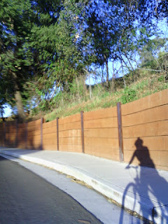
Like many digital cameras, this one is challenged by the sky.

Shadow of pep and bicycle in late-day light next to a retaining wall. (Narrative Clip)
In principle, the little camera seemed ideal for biking. In reality, not so much.