October 22, 2017

The Uetliberg

A rainy day in Zürich. A rainy Sunday, in fact. Most places are closed—shops, and such. I considered buying a train ticket and riding off in some scenic direction (pretty much any direction, here), but rain would spoil the views.

I slept in, instead, which apparently banished any jet lag. When I arrived last night, I was indecisive about choosing a place to eat. Then it dawned on me: I'm staying in a corporate apartment during this visit—shop, and cook!

Watching the radar map, the afternoon promised a break in the weather. I set out for the Uetliberg, finding myself walking uphill almost immediately after turning the first corner.

Girl's pink bike locked to a railing, Zürich, Switzerland
If you were the owner of this tiny pink bike, of course you'd secure it with a pink cable lock. Note the rim brakes—no silly coaster brakes!

There was a detailed topographic map at the base of the trail I found, labeled with numbered segments and their distances. Most had one word in common: steep.

I had no idea where I was, relative to the map. Up the trail! [“Up” being the operative word.]

Fallen leaves cover a trail through the forest, Uetlibergweg, Zürich, Switzerland
Fall, as it turned out, was a marvelous time for this climb. I've lived in (dry) California so long I'd forgotten the earthy fragrance of wet leaves.

They weren't kidding about steep. From time to time, I paused to get my heart rate down. There were no trail markings along the way; I just followed my nose.

Cows graze in a sunlit field near the summit of the Uetliberg, Zürich, Switzerland
During most of the climb, I didn't see another person. It was so quiet I could hear my throbbing pulse.

Section of topographic map showing the Uetlbergweg to Gratstrasse segment, Zürich, Switzerland
A closer look at the topo map, later, suggests that I chose the steepest path—the segment from point 7 to point 5: Uetlibergweg to Gratstrasse, continuing along Gratweg to reach the tower atop the summit. [A mere 2.6km, in all.]

Viewing tower atop the Uetliberg, as seen from stairs along a cliff, Zürich, Switzerland
The exposed rock at the top of the hill revealed that this land was once below the sea.

Swiss flag banner atop the Uetliberg, view overlooking Zürich, Switzerland
Of course I had to climb the tower. Access to the viewing platform involved feeding 2 Swiss francs into a machine. I found myself helping other confused tourists through the payment process, and the turnstile, before I was able to pass.

Looking down and across the Zürichsee from the viewing tower atop the Uetliberg, Zürich, Switzerland
After sweating my way up the hill, I was glad to zip up my jacket and pull on my gloves. The storm front was blowing in; the winds were strong, and cold.

View toward towns in the valleys to the southwest, with rain and storm clouds in the distance, from atop the Uetliberg, Zürich, Switzerland
Both sets of stairs lead to the top; having climbed one, I descended the other.

Twin staircases lead to the top of the Uetliberg, Zürich, Switzerland
Along the way, I found Jupiter, a feature of the Planetenweg. With the first raindrops falling, it seemed prudent to reserve my journey to the other planets for a future visit.

Representation of Jupiter, to scale, along the Path of the Planets on the Uetliberg, Zürich, Switzerland
At work the next day, one of my colleagues exclaimed “You walked up?!” There's a tram that takes you to the top. [But, why?]

October 8, 2017

Pretty Pescadero

Last year we had a touch of rain for this ride; this year was picture-postcard perfect (but, windy). Good thing I'd tossed a jacket in my bag, at the last minute; it was 44F at the start. Volunteers were swaddled in quilts.

The moon was still high in the western sky as I set out on this year's Arthritis Bike Classic Pescadero ride. I arrived later than I'd planned, surprised by one-lane traffic controls on roads still being repaired from last winter's fury. Nonetheless, I managed to start pedaling a few minutes earlier than last year.

Belted Galloway cattle grazing in a field along Cloverdale Road, Pescadero, California
I paused to admire some fancy cattle up close: Belted Galloways, they are. Those white bands are lush and wavy. You might imagine running your fingers through that fur ... that is, until you realize that the dark hindquarters are covered (covered!) with flies.

There were a bunch of guys along Gazos Creek Road with binoculars trained on the opposite hillside. “What's up there?” I asked. “Birds.” Seriously? You make the effort to visit this remote road, and that's the best you can do? The group was so fixated, I thought maybe they'd spotted a condor. “Birds.”

Pigeon Point Lighthouse, viewed from Highway 1 near Pescadero, California
The Pigeon Point Lighthouse looks best in morning light. I took care not to linger, as the headwinds were picking up early.

Field of colorful blooming flowers, Pescadero, California
I chose the “45-mile” route again, which makes two loops centered on Pescadero. This year, one rest stop was hosted at the fabled Archangeli Bakery, where we sampled cinnamon bread as well as the amazing Artichoke Garlic Herb bread. Silly me, asking for half a piece of that bread ... of course I went back for more. As many times as I've been here, this was the first time I noticed the field of flowers next door.

A sign along Stage Road caught my eye, asking people not to feed the pigs, or the dog. Sure enough, there was one large pig and many little pigs. (They weren't photogenic, as pigs go, so I just rode on.)

Yesterday, on a rural Sonoma County road, a young man deliberately swerved his enormous pickup truck into four cyclists on a charity ride. This weighed heavily on our minds today, as we reassured ourselves that normal drivers don't wield their vehicles as weapons to assault other human beings. [The culprit was found and arrested, in large part thanks to video footage from a passing motorcyclist's helmet cam.]

Happily, an uneventful day of riding for me: 44 miles, with some 2,565 feet of climbing.

October 6, 2017

Snowflakes

Snowflake light display, Vasona Park, Los Gatos, California
How I loved our family traditions at Christmastime, growing up. Cherished ornaments, homemade cookies, beloved carols, and of course ... brightly-wrapped presents. A special time. My mom shared stories from her childhood, of decorating the tree on Christmas Eve.

Not in September. Which is when I spotted the first display in a local department store this year. [Really? A month before Halloween?] At this rate, maybe we'll wrap back around the calendar and start pulling out the trappings in December. [If only.]

We're starting to run low on daylight; my opportunities for an evening ride home from work are fading with the sunset. (The full 18 miles, in the dark, is too stressful. I've tried it.)

I had every intention of making the round trip this week; my schedule was free of early meetings on a couple of days. But it wasn't until this morning that I woke up feeling well-rested and pulled it together.

A few quail scurried across the road in the morning, then winged it when they realized they weren't outrunning me.

Cycling tomato wearing a Santa Hat, light display, Vasona Park, Los Gatos, California
In the evening, malfunctioning barriers along a little-used railroad line created an unexpected neighborhood traffic jam; I re-routed myself accordingly.

The sun had dropped below the hills, but there was enough daylight to pass through Vasona Park. Where they have, already, begun to set up the displays for the annual Fantasy of Lights. Which doesn't light up until December 2 (almost two months from now).

Merry ... October.

September 30, 2017

Lookin' for Love

This handsome fella was coming straight at me.

California tarantula walking past my bicycle on Alma Bridge Road, Los Gatos, California
I'm not the female you're looking for ...

Close-up of a California Tarantula, Alma Bridge Road, Los Gatos, California
I was surprised to see a tarantula here, in the hills above the Lexington Reservoir. 'Tis the season, but until today I'd only seen them inland, farther east.

We'd climbed Black Road this morning, an exercise in pain (as always). A late-arriving rider caught up and chatted with me for a spell. I was surprised when he joined me in dismounting and walking the steep pitch on the upper section, as he's a very strong rider. Rather gentlemanly, to keep me company.

Most of the group carried on with the plan, descending to Scotts Valley and returning via Mountain Charlie Road. One guy decided to join my ride buddy and me, who had quite enough climbing after Black (thank you very much) and returned to circle Lexington Reservoir.

At the bottom of Black, a car honked at me as I walked across the intersection. We were chatting with a pair of guys in camo, who were there to train their (black!) Labrador Retriever pups in the art of retrieving. Clearly puzzled, one of them asked “Why'd he have to honk?” [Indeed.]

Lexington Reservoir, Los Gatos, California
I was surprised by the (deliberately) low water level. Let's hope they're right about another rainy winter.

Enough of a workout for me: 18 miles, 2,495 feet of climbing. Is it bedtime yet?

September 22, 2017

Bodega Head

Our cycling done for the day, my biking buddy and I headed for Bodega Bay, a town of some renown. It's not recognizable as the remote hamlet made famous by Alfred Hitchcock—homes blanket the surrounding hillsides now. Ominous clouds moved in from the northeast as the afternoon wore on.

Storm clouds gather over Bodega Bay, viewed from Bodega Head, California
The coastal state park at Bodega Head was light on signage. We skirted an enormous pothole and followed our noses up a narrow road to a parking area. These were the bluffs we were looking for.

View of the cliffs along the Pacific Ocean, looking north from Bodega Head, California
We chose a path that went up (of course), despite our whiny legs. A hiker on his way down cautioned us: “There's nothing but beautiful views up there!”

Natural arch at the water's edge, Bodega Head, California
“Did you use them all up?” I joked.

View of the rocky shoreline from high atop Bodega Head, California
He assured me he'd left some for us.

View of cliffs and the the rocky shoreline, looking south from Bodega Head, California
Fittingly, a flock of seagulls winged past, but I wasn't quick enough with the camera. I did catch a Red-shouldered Hawk in flight.

Red-shouldered Hawk in flight, Bodega Head, California
I have my biking (and hiking) buddy to thank for this excursion; I was not aware of this place. Despite having watched The Birds earlier this year, and biking past in years gone by, it never occurred to me to visit here.

Wind-blown tree with dramatic clouds, Bodega Head, California
A small group of folks gathered off-trail, excitedly studying something near some rocks. One wandered over to us, explaining that they were trackers. He pulled apart an owl pellet, revealing the skull of the unfortunate vole that fed the bird. He generously offered us the remains, but (fascinating as they were) we declined.

Our final bird sighting of the day was back in Sebastopol, on a trail where we met the rooster we'd been hearing most mornings. We learned his story (abandoned, and missing his tail feathers) from a local woman who came by to scatter grain for him. That explained why he was hanging around—he knew where, and when, he'd get fed.

Domestic white rooster with a red comb, Sebastopol, California
And thus, our Sonoma Sojourn drew to a close.

Petaluma

By the time I finished yesterday's adventure, I figured that I was done for the week. My legs were cooked.

But how could I skip a ride that started at a creamery? A ride that promised little climbing?

Our ranks swelled with members of the local club, the Petaluma Wheelmen, and we headed out on Chileno Valley Road. I'd ridden this, in the opposite direction, on at least one organized ride in the distant past.

Raptor perched on a utility wire, Chileno Valley Road, Petaluma, California
Little traffic, at last! Raptors above, egrets below.

Great egret perched above Laguna Lake, Chileno Valley Road, Petaluma, California
Also as promised, the roads were in terrible condition.

In the spirit of this week's routes, I missed a turn—totally my fault, this time. Distracted by an Aermotor on my left, I failed to see the turn on my right as I considered whether it was photo-worthy. With wires overhead, I couldn't find an attractive angle for a shot.

When I first started pushing the pedals this morning, my legs protested. [What does she think she's doing? Enough, already! This is not happening.] I'd missed my evening recovery soak in the cool waters of the hotel's pool.

I channeled Jens Voigt: “Shut up, legs!” [They obeyed.]

Content to ride way off the back and admire the scenery, the occasional downhill would boost me to catch the rest of the group. Near the end of the ride, I saw some of them re-mount and push on ahead. Why had they stopped, I wondered?

Emu walking away and looking back, Petaluma, California
I looked to my left, and right next to the fence was an emu. The bird, however, was having none of me. It ambled away and showed me its rump.

pep's bike outside the Petaluma Creamery, Petaluma, California
Today's ride was only 27 miles, with 1,525 feet of climbing; but after yesterday, I figured I'd earned some of the Petaluma Creamery's finest. Two scoops.

September 21, 2017

King Ridge

Today was the Queen Stage of our little getaway: King Ridge, of King Ridge GranFondo fame. It was out of reach for me at that event—I'm far too slow. I'd heard it was beautiful; this would be my best chance to find out. After reading the Santa Rosa Cycling Club's characterization of the route and studying the profile, I was intimidated. I don't do well with steep climbs. The weather forecast also included some strong winds (20+ mph). I could always dismount and walk uphill; that would cost time, as the steep pitches lasted a mile or more. If the wind was too strong, I could skip the loop and turn back.

The first problem was an epic wrong turn. Left onto Cazadero Highway, the route sheet said. The mileage at that point was spot on. I had caught up to the front of the pack; left we turned, and off they sped. I expected to see something of a town, including a general store; but there were just a few scattered buildings. When I reached the intersection of Highway 116, I knew I had, somehow, missed the turn onto King Ridge Road.

Mis-drawn route segment that marked a left turn onto Cazadero Highway.
Because, we were meant to turn right (not left) onto Cazadero. All it took was this little glitch on the route mapped using “Ride with GPS.”

I studied the map and considered my options. Turn around, return to the start, and spend hours waiting for everyone else to return. Turn around, leave a note for my ride buddy, and ride back to the hotel.

Then the lead guys reappeared, having ridden farther before turning around. “This way to King Ridge,” they confirmed. The rest of the group was ahead of us now, having followed a GPS (not the route sheet). The mistake had put an extra six miles in my legs, and set me back more than half an hour. As we turned onto King Ridge, I told the guys I might not do the whole route; I would see how I felt when the going got steep.

Rock face along the gentle lower section of King Ridge Road, Sonoma County, California
I wouldn't see them again.

A guy drove past and encouraged me. “Good job!”

View of distant hills from high atop King Ridge, Sonoma County, California
I thought I might turn around before the steep drop to Hauser Bridge (which demands a steep climb up the other side), but that was not an easy out: There was no clear summit, and the road meandered down as well as up. More climbing.

What if the group was waiting for me along the route? Maybe they took a break to eat their sandwiches.

Cracked pavement snakes through rolling hills, King Ridge Road, Sonoma County, California
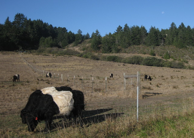
This road is remote. There are no services. There is no cell signal. There are cattle, and cattle guards.

I reached the turn for Hauser Bridge Road. With no one in sight, I was now certain that I was on my own.

New two-lane bridge to the right of the old one-lane metal grid Hauser Bridge, Sonoma County, California
Turning back made no sense. The road was in poor condition, but the descent not as scary as described. The bridge is being replaced, and I was especially grateful to have heeded the warning signs and stopped early. Near the bottom, the pavement was buckled in a huge hump; any cyclist hitting that would crash.

South Fork of the Gualala River viewed from Hauser Bridge, Hauser Bridge Road, Sonoma County, California
I walked across the old bridge, which crosses the South Fork of the Gualala River. My legs were done; I knew I'd be walking up the other side for a mile or more. I pulled out my sandwich and ate half as I walked up the steep grade.

View of the Pacific Ocean, reflecting sunlight, Sonoma County, California
The reward, at some point, was a view clear to the glittering Pacific.

I reached the intersection with Fort Ross Road, which would take me directly back to Cazadero. With that shortcut, I could catch the rest of the group. But after suffering the worst of the climbing, I deserved my reward: reaching the coast.

View of the Pacific Coast looking down Meyers Grade, Sonoma County, California
I paused to admire the view before plummeting down Meyers Grade to Highway 1.

Meyers Grade road sign at the intersection of Highway 1, Sonoma County, California
As soon as I turned south, I realized that I might have made a truly bad decision. Not only did I face a long and unexpected climb on Highway 1—I had found the wind. And ... it was ferocious.

Wind-whipped crests on the Pacific Ocean along Highway 1 north of Jenner, California
You can see the wind whipping crests on the ocean. You can't see the gust that nearly blew me over into the path of a compact RV.

Terrified, I dismounted to continue on foot. A gust ripped the bike out of my hands and slammed it against the guard rail.

I couldn't walk all the way to Jenner. If i got back on the bike, would a gust blow me over the cliff?

View of the beach from Highway 1 near Jenner, California
When it seemed safe to ride, I rode. When it didn't, I walked. After turning inland onto Highway 116, a gust caught my route sheet and peeled the Cue Clip off my stem. Luckily, they landed in a ditch, within reach.

I scanned oncoming traffic for familiar faces. Surely the group would be worried about me. The logical thing would be to start driving the route in reverse, looking for me.

pep's bike and helmet parked next to the sign for the Monte Rio Community Center, Monte Rio, California
When I reached our starting point, the parking lot was empty.

Monte Rio Awaits Your Return sign over Highway 116 leading out of Monte Rio, California
The lead guys had convinced the rest of the group that I'd turned back.

But I hadn't. pep's epic ride: 61 miles and 4,985 feet of climbing.

After they fetched me, I wore my new dress to dinner.