Today was the Queen Stage of our little getaway: King Ridge, of King Ridge GranFondo fame. It was out of reach for me at that event—I'm far too slow. I'd heard it was beautiful; this would be my best chance to find out. After reading the Santa Rosa Cycling Club's characterization of the route and studying the profile, I was intimidated. I don't do well with steep climbs. The weather forecast also included some strong winds (20+ mph). I could always dismount and walk uphill; that would cost time, as the steep pitches lasted a mile or more. If the wind was too strong, I could skip the loop and turn back.
The first problem was an epic wrong turn. Left onto Cazadero Highway, the route sheet said. The mileage at that point was spot on. I had caught up to the front of the pack; left we turned, and off they sped. I expected to see something of a town, including a general store; but there were just a few scattered buildings. When I reached the intersection of Highway 116, I knew I had, somehow, missed the turn onto King Ridge Road.
Because, we were meant to turn right (not left) onto Cazadero. All it took was this little glitch on the route mapped using “Ride with GPS.”
I studied the map and considered my options. Turn around, return to the start, and spend hours waiting for everyone else to return. Turn around, leave a note for my ride buddy, and ride back to the hotel.
Then the lead guys reappeared, having ridden farther before turning around. “This way to King Ridge,” they confirmed. The rest of the group was ahead of us now, having followed a GPS (not the route sheet). The mistake had put an extra six miles in my legs, and set me back more than half an hour. As we turned onto King Ridge, I told the guys I might not do the whole route; I would see how I felt when the going got steep.
I wouldn't see them again.
A guy drove past and encouraged me. “Good job!”
I thought I might turn around before the steep drop to Hauser Bridge (which demands a steep climb up the other side), but that was not an easy out: There was no clear summit, and the road meandered down as well as up. More climbing.
What if the group was waiting for me along the route? Maybe they took a break to eat their sandwiches.
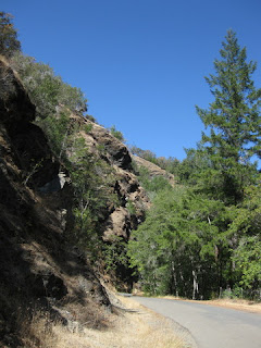
This road is remote. There are no services. There is no cell signal. There are cattle, and cattle guards.
I reached the turn for Hauser Bridge Road. With no one in sight, I was now certain that I was on my own.
Turning back made no sense. The road was in poor condition, but the descent not as scary as described. The bridge is being replaced, and I was especially grateful to have heeded the warning signs and stopped early. Near the bottom, the pavement was buckled in a huge hump; any cyclist hitting that would crash.
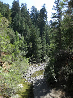
I walked across the old bridge, which crosses the South Fork of the Gualala River. My legs were done; I knew I'd be walking up the other side for a mile or more. I pulled out my sandwich and ate half as I walked up the steep grade.
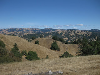
The reward, at some point, was a view clear to the glittering Pacific.
I reached the intersection with Fort Ross Road, which would take me directly back to Cazadero. With that shortcut, I could catch the rest of the group. But after suffering the worst of the climbing, I deserved my reward: reaching the coast.
I paused to admire the view before plummeting down Meyers Grade to Highway 1.
As soon as I turned south, I realized that I might have made a truly bad decision. Not only did I face a long and unexpected climb on Highway 1—I had found the wind. And ... it was ferocious.
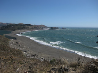
You can see the wind whipping crests on the ocean. You can't see the gust that nearly blew me over into the path of a compact RV.
Terrified, I dismounted to continue on foot. A gust ripped the bike out of my hands and slammed it against the guard rail.
I couldn't walk all the way to Jenner. If i got back on the bike, would a gust blow me over the cliff?
When it seemed safe to ride, I rode. When it didn't, I walked. After turning inland onto Highway 116, a gust caught my route sheet and peeled the Cue Clip off my stem. Luckily, they landed in a ditch, within reach.
I scanned oncoming traffic for familiar faces. Surely the group would be worried about me. The logical thing would be to start driving the route in reverse, looking for me.
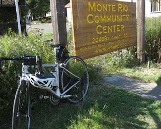
When I reached our starting point, the parking lot was empty.
The lead guys had convinced the rest of the group that I'd turned back.
But I hadn't. pep's epic ride: 61 miles and 4,985 feet of climbing.
After they fetched me, I wore my new dress to dinner.
September 21, 2017
Subscribe to:
Post Comments (Atom)








No comments:
Post a Comment