York—as in the original, not the familiar New World “New” version.
I had chosen to fly into Edinburgh (where the cycling tour will end), and take the train to York (where it will begin). Opting to rent a bike from Wilderness Scotland was the right call for this trip. Apart from the complicated logistics of hauling the bike (and its bag), there is a good chance we'll be riding in the rain. Your bike? You clean and service it. Their bike? They handle it all. (Sold.)
The train was packed with rugby fans returning from an important match. So much for those stunning views of the coast, I thought, as I stood outside the one coach with unreserved seats. I got lucky, though; some gentlemen pointed me at a seat that had emptied after the first hour, and graciously kept an eye on my luggage till we disembarked.
With many daylight hours left on a northern spring day, I set out to see what I might of the city.
I crossed the Lendal Bridge over the River Ouse, and headed for the Minster.
I passed the well-preserved birthplace of Guy Fawkes, still rather notorious more than 400 years after he paid the price of his treason.
I strolled through the Shambles, with buildings dating back to the 1400s.
I watched traffic flow under the Micklegate Bar—including an Uber Prius—some 800 years after it was built.
But there is much more history here, dating back to pre-Roman times and the founding of the city nearly 2,000 years ago. [Yes, you read that right.]
The well-chosen site of the York Museum is dense with history, from the ruins of a medieval hospital ...
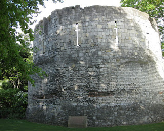
... to a tower built by the Romans around 300 A.D.
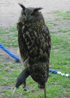
In the shadow of that Multiangular Tower, conservationists were offering close encounters with birds of prey.
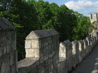
And then of course, there are the city walls. The Romans built a wall. The Vikings buried it. [It's a complicated business, this wall thing.]
The medieval wall was visible from my hotel room. I explored a stretch, but there wasn't enough time to complete a full circuit.
Much more to see here ... next time?
May 14, 2017
May 13, 2017
Edinburgh
What am I doing, here?!
I really hadn't planned on taking a cycling trip this year. I was kind of in a world-funk. Then a brief mention in the New York Times Travel section caught my eye one Sunday, and more or less on a whim I booked a tour with Wilderness Scotland—their Five Countries Tour.
It seemed like a good idea at the time. It seemed like less of a good idea as I boarded the plane, having cycled only about 333 miles to date this year. And still with a sore throat (week number four). I'd visited the doctor, again, on Monday. “I'm supposed to get on a plane to the UK on Friday,” I lamented. “Have a good time!” he replied.
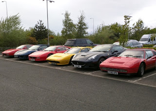
Technically, I am in South Queensferry; hotel rooms were scarce (and expensive) in the city itself. Curiously, there were 24 Ferraris in the parking lot. (An excited little boy counted them.) Earlier in the day, the road bridge spanning the Firth of Forth had been briefly closed to allow a caravan of 75 of them to cross, evidently celebrating the 50th anniversary of the Ferrari Owners' Club.
Hello, Scotland.
May 11, 2017
Big Wheel
It's been an odd year. Cold weather. Wet weather. (Lots of that.) Not a whole lot of blogging going on because, well, not a whole lot of cycling going on.
And then came the Cold of the Century. Three weeks of misery (and counting). Yesterday I despaired that I might not be able to ride at all, today (Bike to Work Day). I assured my co-conspirator that I could, at least, lead people the few miles to our rendezvous point. From there, he might not only have to take the lead—he might have to manage the group alone.
Our peloton was smaller this year. Normally, a few weeks before the big day, I promote the ride and start egging people on; but I had no energy for that. When we reached the bridge leading to the Stevens Creek Trail, a woman and her daughter counted off: one, two, ... twenty-four of us. One rider had turned off before that.
Uncharacteristically this year, we were gruppo compatto for most of the route; at the first energizer station [rest stop], a few speedier riders usually split off. Not this year.
A couple of first-timers joined our crowd of mostly-familiar faces. And we celebrated a new first: an odd number of wheels. [Think it through.] A tricycle? [No.] A unicycle.
Who would ride a 36-inch unicycle some 20 miles to the office? Mixing it up in a line of bicycles, in stop-and-go traffic? In the lead, I didn't get to watch him (or to witness the facial expressions of the drivers who passed us). Having watched him dismount, I'd characterize it as a controlled fall, essentially. “There's nothing to it,” he insisted. “You land on your feet.” [Right. You land on your feet. I'd land on my butt. Or worse.]
Once I started moving, my body just kept moving. Maybe I could ride home after all; I felt surprisingly good.
Until I stopped moving. Suddenly, I was tired. My last real bike ride (also a commute to work) had been six weeks ago.
Twenty-four miles for the day. I made it.
So did my followers: No mishaps, no dropped riders, lots of smiling faces, and only one flat tire.
April 6, 2017
Schwanensee
When they heard I'd be spending the week in Zürich, my friends were eager to hear about my adventures. “It's a trip for work,” I explained. They seemed unconvinced.
Day one began with a 7 a.m. breakfast in the two-story library (33,000 books) at the hotel (in a building that once housed a brewery). The chandeliers were crafted using original beer bottles. The day ended around 7:30 p.m., at which point my boss and I headed out of the office for dinner.
Lather, rinse, repeat. Much good work got done.
One evening was reserved for dinner with the team. Another evening, a colleague and his partner hosted us for a Moroccan-inspired dinner at their apartment. (It was amazing.) I conspired to keep one evening free. In Zürich, as in San Francisco, it's ballet season.
On my way to the Opera House on a lovely spring evening, I strolled through the Arboretum.
What could be more picture-perfect than swans on Lake Zürich?
Tonight's performance? Swan Lake.
I learned that the Opernhaus Zürich has a somewhat surprising history. Not all cultural treasures are treasured, it seems.
I thought the restoration was stunning.
The performance, featuring Anna Khamzina and Tigran Mkrtchyann, was ... interesting. I'm most familiar with Helgi Tomasson's interpretation (which, as fate would have it, I had seen just four days earlier in San Francisco). Alexander Ratmansky's revival includes elements that were unfamiliar to me, truer to the historic Petipa version. Some seemed superfluous or even confusing; other moments I will regret missing whenever I see Tomasson's version.
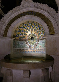
I walked back along the edge of the Arboretum, where this mosaic fountain drew me in for a closer look. Public fountains spouting drinking water are pretty common, but none so lovely as this.
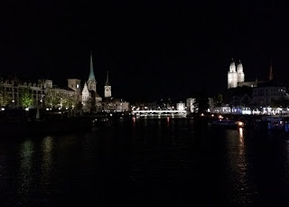
After a moment's hesitation (walking alone, at night, in a foreign city), I backtracked to cross the bridge for a clear view of the Fraumünster and Grossmünster churches. It was worth it.
When my colleagues in Zürich asked if I had visited before, I summarized my bike trip (2015). “You've seen more of Switzerland than I have!” they'd respond. Not on this trip, though. Next time ...
March 18, 2017
Up a Random Hill
Out of shape, I am.
I did manage to commute to (and from!) work one day last week, after daylight savings time kicked in. Getting up took some convincing, it did.
Today wasn't pretty, a bit chilly thanks to overcast skies and more wind than I expected.
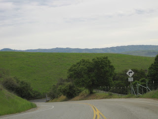
My ride buddy and I kept it short—just one hill. Most of the group skips the climb we chose; instead, we skipped the rest. It's quiet and wide, affording us ample time to chat. (My buddy pedaled up twice, having arrived an hour too early.)
It's been awhile since I last visited this area; there's quite a bit of development in progress.
We met at Random Access Method of Accounting and Control Park. (RAMAC Park, that is.) Named for the first computer to use a hard disk drive, which was invented nearby at IBM. Fittingly, our climb up Bernal Road ends at the Almaden Research Center's gate.
The club has been starting rides from this park after a favored bike shop shut down. Something didn't feel right with this place. Men in aggressive cars were loitering in the parking lot, or circling the neighborhood. I picked up (and recycled) an empty 32 oz. beer bottle that had been discarded. At least it hadn't shattered.
After finishing the ride, the dead-end street next to the park was blocked by adjacent patrol cars; the officers were conferring. That seemed all the more curious after I reached the main road, where the traffic signals were out at two busy intersections. Motorists were left to negotiate the multiple straight-through and turn lanes on their own.
One mile of climbing, 12 miles of flat: 575 feet, in all. In a word, enough.
March 3, 2017
Ah, Altitude
It has been an spectacularly snowy winter in the Sierras. We arrived on a perfect high-altitude-blue sky day,
which became a perfect clear black night.
In a few days, skiers from around the world will compete in the World Cup races at Squaw Valley.
They will be well-prepared. Unlike yours truly, who committed a regrettable tactical error ten days ago by donating a unit of blood. I did consider postponing till after this trip, but then made the wrong choice.
You see, at altitude, you really need those red blood cells.
My heart rate was elevated (normal) and my body was busy shedding plasma (normal) to raise the concentration of those oxygen-carrying warriors. There just weren't enough of them.
I felt tired ... was it only 8:30 p.m.? Maybe I'd feel better in the morning.
I woke up groggy. Maybe I'd feel better after lunch.
Sliding around on a pair of skis while lightheaded would not count as a good idea. The sled dogs were fully booked.
The skies had clouded over as the next storm approached.
I boarded the tram to visit the mountain-top High Camp.
Lake Tahoe was just visible in the distance, through the rings that remain from the 1960 Winter Olympic games.
I wandered through the Olympic Museum. I would not have fared well on those skis, not at all.
Graceful skiers carved their tracks down the slope as I watched with wistful envy.
Next time.
February 18, 2017
Water Finds a Way
With a respite between storms, I could have completed my errands by cycling around town. That would have been quicker, but I wanted more exercise. More time outdoors.
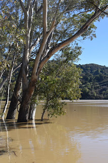
I laced up some hiking shoes and set off on foot. I first crossed the creek on my way to the dry cleaner's. Fast-moving water, the color of caramel.
Backtracking to the creek trail would likely save time: no traffic lights or crosswalks, just a direct (and scenic) route to downtown. The acacia trees are in bloom.
I was lucky to score some Girl Scout cookies after I left the Post Office, just as they finished packing up and started to roll their cart back home.
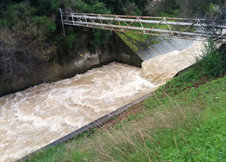
That was a genius move, as I had brought along a bottle of water—but no snack. My plan was to continue following the trail upstream, to see how much water was flowing over the spillway at the dam. Lunch could wait.
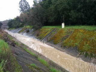
So much water, raging urgently down the creek.
Splashing and tumbling, surging and swirling.
It seemed almost angry when it sprayed up and around any obstacle in its path.
It picked up speed as it flowed from one level to the next.
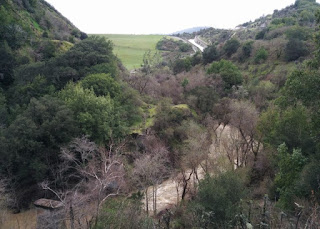
It slowed in apparent confusion, losing direction when the banks widened enough for the water to pool.
Once the spillway was in sight, I couldn't resist continuing across the face of the dam to behold the sights from above.
So much water, and more on the way.
Raindrops sprinkled now and then, which kept many people at home. There were joggers and dog walkers, mountain bikers and road cyclists, parents and children.
Plenty of mud, along with puddles and rivulets, on the trail.
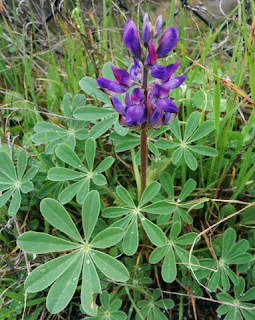
And one lone lupine.
February 11, 2017
Crud
No, I wasn't off-roading on my skinny tires.
A friend recently asked if I'd stopped riding, or stopped blogging. Not exactly.
The thing is, we've been having a bit of weather this winter. Wet weather. Wet, windy weather. Trees topple. Hills slide. Roads crumble.
Highway 9, closed. Highway 84, closed. Highway 35 (Skyline) will need to straddle a small new ravine that washed away the roadway (needless to say, closed). A section of Skyland Road was similarly torn away. I can't imagine what Highland Way must look like, given that the hillside had already taken its toll on a stretch that had been under reconstruction for years. Trails, which typically run alongside creeks, flooded and closed; some will need repair, like a section where Stevens Creek eroded and widened its banks.
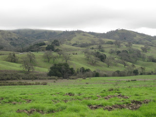 The lower portion of Mt. Hamilton seemed like it would be a reasonable place to bike—and it was ... mostly. The asphalt was patched where a falling eucalyptus had torn out a chunk. The remains of the enormous tree were cut and left on both sides of the road. Culverts did their job, channeling much water safely beneath the surface. The road was in much better shape than I'd expected, though one section had some ominous cracks.
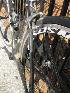
The road was also in much better shape than I was; I had no intention of trying to reach the summit today. In fact, I was never so happy to reach the intersection at Alum Rock Road, after descending cautiously through mud-caked and wet curves, on slick, sandy tires.
I felt victorious after covering 17 miles—not to mention climbing (and descending) 1,985 feet. After six long weeks without a “real” bike ride, it required a serious effort to pull my routine together. Luckily it was, well, just like ... riding a bike!
A friend recently asked if I'd stopped riding, or stopped blogging. Not exactly.
The thing is, we've been having a bit of weather this winter. Wet weather. Wet, windy weather. Trees topple. Hills slide. Roads crumble.
Highway 9, closed. Highway 84, closed. Highway 35 (Skyline) will need to straddle a small new ravine that washed away the roadway (needless to say, closed). A section of Skyland Road was similarly torn away. I can't imagine what Highland Way must look like, given that the hillside had already taken its toll on a stretch that had been under reconstruction for years. Trails, which typically run alongside creeks, flooded and closed; some will need repair, like a section where Stevens Creek eroded and widened its banks.
 The lower portion of Mt. Hamilton seemed like it would be a reasonable place to bike—and it was ... mostly. The asphalt was patched where a falling eucalyptus had torn out a chunk. The remains of the enormous tree were cut and left on both sides of the road. Culverts did their job, channeling much water safely beneath the surface. The road was in much better shape than I'd expected, though one section had some ominous cracks.
The road was also in much better shape than I was; I had no intention of trying to reach the summit today. In fact, I was never so happy to reach the intersection at Alum Rock Road, after descending cautiously through mud-caked and wet curves, on slick, sandy tires.
I felt victorious after covering 17 miles—not to mention climbing (and descending) 1,985 feet. After six long weeks without a “real” bike ride, it required a serious effort to pull my routine together. Luckily it was, well, just like ... riding a bike!
January 14, 2017
St. Joseph's Hill
So much rain, so many roads closed for repair or clean-up. I was apprehensive about venturing into the hills today, even though it would be sunny and clear. Rocks, mud, and trees continue to tumble down the unstable slopes.
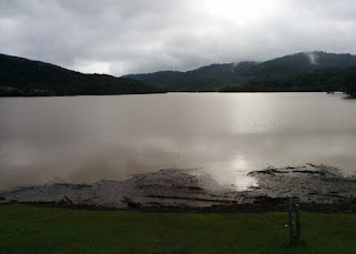
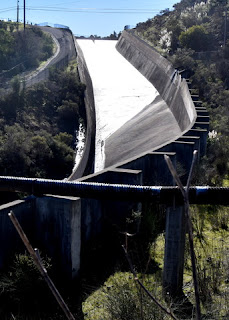
So much water that it was still flowing down the spillway at the now-filled Lexington Reservoir!
Could we find a place to hike that was not only safe and accessible, but interesting?
We could walk up the Los Gatos Creek Trail to Lexington Reservoir; the trail is high enough above the creek. Not a serious hike, though.
Then it dawned on me: continue on to St. Joseph's Hill Open Space Preserve. Small, but with mostly-exposed trails and mostly-gentle grades on high, rolling hills.
Perfect. Especially at this time of year, before the baking-hot sun of summer (or spring or fall, for that matter). You can't really get lost up there, either; little need for advanced planning.
And so we set off along the trail, busy with runners and cyclists and dog-walkers and people like us, out for a stroll on a precious sunny day between the “atmospheric rivers” of rain that have been battering us this month.
From the summit, we had clear views in all directions: The cube atop Mt. Umunhum, across the valley to the domes of Lick Observatory on Mt. Hamilton. Mt. Diablo to the north east, and the city of Oakland. Even San Francisco was visible, and Mt. Tamalpais beyond that. A thin line of smog hovered over it all, having risen quickly after the rains subsided.
We returned on the hikers-only Flume Trail, having hiked almost seven miles. (Not to mention the three miles we covered, walking to and from the trailheads.)
Nearly ten miles. Not bad for a walk-out-your-front-door-and-take-a-hike kind of day.
So much water that it was still flowing down the spillway at the now-filled Lexington Reservoir!
Could we find a place to hike that was not only safe and accessible, but interesting?
We could walk up the Los Gatos Creek Trail to Lexington Reservoir; the trail is high enough above the creek. Not a serious hike, though.
Then it dawned on me: continue on to St. Joseph's Hill Open Space Preserve. Small, but with mostly-exposed trails and mostly-gentle grades on high, rolling hills.
Perfect. Especially at this time of year, before the baking-hot sun of summer (or spring or fall, for that matter). You can't really get lost up there, either; little need for advanced planning.
From the summit, we had clear views in all directions: The cube atop Mt. Umunhum, across the valley to the domes of Lick Observatory on Mt. Hamilton. Mt. Diablo to the north east, and the city of Oakland. Even San Francisco was visible, and Mt. Tamalpais beyond that. A thin line of smog hovered over it all, having risen quickly after the rains subsided.
We returned on the hikers-only Flume Trail, having hiked almost seven miles. (Not to mention the three miles we covered, walking to and from the trailheads.)
Nearly ten miles. Not bad for a walk-out-your-front-door-and-take-a-hike kind of day.
January 1, 2017
Rancho Cañada del Oro
My New Year's tradition is to eschew New Year's resolutions. As this year begins, though, I could use some inspiration. Motivation. Something.
And so I resolved that I should hike more often. In fact, why not start today?
We are blessed to have so many unspoiled places to visit, just a short drive outside the sprawling, heavily-developed valley. County parks, open space preserves, state parks—even national parks.
My chief biking/hiking buddy suggested Rancho Cañada del Oro, an open space preserve.
After taking a wrong turn and circling round on the Llagas Creek Loop Trail, we headed onto the trail we'd planned: Mayfair Ranch.
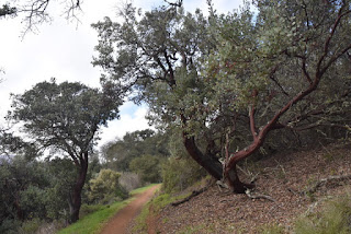
We crossed paths with a few hikers as we surveyed some of the hillsides that the Loma fire consumed last fall. Hay bales and signs have been placed to keep people from straying off the trail onto the fire roads and into the burn zone.
We also met a family on mountain bikes, but for the most part we had the serenity of the preserve to ourselves.
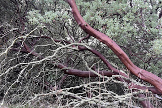
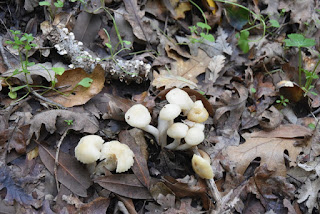
There were trailside mushrooms and a few flowers in bloom, and plenty of birds twittering about. Our fellow hikers had asked if we were participating in the annual Audubon Society bird count (no), but then I did spot a few small birds with yellow patches exposed above their tail feathers as they flew (Audubon's warblers?). Not to mention the turkeys we saw on the way to the park, and the ubiquitous turkey vultures circling overhead.
And so, with a five-mile hike, 2017 begins.
Subscribe to:
Posts (Atom)


