The friendly young clerk in the local market asked me what I was planning to do this weekend. [No, it wasn't a pickup line; he's young enough to be my ... well, let's not go there.]
“I'm going for a bike ride tomorrow.” He smiled, but when he asked ”Where?” he wasn't prepared for my answer: Up Mt. Hamilton. “To the top?!” he asked, incredulous.
Of course, silly boy.
I had a birthday recently, and climbing my favorite mountain seemed like a good way to celebrate. When a club member listed a ride for today, even though it was much earlier than I would normally start, it seemed ordained. One downside of the early start was that, heading east, we were riding into the sun.
One of my regular riding pals joined me (no small sacrifice, at such an early hour)—and further surprised me with some lovely flowers, which elicited birthday greetings from the rest of the group.
Sunday is the better weekend day for climbing Hamilton, as it's less busy. I was surprised that a few motorcyclists were also getting an early start, and even more surprised by cyclists already coming down the hill. Did they start before dawn? Maybe; the moon was nearly full, and the skies were clear.
The rest of the group was embarking on a century ride, and we wished them well. It would be a hot day; just doing Hamilton would be enough for me. A fellow cyclist pointed out that “just” doing Hamilton wasn't exactly sitting on the sofa playing video games, as it's nearly 5,000 feet of climbing.
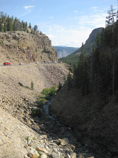
There was an uncommon amount of roadside junk: faded sofas, broken furniture, large pieces of rusted equipment. My guess is that some authority has hauled this detritus out of the ravines for pickup. Hopefully soon, since that sort of stuff is a magnet for more.
I've seen a lot along this road, but today I spotted something I'd never found before.
Right there along the edge of the road, its pink ribbon caught on some brush, was a Mylar balloon. A Happy Birthday balloon.
What are the odds?
I tugged it free and tied it to the back of my helmet. [And no, there wasn't enough helium to give me a lift.] This inspired many more passing cyclists to wish me “Happy Birthday,” making this climb one that I'll always remember.
The usual 39 miles with 4,715 feet of climbing. As someone recently reminded me, growing old is a privilege.
September 18, 2016
September 10, 2016
Shades of Gray
Mystery solved: The reason I never see two folks I know on the road—the reason I never see them pass me on this ride—is that they start off with a shortcut. Instead of turning right at the start with the rest of the pack, they skip the first six miles and head directly toward the coast.
Tempting. But I have always done the full route, and today is no exception.
Last night I broke with routine and attended the opening festivities. The invitation said “cocktail casual,” so I turned to the Interweb for fashion advice. I forgot how cold it was likely to be; my nice dress ended up hidden under a less-than-cocktail jacket. [Most of the guests paid far less attention to their attire.]
The marine layer was thick in the morning; with that, we trade a visible sunrise for warmer temperatures. The gray fog, however, would shroud us all day. Around Big Sur, we climbed high enough to feel the tiny droplets ping our faces. The yellow flower that adorns my saddle bag was often the only spot of color in the landscape, and it drew many comments. “It makes people smile,” I'd say each time. And that's true. One rider recognized me from last year (well, he recognized the flower).
The route down the coast is up and down, with a just a few extended climbs. Big Sur is the first, and that's where I begin reeling them in. Riders from flatter places, or those who haven't sufficiently trained, start blowing up there. One was already off the bike, walking up the hill. [That did not bode well for the tougher climbs after lunch.]
There were a few short stretches of pavement that had been scraped and grooved, as if in preparation for re-paving. I took extra care on each of these, wary that I'd catch a tire and go down. Later I would learn that at least one rider required a trip to the emergency room to get his arm stitched; his bike was damaged and his helmet destroyed, but he had no broken bones or concussion.
The Soberanes fire was still burning; having consumed more than 103,000 acres, it was only 60% contained. There was a hint of the sour smell of damp ash as we reached Big Sur, and signs for firefighter staging areas and encampments. The fog denied us great views of the coast, but I knew it could only help suppress the fire.
On the east side, near Fernwood, the fire had burned down to the edge of the road. Homes, and the life of one firefighter, have been lost. All because some selfish fool lit an illegal campfire on July 22.
Hearst Castle itself was closed just 10 days ago, and some of the Hearst Ranch property was scorched by another wildfire (dubbed “Chimney;” cause, as yet, still under investigation). Battalions of firefighters defended the historic property as the flames advanced to within a mile or two.
We were quite fortunate indeed to be able to proceed with this ride.
Today marked my tenth foray down the coast for Best Buddies; by now, the route is very familiar. The speed sensor on my bike was acting up (as in, not functioning), which meant that I needed to rely on memory (and the event signs placed at 10-mile intervals) to gauge where I was, between rest stops. I focused instead on the elapsed time from one stop to the next, and tried to keep each stop to a minimum. Ten minutes at the first stop, fifteen at the next two.
Past Rocky Point, where we used to descend a steep hill to our first rest stop. Past the private home that hosted us, one special year. Over the Rocky Creek Bridge, the iconic Bixby Creek Bridge. Past Andrew Molera State Park, closed as a staging area for firefighters. Through Big Sur, past Ventana and Nepenthe. Over the Big Creek Bridge, through Lucia and Gorda. Past the Piedras Blancas Elephant Seal Rookery, to the finish line at William Randolph Hearst Memorial Beach.
100 miles in all, with 6,205 feet of climbing. My legs were a bit sore afterward, despite my recent 500-mile tour of Greater Yellowstone (more, and steeper, climbing on this route).
This year, after several moving speeches, we were entertained by The Beach Boys. [A subset of the original band, of course.] They rocked us with one hit after another, projecting images of the sixties on a giant screen at the back of the stage. Pictures of their own youthful selves, of cars and surfer girls. Their music is just fun ... [fun fun fun till her Daddy takes the T-bird away ... ]
The sweetest moments came when a very talented Buddy, Marlana VanHoose, joined them for vocals on “Help me Rhonda” and “Barbara Ann.” And when Maria Shriver (and more) flooded the stage for “California Girls.”
And now, a word for my sponsors ...
I wouldn't be here for the tenth time without the generous support of all the friends who respond year after year when I reach out for donations (and my employer, who matches them). I learned a valuable lesson about fundraising years ago, when I was too timid to solicit a single contribution. A more gregarious colleague, with experience in sales, counseled me: “Just ask.”
Even then, I agonized over the list of people I would approach. There was one, in particular, that I almost skipped—someone I knew professionally, but hadn't seen in years. “What's the worst that could happen?” I thought. “Someone might tell me never to ask again?” Okay, I could handle that.
Not only was he the very first person to donate—less than an hour after receiving my email message—in later years, after I started riding for Best Buddies, he went on to hire a Buddy.
There is no better outcome than that.
September 5, 2016
The Full Monte
I turned out of the parking lot, leaving the group to head home after our post-ride snack. My rear wheel felt squishy and slipped—did I just ride over something I hadn't seen, or ... was my tire flat?
 Bad karma. After being dismayed at the sight of five discarded CO2 inflators and two empty inner tube boxes on Montebello, I had a flat. Note to the unknown rider who left the trash behind: You carried it there—carry it out.
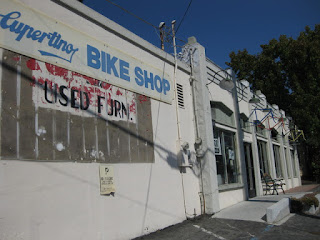
It was a day for mechanical failures. One rider had met us at a rendezvous point, Cupertino Bicycles, with a broken spoke. He had tried to repair it with duct tape (which, MacGyver, does not solve all problems). This being a Monday, and Labor Day to boot, the bike shop was closed. Another rider in our group flatted (twice); the cause had not been found. (Hence, the second flat?)
It's been a while since I've gone up Montebello, and today it hurt. Whoa, that lower section was steep. I kept watching for the landmark mailbox (American-flag themed); the grade eases up at that point. Did I miss it? Maybe it's gone.
Whew. There it was. A welcome break, till the crux stretch near the top.
 We had a large group today, and the men were outnumbered! (A nod to our ride leader, another woman.) Apparently one of the guys appointed himself ride sweep and kept me company on the climb. People charged past, panting and gasping for air, and I was just spinning along. My sweep was surprised when I rode strong up the the steep bits at the top, nosing ever so slightly ahead of him. “I'm impressed at the effort you put in up there!” he remarked. [Uh huh.]
There wasn't much of a view today; there was so much haze across the valley that the Diablo range wasn't visible. Wildfire smoke, still? I could smell it. The sun reflected off the hangar at Moffett Field and the white peaks of Shoreline Amphitheatre. That was about all you could distinguish.
I was relieved to discover my flat tire after turning away from the group; otherwise, some of the guys would have felt obliged to stay and help me fix it. I found a shady alcove and set to work.
The cause of my flat wasn't obvious, either. Ah, well. Plenty of time to sort that out later, at home.
39 miles, with 3,435 feet of climbing
 Bad karma. After being dismayed at the sight of five discarded CO2 inflators and two empty inner tube boxes on Montebello, I had a flat. Note to the unknown rider who left the trash behind: You carried it there—carry it out.
It was a day for mechanical failures. One rider had met us at a rendezvous point, Cupertino Bicycles, with a broken spoke. He had tried to repair it with duct tape (which, MacGyver, does not solve all problems). This being a Monday, and Labor Day to boot, the bike shop was closed. Another rider in our group flatted (twice); the cause had not been found. (Hence, the second flat?)
It's been a while since I've gone up Montebello, and today it hurt. Whoa, that lower section was steep. I kept watching for the landmark mailbox (American-flag themed); the grade eases up at that point. Did I miss it? Maybe it's gone.
Whew. There it was. A welcome break, till the crux stretch near the top.
 We had a large group today, and the men were outnumbered! (A nod to our ride leader, another woman.) Apparently one of the guys appointed himself ride sweep and kept me company on the climb. People charged past, panting and gasping for air, and I was just spinning along. My sweep was surprised when I rode strong up the the steep bits at the top, nosing ever so slightly ahead of him. “I'm impressed at the effort you put in up there!” he remarked. [Uh huh.]
There wasn't much of a view today; there was so much haze across the valley that the Diablo range wasn't visible. Wildfire smoke, still? I could smell it. The sun reflected off the hangar at Moffett Field and the white peaks of Shoreline Amphitheatre. That was about all you could distinguish.
I was relieved to discover my flat tire after turning away from the group; otherwise, some of the guys would have felt obliged to stay and help me fix it. I found a shady alcove and set to work.
The cause of my flat wasn't obvious, either. Ah, well. Plenty of time to sort that out later, at home.
39 miles, with 3,435 feet of climbing
September 4, 2016
A Pair of Peaks
 “I like Country View, the road is in great condition and there's no traffic,” commented our ride leader.
Those are words I never expected to hear in the same sentence (“like” and “Country View”), but that's what she said.
Fortunately I'm not required to climb this punishing little hill, as just desserts for having introduced it to our club. There were a few first-timers on the ride today, including one who was in way over her head. [She bailed out before the midway point.]
Seemed like I should be able to pedal up the whole way. Without a break. Having done that before, I know I can do it again. [That sort of self-talk helps.]
There is a driveway where I've paused before, and that's where I passed our ride leader. Because I remember that although the road keeps climbing after that, it's ever-so-slightly less steep around that next bend, I can make it. [And I did.]
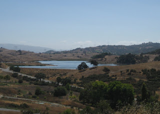
 The reward at the top is a clear view of Mt. Umunhum to the west and much of the Santa Clara Valley and Diablo range to the east. Calero Reservoir is visible only from a lower point. There is also a view of the IBM Almaden building at the top of the next bump we'd tackle, though that part is private and off-limits. Bernal Road has its uphill moments; after Country View they felt like small moments indeed.
I spotted a hand-made “deer xing” at the bottom, alongside the Santa Teresa Golf Club's greens, and looked to the right. Well-placed.
46 miles, only 2,410 feet of climbing ... so you see, much of it was flat. More or less.
August 28, 2016
Easy Like Sunday Morning
Back home, after all that riding, and off the bike for an entire week.
That's just not right, not right at all.
Having donated blood two days earlier, what I needed was an easy-going ride. Short, nothing to get my heart rate up too high.
There was a club ride that fit the bill: just one hill to climb. [So it's steep. Get over it.]
Normally the group would make a turn to climb up a side road, toward Walden West. The plan today was to bypass that, going straight to Sanborn County Park instead.
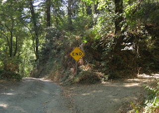 There was some chatter about going to the very end of the road. [Huh. What's up there?] I hadn't visited the actual park in years; the road doesn't end at the park?
Of course I had to keep going.
There was a spirited disagreement about whether, if you kept going past the end of the pavement, you would connect to Bohlman or Black. Looking at the map, it appears that both answers are correct—though private property might get in your way.
Twenty-eight miles, 1,735 feet of climbing.
Easy. Like Sunday morning.
That's just not right, not right at all.
Having donated blood two days earlier, what I needed was an easy-going ride. Short, nothing to get my heart rate up too high.
There was a club ride that fit the bill: just one hill to climb. [So it's steep. Get over it.]
Normally the group would make a turn to climb up a side road, toward Walden West. The plan today was to bypass that, going straight to Sanborn County Park instead.
 There was some chatter about going to the very end of the road. [Huh. What's up there?] I hadn't visited the actual park in years; the road doesn't end at the park?
Of course I had to keep going.
There was a spirited disagreement about whether, if you kept going past the end of the pavement, you would connect to Bohlman or Black. Looking at the map, it appears that both answers are correct—though private property might get in your way.
Twenty-eight miles, 1,735 feet of climbing.
Easy. Like Sunday morning.
August 24, 2016
Yellowstone Wrap
Thanks to a shift in the winds, the view of the Yellowstone River from my balcony was crisp this morning.
Tomorrow is the 100th anniversary of the National Park Service, and for three days admission to all National Parks and Monuments will be free. [Translation: Crowded.]
That won't matter to me, as I will return to the Bay Area today. But before heading north, back to Bozeman, I had some time to slip through the Roosevelt Arch one more time.
The 45th parallel is marked where it passes through the park. [I know you were wondering about that.]
My plan was to head south (counter-clockwise) on the Grand Loop Road, as far as my time budget would allow. Perhaps the road construction wouldn't interfere. [Wrong.] Apparently one section is under one-way control, with traffic being released at 30-minute intervals. I made a u-turn.
My GyPSy guide suggested some interesting basalt columns, which gave me the opportunity to stretch my legs alongside the Gardner River.
A boy and his father were climbing the 500,000-year-old columns closest to the road, which appeared to be crumbling naturally. I didn't stick around to see how that turned out (but I was rooting for the rocks).
Given that I couldn't venture deep into the park, I paused to see whatever I could. I stopped at Swan Lake to admire the distant peaks of the Gallatin Range and spotted some white birds on the water. [Duh.] Swans.
A very detailed description of another roadside turnout rewarded me with a view of Rustic Falls, with Glen Creek snaking through the canyon, hidden from the drivers high above who must keep their eyes on the road.
During this trip, I've noticed that if I am the first to pull over, others almost certainly follow. Not a bad strategy, I suppose, if you're not being guided (by book, map, or app).
There was also an opportunity to pass through Silver Gate, a tiny loop through a field of massive limestone boulders that have toppled down from Terrace Mountain. For a closer look, I found a spot to park and walked back (along the road, very carefully).
Technically, they're not hoodoos—but that's the name that's stuck.
People often combine a visit to Yellowstone with a trip to Grand Teton National Park. Another time, for me.
August 23, 2016
Smoke, Steam, and Sulfur
My goal today was to meander over to Old Faithful, fitting in a couple of stops I missed yesterday and covering some new territory. To avoid the road construction delays, I still needed to travel the loop clockwise—not the most direct route to reach Old Faithful.
I arrived at Dunraven Pass, the other side of Mt. Washburn, around the time I needed to stretch my legs. It was less windy today, so ... of course I had to go up. The parking lot was nearly full; there was plenty of activity on the trail.
This chipmunk appeared to be working on a sun salutation. Looked like an open invitation to feed an eagle, to me, but there weren't many birds in the air.
The elevation at the start is apparently around 8,859 feet. The altitude wasn't bothering me, but I took my time. No need to rush. There is a building at the summit, a tiny bump on the peak to the left in the next photo.
The views were not great, with all the smoke hanging in the air, but it was still a good workout. The summit was marked: 10,213 feet. An upper segment of the trail, following the ridge, was a prominent sight.
I wasn't sure what to expect when I reached the top, so I was happy that we were welcome to enter the building, where there were some displays (and a logbook to sign!). I recorded the route as I hiked back down. I wasn't planning to do a long hike, but it was 7.4 miles round-trip, gaining more than 1,300 feet in elevation. By the end of the day, I would cover nine miles, and my legs were feeling it. [Note to self: do more hiking to cross-train.]
There were the remnants of a paved road up there, and a fence (weighted against the wind with wire baskets of rocks) to mark a stretch where the land slid out. Nothing fancy, but I suspect that's not a problem because the people who make it this far are hardy folks with common sense. [Not the tourists who treat every park like Disneyland.]
Near the summit, we were rewarded with the sight of a small herd of pronghorn. I was surprised to learn that they're more closely related to the giraffe than to the antelope. They can run fast, for a long distance; but this group was just grazing, keeping a wary eye on the humans.
There weren't many wildflowers this late in the season, but with a little patience I snapped a photo of a butterfly. The ecosystem has its share of small creatures, too.
After lunch at the Canyon General Store, I ventured south. Thermal features are particularly concentrated in this part of the park, and I stopped to check out a few. The Churning Caldron is a bubbling mud pool with a small geyser spouting pretty regularly.
A reminder of the dynamic earth just below the surface was a steaming hole fenced off in the parking lot.
I continued to the Lake Village area and Pumice Point for a shoreline view across the vast expanse of Yellowstone Lake. A lone bald eagle soared offshore.
I was headed for the West Thumb Geyser Basin, which is right on the shore of the lake.
There are plenty of signs warning visitors to stay on the boardwalk, because the area around the springs is often just a thin crust of minerals deposited above a pool of boiling acidic water. And of course I wouldn't think of stepping off. But I was amused to see an elk grazing nearby, and tracks (and scat) through much of the area. If it were winter, I could understand that the animals sought the warmth around the springs. But now? I wondered what would attract them here, with its sparse vegetation, toxic gases, and pools of acidic mud. Somehow they don't break through the crust. [Or, maybe, sometimes they do?]
A family passed. “Are we going to see stinky stuff every day?” asked a child. [Yup.]
There wasn't time to linger, though, if I wanted to fit in a visit to Old Faithful.
Seeing the famous geyser was not at the top of my list of sights-not-to-missed in Yellowstone. Frankly, it felt like a cliché. But then, I'm here ... how can I not see it? That just seemed wrong.
My timing was (im)perfect ... the parking lot was packed, but the crowds were headed for their cars. That plume I'd glimpsed rising above the rooftop as I pulled in was, of course, the geyser erupting.
The next eruption would be around 8:20 p.m., give or take 10 minutes. Waiting would mean driving 70 miles back to Gardiner through the park (in the dark), which seemed foolhardy.
My GyPSy guide was emphatic about visiting the lobby of the Old Faithful Inn. “I'm not going to say anything more. Just do it.”
So I did. [He was right.]
By the time I had a snack and whatnot, it would be close to 8 p.m. and I'd be driving back in the dark anyway.
I took a seat. Perhaps this was meant to be: at this hour, there was no crowd. The sun would set at 8:14 p.m.
The geyser steams away, in wisps and puffs and occasional blasts. As the pressure builds, it throws up small spouts of water.
At 8:30 p.m., on schedule, Old Faithful erupted. [It was worth it.]
As I headed for my car, I convinced myself that there would be other cars on the road. Most of them were headed for West Yellowstone, of course; the nearest exit. Once in the lead, I carefully scanned left and right, right and left, for wildlife. Headlights can't help around corners, so I took the curves particularly slowly.
A pair of cars heading south temporarily impaired my night vision; they were moving very slowly. I soon saw why.
There was a big animal in the road ... was it a moose? [Nope.]
A huge bison was ambling up the road. In my lane, traveling in the right direction. His taillights were out.
Subscribe to:
Posts (Atom)
