Next week is our club's big event, when we host hundreds of cyclists on a tour along some of our favorite roads. We'll be working hard then, so today we ride (and raise an alert if we see any potential problems along the way).
It was a sunny cloudy kind of day. Chilly.
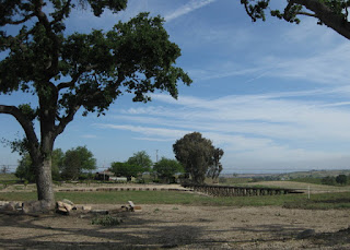
Windy, too. Oh, look! It's another Aermotor.
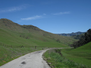
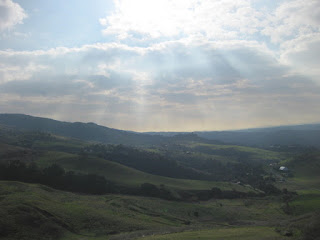
Rolling (still green) hills, ranches, farms, suburban sprawl ... we have it all.
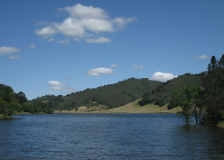
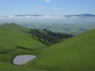
The wildflowers peaked a week or two ago, but this year the reservoirs along the loop are nearly full. What a welcome sight!
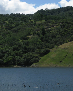
I am now so accustomed to low water levels, sad to say, that I thought I saw a bunch of sticks poking through the surface of Chesbro Reservoir. (Wrong! Waterfowl.)
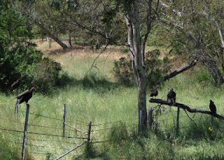
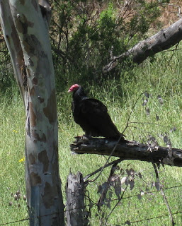
I was motoring along with the tailwind I (finally) deserved when I was startled by loud wingbeats at close range. Not one, not two ... five turkey vultures perched near the side of the road. I made no move toward their prize—a carcass in the ditch—so they paid me little mind.
They are not the most attractive creatures ... unless you're one of them, I suppose.
A healthy 55 miles, with 2,160 feet uphill and into the wind.
I reported three patches of broken glass, which I hope will be swept away before next weekend. The biggest problem is one we can't fix: Starting last year, the Santa Clara County Board of Health got carried away. Safe food handling is not enough. Whole fruit only! (Which means: lots of waste.) Snacks must be bagged! (Which means: lots of waste.) No homemade nut breads—our signature and popular treat. (Which means: disappointed riders, and fewer of them.)
April 23, 2016
April 14, 2016
Santa Rosa Creek
Given the choice, would you rather bike on a road named Green Valley or California State Highway 46? [Let me guess ...]
But that's a trick question, because they're the same road.
I've admired these very hills from the comfort of a tour bus each September, returning from the Best Buddies Hearst Castle Challenge. I didn't expect that I might ride my bicycle here. Ever.
Today was the queen stage of our little getaway, the route with the most climbing and the longest distance. I decided I was up for it. Then I checked the forecast.
We were headed for the coastal town of Cambria, and the weather service had posted a wind advisory. Strong winds in the afternoon, gusting to 35 mph, from the northwest. That would present crosswinds on the return trip; so far this week, I'd wobbled twice in crosswinds that were far weaker.
Time for Plan B.
My wise roommate had been planning all along to drive to the end point for today's climb. I joined her. When I saw that the return to Paso Robles on Highway 46 would have involved more climbing, I was ever-so-glad that I would not be biking it today.
As we parked, we met a couple of guys setting up a rest stop of sorts. They said they had about 20 riders coming through and asked where we were headed. “Oh, you're coming up the wall,” they said. I asked them about the steep bits on Santa Rosa Creek Road. 20% grade, one explained; a steep section, followed by a steep switchback. [I see some uphill walking in my future.]
Heading west entailed a bit of climbing to earn a creamy downhill to the coast. We turned right onto Highway 1 ... right into the wind.
It was too early for lunch. But it was not too early for a warm slice of olallieberry pie at Linn's. (Thanks, Ms. C., for the recommendation.)
Santa Rosa Creek Road was spectacular. See the tree trunk heralding a bend in the road?
Segments reminded me of some Bay Area favorites: Tunitas Creek (though without the redwoods). Lobitos Creek. Bear Gulch West. After several miles, the steady gentle climb ticked up. And then ...
There were two steep (but short) ramps in succession, each affording a (more or less) flat bit for recovery. Was that it, or would it get worse? Where's that nasty switchback?
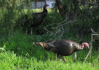
The road took a bend to the left, and ... [gulp]. Unclip, unclip now! My left cleat would not release. I'm going to topple over. Rotate the pedals, steady, steady, unclip. [Whew.] Turkeys, unseen, cackled nearby. [Funny, very funny.]
The support van had relocated to (effectively) the top of the climb, and the racers were arriving as I got there. As I prepared to roll on, a bunch of them clipped in to do the same. Should I wait, let them pass? [Nah.]
And, we're off! Downhill, curvy, one lane, through the woods. One guy was ahead of me, and I wasn't losing ground. [Hmm.] Thoughts buzzed through my head. You don't know this road. The guy ahead of you does, follow him. We're really moving. Don't give chase. But he knows the road. Chill out. A couple more guys joined the first one, but the gap between us did not expand. When there was enough of a straight stretch, I checked my mirror. Maybe I should sit up and let the rest of the group come together.
They were nowhere in sight. Nowhere.
I could see the road ahead tilt up. Ah, that must be the “one more climb” a rider had foretold. I didn't want to crawl uphill. Aerodynamics and some mad pedaling paid off: not only did I make it up the hill with little effort, I actually closed the gap to the racer guys! [Thank you, Cervélo, thank you.]
The road leveled out and a spread of lupines called for a photo. I sat up and slowed. As they passed, one of the women called out “You did a great job descending back there!” I smiled. “That's why I climb.”
Our ride leaders for this trip were clever indeed. With each day's loop out of Paso Robles, we explored a new direction: southwest, southeast, northeast, saving the best for last: 32 miles, 2,795 feet of climbing west, to the coast (and back).
April 13, 2016
Santa Margarita Express
I've come to believe that there are two varieties of hillsides in this area: those that are covered with grapevines, and those that will be covered with grapevines in the future.
With today's route, we left the vineyards behind and passed through ranch lands. Horses and cattle, mostly. A few goats.
We paused to admire an impressive private narrow-gauge railway along the way, complete with a trestle and working signals. Not surprisingly, this being a weekday, the train wasn't running.
We stopped for a snack (freshly baked cookies!) at the Creston General Store.
Over the years, I've developed something of an affinity for Aermotor windmills. I just have to stop and take a picture. It's a thing, I guess. A harmless thing. Today was a four-Aermotor day (though I skipped photographing the fourth one, which was planted in the parking lot of a farm supply business).
This little eccentricity of mine paid an unexpected dividend. Just as I climbed back on the bike after admiring my third Aermotor, a bald eagle glided just overhead. A few moments earlier and I would have had my camera at the ready. I kept my eye on the soaring bird as I pedaled on, hoping for another chance but expecting it to fly out of sight.
Then I got lucky.
The bird circled back. I stopped and pulled out my camera, just in case it would pass nearby. I pointed and shot, hoping for the best: one shot in flight, the second with tail feathers fanned out as it prepared to land in a tree. For much of my life, these birds were nearly extinct; seeing one in the wild will always make my heart race. I've never been closer to one than I was today.
We rode into Santa Margarita looking for lunch at the Mercantile, but it's apparently out of business. We invaded the Southern Station instead, where they accommodated our crowd with grace and good humor. Their outdoor seating was perfect for our small herd of cyclists.
The general profile of our return route was downhill, but along the way we gained 600 feet in elevation as the hills rolled up (and down).
The locals were mostly tolerant, though I wondered at two signs along one rural road: a picture of bicycle, with the words “PASS 3 FT MIN.” It is the law, but it left me curious about what led to those signs [which I'd never seen before] being posted on this road. Then there was the pea-brained troglodyte in an oversized pickup truck, backed up in traffic in some small town, who deliberately belched a huge cloud of black exhaust as he passed the core of our group. I'll bet he doesn't give bicycles three feet on any backroad.
At the end of the day, we'd covered 53 miles and climbed some 2,230 feet along some beautiful back roads. It was the bald eagle, though, that made my day.
April 12, 2016
Girls Rule
Pop.
Riding along, it's not uncommon for a high-pressure bike tire to catch the edge of a pebble or whatnot and launch it off to one side. Or to roll over something that goes “pop!”
I did wonder at a lighter spot on my front tire, trying to puzzle out what I might have ridden through. A patch of sand?
Nope. A stout roofing nail, driven smack into the center of my front tire. If I wanted to do that deliberately, I have no idea how I would make it happen.
We weren't even 1.5 miles into the ride. The route started with a climb, so most of the group was ahead of me. Three of the women in our group stopped. “Go on without me, it will take me a long time to fix this, I'll probably just turn back,” I said.
Nonsense! Let's get this started, where are your tire levers? With four of us sharing the work, we were rolling again in record time. [They insisted I save the nail for show-and-tell, later.]
Down the road apiece, I paused at a random spot when I realized that one of our riders had dropped out of sight. We reconnected, and within moments a pickup truck that had been trailing us stopped just ahead. We were a bit nervous when the driver got out and started walking toward us. “We have to stop meeting like this,” he joked, and then sensed our uneasiness. GPS unit in hand, he was looking for a geocache located somewhere within a few yards of where I'd chosen to stop. I think he'd assumed we were at that spot for the same reason. (No, unless I've somehow developed a sixth sense for finding hidden treasures ...)
We would eventually catch up to a couple of stragglers, but we didn't see the rest of the group until our lunch stop around mile 33. We passed on the café they'd overwhelmed, heading instead for a little local Mexican food. Climbing out of San Miguel entailed going up a steep hill—it was only one block long, but a sign posted along the edge announced it was a 15% grade. (Made it. Just. Whew.)
For us, lunch was at the top (yay!). The rest of the group would climb that on full stomachs.
Our next challenge was to merge onto Highway 101 South and ride the shoulder for about a mile before exiting onto our next lovely back road. Being a bit heavy laden with lunch, we were feeling sluggish. Once on the highway, I quickly found the motivation I needed to move—fast! There were multiple lanes and not much traffic, but the speed was intimidating. As we circled off to continue our route, the bridge we'd crossed loomed high overhead; we paused to gawk at the tractor trailers zooming by. We'd biked that! (Yikes.)
The reward for that stressful mile was a peaceful trip through ranch lands. I thought I'd seen long-horned cattle before today, but ... maybe not.
We lost our fast lunch advantage over the rest of the group when another one of us flatted. Our well-practiced crew sprang into action, this time changing out the tube on a rear tire. When they caught us, the rest of the group stopped to see that we had matters well in hand ... and then continued on their merry way.
For the day, 47 miles with a mere 1,720 feet of climbing. Girls rule.
April 11, 2016
Just Peachy
A spring getaway? Why not venture out and see more of my home state?
My curiosity was piqued when some club members proposed a set of rides in the Paso Robles area.
The plan was to drive down early enough to start our first excursion around 11:30 a.m. I thought a poor night's sleep spelled doom for my first ride, but I made it. With time to spare.
When you walk into a hotel lobby and pass two bike boxes waiting for FedEx to pick up, you know you're in friendly territory.
Did the gloomy gray cloud-filled sky also spell doom? It was chilly, but dry ... until nearly the end of the ride. Was that, or was that not, a raindrop?
Perhaps. Perhaps not. Blue skies opened up only after we all arrived back at the hotel.
Somehow I rode off the front today, instead of the back. This group was riding at a slower-than-advertised pace. (Which is fine.) The strongest rider got a late start, appeared out of nowhere to catch me, and then sociably kept me company.
This is Central Coast wine country; lots of vines staked on the hillsides, fewer wildflowers than I'd hoped. We cruised through the oak woodland, where I noticed two distinct types (and probably failed to notice more, this being the “Pass of the Oaks”). And the understory of poison oak doesn't count.
When the tracks of more bicycle than vehicle tires streak the pavement, you know you're in friendly territory. But when you pass “Hanging Tree Road” you can't help but wonder at the story behind that name.
Peachy Canyon was the highlight of today's 33 miles and 2,330 feet of climbing.
With modestly sore muscles, I'm hoping for better night's sleep.
March 26, 2016
A Hill Too Hard
Ah, Hicks. Whatever was I thinking?
I sighed dejectedly at our lunch stop. “I'm really out of shape.” A wiser rider reminded me that it's relative. Few of my peers would be out on a bicycle today, even fewer pedaling up a relentlessly steep hill. [We tackled it from the “easy” side. That's relative, too.]
I slipped off the back almost immediately. No riders were in sight long before I reached the base of the climb.
I heard some wild turkeys. I admired the rushing flow of the creek. I listened to the buzzing of hundreds of bees, somewhere nearby. I watched a doe, watching me.
I struggled. I paid for yesterday. My legs had not recovered. On the last long steep section, I surrendered. I walked.
For the day, 30 miles with some 2,220 feet of climbing; for the week, 86 miles. Looking back, I haven't biked this much in a single week since last September.
And now I really must go to sleep.
March 25, 2016
Round Trippin'
Daylight Savings Time took effect almost two weeks ago. Which means, spring is here. Which means, enough daylight to bike home from (as well as to) work.
I was so close to bailing out this morning; my body was balking. It would be easier to tackle the difficult club ride I had in mind for tomorrow if I didn't ride today. [Or would it? I haven't been biking enough this year.]
I knew traffic would be light, which makes for a much nicer bike commute. I could shuttle home to save something for tomorrow's ride.
One of the school crossing guards I see along the way had been given the day off. In her place, the Easter Bunny. [Okay, not in full costume—just fuzzy pink bunny rabbit ears. And a basket of candy.]
I ate a jelly bean, but saved the rest of my bounty for my fellow bike commuters at work. [I bet you didn't meet the Easter Bunny on your way to work.]
On such a lovely day, how could I shuttle home? [Easy: Just load the bike and climb aboard.]
Not today.
For the day, 40 miles with 885 feet of climbing. [I skipped the gratuitous hills, but finished with a pleasant little spin through a local park.]
February 29, 2016
Leap Fog
On any given winter morning, it is so easy to decide not to ride. This morning, dense fog. Low visibility. Kinda scary. Should I? Should I not?
Oh, get out of the bed. Don the bright jacket. Switch on the flashing lights (front and rear), and just go.
After persuading my boss to try a different commute, who am I to wimp out?
Day one, last week, he arrived sweaty and sore and somewhat out of breath, but surprisingly enthusiastic. He was already hooked. Instead of stewing, alone in his car, for more than an hour, he had been relaxed and productive on a train. Followed by a few miles of biking (mostly on trails) to the office.
Anxious about the possibility of missing the evening train, which has limited availability, we talked about the importance of working out a Plan B in advance. I shared tips about riding in the rain, the advantage of slick tires (for his mountain bike), and the reason to wear padded shorts and stick with his firm saddle.
Today marked his third trip. “I can't believe I'm saying this, but I can tell that I'm going to want a longer route soon. What if I take the Bay Trail?”
Ladies and gentlemen, we have a winner! He's already thinking about picking up a bike more suitable for commuting. Last week, on his second train-plus-bike commute, he arrived home in less time than the trip would have taken that evening by car.
The advantage to following my timeworn route was evident this morning, when the fog was so opaque I worried that I might outpace what I could see. There's a turn up there, somewhere ... Droplets condensed and fell from my visor and rear-view mirror; my glasses were speckled with tiny dots. I looked down to see a layer of mist twinkling on my capri tights.
Hydration is not much of an issue when you can, more or less, drink the air.
Tomorrow? Lather, rinse, repeat. The forecast shows the rains will soon return, possibly spoiling any weekend rides.
A shuttle ride home tonight for me and the bike; in two weeks, daylight savings time will liberate me from the bus. (Cycling the 20 miles home in darkness is just not for me.)
February 27, 2016
The Clean-up Crew
Gray clouds loomed over the hills (where we were headed, of course). It was a leap of faith that the skies would clear. [And they did.]
I was bringing up the rear, as usual. [Note to self: Ride back into shape. Soon.]
It was an ideal day to visit some little-traveled roads east of Tres Pinos. Roads that snake through wide-open rolling hills, dead-ending at gates to private ranches. The hills are green, now, and the cattle are fat. Dramatic cliffs pop up in surprising places.
I regret not pausing to snap a photo of the oh-so-blue sky and green hills reflected on the surface of a pond, with a bull lounging nearby. “I'll stop on the way back,” I thought. But then, some twenty minutes later, a stiff wind rippled the water. A memory, that's all.
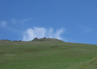
Having learned that lesson, I did stop for a peculiar alignment of cloud and hillside.
Heading back toward Tres Pinos, I spied not three pines, but three enormous buzzards on the road. One with wings spread wide, the other two picking at a freshly flattened ground squirrel. I slowed; they were surprisingly reluctant to move, and promptly circled back to their prize once I'd passed.
The longest ride I've done in a while: 46 miles, 3,440 feet of climbing. Sleep well tonight, I will.
February 21, 2016
Singletrack?!
There is a popular equation in cycling, and it goes like this: Let N represent the number of bicycles you own. What is the value for the number of bicycles you need?
When a friend in our bike club was parting with her mountain bike late last year, I took it for a test ride. The handling, with a front shock, was unfamiliar; so were the shifters. By the time I finished a small loop through the neighborhood, though, it felt like a perfect fit.
The solution for that equation, above? N + 1, of course.
I had been thinking about getting a mountain bike. One could explore more territory, in less time, than on a typical hike. Nice, wide fire roads abound. I had no desire to go bombing down steep trails, sliding over gnarly roots and rocks.
Where to begin?
A few days ago I announced my new steed to a friend who is a mountain biker par excellence. Would she consider teaching me the basics? She pulled out her calendar. Sunday? Game on. [I have the best friends.]
I was nervous. “Don't hurt me,” I pleaded. Herewith, her response for all to see:
Clearly I lived to tell this tale, so she delivered on points 1 and 2. On points 3 and 4, well, I was already thinking I needed a big caution triangle: “First time on a mountain bike, stand clear!” If anything, she insisted that I was more skilled than I thought I was.
Which brings us to point 5, and the time I had to stop because we were laughing so hard after I took the (evidently more difficult) inside line downhill on a switchback. “You're a natural!” she exclaimed. [No way. Not me.]
“This is probably steeper than anything you've been on today,” she explained, as we headed back toward the parking lot. “You'll be fine.” Only when we reached the bottom did she reveal that she'd wiped out on that very descent, cracking her helmet and whacking her head hard enough to be carried out by EMTs. On her first time down that hill.
There was a crash today, and it wasn't us, and it wasn't on the trails. As we approached the road, we hung back behind a woman with a stroller and several kids, and a girl on a horse. Don't spook a horse. We heard the unmistakable clatter of a bike skittering on the road, and my friend shot ahead to help. The horse spooked a cyclist, who hit a bump in the road and went down. Cars stopped, cyclists waved to slow traffic. He was shaken, but not broken; his companions congratulated him on falling well. “You'll have to ride home after all,” I joked. “Best way to flush all the adrenaline out of the system,” he smiled.
Quite the workout, it was, for a mere 7 miles ... with 1,040 feet of climbing. Perhaps that was a factor? Just maybe?
Thank you, Ms. T, for coaching me through my first mountain biking excursion!
When a friend in our bike club was parting with her mountain bike late last year, I took it for a test ride. The handling, with a front shock, was unfamiliar; so were the shifters. By the time I finished a small loop through the neighborhood, though, it felt like a perfect fit.
The solution for that equation, above? N + 1, of course.
I had been thinking about getting a mountain bike. One could explore more territory, in less time, than on a typical hike. Nice, wide fire roads abound. I had no desire to go bombing down steep trails, sliding over gnarly roots and rocks.
Where to begin?
A few days ago I announced my new steed to a friend who is a mountain biker par excellence. Would she consider teaching me the basics? She pulled out her calendar. Sunday? Game on. [I have the best friends.]
I was nervous. “Don't hurt me,” I pleaded. Herewith, her response for all to see:
@Arastradero, I promise not to:Remember that bit about fire roads? She led me straight up the Wild Rye Trail to coach me through my first switchback. [Fire roads are boring, I'm told.] I made it. Then I freaked out. What was I getting myself into?
- kill you
- lose you
- make you feel like toooo much of a newbie
- make fun of you for being a newbie (well, maybe)
- make you laugh and enjoy yourself; you'll want to schedule the next “session” :)
Clearly I lived to tell this tale, so she delivered on points 1 and 2. On points 3 and 4, well, I was already thinking I needed a big caution triangle: “First time on a mountain bike, stand clear!” If anything, she insisted that I was more skilled than I thought I was.
Which brings us to point 5, and the time I had to stop because we were laughing so hard after I took the (evidently more difficult) inside line downhill on a switchback. “You're a natural!” she exclaimed. [No way. Not me.]
“This is probably steeper than anything you've been on today,” she explained, as we headed back toward the parking lot. “You'll be fine.” Only when we reached the bottom did she reveal that she'd wiped out on that very descent, cracking her helmet and whacking her head hard enough to be carried out by EMTs. On her first time down that hill.
There was a crash today, and it wasn't us, and it wasn't on the trails. As we approached the road, we hung back behind a woman with a stroller and several kids, and a girl on a horse. Don't spook a horse. We heard the unmistakable clatter of a bike skittering on the road, and my friend shot ahead to help. The horse spooked a cyclist, who hit a bump in the road and went down. Cars stopped, cyclists waved to slow traffic. He was shaken, but not broken; his companions congratulated him on falling well. “You'll have to ride home after all,” I joked. “Best way to flush all the adrenaline out of the system,” he smiled.
Quite the workout, it was, for a mere 7 miles ... with 1,040 feet of climbing. Perhaps that was a factor? Just maybe?
Thank you, Ms. T, for coaching me through my first mountain biking excursion!
February 20, 2016
Nature's Way
I sense a letter theme developing: today I bring you the letter “V” (more or less). And a tree that grew, for years and years; a host for moss and other clinging plants of the damp forest. Until it shattered, falling away from the creek. There it will rest, slowly breaking down, long past the day when I might visit no more.
On a day like today, it can be hard to get the layers right. Jacket, or jacket-plus-arm warmers? I shed the latter, but as soon as we were moving I regretted that decision. Nothing a few more watts of exertion couldn't improve.
At the upper end of Alpine Road, our group gathered in the shade. I decamped to a sunny spot a few yards away, but they stayed put. [Go figure.]
Watching some mountain bikers emerge from the trail at the end of Alpine Road, a fellow rider started spinning tales of doom and danger. To which, at the moment, I was not particularly keen to listen. She mentioned being a nervous descender, afraid of crashing. “Don't focus on that,” I advised. “If you're thinking about crashing, you'll crash,” I offered as I accelerated down the hill. Really. Focus on where the pavement is wet. Focus on the slick grime near the roadside construction. Focus on taking a clean line at a safe speed around a blind corner. Focus on staying upright.
1,939 feet of climbing over 24 miles—enough to tire me out.
February 13, 2016
Seasons Change
Today's tale is brought to you by the letter “O”. (No, not really.)
The entrance to one of the local Christmas tree farms features a giant artificial wreath, year round. Most incongruously, daffodils were blooming beneath it today. In this break between storms, we're having some (lovely) unseasonable weather.
Yet, just about the time I was overheating and thinking about shedding my jacket, I rode into a downright chilly dip of air. Procrastination has it rewards.
A simple ride in familiar territory, with friends; nothing strenuous or eventful. Apart from the sad carcass of a doe in the middle of the road, that is. Looked like something of a mountain-lion feast, but I'll spare you the details.
A comfortable ride, 31 miles with 2,460 feet of climbing, before the welcome rains return.
February 9, 2016
Blue Sky Daze
Mother Nature smiled upon me and delivered a fresh foot of snow for my first day on the slopes.
But first, there was the matter of getting fitted with new boots. My old ones were, well ... old. Very old. With (at best) a handful of days per season, I don't wear them out. The master fitter at The Sport Loft joked that the new pair would need to last 20 years, as well.
There's nothing like that new-ski-boot feeling, crushing the bones in your foot and leaving you to wonder if you will, in fact, be able to pull the thing off.
No worries. The master knows his trade. K2's Spyre 110 was the boot for me. Low-volume edition.
New boots. New skis. First day on skis in four years.
What could possibly go wrong?
I gently glided downhill to the chairlift. [Whew.] Would I remember how to do this? [Yes.]
I've spent so much time with ski instructors that it seems they are always with me. If only my performance would measure up to their expert coaching! But no matter, I made it downhill. And by the end of the day, I had the confidence to tackle a black diamond trail. (It wasn't pretty, but I got down. Without tumbling.)
Alta is my favorite place to ski. [No snowboarders.] Rock 'n Roll. Challenger. Rollercoaster. Corkscrew. Staring down the steep and narrow Extrovert, my bravado faded fast. [Repeat after me: You're a better skier than you think you are.] Definitely outside my comfort zone, and that's important.
“What's the plan today,” I'd ask my friends in the morning. “Ride up. Ski down.” I haven't heard the familiar words in years. All is right with the world.
Uncharacteristically, we even spent a day skiing together (they're much more skilled than I). They led me on a grand tour of Deer Valley, from Jordanelle to Orion, and back—over and under bridges, past lodges and chalets, and ... wait for it ... no snowboarders!
Sunshine, stillness, snow-covered peaks. Yes, I do remember how, and why, to ski.
January 10, 2016
Poor Pitiful Pep
The bad thing about promising to meet up with a buddy for a ride is that the weather might be less than enticing, when the time comes.
The good thing about promising to meet up with a buddy for a ride is that you need to show up, anyway.
And so it was this morning, gloomy and gray at home. But not so in the east bay, where skies were clear and blue. For a while, anyway.
Winter rains have returned, at last, greening the landscape. In this break between storms, I was mindful of the road surface—pockets of wet lingered from yesterday's storm. This moss-wrapped tree was a sign.
So were the emergency vehicles, sirens wailing, that passed us on the climb up to the canyon. With no evidence of a car wreck, almost assuredly some cyclist had gone down—as had a veteran of our club, yesterday, on this very route.
The road surface was almost entirely dry today, with a few mini-landslides on the fringes. More roadkill than I've seen here before; skunks, mostly. With the low volume of traffic on this road, that's truly a puzzle.
We were headed for Sunol, but ominous clouds rolled in over the hills as we got closer. I had the legs for it, but not the toes. The wind picked up, and it was not a warm one.
We turned tail and hoped to avoid the rain that surely was falling on some not-too-distant hills. How fast that blew in!
28 miles with 2,550 feet of climbing tuckered me out. I'm in poor shape, a pitiful pudgy pep.
I took care not to get carried away on the descent. There is that stop sign, at the bottom, after all. Where's that clever electronic speed sign? [Ah, partially obscured by a bush, these days.]
36 mph. Oopsie.
January 1, 2016
Ham, or Turkey?
In 2015, I climbed more than 149,000 feet and pedaled more than 3,575 miles. Time to reset the cycle computer.
It's a Bay Area tradition to climb Mt. Hamilton on January 1st. One of my biking buddies invited me to join her, and ... well, it seemed like a good idea at the time.
It seemed like less of a good idea this morning, with the thermometer at my house reading 31F. In other words, -0.5C.
Why do this? Maybe she'll bail out. [Nope.]
Who am I to cancel, then? Some sort of cold-weather ultra-wimp?
The climb was comfortable enough; it's the descent you have to keep in mind. The road was wet, in places, just as I expected. My toes were numb, despite wool socks and booties. It was a challenge to brake with stiff fingers. I've come down from the top before, with teeth chattering.
Sensibly, we opted for half-a-Ham today, declaring victory at the entrance to Joseph D. Grant County Park. The sun was determined to hide in the clouds; the summit was just not enticing.
Let's get this New Year started: 17 miles, 2,030 feet of uphill.
Subscribe to:
Posts (Atom)


