June 17, 2015

Schöllenen Gorge

Given today's short ride, there was time for a bonus hike (and history lesson).

Auto, pedestrian, and train passages through a tunnel at the Schöllenen Gorge, Switzerland
To begin our loop, we walked through a tunnel with passages dedicated for autos, pedestrians, and trains, located along a key route through the Alps.

Train heading over the bridge toward the tunnel, Schöllenen Gorge, Switzerland
We followed the trail for a little more than a mile, down (and back up) steps, through tunnels, and ultimately over the old bridge itself. My legs reminded me that they'd climbed nearly 7,000 feet in the past two days.

Water cascading over rocks toward the Teufelsbrücke, Schöllenen Gorge, Switzerland
The Teufelsbrücke (Devil's Bridge) spans the Schöllenen Gorge. Several bridges preceded it, the first dating back to the 13th century. It's an impressive feat of engineering. The gorge is deep, the waters of the Reuss fast-moving. How did the first people decide it was feasible to build a bridge here, and then carry through?

River Ruess flowing through the Schöllenen Gorge, Switzerland
This site saw a battle in 1799, when the Russian general Suvorov fought against the French forces of Napoleon. A monument to the Russians who lost their lives is hewn into the adjacent cliff.

Monumental cross honoring slain Russian soldiers, Schöllenen Gorge, Switzerland
At the start of our hike, we had passed an apparent bunker in the rock wall. Fortunate are we, to come in peace.

Gotthardpass

Those who skipped yesterday's climb were itching to ride. Our leader suggested a short trip up the Gotthardpass.

Gotthardreuss snakes through the valley near Hospental, Switzerland
Why not? Besides, it wasn't raining.

This was not a pre-planned route. The rest of the group was out of sight when the slowest of us reached a fork in the road. Stay on the highway, or take the old road? Looking up at the “new” road, with a long uphill tunnel and fast-moving traffic, the old road was much more enticing. Having done some research last night about the Gotthardpass, I knew there were cobblestones. The classic approach (for bicycle racers) ascends the other side of the pass—cobbles all the way. For us, merely 3 km (a little under 2 miles). Take it from me: that's plenty of cobbles.

Gotthardreuss flows alongside the cobblestones of the Strasse Vecchia, descending from the Gotthardpass, Switzerland.
The theme for today? Waterfalls and wildflowers. Oh, and snow.

Bicycle parked next to a snowbank near the summit of the Gotthardpass, Switzerland
Facing a second day of wind and cold temperatures, I regretted not bringing a Buff on this trip. [Something easily remedied later this afternoon at a shop in Andermatt.]

Lago della Piazza near the summit of the Gotthardpass, Switzerland
I was grateful to warm up with a cup of hot tea and a pastry at the top, and looked forward to a fast and smooth descent on the “new” road.

But alas, it was not to be. We followed our leader, and ... he turned onto the cobbles of the old road. Cobblestones call for staying loose on the bike. I had a bit of an over-training headache from yesterday's exertion, and ... every ... little ... jostle ... hurt.

Valley view on the return from the Gotthardpass, Switzerland
At 6,909 feet, the Gotthardpass tops out higher than the Oberalppass.

pep and bicycle at the summit of the Gotthardpass, Switzerland.
Today's divertissement (16 miles, 2,240 feet of climbing) left time for some sightseeing and shopping back in town. No regrets.

June 16, 2015

Oberalppass

Rain. Again.

I came here to ride my bicycle, not to tour the country by car. If I don't ride today, in the rain, I will miss the opportunity to climb an alpine pass. I did, after all, bring rain gear.

Looking back toward Versam along the rain-slicked road, Switzerland
I suited up. The radar map was less discouraging; today, the rain would not be constant.

Oberalpstrasse snakes through the valley above the railroad tracks, with dramatic clouds sweeping up from a distant peak, Switzerland
The Tour de Suisse is underway, and although our routes will not align with the race, the team cars were advancing to reach Flims, for the noontime start of Stage 4. On a rural road,we rounded a bend and along came a bright green car of the chief sponsor (Vaudoise) adorned with a giant cyclist on the roof in the yellow jersey kit of a race leader. The driver was enthusiastic, honking and waving at us. Later, the team cars for Cannondale-Garmin and Lampre-Merida would appear—always around a bend, faster than I could snap a photo.

This style of stacking logs was common here, but new to me. In a word: ingenious.

Ingenious V-shaped arrangement of stacked logs, Switzerland.
I encouraged the rest of the group to go ahead. I was quite the sight in my rain gear: black shoe covers, rain pants and jacket streaked with road grime; a clear shower cap covering the vents in my helmet. To keep my hands warm, I recalled this helpful hint: wear thin latex gloves layered under regular long-fingered gloves. Your hands get wet as they sweat inside that latex, but they're warm.

Aranka and pep in her rain gear outside a café in Trun, Switzerland.

Pink, purple, and white wildflowers along the rocky roadside, on the way to the Oberalppass, Switzerland.
Our co-leaders were staying dry today; I met up with them at a café, where I indulged in my favored local treat for this trip: a nut tart (my second of the day).

The long climb came late on the route. A sign confirmed that the pass was open; I paused to let a passel of Porsches have their fun. As expected, the rain let up for a spell. Wildflowers alongside the road cheered me, and ... I just kept turning the pedals.

Flowers line the slick roads, approaching a snow-streaked peak on the way to the Oberalppass.
Higher and higher I climbed, till I was higher than patches of snow. At 6,722 feet,
the pass is high enough to be included on a list of the highest paved roads in Europe (though, not the highest of the passes I've cycled). At the summit of the Oberalppass, it was not liquid water that was falling from the sky—it was sleet.

pep with bicycle at the summit of the Oberalppass, altitude 2046 meters, Switzerland
I knew there would be tunnels. This tunnel near the summit has two passageways, one for the railroad and one for autos. I was fortunate to have the tunnel to myself.

Water, snow, and twin tunnels near the top of the Oberalppass, Switzerland
And then, I was in the cloud. A real, big, mountaintop cloud. How effective was my blinking red taillight? Visibility was a few feet, nothing more. I slowed my pace to be sure I stayed on the road, hoping for the best as I negotiated the switchbacks down the other side of the mountain.

Where was I? How much farther did I need to go? On a clear day, I would have seen the town and the valley below. Today, I could only hope that I was still heading in the right direction.

Eventually I dropped low enough on the mountain to see the valley, and a town. Surely, that must be Andermatt? (It was.)

Buildings line a channel flowing with rushing waters, Andermatt, Switzerland
The view from my hotel room could not have been more charming.

View from my hotel room, through lace curtains, Andermatt, Switzerland
A day to stand tall: only three of us did the climb—the rest bailed out and boarded a train. For me, 47 miles with 4,700 feet of climbing.

June 15, 2015

Versam

If I can see my reflection on the road, I'd rather stay home. But today we needed to move on to the next town, some 50 miles away.

I looked at the weather radar map.

Rain, lots of it. Rain, along the entire route. Rain, all day.

Two riders wimped out. I was one of them. Bikes were loaded into the trailer, riders were loaded into the car. We shadowed the rest of the group as as they progressed along the route. They were cold. They were wet. But they were determined.

Everyone made it safely to our destination; again, a few opted for a boost by train.

We stopped for a good view of a pair of bridges (one old, one new) spanning a deep and narrow gorge.

Farther along, we paused to admire the Ruinaulta, impressive even on a rainy day.

Our destination was the town of Versam, which seemed (to me) like the very town you might picture when you picture Switzerland.

The local church, along with its beautifully carved and painted organ, dates back to the 18th century.

Our hotel was perched on a cliff at the edge of town. Irregular additions to the building over the years made room numbers impractical. The innkeeper led the way, showing me where to turn at each staircase and level. On my door, and on the key ring, were wooden panels with handpainted images of a horse. Across the hall was the “stork” room (and so forth).

Dinner featured a traditional local dish, a kind of dumpling called capuns.

I'm not convinced there's a better way to visit a country than on the seat of a bicycle. Though, perhaps not on a rainy day.

June 14, 2015

Rinerhorn

After yesterday's challenging ride, today was a planned rest day. The local area is keen to promote tourism during the off season (this being ski territory), and so we received passes good for some local bus routes and attractions.

Hiking path along the Rinerhorn toward Sertig, near Davos, Switzerland
Our hosts had something special in mind: reputedly one of the top ten hikes in Switzerland.

Yellow wildflowers with distant snow-capped peaks, viewed from the Rinerhorn near Davos, Switzerland
Gondolas whisked us to the top of the Rinerhorn, where a wonderland of wildflowers awaited.

Four varieties of alpine wildflowers along the Rinerhorn, near Davos, Switzerland
Being rather a fan of wildflowers (and I mean that in the true sense of the word: fanatic), I was enthralled. The meadows were carpeted with flowers, with more variety than I had ever seen. This spawned a friendly guessing game at dinner: “How many pictures of flowers did pep take today?”

Hiking down into the Sertig valley from the Rinerhorn, near Sertig Dörfli, Switzerland
My GPS spontaneously shut down early on the hike, so I have only a partial track to share.

View of the Sertigbach and the Sertig Valley from the ridge above Sertig Dörfli, Switzerland
The view of the Sertig valley was breathtaking. We hiked along the ridge before dropping down to cross the Sertigbach and enjoy lunch on the deck at the Restaurant zum Bergfuhrer in Sertig Dörfli.

Wooden footbridge over the fast-moving waters of the Sertigbach, Sertig Dörfli, Switzerland
Oh, the flowers! The snow-capped peaks! The chalets! The Swiss countryside is like something out of a fairy tale.

Wildflower meadow with snow-dusted peaks in the distance, Sertig Dörfli, Switzerland

I was fascinated by these rigs, sharpened branches criss-crossed just so. I noticed they were frequently hung over windows, and wondered if they were a form of shutter. One of my hosts, expert on local history and traditions, enlightened me. They're racks, used to elevate hay bales in the fields to dry them.

Passing the other car on the Schatzalp funicular above Davos, SwitzerlandThe transportation network here is phenomenal. We boarded a bus that returned us to Davos, where some of our group hoped to view an exhibit at the art museum. We wandered through town; there was no museum in sight. This being a Sunday, virtually everything was closed. I pulled out my smartphone, and (you guessed it) found the museum on a parallel street.

It was closed. A pastry shop was open, though. Our group had winnowed down to three, and I persuaded them to put our passes to good use on the Schatzalp-bahn funicular.

Broad-leaved marsh orchid, Schatzalp, Davos, Switzerland
The skies were dark and the raindrops started falling. My companions had little enthusiasm for lingering at the top. “Just a little farther,” I coaxed, admiring the flowers. Our host explained that this one, in particular, was special: an alpine orchid, the broad-leaved marsh orchid. We had seen a few on the Rinerhorn, and here was a meadow dotted with them.

Not all of my flower photos were keepers, of course; some were blurry, some were repeats. How many unique specimens did I capture? Half of all I shot? One-third? The unexpurgated total (close-up photos, not sweeping vistas): sixty-three.

June 13, 2015

Davos Wolfgang

“Share the road” takes on a different tone here. We figured it was best to yield to farm equipment,

Cyclist yields to farm equipment along a gravel path, Liechtenstein.
though we passed a carriage drawn by four horses (with care).

Cyclists passing a horse-drawn carriage, Liechtenstein.
With a long day ahead, I could have used an earlier start. We would leave Austria, biking some 53 miles from Feldkirch, Austria to Davos, Switzerland. Our hotel awaited at the top of a climb at Davos Wolfgang.

How much of a climb? Mapping websites tend to be generous when estimating elevation gain, but two of them suggested 5,500 feet. (You get the picture: not flat.)

Paved path along the Rhine River, Liechtenstein.
Except that the route was mostly flat for the first 19 miles, and I was counting on making good time there to compensate for my pathetic uphill pace. But the best laid plans ...

Alte Rheinbrücke, wooden bridge spanning the Rhine at Vaduz, Liechtenstein.
Our slow group left a bit later than the rest (not an auspicious start). Our co-host was leading us today on her electric bike, but she was not planning to ride the entire distance. This made for an uncomfortable mismatch in goals. Instead of zipping along the flats, the group was riding at the leisurely conversational pace of 10 mph. Another rider and I took turns at the front in an effort to pick up the pace, but we were repeatedly thwarted by the electric bike, which kept throwing off its chain.

Lietchtenstein/Swiss border inside the Alte Rheinbrücke, Vaduz, Liechetenstein
Our route essentially traversed the length of Liechtenstein, from north to south. We crossed the border twice: first on the Alte Rheinbrücke, which spans the Rhein at Vaduz. We had a rest break at a gas station near a winery set on a hillside, with a building that looked like a castle.

Balzner Winery, Balzers, Liechtenstein
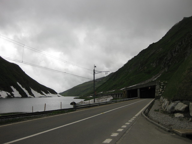
Around mile 19, as expected, the road kicked up for two miles at an average grade of more than 7%. When I saw Sagan painted on the pavement, it confirmed what my legs were telling me: some sections were steeper.

We passed through the region of Maienfeld—Heidi country. Having just re-read the story, I couldn't help but picture her running through the rolling fields of wildflowers, surrounded by goats. Instead of flying down the other side of the hill, I shadowed our leader into a local park to refill my water bottles at the “Heidi Fountain.”

Heidi Fountain, near Maienfeld, Switzerland
At 1:30 p.m., we were a little more than halfway to Davos. It had taken us 5.5 hours to travel the first 32 miles (with 1,860 feet of climbing), including two hours' worth of stopping.

Golden field surrounded by green fields, mountains in the background, Switzerland.
Time for a reality check: I looked at the route profile. I did the math. The rest of the route would be uphill for close to 24 miles, climbing 3500 feet or more—supposedly with some steep sections. Even if I averaged 6 mph, I would need 4 hours. More likely, my average pace would be slower.

I would have to abandon the first real climb of our tour.

Rather than taking the train, our host fit three of us into the car (with our bikes in the trailer) for the trip to the top; the others would continue by bike. With much sadness, I watched the scenery pass by the car windows.

When they finally arrived, we learned that the guys had a bit of an adventure. They did their best to follow the route, but lacking a GPS and an appreciation for the difference between the icons for mountain bike and road bike routes, they ended up on a steep dirt path—and ultimately watched the scenery pass by the windows of a train car.

June 12, 2015

Feldkirch

Time to move along, into Austria—my first visit.

Sonnenkönigin ship, Bregenz, Austria
We got a close look at the unusual Sonnenkönigin at the harbor in Bregenz, where we waited for the arrival of our co-host (who chose to shave off some distance by taking a boat from Lindau). She's an expert navigator, with a spiral-bound book of cycling routes, but nonetheless led us a wee bit off course. When I pulled out my phone and pointed to the clear blue dot on the map, I won another convert. “You have to show me how to do that on my phone!”

Colorful bike advertising www.fahrradwettbewerb.at, near Bregenz, Austria
Colorful bikes were planted at each end of a bridge, encouraging cyclists to sign up for some friendly competition, racking up the miles this summer.

View of the distant Alps from a bridge over the river Rhein, Austria
For the most part, our route followed the Rhein, crossing it a couple of times.

Bike racks featuring cigarette ads at a café near Lustenau, Austria
We happened upon a café along the Alter Rhein on the outskirts of Lustenau that really welcomes cyclists. There were few parking spots for cars, but enough racks to accommodate a cycling event. The racks sponsored by a brand of cigarettes were ironic. There was also a standalone building with restrooms, much as you'd find in any of our public parks, with one notable difference: lace curtains on the windows.

I ordered “ein apfelstrudel und ein nusskipfel,” apparently convincingly enough that the server responded in German. (Uh oh.). I kind of got the gist, that it would be a few minutes for my buddy's strudel (probably because they'd warm it).

Biking through the forest, getting closer to the Alps, near Feldkirch, Austria
We made our way south, toward the Alps, reaching our destination early enough to allow for some exploration before dinner.

Katzenturm, Feldkirch, Austria
Feldkirch is a busy city, a curious mix of old and new. Medieval buildings, modern roads with undercrossings for pedestrians and cyclists. A friendly passerby tried to chat with me; we had no language in common, but I understood enough to get that English is taught in school these days, but wasn't during his time.

Schattenburg castle, Feldkirch, Austria
With the opportunity to order tonight's dinner from a menu, I chose a traditional veal schnitzel, with white asparagus and potatoes. For dessert, a luscious Austrian specialty (with a name that rankles modern sensibilities), Mohr im Hemd.

A flat and easy stage today, 33 miles with a mere 520 feet of climbing. Definitely not a calorie-neutral sort of day ...