April 13, 2014

The Morning Wacko

View to the east from Ridge Winery: Montebello Road, hazy valley, and distant hills.
How many random factors came together to stop me at a particular intersection at a particular moment in time? [More than I can count.] The vagaries of getting up, getting dressed, assembling lunch and my gear, setting up the bike, pedaling on my way. Pausing for cross traffic, and another stoplight. Flying downhill, slowing to check for traffic merging from the freeway, and then rolling to a stop at a red light at a particular intersection at a particular moment in time.

I glanced to my left. The walk signal was flashing; this would be a long light. An old man in a light blue jacket, tall and robust, was crossing the street, staring at me. He veered out of the crosswalk to confront me, gruffly asking if I paid $3,000—or $4,000—for my bike.

There is no satisfactory answer to his question. He knows it's not a cheap bicycle. “Maybe,” I said; “it's old, I've had it a long time.”

It was 9:00 a.m. on Sunday morning and there was no one else in sight.

Nothing prepared me for the ugly question that next spewed from his mouth. A question with centuries-deep roots in ignorance and hatred.

“Are you a member of the Jewish clan?”

My blood froze. A storm of profanities raged in my brain. More furious than frightened, I summoned a reply. “No, I am not,” I said curtly. He continued on his way, rambling about the bike he got from Goodwill and suggesting that I should go spend more of my money on a new one.

How many random factors came together to stop me at that particular intersection at that particular moment in time? Thirty seconds, either way, would have spared me this encounter with the scum of the earth and this reminder that bigotry is alive right here in my own town, in the liberal Bay Area, in the twenty-first century.

Poppy-covered hillside with old grape vines and trees at Ridge Winery.
Following this rude wake-up call, it is not hard to imagine that the rest of my day was considerably more pleasant. I biked to the start of our club ride, meeting up with friends old and new, with diverse national heritages and beliefs, from all walks of life. The morning gloom burned off sooner than my thoughts about the morning's sickening start.

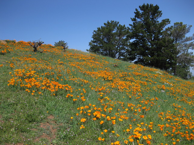
Our ride leader insisted that we were welcome to picnic at Ridge Winery. After climbing to the top of Montebello we headed a mile or so back down and turned into their driveway. It was an unexpectedly lovely spot, but it is reserved for customers only. [That, I expected.]

A day of stark contrasts: 39 miles and 3,500 feet of climbing with scenic views, and one chance encounter with abhorrent views.

April 12, 2014

Cephalopoda

I never tire of visiting the Monterey Bay Aquarium. A new exhibit (Tentacles) has just opened. With some help from MBARI, they can share some uncommon finds. If you stop by soon, you might see some deep sea visitors—a pair of Flapjack Octopuses.

I never tire of looking out onto Monterey Bay, either. To our delight, a mother otter and her pup floated past the building, not far offshore.

Cephalopoda include cuttlesfishes as well as squid and octopuses. I didn't realize they were mollusks, minus the shell.

Cuttlefish
Nor did I realize that the chambered nautilus is a Cephalopod.

Chambered nautilus
We don't often see much of an octopus; the creature will habitually draw tightly into a corner, maybe exposing a few suction cups on the glass. The resident Giant Pacific Octopuses, not to be outdone by the splashy new exhibit on the opposite side of the building, decided to put on a show. I have seen them unfurl and slide along the glass before, but tonight—they swam!

Giant Pacific Octopus
Every tank is worth a closer look. This fish was annoyed at being found, despite some impressive camouflage.

Fish hiding in pink coral
Well worth the trip, again and again.

April 6, 2014

Poppy Rocks

California poppies blooming on a rocky hillside
Ride 100 km on a warm spring day? It's a job. Someone's got to do it.

Next week is one of our club's main events, when approximately 1800 cyclists will visit to ride on some of our favorite roads. Supporting all those folks would not be possible without the volunteer labor of hundreds of club members (before, during, and after the event). Some volunteers can ride that day, but most of us will be busy at our stations.

Volunteers, instead, are invited to ride the course a week in advance, and today was that day. A couple of rest stops are set up for us with water and snacks, finishing with a barbecue lunch. [We miss out on the famous nut breads and wraps. Of course, we could make those anytime.]

Field carpeted with wild mustard at the foot of green hills
Back to the job: We're looking for potential problems to fix before next Saturday. For my part, I called attention to a potentially troublesome pothole and a spot where some arrows on the pavement might help.

The biggest problem of the day had four legs and a collar. I saw the loose dog. He was intently watching something on the other side of a fence.

Then he saw me.

How fast can a dog run? [Pretty darned fast.] How fast can I sprint? [Not that fast.] In a matter of seconds, I accelerated from 11 to 21 mph and my heart rate spiked from 145 to 175 bpm. The snarling, barking menace was keeping pace, inches away. I had visions of his fangs shredding my left calf.

That stretch of road was level, with a slight downhill advantage yards ahead. Primarily, I got lucky—I could not out-sprint the little monster.

Uvas Reservoir, nearly run dry
Recent rains have turned the hills green and coaxed out the wildflowers, but not relieved the drought. There was precious little water to see on our “reservoir loop;” by summer's end, there may be none.

For the day, 66 miles with just a little climbing (2,420 feet). I hope our guests will enjoy a day as picture-perfect as today.

March 30, 2014

Picturing Panoche

“Don't Frack San Benito,” the sign read. I couldn't agree more.

Roses and grapevines, with a sunlit hill in the background, Paicines.
Our well-timed ride was slotted between a pair of storms, giving us dramatic lighting and clean air.

Cloud bank in the distance, Panoche Road.
The Aermotor was spinning fast at the Summit Ranch. With a dual assist from gravity and the wind, I plummeted down the backside toward the Inn.

Aeromotor, Summit Ranch, Panoche Road.
Another rider thought the road had more patches. “How could you tell?” I asked. It's best to ride that stretch with a light grip on the handlebars—or wind up with an aching head and some loose fillings.

Look at that view! Look at it again. Picture it paved with solar panels, because that is the future for this land—some 4,000 acres of solar panels and power lines.

Open fields, distant hills near the Panoche Inn.
More than 20 miles out on Panoche Road, an approaching car slowed to a stop. A wayward European visitor was looking for the National Park (Pinnacles). I set him straight.

Field with yellow flowers near low cliff, Panoche Road.
The wind is a constant. You can count on a headwind for the return; on unlucky days, there can be a headwind in both directions. Which means more time to admire the scenery.

Distant hills under gray clouds, Panoche Road.
A mere 2,750 feet of climbing, with 54 miles of scenery.

Enjoy it now.

March 22, 2014

Springtime for Hollister

When the Bay Area forecast reads “Partly Cloudy,” the morning will be gray and gloomy.

Low clouds mix with the hills along Lone Tree Road.
That's the cloudy part. The rest of the day will be glorious.

Blue sky is breaking through along Lone Tree Road.
After a poor night's sleep, I was semi-conscious when the alarm went off. I desperately wanted more sleep. If I bailed now, would my ride partner see the email? The ride start was not local. Drive an hour, bike 50 hilly miles, drive an hour back. I needed more sleep.

It is a perfect day for this route. It will still be (somewhat) green. Soon it will be too hot to bike down there.

View from the top, end of the public portion of Lone Tree Road.
I pulled myself together. I could further shorten the route, maybe just tackle the first (and longest) hill.

Quien Sabe Road winding through an open valley.
But the second hill is one of my favorites.

Cliff at the end of the public portion of Quien Sabe Road.
With so many back roads to explore, I saw no merit in returning on busy Highway 25. Having pored over the map, I had a better idea.

Lone tree on the russet-colored hills along Santa Ana Valley Road.
Instead of being buzzed by speeding SUVs and pickup trucks, I had John Smith Road to myself. (Two vehicles passed me, heading in opposite directions.) The birds told me how little traffic uses this road. I startled a hawk into seeking a higher perch; moments later, it comfortably swooped to my left along the road before veering over the rolling hills. To the right a small flock of birds escorted me, rising and falling to match my slow pace.

I turned into a residential neighborhood. “Not a Through Street,” warned a sign. It had looked so enticing on the map.

Strategically-placed barricades blocked vehicles from passing through ... but not bicycles!

For the day, 54 miles with some 4,830 feet of climbing. I'll sleep in tomorrow.

March 21, 2014

Side by Side

Two folded Stridas, one white, one black.
Tucked into the belly of the bus, a study in black and white.

This morning I needed to catch the first shuttle to arrive at the office in time for my earliest meeting. This is not my routine, and I hardly expected to find another bike already loaded when I lifted the door to the first compartment (before sunrise).

I definitely did not expect to see another Strida. Now I understand why I have only seen the black bike when I catch an early shuttle home.

These folding bikes are ideal for our short (flat) little trips to and from the shuttle stop. For me, the distance is a little more than a mile (studded with five traffic signals). Driving that distance would be, in a word, ridiculous. It would also take as much time, if not more. Having the bike for quick trips on campus is mighty convenient, too.

With enough daylight remaining, I opt for a longer route home. Each trip seems insignificant, but the miles add up: about 43 miles this month, alone.

Best time? Door-to-door, with no red lights: 6 minutes, 33 seconds.

March 19, 2014

Make It a Double

Vasona Park Bridge, near dusk.
Today was the day.

Daylight Savings Time took effect a couple of weeks ago, but my first attempt to enjoy a round-trip commute had been thwarted by a late meeting.

I am not a big fan of DST; waking up in the dark is a struggle. I wish we could just leave the clocks alone. But now that we have sprung forward, there is ample daylight for my long ride home. My headlight and its battery pack have been stowed away for the season, and I treated the oft-neglected commute bike to a thorough cleaning and fresh lube over the weekend.

In celebration, I climbed a familiar gratuitous hill this evening and spotted a doe trotting down the middle of the street, heading for the open area at the end.

This morning, my ears were cold and my legs were leaden; even though I rode home at a slower pace, I felt stronger. For the day, the usual 39 miles and 980 feet of climbing.

Just the way I like it.

March 15, 2014

Diablo Seco

Notices were posted: no water available until you reach the summit. Was there a contamination problem? A broken pipe?

Chalk it up to the drought. We learned that most of the water on Mt. Diablo is supplied by local springs, and they're dry.

“Thank you for stopping.” Despite his transaction with a car at the South Gate, the Ranger noticed and addressed me. As I pedaled forward, I was summarily passed by three cyclists who did not trouble themselves to stop. At the stop sign. Really, guys? It's not hard.

Charred trees and bare hillside near the top of Mt. Diablo
I had been looking forward to climbing Mt. Diablo one weekend last fall ... and then, it burned. A target shooter's stray bullet hit a rock on a hot day in a dry year. Six days, $4.5 million, and 3,100 charred acres later, the fire was contained. The enormous plume of smoke taught me that I could see Mt. Diablo across the bay, 28 miles away (in a straight line).

Six months later, we were riding through the burn zone. There were bare blackened trees next to the stone walls at the summit—the buildings had nearly been lost.

Thinking of the tower at the top of the mountain, this morning I donned a bike jersey featuring the tower on a far-away summit: Mont Ventoux. Not only was this a good conversation starter, it earned me some respect: not one patronizing comment about being “almost there” as I slowly made my way to the top.

My bicycle at Mt. Diablo State Park North Gate entrance sign
I felt so good at the summit, I decided to descend the mountain to the North Gate and climb back up to the junction before returning through the South Gate. The rest of the group had made a longer loop, to Morgan Territory; I didn't have the stamina for that distance.

The north side was more exposed. The day was warm, and the sun higher in the sky. Long before I reached the gate, I began to wonder ... what had I been thinking? What might have been, simply, a lovely day would now be a suffer-fest. I should have topped off my water bottles at the summit.

I peeled off my knee warmers, slathered on another layer of sunscreen, and started climbing. Forty-four miles, some 5,600 feet of climbing. It was worth it.

Field of California poppies overlooking distant hills

March 8, 2014

How Green is the Valley?

Cattle grazing in the bright green foothills.
You might think that there could be nothing new for me to discover on Mt. Hamilton (and you would be wrong). I have bicycled to the top more than two dozen times, and in all seasons. As the group prepared to depart, one rider remarked that he had no intention of including Kincaid today. He might do that once a year; he just didn't see the point. [Oh, what he's missing!]

New leaves emerging on gnarled trees along Mt. Hamilton Road.
I would not include Kincaid today, either; I am in no shape for that. I crawled my way to the top, where I was most grateful to put my feet up on the Reverend's patio and savor my luscious peanut butter-and-jelly sandwich.

View of San Francisco Bay in the distance.
On the climb, it is natural to focus on the road ahead and neglect the view behind. White clouds smudged the sky. Old trees were popping out the first leaves of another spring. San Francisco Bay glistened in the distance. From the summit, the snowy peaks of the Sierras were evident.

Ironwork detail, Lick Observatory.
The buildings have seen a new coat of paint in the past year or so, and from my vantage point the detail on an external stairway caught my eye. How had I never noticed the curled ironwork, the stars in the railing?

The uphill interludes on the descent afford more leisurely sightseeing. A raucous pair of Steller's Jays caught my attention, and as I slowed to listen I noticed a proud wild turkey strutting his stuff. It's mating season! I was a few feet away from his flock of hens; some were foraging, others were taking dirt baths and possibly nesting. The dominant sound in the video clip is that of the noisy Jays. Listen for the turkeys; they made a sound like the resonant plink of a large drip of water hitting a pool.


Always something new to see, and to learn, on Mt. Hamilton.

March 7, 2014

Winter Break

Off to the Sierras with my colleagues for a two-day refresher course, Winter Fun 101.

Towering trees in the Sierras, near Fish Camp
After a whirlwind of spa mini-treatments, I set off on a short hike before dinner. Engineers had scattered, eager to check in (and log in). Equipped with a rudimentary paper map, I trudged down an old logging road and found the trail. Some landmarks were clear; others, not so much. When the U-shaped route returned to the road, I opted to retrace my path through the forest instead. The moon was high overhead, but there was enough daylight remaining.

Badger Pass Ranger Station
With none of the white stuff at the lodge (elevation: 5300 feet), Friday's snowshoe hike was relocated to Yosemite. There was snow, albeit slushy, at the 7200-foot elevation of Badger Pass, one of California's earliest recreational ski areas.

Primitive snowshoe show-and-tell with Ranger Christine
Ranger Christine was our enthusiastic guide. Crunching uphill at altitude wasn't challenging enough for a couple of guys in our group: they took off at a run, racing each other to the top of the steepest hill we climbed.

The reward? A view across Yosemite to the snow-dusted highlights of the Clark Range.

My feet strapped into snowshoes.
The ranger invited me to join her in running down the hill, but with clumps of ice caked on my crampons, that would have ended badly.

Winter. Fun. Exercise. Education.

And then, back to work.

March 1, 2014

Beautiful Noise

A slippery rainy day is not the sort of day to trot out the exotic automotive plumage.

But this was not an ordinary rainy day. It was a rainy day during a Bay Area visit by the legendary Valentino Balboni.

Valentino Balboni, eight Lamborghinis, and drivers
Signore Balboni led the train up the rain-slicked roads, down to the coast and into the city. Navigating through San Francisco, with its hills, potholes, and close-packed traffic, was less nerve-wracking than I had feared.

Early in the drive, a muddy hillside released a soccer-ball-sized rock that oh-so-luckily came to rest at the edge of the road. It was still settling into place as I passed. Most drivers skillfully dodged the debris that the latest storm had thrown our way. One vehicle flatted a rear tire, providing a useful demonstration for a few of us on how not to use a tire repair kit.

On the road, the train was interrupted by the occasional minivan or compact. Most had the courtesy to pull aside, with the notable exception of a seemingly clueless motorhome from Arizona. Leaving our lunch stop, I yielded (not without a sigh) to a Tesla sedan. To his credit, he moved to the shoulder when he had the chance.

“Your car is beautiful.” High praise indeed, in this rarefied atmosphere of Diablos and Murcielagos, Gallardos and Aventadors. There were a couple of fast red cars in our midst, too.

One by one, we filed into the garage at our endpoint. And that, ladies and gentlemen, was a sound to behold.

Packing a garage with Lambos

February 22, 2014

Achy Brakey Bike Ride

View of Los Gatos Creek from the bridge at Wrights Station
I warned the group that I would be even slower than usual, since I had been off the bike for four weeks. As it happens, I miscounted: it had been five weeks.

First, a seasonal cold virus took me down (for two weeks). Next, I staffed registration and the finish line for the annual Mega-Monster Enduro; the following day, it rained. Then I made a quick trip to the other coast for a family celebration over the long holiday weekend. After packing eight bicycle commutes into the first half of January, wet weather and fog dissuaded me in February.

Which brings me to today, warm and dry and sunny: a taste of spring before the month ends. My cranky legs complained within the first fifty yards, and I wondered if I would cut the ride short. Maybe skip the last, most challenging hill?

Of course, that didn't happen. I plodded along, last to roll up at every regroup (except the finish, despite being a bit more conservative with the brakes than usual). Technically, those five weeks did include some time on a bike (33 flat miles or so)—mostly trips to and from the shuttle bus. Three to five miles a day? Rounding error, essentially.

We racked up some 2,820 feet of climbing along our 24-mile route. The end of Aldercroft Heights Road is about a mile from the base of Wrights Station Road, but the connecting dirt road is strictly off-limits (razor wire courtesy of the San Jose Water Company). With so much of the rest of the watershed fully accessible, one can only wonder what makes that one mile so special. We peered down at Los Gatos Creek from the bridge at Wrights Station; one rider remarked “That little thing fills the Lexington Reservoir?” Yes; but this year, not so much.

The forecasters tell us more rain is on the way, and that is a very good thing. Though for biking, not so much.

February 19, 2014

Land of Ice and Snow

Newark Airport runway 4 bracketed by snow-covered ground.
Between storms, I managed to slip in a quick visit to the east coast for a family celebration.

The gold medal goes to Virgin America, a class act from start (clever safety video) to finish (AC power and USB charging outlets at every seat), including a pre-flight plug for the upcoming Best Buddies Hearst Castle Challenge on every seat-back entertainment system. Not to mention the email they sent a few days before the trip, warning of possible weather problems and offering the opportunity to re-book without penalty. Get out in front of the problem, before it snowballs (so to speak)—unlike the travel nightmare mismanaged by Continental a few years back.

In contrast, NJ Transit was not only off the podium—they barely managed to finish in last place. My experience pales in comparison to the recent Super Bowl debacle, but I am gratified to learn that the executive director resigned this week.

I have taken trains in Italy and France without difficulty, despite my fluency in one language (English). I have taken the train in Alaska, where it snows (a lot). On the day after yet-another-snowstorm in a modern civilized nation, the train seemed like an ideal way to transport myself from Newark Airport to the Jersey Shore.

A trip that should have taken a little over two hours stretched well over four.

The train for the first leg of my journey was canceled, a fact not reflected on the large color flat-panel display. 5:55 P.M., the schedule read. Luckily I caught the audio announcement. Now, what?

I pulled up the njtransit.com trip planner on my smartphone, which sent me to a different platform to head for Newark Penn Station. Many trains were running late; we arrived at 6:09 P.M. I dashed down and up the stairs to the next platform for my connecting train. It had departed on time, at 6:08 P.M. Now, what?

Catch the 6:40 P.M. train from yet-another-platform? Or catch an earlier connecting train at 6:18 P.M., from this very platform? The overhead schedule listed that as Train 3273, and the number glowed on the engine as it pulled up. I boarded; the LED banner in my car displayed Train 3510. [Have I entered the Twilight Zone?] Another passenger confirmed that the train would indeed stop in Long Branch, where I would wait for that 6:40 P.M train to catch up.

Except that the 6:40 P.M. train developed a mechanical problem and was canceled. We would have to wait for the next train, scheduled to arrive an hour later. Which turned into an hour and a half, due to some other delay.

De-icing the wing of our Virgin America AIrbus.
There is a word that succinctly captures this public sector fiasco. [I'll leave that to your imagination.]

The party was wonderful, and the next snowstorm failed to thwart my escape back to the west coast.

I took advantage of a single sunny day to re-visit a post-Sandy reconstruction site. The pilings are in, the cranes are gone, and the massive building has been shifted to its new perch at the water's edge: modern engineering finesse in the private sector.

Bay Head Yacht Club building atop new pilings.

January 18, 2014

Turkeys

Cyclists on Cienega Road
Passing the Upper Ranch entrance to the Hollister Hills State Vehicular Recreation Area, I noticed a driver standing beside one of three (large) pickup trucks.

“Stay on the right side of the road!” he shouted.

Interesting, what drama did I miss?

“Don't ride in the center of the road! You almost caused an accident back there!”

Oh, he is addressing ME.

“I wasn't riding in the center of the road,” I called back. (Nor did I ride on the wrong side of the road.) With that much adrenaline flowing, I was glad he was taking it off-road.

What prompted his angry tirade?

Heading uphill on a shoulder-less stretch of rural Cienega Road, I passed a cyclist standing next to his bike. Before doing so, I checked my rear-view mirror for approaching traffic. I saw the white pickup truck. There was ample distance for me to pass the cyclist before the truck would overtake us, and there was another vehicle approaching in the opposite lane, in plain sight.

The pickup driver chose to pass me as I was passing the cyclist. The oncoming driver tooted his horn.

Mr. White Pickup: I didn't almost cause an accident—YOU almost caused an accident, by passing unsafely. This maneuver saved you, what, five seconds?

What might I have done differently? I should have signaled with my left arm, instead of assuming that the driver would reasonably expect me to pass the stationary cyclist in my path. (Honestly, I doubt this would have made a difference. Nonetheless.) I suspect he was so focused on the cyclists (target fixation) that he failed to look at the opposite lane.

Something crashed through the underbrush near the road. I slowed and scanned the woods. Sure enough, a deer. The first time I biked this road, a deer sprang across the pavement in front of me. This one darted back through the trees.

Dry hills along CA 25, Airline Highway
Our destination was the Pinnacles, now a National Park (though the sign still reads National Monument). The pool at the visitor center looked so inviting (in January?), but it was closed; the high temperature for the day was 79F (in January!). I was pleased to average 12 mph on our 66-mile route, with its modest amount of climbing (2,895 feet) on a rare day with no headwind.

Saw some wild turkeys on Cienega, too.

January 11, 2014

Rattlin' Roads

We got our share of gloomy clouds, but no rain. We need rain.

Low water pulling back from an arm of Lexington Reservoir
The Lexington Reservoir has fallen to 31% of its capacity. A great egret and great blue heron joined a crowd of ducks foraging in the shallows. The retreating water leaves puddles in the mud.

Climbing through the redwoods, five deer boldly watched me from the side of the road. When I made eye contact, they turned tail and fled into the forest.

Empty beer can in bike rack tire well.
No matter how familiar the route, I always notice something new. Broken glass, remnants of flares, and melted pavement where some car recently crashed on Old Santa Cruz Highway. Power lines attached to a conveniently-situated tree. Dual-purpose bike racks. [Hipster mountain bikers.]

Landslides continue to exact their toll on the mountain roads. It took years to repair one section of Highland Way; the guardrail has already been mostly ripped away. In places, the pavement is broken into pieces that fit together like a crude jigsaw puzzle. The combined weight of me and my bicycle is enough to rattle the loose pieces as I ride over them; imagine the effect of the SUVs and trucks that frequent these roads. [Trust me, I'm lighter.]

View of Monterey Bay from Loma Prieta, overcast skies
The jackrabbits in the group headed down to the coast. I was content to admire Monterey Bay from the ridge. Forty-three miles, 3,895 feet of climbing. It was nice to come home to a hot bowl of soup.

January 4, 2014

Mines, All Mine

View toward Livermore along winding, hilly Mines Road
I started ahead of the group, knowing they would all pass me. Once I held the rear position, I had the road to myself.

The hills should be green, in winter. We need rainy days, not days with cloudless blue skies and temperatures in the mid-60s. It is January, for goodness' sake!

Might as well make the best of it by riding Mines Road to the Junction. Is a 60-mile ride unwise after being off the bike for a couple of weeks, through the holidays? Biking to work the past two days felt fine. The route is out-and-back, I could turn around at any point. [Right ...]

After passing me twice, an amiable fellow matched my pace and chatted for a few miles. He had been dropped by the rest of his group and was uneasy about riding out there alone. “You're not alone,” I pointed out. His plan was to turn around at the county line; he needed to get back into cell phone range to reserve a tennis court at noon. [Life is complicated.] The Alameda county line is around mile marker 20, I learned. Crossing into Santa Clara County, the count flips because mile marker 0 is at the summit of Mt. Hamilton.

Holiday decorations at a ranch along Mines Road
When you travel at a human pace, you take in all the sights. With bales of hay, pumpkins, corn stalks, and reindeer, this ranch had the fall harvest and Christmas covered. “Our Neck of the Woods,” the sign reads—adorned with a cowboy hat.

Arriving at the Junction, we were dismayed to find the gates leading to the café locked: Temporarily closed, under new management. Renegades that we are, we slipped around the gates and hiked up the hill to their picnic tables. Fortunately, my lunch was in my jersey pockets; but I had been looking forward to a nice chocolate cookie. [And their restroom.]

They were working on the place, and the new manager came out to chat with us. There are good things ahead! He plans to stock some things that cyclists need: bananas, oranges, energy bars, CO2 cartridges. [Yes!] With some advance notice, they would prepare barbecue—pulled pork sandwiches!

Heading back toward Livermore, I hardly noticed the early climbs as I scouted for some privacy. Barbed wire fencing. Steep drops at the edge of the road. Flat spots were always near residential access roads. Just as I climbed out of some bushes, I heard a motorbike approach, pass, round a bend ... slow down ... and return. He came back to check on me! Proof: on this remote stretch of road, you're not alone.

Back at the start, some people were chatting around a nearby car. “Nellie! What are you doing? Come back here, that's not your car!” I looked up to see a slow bulldog eying my passenger seat. Were it not for the heap of bike gear, I think she would have hopped right in.

First club ride of the year: 59 miles, 3,765 feet of climbing. My endurance endures.

January 3, 2014

Lane Spotting

Bike lane completely blocked by trash and recycling bins.
Can you spot the bike lane in this photo? (This is not a trick question.)

Improving bicycle and pedestrian safety in this corridor was a multi-year, $3.5 million project.

Last year, the city of Monte Sereno paved sidewalks along the highway—four-foot-wide sidewalks. They formed curbs and paved those sidewalks right on top of the bike lane, and erected signs citing the ordinance that forbids bicycling on sidewalks.

Four-foot-wide sidewalks. Two-foot-wide bike lanes, where we pedal alongside traffic traveling in excess of 35-45 mph.

We need fewer self-congratulatory ribbon cuttings and more municipal officials on bicycles. In the bike lane. Especially on trash collection day.

January 1, 2014

Reset

Fantasy of Lights Happy New Year display, Father Time and Baby New Year
A new year has begun: time for the traditional resetting of the bicycle computer.

Some new personal records in 2013: I covered more than 3,835 miles by bicycle, including some 1,895 miles commuting to (and usually from) work and at least 200 miles on my Strida.

The hills add up: I climbed more than 191,000 feet. (That's not a record; clearly, I'm slacking off.)

The dollars add up, too: I raised more than $300 for charity just by riding my bike (through a company-sponsored program to encourage “self-powered commuting,” and through Plus 3 Network).

In 2014, I can do better.