Out on this coast for business, my brother dropped by for a brief visit. I've often felt that he's not particularly impressed with California. We don't share many interests; how would I entertain him?
Flipping through the weekend listings, I realized it was Fleet Week in San Francisco. Heavy traffic, big crowds ... two reasons I've always steered clear of this event.
Research suggested that BART was the way to go. From the Embarcadero station, we walked along the waterfront. After peering at the not-yet-commissioned U.S.S. America (from afar), we wandered through the farmers' market at the Ferry Building. For lunch, we found the vendor with the longest line [deservedly so] and enjoyed some fine porchetta sandwiches. He managed to overlook the arugula.
Apart from the U.S.S. America, and one ship being towed through the bay, we were puzzled to see more Canadian than U.S. naval vessels. People stood patiently on epically long lines to tour some out-of-sight ships, and we guessed those must be some of our own.
The airshow was underway as we made our way along the waterfront, seeking a good vantage point. We paused at Aquatic Park to marvel at the acrobatics. I expected the lawn to be packed; it wasn't. We slipped into a gap at the water's edge, inching forward into the second row as others moved away.
Trailing red, white, and blue smoke, the Patriots Jet Team warmed up the crowd. As two jets split into opposing arcs, I smiled. I realized they would trace a heart in the sky, but a third jet surprised me by piercing it through.
To the east, the Blue Angels cruised by in the distance as another acrobatic interlude was wrapping up. “They're gonna come straight at us—watch!” We had scored perfect seats. I saw the smoke before I saw the jets; all six soared right over our heads.
They flew straight at each other and rolled sideways to pass. They flew high. They flew low. They flew straight up. They flew upside down. [How long can they do that?]
And then, as a couple of them distracted us with some tricky low maneuvers over the bay, a pair of Hornets flirting with the speed of sound roared low over our heads.
The expression on my brother's face? Priceless.
October 11, 2014
October 8, 2014
Tranquility
I'm not keen on biking long distances in the dark.
With daylight savings time still in effect, I have felt discouraged by the ever-later sunrise. At the far end of the day, there isn't much light left for the long ride home, either.
I could afford the luxury of a slightly later start today; no rush to get cleaned up in time for a morning packed with back-to-back meetings. [Yay!] In the afternoon, I could leave early enough to arrive home at dusk.
A later start, though, means heavier traffic. What if ... what if I cut through the local park, instead? Having optimized my route, and being a creature of habit, I had never tried this variation in the morning. It would add some distance and subtract some climbing.
How did it turn out? Well, you be the judge. [I'm biased.] The surface of the lake was as smooth as glass, and the changing leaves [yes, in California] were vibrant in the early morning light.
Tradeoff: traffic for tranquility.
October 5, 2014
Loop de Loop
We returned to the neighborhood we visited last week, this time tracing a pair of loops instead of a pair of dead-ends. I looked forward to a peaceful climb through the redwoods on a hot early fall day.
I didn't expect to share the road with a steady parade of cars heading up Black. But then, if I wanted to avoid the single-lane controls on Highway 9 and the beach traffic on Highway 17, I might drive up Black to Skyline, too.
A driver coming down the hill in a white pick-up truck reinforced the stereotype by blaring his horn. Because he doesn't like cyclists? It made no sense, we were going up the hill in the opposite lane. Similarly, he leaned on the horn again when he returned to pass us as we were still climbing. One cyclist in our group put a positive spin on it: If they're honking at you, at least you know they see you.
Having completed our first loop, we circled the Lexington Reservoir. The water level was alarmingly low, and it will get lower still. [Keep watering those lawns, people.]
At some point in the Eastern Sierras, my bicycle started putting out a loud creak with every rotation of the crank. “Is that normal?” my fellow cyclists would ask. Post-ride, I sought out a recommended mechanic at a bike shop in town. He no longer worked there, and the shop didn't have the right-sized part (bottom bracket) in stock. [Why is this so hard?] I had better luck at a second recommended shop in a nearby town: Not only did they have the part, they fixed it on the spot and applied our club's discount without my asking for it—they saw the affiliation on my jersey.
Taking stock of the day: 20 miles with a mere 2,520 feet of climbing, one quite happy cyclist, and one quiet happy bicycle.
I didn't expect to share the road with a steady parade of cars heading up Black. But then, if I wanted to avoid the single-lane controls on Highway 9 and the beach traffic on Highway 17, I might drive up Black to Skyline, too.

Having completed our first loop, we circled the Lexington Reservoir. The water level was alarmingly low, and it will get lower still. [Keep watering those lawns, people.]
At some point in the Eastern Sierras, my bicycle started putting out a loud creak with every rotation of the crank. “Is that normal?” my fellow cyclists would ask. Post-ride, I sought out a recommended mechanic at a bike shop in town. He no longer worked there, and the shop didn't have the right-sized part (bottom bracket) in stock. [Why is this so hard?] I had better luck at a second recommended shop in a nearby town: Not only did they have the part, they fixed it on the spot and applied our club's discount without my asking for it—they saw the affiliation on my jersey.
Taking stock of the day: 20 miles with a mere 2,520 feet of climbing, one quite happy cyclist, and one quiet happy bicycle.
September 27, 2014
A Touch of Fall
This week brought us the first day of fall, and already a chill is in the air. It seemed like a good day for a short local ride.
Some folks in our group were in for a real treat, never having climbed Montevina before. With the marine layer hovering over the coast, though, they had to take my word for the view of Monterey Bay we were denied. We did get some close-ups of the ever-shrinking Lexington Reservoir. As we descended Montevina, we met too many cars coming up the hill—too many cars for a dead-end road, too many cars driven by people unaccustomed to the road. Something about a meeting for a llama (yes, the two-L llama) group.
One hill just isn't enough, so we headed back across the highway for a longer climb. The summit of Soda Springs tops out around 3,000 feet, and it was already colder than I expected. “Don't wait for me,” one rider warned. She expected to turn back, but ultimately changed her mind and followed us to the top.
We packed an impressive 4,860 feet of climbing into a short 27 miles. [Half of that distance was downhill. Think about it.]
September 20, 2014
Arcangeli's
Our ride leader presented us with a choice for today's loop: clockwise for an easier climb, counter-clockwise for lunch at Arcangeli's.
[No contest.]
This is a popular cycling route; you're never alone at the San Gregorio General Store. My photo has it all: eclectic merchandise, live music (inside), cyclists (outside), and the marine layer over rolling hills.
Arcangeli's, aka Norm's Market, is the source of some heavenly carbs. Artichoke Garlic Herb bread. Hot-out-of-the-oven Artichoke Garlic Herb bread. It wasn't hard to devour the three loaves we bought. One rider pressed a plastic grocery bag into service as a backpack to tote a loaf home. [Uphill.] That's how good this bread is. Unless you've had it, you've had nothing like it.
This little piggie didn't go to market. Mom was nearby, but we suspected that both of them were on the lam in the field where we spotted them.
The skies were clear by the time we started up Haskins Hill; somehow, that's always the way it is. The marine layer lifted late enough to keep us from overheating on the exposed part of the climb. One rider, less prepared, dismounted and walked up the last stretch.
For the day, 31 miles and a modest 2,280 feet of climbing. Not enough, I'm afraid, to offset my intake of heavenly bread. And that's okay by me.
September 17, 2014
Sonora Pass
I was so inspired by the Sonora Pass on my way to the Eastern Sierras that I chose to return to the Bay Area over the same route. Following no timetable, I could dawdle along the way.
A steep hairpin rounded an overlook where I found a forestry worker monitoring a distant fire near Yosemite. Bypassing the famous National Park had kept me clear of the crowds, and the smoke.
The next stop that caught my eye was Leavitt Falls. Given the current state of drought, my expectations were low. Happily, some water was flowing.
The summit beckoned, but ... what about that cooler on the front seat of my car? Signs in the parking area recommended the bear-proof lockers, explaining that the bears know what a cooler signifies. I was car hiking, not car camping; should I worry?
As I picked my way along the crumbly trail up the hill, I wondered why I hadn't taken a few moments to don my hiking boots and grab my walking stick. Climbing back down would be tricky.
At this pace, I reckoned it might take most of the day to complete the 80-mile scenic drive. And that was fine with me.
My last stop was the Donnell Vista. I'm not uncomfortable with heights, but here I met my match. Gazing up at the distant lava formations of the Dardenelles was much easier than gazing down [way, way down] at Donnell Lake and the Middle Fork of the Stanislaus River. I must have never stood at the edge of such a precipice, till now.
Past this point, the road snaked through the forest and delivered me to the edge of the Central Valley by dusk, bringing my fall Sierra adventure to a close.
Mono Lake
I have wanted to visit Mono Lake from the first time I saw a photo of its iconic spires, well before I moved to the west coast. From the Bay Area, it's a long drive ... and I'm not particularly comfortable with long drives.
I made it out there, finally, to cycle in the Eastern Sierras. As I drove past the lake, I couldn't resist making a quick stop. Surely I could manage a proper visit today, early on my long drive home.
Rather than the visitor center on the western shore, close to the highway, I headed for the southern edge to get a good look at the famed tufa formations.
I wandered freely on the trails. There was a small group of children on a school trip, but otherwise not much of a crowd. Curious, I dipped my fingers in the alkaline water. Not surprisingly, it felt soapy.
The passing clouds and the wind altered the view throughout my visit; it would be easy to spend the better part of a day here, especially when the migrating birds are in town. But having stretched my legs and my sense of wonderment, it was time to embark on the next phase of my journey. Westward, home!
September 16, 2014
Death Valley Road
With a name like Death Valley Road, you might expect today's ride would be exceptionally grueling. This would be my final ride with the group, and after the past week's riding it would take more than a name to intimidate me.
In the first edition of the Complete Guide to Climbing (By Bike) in California, John Summerson ranked this as merely the 64th most difficult climb in California. In his top 100, he also ranks some crazy-steep Bay Area climbs as easier than this one. Climbs that I lack the guts (and the gearing) to attempt. [Go figure.]
The day would only get hotter. Ready ahead of most of the group, I got an earlier start; they would catch me before long, anyway. The sun had no mercy. My self-generated breeze wasn't enough to compensate for my self-generated heat as I pedaled upward through the desert. I was certain that the air was perfectly still, but whenever I paused a weak breeze would tease me.
I haven't spent much time in the desert. Maybe, like me, you imagine a landscape of drifting sands and cactus—not rocky brown acres dotted with low brush. Cactus plants were less common than flowering plants. I only caught a glimpse of the mysterious little critters that set off cascades of dirt and rocks as they scampered away as I made my way up the hill.
At the higher elevations, my wish for a breeze was granted, in the form of a headwind. [Sigh.] From the first turn onto this road, it had been evident that there would be no shade. None, whatsoever, save for a brief respite where the road cut through a massive rock formation ... and a single roadside tree at the summit. Having reached that point alone, I continued a short distance to be sure the road climbed no higher. The terrain on the east side changed immediately, with trees suggesting a seasonal creek might flow nearby.
I turned back before long. Descending into Death Valley was never part of the plan. The Owens River Valley was a welcome sight.
For the day, about 3.681 feet of climbing over 34 miles. The rest of the group will travel farther south to continue their cycling adventure and I will travel west, just as the Bay Area's heat wave breaks. I paid my dues here.
September 15, 2014
Electrolytes
Electrolytes. You need them.
You also need water, which is probably your first thought when you look at the two cyclists (tiny specks) in the unforgiving landscape in the photo. Water is necessary, but not sufficient, when you're stressing your body on a hot day.
Leg cramps afflicted one of those cyclists before we were eight miles into our 49-mile ride. I rooted through my saddlebag for some capsules I thought I carried for just this situation; I had none. She was able to score some electrolyte-fortified drinks and snacks from other riders along the way [but it wasn't enough].
In the heat, she kept drinking water to stay hydrated. But there is more to hydration than H2O. Water is a transport mechanism for some of the waste your body sheds, and it is key for the evaporative process that cools you when your body sweats. In both cases, you are losing more than plain water—you're losing minerals, as well. Primarily sodium, but also potassium, calcium, magnesium, and zinc.
Ever wonder why cyclists are so enamored of bananas? Potassium. In thousands of miles of cycling, I was afflicted with muscle cramps just once—on a poorly-managed charity ride, where the organizers provided only bananas at a rest stop. [Personally, I find bananas revolting.] No oranges, cantaloupe, or any other type of fruit. No potassium. A few miles down the road, my leg muscles seized up and taught me always to bring my own stash of electrolyte-laden snacks. Always. Don't count on anyone else to take care of your needs.
The biggest mineral loss in sweat is sodium, which explains that other favorite of cyclists: salty snacks. Pretzels, salted nuts, roasted salted potatoes. After a ride on a hot day, I can feel the gritty salt deposited on my skin. I have a friend who loses so much salt during a ride on a hot day that he looks like he's been dusted with white powder from head to toe.
Back to our cyclist with the leg cramps, who kept riding. Under the circumstances—in which she was ill-prepared for a strenuous ride in the heat—she should have turned back. Let me say that again: she should have turned back. We did not appreciate this, and had we insisted on it, I doubt she would have heeded our advice.
Instead she kept riding, and evidently drinking more water, further diluting the level of electrolytes in her system. When we made the final turn into the park where we began our ride, she waved us off and continued riding straight ahead. Maybe she wanted to ride around the block, or to the park's restroom, we thought. As more time passed without her return, it was clear that something had gone terribly wrong.
What we didn't know was that she had become hyponatremic. Her brain was swelling from the excess water in her system, leading to confusion. She rode another 15 miles south, where somehow she crossed paths with a kind soul who recognized that she was in trouble. He found our ride leader's phone number on her route sheet and called.
At that point, she needed emergency care; she was admitted into the local hospital. She might have died. [Yes, it was that serious.]
Electrolytes. You need them. Know your body. Find something that works for you: supplements, sports drinks, foods with salt and potassium.
And if a fellow athlete seems confused, get help.
Ancient Bristlecone Pine Forest
Over the years, some riders have found today's route to be the most difficult in our Eastern Sierras series. Not Onion Valley. Not Horseshoe Meadows. White Mountain Road, all the way to the Ancient Bristlecone Pine Forest.
In his Complete Guide to Climbing (By Bike) books, John Summerson ranked this as the third most difficult climb in California, and 11th in the United States. He cautions: “This is a long and tough climb so make sure you are prepared.” Heed those words.
Our ride leaders told us we'd find water a little past mile eight at Sweetwater Springs; they also kindly left some gallons for us around the halfway point. Nonetheless, it seemed prudent to carry a third bottle; I stashed a frozen one in a cinch sack for the occasion. A little extra water, a little extra cooling.
As I climbed higher and higher, I thought of the folks who rode the White Mountain Double on Saturday. We were tracing part of their route; this was the first climb of their 200-mile day—and the only climb of our 48-mile day.
Before turning onto White Mountain Road, we continued along California State Route 168 to the summit at Westgard Pass. Unlike the White Mountain Double riders, we made a u-turn there instead of descending into Nevada.
As my two riding companions lingered at our water stop, I began my solo ascent along White Mountain Road. How would I fare on this hot, challenging, high-elevation climb?
Consistent with the theme for this trip: I kept expecting it to get horrible—and it didn't. Sure, it was hot. Sure, it was a long climb. I paused at the 10,000-foot marker for a photo; evidently there is enough oxygen up there to keep me going. By the end of the day, I would climb 6,400 feet over 49 miles.
I marveled at the ancient trees, thousands of years old. The key to their survival is the low level of nutrients available in the soil— which is high in calcium magnesium carbonate, White Mountain's dolomite. This seems paradoxical, but perhaps it's analogous to animal research suggesting that caloric restriction is beneficial for longevity? A ranger pointed out one tree that went crazy producing cones this year; they are most curious about what's ahead, now that it has expended so much energy on those cones. To provide some perspective on their growth rate, he drew my attention to a small, bushy specimen, no more than 10 inches high. “That one is 20 years old,” he explained.
Wishing I had more time to explore the Methuselah Grove, I was the last rider to depart. Despite a few photo stops along the way, I caught up to three members of our group a few miles from the bottom. Taking the lead, I heard a trailing rider shout left turn—the rider on my wheel was inclined to turn right. She followed me on the next turn, approaching the park where we started, but then continued straight. And disappeared.
Therein lies a tale.
September 14, 2014
Tyee Lakes
Our group has continued to shrink, with some people returning to the Bay Area already. We expect some reinforcements, though.
Today was another rest day, which most cyclists took literally. [Imagine that?] To some of us, this meant: Let's go for a hike! In fact, let's hike to a lake that's 10,000 feet above sea level!
I tagged along with two of the guys. One would go too far, the other would be too fast. Me? I was Goldilocks, seeking a pace and a distance that was ... just right.
We returned to South Lake Road, this time by motorized vehicle, to explore another fragment of the vast John Muir Wilderness. The posted Wilderness Use Restrictions prohibited, among other activities:
I ambled along in comfortable solitude, savoring the views below Table Mountain. Granite boulders the size of whales. Lodgepole pines rooted in rock. Trembling aspens with golden leaves. Bare, craggy peaks and distant ridges.
I hiked only to the first lake in the chain; despite the promise of greater beauty at the upper lakes, I needed to conserve energy for tomorrow's challenging ride. Perched on a rock along the shore, I enjoyed my own private picnic. This lake was beautiful enough.
Mother Nature had her own plan. Huge clouds rolled over the peaks and darkened the sky. What is this unfamiliar wet substance falling from above? Raindrops dotted the dirt and stained the rocks. Before the cloudburst passed, I sheltered under some large branches to avoid a thorough drenching. It was a rare treat, this rainfall.
I timed my return well, arriving back at the trailhead five minutes ahead of our trio's agreed rendezvous.
4.4 miles and more than 1,000 feet of climbing: Just right.
Today was another rest day, which most cyclists took literally. [Imagine that?] To some of us, this meant: Let's go for a hike! In fact, let's hike to a lake that's 10,000 feet above sea level!
I tagged along with two of the guys. One would go too far, the other would be too fast. Me? I was Goldilocks, seeking a pace and a distance that was ... just right.
We returned to South Lake Road, this time by motorized vehicle, to explore another fragment of the vast John Muir Wilderness. The posted Wilderness Use Restrictions prohibited, among other activities:
Entering or using the wilderness with more than 25 head of stock.So noted.
I ambled along in comfortable solitude, savoring the views below Table Mountain. Granite boulders the size of whales. Lodgepole pines rooted in rock. Trembling aspens with golden leaves. Bare, craggy peaks and distant ridges.
I hiked only to the first lake in the chain; despite the promise of greater beauty at the upper lakes, I needed to conserve energy for tomorrow's challenging ride. Perched on a rock along the shore, I enjoyed my own private picnic. This lake was beautiful enough.
Mother Nature had her own plan. Huge clouds rolled over the peaks and darkened the sky. What is this unfamiliar wet substance falling from above? Raindrops dotted the dirt and stained the rocks. Before the cloudburst passed, I sheltered under some large branches to avoid a thorough drenching. It was a rare treat, this rainfall.
I timed my return well, arriving back at the trailhead five minutes ahead of our trio's agreed rendezvous.
4.4 miles and more than 1,000 feet of climbing: Just right.
September 13, 2014
Glacier Lodge
There is no lodge at the end of Glacier Lodge Road; sadly, it burned some time ago. There isn't much glacier left, either—or at least, not much that's visible.
Some riders chose to skip this climb; not one of their favorites, they said. Scary descent, they said. In his Complete Guide to Climbing (By Bike) books, John Summerson ranked this as the 15th most difficult climb in California, and 38th in the United States. He notes that it is “almost identical in length and average grade to the mighty Tour de France climb of the Tourmalet,” and cautions that “it is an extremely fast descent in places so watch the drop off into the creek.”
What was I getting myself into?
Glacier Lodge was a long, exposed, and challenging climb. Some clouds had rolled in, and I was grateful for the looming shadows they cast. The breeze picked up, but morphed into crosswinds on the descent.
My ride partner and I met a few others at the top, where we enjoyed an impromptu picnic next to a small pond stocked with trout for fishing.
Mindful of the wind and the warnings, I descended with abundant caution. One gust was strong enough to move me and force me to adjust my balance.
On a descent like this—especially on a descent like this—don't hug the rightmost edge of the pavement. Whenever there were no vehicles in sight (which was most of the time), I took the lane. That is, I rode smack in the middle of the right lane—often edging close to the center line. A lane wide enough for a truck is plenty wide enough for a skinny little bicycle.
It was a short-ride day (22 miles, with a stout 3,655 feet of climbing) and a not-so-scary descent after all.
September 12, 2014
Lakes, South and Sabrina
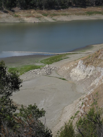
Decisions, decisions. The full route for today's ride sounded pretty daunting, with the first climb a slow uphill grind through the desert on a state highway with little or no shoulder (and some blind curves). We would visit two lakes today, South Lake and Lake Sabrina, and the group was buzzing about the steep approach to South Lake.
Hot day. Steep finish. High altitude.
Riding straight from the hotel had a certain appeal, but I fretted about completing the ride. This group of riders is a class above; if they think this is a difficult ride, for me it might be a climb too far. In his Complete Guide to Climbing (By Bike) books, John Summerson listed South Lake as the 8th most difficult climb in California, and 21st in the United States (13th and 32nd for Lake Sabrina). The cover of the first edition to his Complete Guide to Climbing (by bike) in California features a photo taken on the climb to Lake Sabrina.
Maybe I should ride from the hotel to Lake Sabrina, skipping South Lake. After poring over the map online [thank you, Google Streetview], I embraced the wisdom of the crowd. Most people planned to drive to an intermediate point, skipping the long climb through the desert in favor of the upper climbs.
When I stepped out of the car at Aspendell (elevation 8,400 feet), I felt a little woozy. [Uh oh.] I decided to start the ride and turn back if I felt unsteady. I often start to feel the effects of altitude at an elevation of 8,000 feet, so this was no surprise.
My regular ride buddy, having done these rides before, had moved on to tackle some mountains farther south. I was delighted to pair up with another rider who was content to match my pace—and who shared my weakness for photo ops.
We paced ourselves up the long climb to South Lake, dreading the long steep pitch we expected at the end. It was so quiet that I was startled by a loud whoosh whoosh when a pair of ravens swooped alongside us, checking us out.
The road pitched up a bit ... and then, there we were! A recurring theme of this trip is “I kept expecting it to get horrible, and it didn't.” [Not that I'm complaining.] I felt triumphant as I circled the parking lot at the top; another rider commented that I looked fresh. [Pacing. It's all about the pacing.]
We headed back down and turned onto the (easier) climb up to Lake Sabrina, which rewarded us with a clear view of the old Cardinal Gold Mine along the way; today, the only gold we saw was in the changing colors of the aspen leaves.
Mountain berry pie à la mode was my reward for 3,110 feet of climbing over 23 miles.
Back at the hotel, I found a cyclist pulling a beautiful bicycle out of his somewhat rare 12-cylinder BMW. He was not part of our group; he was in town for the weekend's big event, the White Mountain Double. And because he was using this as a training ride for the Everest Challenge, he was hoping to make it a double double: Ride the 200-mile course twice (Saturday and Sunday).
Crazy. I will never attempt a double century, much less back-to-back double centuries; not tomorrow, and definitely not when I'm ... 72 years old. Crazy.
Nonetheless, we are sampling our way through the Everest Challenge. One climb at a time.
Subscribe to:
Posts (Atom)