Day five, and I was ready for a rest day (but that's not today). I was feeling a little bit off, and we were slated to climb about 2,000 feet.
Faced with a steep (though short) climb before we'd even warmed up, several of us were quick to dismount (max grade today, 22%).
I wasn't expecting to be rained on. [You'd think I'd learn?] Luckily, it was only a short burst, not much wetness.
Ping!
Was that a hailstone that just bounced off my mirror? Ping! Another one hitched a ride on the lid of my bag until it melted.
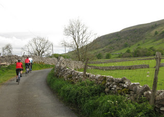
We waved at a stream of cyclists passing in the opposite direction, members and supporters of the Gwernyfed rugby football club, on a two-day fundraising ride from the most northerly club in Wales to the most southerly.
There was talk of a steam train, and whether our timing would align to see it. I caught a glimpse through the trees. Evidently it's coal-powered—and a very sulfurous coal, at that. One of the Welsh Highland Railway's trains, I believe.
We stopped for our morning break at a pub in Beddgelert, which was fortuitous for me as the menu offered a ginger beer that helped settle my system. Shortly after we stepped inside, the rain came pouring down. It stopped by the time we were ready to roll out, and I was the only one who suited up in my rain gear. [Which meant, of course, that we would see no more rain.]
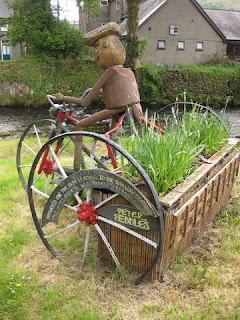
Regrettably, we didn't pay a visit to the local bike shop, but were surprised to find a wicker bicycle mounted above the stairs inside the pub.
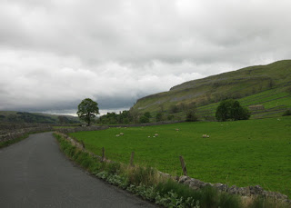
We continued on our way through Snowdonia National Park, heading for the coast.
Looking at the map, and the roads not taken ... I just might have to come back here.
We had a schedule to keep today, as we would be crossing the Irish Sea (by ferry) to Dublin. We made good time, affording a chance to admire the nature reserve at Foryd Bay.
Our riding ended at Caernarfon, where we enjoyed lunch and a stroll around the town square near the Castle. Despite the weak start to my day, I felt pretty good at the end: 33 miles, 1,830 feet of climbing.
A local cyclist struck up a conversation, wanting to learn about our trip. “You weren't cycling on Monday?!” she exclaimed.
The scavenging gulls were a menace! You had to keep close watch on your food, and they'd dive at a table as soon as the diners departed, knocking plates and cups to shatter on the stone plaza. Before the trip, while I was languishing sick at home, I had binged on Hitchcock movies. Fittingly, the last one had been “The Birds.” Here, we laughed at a little boy chasing them down—he couldn't have been more than four years old. “Shoo, you bloody bird!” he cried, flailing his arms at one. [He hasn't seen the movie.]
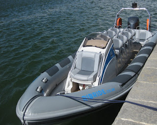
To free us from the time pressure of biking across the Isle of Anglesey to reach the ferry at Holyhead, the group would get a tour up the Menai Strait on a speedy boat (45 knots, at one point).
We cruised under the Menai Suspension Bridge, regarded as the first modern suspension bridge (completed in 1826).
From St. George's Pier, the van carried us onto the ferry and the next phase of our adventure: Ireland, the third country of our Five Countries Tour.
May 19, 2017
May 18, 2017
Ffestiniog
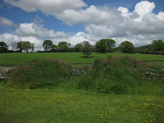
To avoid a busy road, we started cycling on the outskirts of Oswestry and soon crossed the border into the second country of our Five Countries Tour: Wales.
Sunshine, albeit patchy, at last!
With luck, we'd leave the ominous clouds behind.
We enjoyed another lovely tea break in the town of Llangynog before our big climb started.
We have magical water bottles on this tour: Whenever I return to my bike after a tea break or lunch, my bottle is full. (If I pinch myself, will I wake up and find that this has all been a happy dream? Our guides are fabulous.) Though there is a slight downside to this, as the electrolyte mix that sustains me on long rides gets diluted.
The climb started right outside of town, as we would pass through the Berwyn Range.
It wasn't bad, gaining about 1,000 feet over three and a half miles. Somewhere, though, I met a 15% grade (must have been short); that's probably where my heart rate peaked at 184 bpm.
It wasn't long before I was way off the back, the rest of the group no longer in sight.
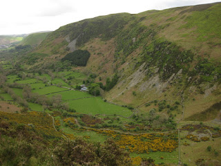
Which suited me just fine, because (at last!) I was eager to capture some photos of these peaks and valleys.
I've been feeling bad that people have to wait for me, though they're politely saying they don't mind. We were excited to snap photos at the summit, especially as we could see blue skies ahead.
A couple of our riders have been breezily passing me on the hills. They'd opted for hybrids instead of road bikes, and those were equipped with lower gearing (and disc brakes). I briefly wondered if I should have done the same, but even if I'd inquired about the groupset I know I still would have chosen the road bike. I wouldn't be comfortable at speed on the downhills, otherwise.
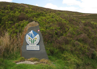
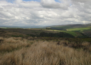
Oh, and about that. We crossed into Snowdonia National Park, with broad vistas and an enticing roadway—dry and smooth. Only because it leveled out a bit, and the park's logo was beautiful, did I stop [on a descent!].
We regrouped at the bottom, having reached an intersection. Our leader is mindful to keep track of us, although they're trying a new routing solution this year: each bike is outfitted with a Garmin. Every night our guides collect the units, load them up with the next day's route, and charge them. [More magic!]
Not being a Garmin aficionado, I'm leery of accidentally resetting the thing. After some teething pains the first couple of days, things began to run more smoothly. It's reassuring to get advance notice of turns and to see that you're on course, but some tricky bits (parallel roads, or cycle paths) can confuse it. And since the route is statically loaded, we need to be alert about being off-course whenever we do make a detour. The Garmins handle the miles vs. kilometers challenge nicely, as they can be set up either way.
We caught sight of Bala Lake on our way to lunch at a fun place, Gorwelion.
There was more climbing after lunch, but with the sunshine and the views, everyone was smiling.
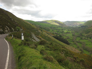
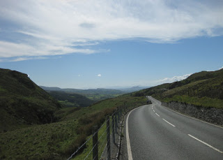
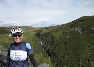
Just look at that ribbon of road! [Okay, maybe I smiled more broadly than my companions.]
We did stop to admire a waterfall. And even though we climbed some 3,740 feet over 47 miles, we arrived at our hotel in Ffestiniog with time to enjoy the environs,
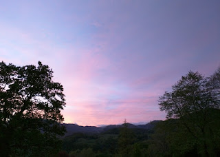
and a colorful post-dinner sunset for a beautiful close to the day.
May 17, 2017
Waddington
It was cloudy, with a threat of rain later in the day, but we finally got a break: it didn't actually rain today. While we regrouped at a turning point, I watched three bulls locking horns. The black bull and the brown bull, then the two brown bulls. They didn't seem to be at odds with one another, so I'm not sure what was up.
I was starting to feeling stronger, despite back-to-back days of cycling. My cardio is not where it should be; I'm dropped on every steep hill unless I can take advantage of a roller leading up to it. Today, at least, there was no need for me to walk (yay!)—maximum grade was about 12%. (It's pretty clear that I cross the pain threshold above 13% at my current level of unfitness.)
Our group is pretty well-matched: two riders are stronger and always in the lead, I'm generally in the back (sometimes with another rider), and the middle is elastic.
Today we left Yorkshire Dales National Park behind for the Forest of Bowland, an Area of Outstanding Natural Beauty. [That's a mouthful; more commonly known as an AONB.]
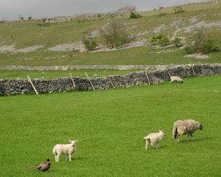
It's spring, so there are lambs in the fields—including a few black ones. (Turns out that's due to a recessive gene, which was my hunch.) From deep in the recesses of my brain, the old nursery rhyme “Baa, Baa, Black Sheep” surfaced; my cycling companions enthusiastically filled in the one line I couldn't dredge up.
When we regrouped at a fork along a country road, we happened upon a few locals assembling for a ride. “You weren't cycling on Monday, were you?” they asked. Their eyes stretched wide when they heard our reply.
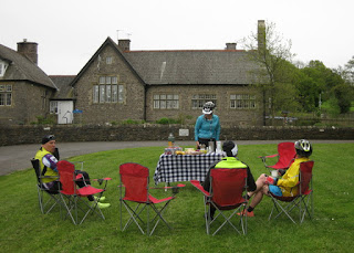
With the rainy weather, we've been taking our tea breaks in local pubs, so today's stop was a surprise: A picnic! Complete with tablecloth, camp chairs, tea, and snacks—including Aunt Agatha's homemade shortbread cookies, contributed by one of our riders!
We had a little time to peek into St. Peter and St. Paul's Church in Bolton-by-Bowland, with a history dating back to the 12th century.
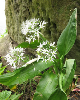
We crossed and (many miles later) paused to admire the meandering River Ribble. It was time to start feeding my wildflower photo habit.
Today's route was our shortest, and least taxing—a mere 20 miles and 940 feet of climbing. The group made good time, and I was certainly less pathetic. Our riding ended in the town of Waddington, with an opportunity to wander before lunch. The embattled King Henry VI was captured here in the mid-fifteenth century.
How times change: from a defibrillator in a decommissioned phone booth, to a set of medieval stocks outside St. Helen's Church.
We boarded the van for our journey to Oswestry, where we stayed nearby in a lovely old country house. Sheep were scattered around the surrounding fields, but when the farmer drove up they virtually stampeded to reach him and created quite a ruckus.
Not unlike hungry cyclists, perhaps, at the end of the day? Tea and fresh-baked shortbread cookies welcomed me to my room,
and my lamb burger was the envy of all at dinner. [Eat local.]
May 16, 2017
Malham
Into each day, some rain must fall. The original plan for today was to bike some 50 miles; I didn't feel strong, and I certainly didn't feel like I had 50 miles in me. Defeated, that's how I felt.
Wiser today, I was fully bedecked in my rain gear. Glad, in fact, that I'd brought the heavy-duty rain pants. As we passed, I considered whether it was feasible to cuddle with some sheep under a tree—all that warm wool was enticing. Maybe I would just have to bail out at the first steep climb.
You know how a tune gets stuck in your head? Yesterday, and today: King of Pain.
The toughest climb would come early in the ride: Buttertubs Pass, also featured in the 2014 Tour de France. Unlike the pros, we were tackling the more difficult side (north to south). This article sums it up well; I threw in the towel when I hit the 17% grade, facing sections in excess of 20% further up the hill. (One sign warned: 25% grade for 500 yards. Switchbacks, anyone?) It was was too far to walk, especially in the rain and wind. I'd pedaled less than 8 miles.
My disappointment must have been written all over my face; one of our guides snapped a selfie of the two of us, making me laugh and raising my spirits immeasurably.
The views, and the descent, would have been stunning on a clear day. But I chose to stay in the van, with a few other riders. The road was slick, the wind was blowing, and I didn't have a good feeling about it. It was raining enough, and I was dejected enough, that I didn't even snap a photo.
It was the right call not to descend. One of our riders crashed; luckily, not injured.
I felt reasonably well after a bowl of soup and a cup of tea. Might as well get back on the bike.
We stopped to admire Aysgarth Falls, though it was less than picture-perfect with sediment stirred up the by rain-swelled flow.
Kidstones Pass was another climb in the 2014 Tour de France; again, we were tackling it in the opposite direction. Looking at my stats, I did manage a few stretches of road at 13% grade today (heart rate peaked at 180 bpm). Kidstones was steeper than that. Back into the van for me; again, no photos.
Eventually, it stopped raining, the terrain mellowed out, and I began to suffer less—maybe, even, to relax.
Our destination was Malham, but with enough challenges for the day, our leader amended the route.
We had tea at a pub in Grassington, racked up the bikes, and brought another epic day to a close.
I managed to bike 36 miles after all, with a mere 2,533 feet of climbing. (The gaps on the map represent the segments not biked.)
Wiser today, I was fully bedecked in my rain gear. Glad, in fact, that I'd brought the heavy-duty rain pants. As we passed, I considered whether it was feasible to cuddle with some sheep under a tree—all that warm wool was enticing. Maybe I would just have to bail out at the first steep climb.
You know how a tune gets stuck in your head? Yesterday, and today: King of Pain.
I have stood here before inside the pouring rain
With the world turning circles running 'round my brain.
My disappointment must have been written all over my face; one of our guides snapped a selfie of the two of us, making me laugh and raising my spirits immeasurably.
The views, and the descent, would have been stunning on a clear day. But I chose to stay in the van, with a few other riders. The road was slick, the wind was blowing, and I didn't have a good feeling about it. It was raining enough, and I was dejected enough, that I didn't even snap a photo.
It was the right call not to descend. One of our riders crashed; luckily, not injured.
I felt reasonably well after a bowl of soup and a cup of tea. Might as well get back on the bike.
We stopped to admire Aysgarth Falls, though it was less than picture-perfect with sediment stirred up the by rain-swelled flow.
Kidstones Pass was another climb in the 2014 Tour de France; again, we were tackling it in the opposite direction. Looking at my stats, I did manage a few stretches of road at 13% grade today (heart rate peaked at 180 bpm). Kidstones was steeper than that. Back into the van for me; again, no photos.
Eventually, it stopped raining, the terrain mellowed out, and I began to suffer less—maybe, even, to relax.
Our destination was Malham, but with enough challenges for the day, our leader amended the route.
We had tea at a pub in Grassington, racked up the bikes, and brought another epic day to a close.
I managed to bike 36 miles after all, with a mere 2,533 feet of climbing. (The gaps on the map represent the segments not biked.)
I guess I'm always hoping that you'll end this reign,
But it's my destiny to be the king of pain...
May 15, 2017
Low Row
Our tour's rendezvous point was the “ATM side” of the clock in the York train station. There was a coffee shop called “AMT” on one side, so I thought that might be a typo—until I spotted a pod of ATMs on the other side of the clock.
The composition of our group surprised me: women outnumbered men. On a cycling trip?! Including our guides, six countries were represented: Australia, Canada, Ireland, Luxembourg, Scotland, and the USA. Three people had traveled with Wilderness Scotland before—an auspicious sign.
Our leader ferried us to Masham, where our second guide was waiting with our bikes. We started with lunch at a pub; coal [yes, coal!] was burning in the fireplace, and the resident dog was curled up in his bed and barely even looked up at us.
The bikes (Merida, Ride 400) were brand new, and labeled with our names. (So were our water bottles!) Capacious bags were mounted on our handlebars, and helmets were also provided (though I'd brought my own, along with my saddle and pedals). Luck of the draw, my bike was tagged “1.”
The bike fitting I'd had many years ago continues to pay dividends: I'd shared the diagram, labeled with each measurement, in advance. I expected that they wouldn't be able match it exactly (crank length, for example), but it was close enough. The bike felt like my own; I was immediately comfortable. The compact double gearing was the same as on my Cervélo (lowest gear 34-32), though the overall setup was heavier (especially with that handlebar bag).
We were headed for the Yorkshire Dales, to reach the inn where we'd stay tonight, near Low Row (inside the National Park). Rain started coming down. We pedaled through a flooded section (not my bike to clean!) and one of our guides shared a new word with us, a family favorite: “floodle” (rhymes with puddle). Spot on.
I'd donned my helmet and shoe covers, but not my rain pants. Silly optimist, I'd been. It wasn't cold, though; and my motto is “once you're wet, you're wet.” Meaning, it doesn't get worse. [But you do end up pretty grimy.]
Except that it got windy. So windy that, coming out of Leyburn and approaching the climb up and over Grinton Moor on Whipperdale Bank (2014 Tour de France Stage 1, albeit in the opposite direction), our leader chose to divert us. We'd ride around the moor, instead. I was grateful, because I was already off the back.
The sore throat that had plagued me for four weeks had finally abated last night; here I am, unfit and still mending, riding in the rain. I'd expected an easy first day, with gentle rolling hills. (Ha!) How did they get horse-drawn carriages up a 12.5% grade? I was gasping for breath; max heart rate was 177 bpm (sustained over a minute and a half).
Detouring around the moor took us through a military “danger zone.” It all looked so pastoral, but I imagine some of the sheep get unlucky.
Did I mention the rain? [Oh yes, I think I did.]
I'd been anxious about whether I would forget to ride on the left edge of the road; in practice, it wasn't a problem. Right turns took a lot of conscious effort, though, not to goof and wind up on the wrong side of the road.
The other tricky thing was to remember that the lever for the rear brake is on the left. One of our guides explained that the intent was to brake safely when you need to signal a right turn. An ex-pat colleague had tipped me about the switcheroo in advance, so I was mentally prepared. In practice, this also turned out not to be a problem for me. (Whew.)
From behind, I heard “I don't want to go up that!” ... just as I was thinking the same thing. It's the first day and I'm struggling, should I have bailed out of this trip? Then I thought how aggravated I would have been, sitting at home, to have my sore throat vanish the night before the tour would have started. Keep turning the pedals.
Rain is not conducive to photo stops. Trailing off the back also discourages picture-taking, not wanting to make the group wait even longer for me to catch up.
Getting up the inn's driveway was the final challenge of the day: steep, with broken pavement and potholes. Despair turned to delight when I learned that our guides had delivered our bags to our rooms (and, would fetch them in the morning). What an indulgence!
For the day, 27 miles with 1,745 feet of climbing. How ever will I fare tomorrow?
The composition of our group surprised me: women outnumbered men. On a cycling trip?! Including our guides, six countries were represented: Australia, Canada, Ireland, Luxembourg, Scotland, and the USA. Three people had traveled with Wilderness Scotland before—an auspicious sign.
Our leader ferried us to Masham, where our second guide was waiting with our bikes. We started with lunch at a pub; coal [yes, coal!] was burning in the fireplace, and the resident dog was curled up in his bed and barely even looked up at us.
The bikes (Merida, Ride 400) were brand new, and labeled with our names. (So were our water bottles!) Capacious bags were mounted on our handlebars, and helmets were also provided (though I'd brought my own, along with my saddle and pedals). Luck of the draw, my bike was tagged “1.”
The bike fitting I'd had many years ago continues to pay dividends: I'd shared the diagram, labeled with each measurement, in advance. I expected that they wouldn't be able match it exactly (crank length, for example), but it was close enough. The bike felt like my own; I was immediately comfortable. The compact double gearing was the same as on my Cervélo (lowest gear 34-32), though the overall setup was heavier (especially with that handlebar bag).
We were headed for the Yorkshire Dales, to reach the inn where we'd stay tonight, near Low Row (inside the National Park). Rain started coming down. We pedaled through a flooded section (not my bike to clean!) and one of our guides shared a new word with us, a family favorite: “floodle” (rhymes with puddle). Spot on.
I'd donned my helmet and shoe covers, but not my rain pants. Silly optimist, I'd been. It wasn't cold, though; and my motto is “once you're wet, you're wet.” Meaning, it doesn't get worse. [But you do end up pretty grimy.]
Except that it got windy. So windy that, coming out of Leyburn and approaching the climb up and over Grinton Moor on Whipperdale Bank (2014 Tour de France Stage 1, albeit in the opposite direction), our leader chose to divert us. We'd ride around the moor, instead. I was grateful, because I was already off the back.
The sore throat that had plagued me for four weeks had finally abated last night; here I am, unfit and still mending, riding in the rain. I'd expected an easy first day, with gentle rolling hills. (Ha!) How did they get horse-drawn carriages up a 12.5% grade? I was gasping for breath; max heart rate was 177 bpm (sustained over a minute and a half).
Detouring around the moor took us through a military “danger zone.” It all looked so pastoral, but I imagine some of the sheep get unlucky.
Well, that's plainly stated.DANGER: Military Debris May Explode and Kill You
Did I mention the rain? [Oh yes, I think I did.]
I'd been anxious about whether I would forget to ride on the left edge of the road; in practice, it wasn't a problem. Right turns took a lot of conscious effort, though, not to goof and wind up on the wrong side of the road.
The other tricky thing was to remember that the lever for the rear brake is on the left. One of our guides explained that the intent was to brake safely when you need to signal a right turn. An ex-pat colleague had tipped me about the switcheroo in advance, so I was mentally prepared. In practice, this also turned out not to be a problem for me. (Whew.)
From behind, I heard “I don't want to go up that!” ... just as I was thinking the same thing. It's the first day and I'm struggling, should I have bailed out of this trip? Then I thought how aggravated I would have been, sitting at home, to have my sore throat vanish the night before the tour would have started. Keep turning the pedals.
Rain is not conducive to photo stops. Trailing off the back also discourages picture-taking, not wanting to make the group wait even longer for me to catch up.
Getting up the inn's driveway was the final challenge of the day: steep, with broken pavement and potholes. Despair turned to delight when I learned that our guides had delivered our bags to our rooms (and, would fetch them in the morning). What an indulgence!
For the day, 27 miles with 1,745 feet of climbing. How ever will I fare tomorrow?
Subscribe to:
Posts (Atom)


