February 21, 2015

Keepin' Score

Metrics are everywhere. Take, for example, a simple wooden sign nailed to a utility pole at a curve along today's route:
CAR 5
POLE 17
The paint looked fresh. Odds are that the pole's count merited the latest update.

Bare trees in an orchard carpeted with blooming yellow oxalis along Eureka Canyon Road above Corralitos, CA
One rider in our group was proud to show me his bare handlebar: no bike computer, no stats. Others compete to climb more hills or cover more distance than their peers. The rider at the top of our club's leaderboard for 2014 biked more than 10,000 miles and climbed over 836,000 feet—just on club rides. He often commutes by bike, as well.

Creek flowing along Eureka Canyon Road above Corralitos, CA
We had a preview of summer at the coast today—cold and fog. Not that I'm complaining: I'm out here riding my bike through the redwood forest, while friends and family on the other coast suffer temperatures in the single digits and more snow than they'd like.

Creeks were flowing and the traffic was light.

58 miles, 4,860 feet of climbing. The fun factor is harder to measure.

February 16, 2015

One Cool Cat

You can be sure you're in Woodside when you get the traditional Woodside Welcome:
Go home and ride your bike in your own neighborhood!
A lady of the manor rolled down her window to shout at one of the women in our group, as if we were teenaged delinquents rampaging through town.

You should have replied “This is my neighborhood,” I suggested wryly.

We were climbing the steep section of a wide residential street, impeding no one on this sunny holiday. [Technically, we were in Portola Valley, but the animus is the same.]

Ferns sprouting on a moss-covered tree trunk alongside a creek, Alpine Road, Portola Valley, CA
We had already biked up (and down) Alpine. The group had traveled at a fast clip, intent as they were to reach the end of the road. Whereas I tend to meander, looking about. And, well, I have this knack for noticing things.

What I will remember most about this ride were the pawprints I spotted on the upper stretch of Alpine Road, which climbs gently alongside a creek. Still damp, in a line, claws retracted. The cat must have climbed up from the banks and then ... where? I considered stopping to snap a photo, but the prints had to be fairly fresh. Was the puma watching me? Wiser to keep moving and catch up with the group, ahead.

Enjoy the simple things: An invigorating ride with friends on a glorious day off (24 miles, 1,960 feet of climbing). Savor a sweet indulgence: A post-ride Linzer cookie from the Woodside Bakery. Embrace beauty.

Money doesn't buy happiness.

February 14, 2015

On Being Excessive

Stand of redwoods near the store in Big Basin Redwoods State Park, California
My thoughts wandered as I passed the towering redwoods on today's ride. The age of the trees, the age of the planet, the age of the universe, the age of the cyclist having these thoughts.

On a recent visit to the local library, I spied a copy of Half the Road on a rack and checked it out. A documentary I had meant to watch, then forgotten.

Not being a runner, I didn't know the story of K. V. Switzer, the first woman to register successfully and run the Boston Marathon. There were shots of the race manager physically accosting her, trying to pull off her race numbers—women were not allowed to run more than 800 meters, much less a marathon. In 1967. I remember 1967.

Our group was heading for a 65-mile ride with some 6,800 feet of climbing, and that was more than I wanted: more distance, more climbing. I hatched an alternate plan that would shave off some distance and elevation. My ride partner, working to rebuild endurance after a hiatus off the bike, trusted me.

pep and her bicycle standing inside a hollowed-out, burned redwood tree, Big Basin Redwoods State Park, CaliforniaThe film also told the story of an angry letter from the chauvinistic UCI to the organizer of the Women's Challenge bicycle race, refusing to sanction the event because it included excessive climbing. Excessive stage distances. Excessive number of stages. Excessive duration of event. Women weren't allowed to climb that many feet, cycle those distances, ride that many days. In 1990. In 1990, 1967 was 23 years ago.

To say that I had miscalculated our alternate route would be ... an understatement. It was how far from the park's headquarters to Boulder Creek? [Uh-oh.] And I'd thought we'd climb just a couple of miles back to the intersection that had led us to the park. [It was nearly eight miles.]

The film was inspiring with stories of strong, determined women. And here we were: not racing, but headstrong and determined to finish. “Where's my chauffeur?” joked my ride buddy. “Send the limo!”

My ill-conceived route entailed 64 miles with 6,180 feet of climbing. I got home in time to return the DVD to the library. By bike.

January 31, 2015

Nano Climates

Acacia blossoms along Burchell Road, Gilroy, CaliforniaOn with the insulated knee warmers at home; the air was decidedly brisk.

Off with the knee warmers 20 minutes later, stepping out of the car at the start.

Cruising along in the sunshine after the first climb, I considered peeling off my arm warmers.

Moments later, I passed through a pocket of chilled air. So it goes, in the Bay Area.

Dirt road beyond the pavement on Mt. Madonna Road near Gilroy, California
I was curious about today's climb to the end of the pavement on Mt. Madonna Road, with the usual trepidation of the unfamiliar. [It was fine.]

Had the group not been waiting, I would have ventured up the first section of dirt to the bright sunshine ahead.

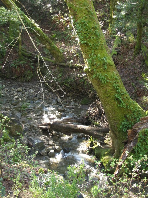
Instead I descended, with care. A technical descent, this one, steep and curvy. I had taken special note of one short slick section on the way up. Evidence of road repair suggests a chronic wetness, there.

Returning along Redwood Retreat, my pace slowed as I approached a knot of cyclists stopped off the road. No one I recognized; one guy timidly signaled for my attention. “Where are we?” They were looking for Uvas Road. Hard to imagine that in their group of six or eight, no one had a GPS device at the ready. “Where does this road go?” I set them straight, and encouraged them to check out the rest of Redwood Retreat and Mt. Madonna first.

Oak tree near the summit of Country Drive, Gilroy, California
The rest of the gang now having caught and passed me, I sought an additional challenge. They were headed into town for lunch; I had other plans. Being in the neighborhood, why not check out another unfamiliar climb?

The back side was mostly rural, with a sweeping view of pasture and green hills topped with an impressive oak tree. Dropping down the front side, I passed a cautionary sign for trucks: 15% grade. [Uh oh.] I made my u-turn in the residential section at the bottom; the houses got bigger the higher I climbed. This presented a healthy challenge, though I'd wager it didn't touch 15%. [I'm not complaining, mind you.]

Uvas Reservoir, west of San Martin, California
My route deviated further from the group, as I opted for scenic rolling hills instead of a long slog into the wind along a busy thoroughfare—with the bonus option of my own little picnic at the Uvas Reservoir, and clear views of the familiar summits of both Mt. Hamilton and Mt. Umunhum along the way.

Having seen very little wildlife, I was charmed by a pair of western bluebirds darting along a fence line on Bailey Avenue. They were bluer than blue: Azure? Cerulean? The color of lapis lazuli, and too fast for any chance of a photo.

By the end of the day, I had unzipped my vest to flap in the wind, shed the arm warmers, and slathered on the sunscreen. 62 miles, 3200 feet of climbing—farewell, January!

January 25, 2015

As Luck Would Have It

Guadalupe Reservoir near San Jose, California
The first bit of luck was an impromptu listing for a challenging ride with a local start, leading to our club's annual appreciation luncheon for last year's ride leaders. Of course, it would make more sense to take a flat route after yesterday's long, hilly ride—and that was my original plan. But I don't have enough sense for that.

Tower atop Mt. Umunhum, Sierra Azul Open Space Preserve, near San Jose, California
I stopped at the base of Mt. Umunhum Road to congratulate myself for another successful climb up the west side of Hicks, and that was the second piece of luck. A long, loud stream of motorcycles roared past. They couldn't have been too far behind me. There were so many of them that I was glad not to be on the road at that moment.

Almaden Reservoir near San Jose, California
I had mapped out a slightly longer route to the luncheon, avoiding the direct route along a busy expressway. Among the earliest arrivals, I claimed my raffle ticket and mingled before settling down with my plate near some faces familiar from last fall's rides in the Eastern Sierras. My raffle ticket was number 726. The guy to my left? Number 727. To his left? 728. We didn't ride together, but evidently we arrived sequentially, and then ended up sitting sequentially.

What are the odds?

I was happy with my prize, a water bottle from a local bike shop filled with goodies (patches, patch kit, and various sample packets). That being the most common prize, the ride leaders at our table raised our bottles in a mutual-admiration toast to our prowess. Our sequential trio had led a total of 43 rides in 2014.

Maybe, just maybe, I burned more calories than I consumed. 27 miles with 2,060 feet of climbing doesn't sound like much. But if you've climbed Hicks Road, you understand.

January 24, 2015

At the Edge

Hillside along Calaveras Road, Santa Clara County, California
Seeking a sunny ride on a winter's day, a trip along Calaveras Road fit the bill.

Of course, I trailed the group; but I powered right up The Wall nonetheless.

The day was so warm I peeled off my knee warmers before we started; a vest and arm warmers were all I needed. [In January?]

Heading north, it was surprisingly windy—the gusts were strong enough to knock me about. Time for more aerodynamics and less sightseeing.

Receding southern end of Calaveras Reservoir, Santa Clara County, California
Near the southern edge of the reservoir I slowed to watch a hawk soar overhead, but there was no sign of the resident bald eagles. A little research revealed that, in recent years, they've moved their nest from atop one of the power transmission towers into nearby oak trees.

The viewing spectacle of the day was a veritable parade of recumbents—two-wheelers and trikes—heading south. One of our riders recognized the group and commented that he's probably been “excommunicated” (for the sin of riding a diamond frame?) since he hadn't seen an announcement for their outing. No small effort there, pedaling those heavy machines uphill.

Mistletoe-studded oak tree near Calaveras Reservoir, Alameda County, California
After lunching in Sunol's local park, we headed back from whence we came. Now, with tailwind!

A solid day, covering some
43 miles with 2,940 feet of climbing.

At the base of the hill, I kept it under the limit—lighting up the electronic sign at 34 mph. Just right.

January 10, 2015

Ramp It Up

Number of miles biked last week: Zero.

Number of miles biked the week before that: Zero.

And the week before that? Zero.

During the first two weeks of December, I managed to bike a whopping 31 miles. [That's just not normal.]

Having been off the bike for three weeks, it would seem prudent to increase my activity level gradually.

Biking to work on Monday felt good.


So did Tuesday.

Lake Vasona just after sunrise.

Why not Wednesday?

Moon reflected in Lake Vasona at sunrise.
Short on sleep, Thursday seemed unlikely. But then, I woke up at the usual time and felt adequately rested.

Friday was fine. A new co-worker was impressed; even more so when he heard how long my trip is. “You look normal,” he said. “Not like one of those emaciated 0%-body-fat types.”

[Chocolate. Dessert. Chocolate desserts.]

Which brings us to Saturday, a sixth consecutive cycling day. The perfect day for a loosely-organized club ride with a late morning start.

The first hill hit me hard. [Payback.] The rest? Not so much.

Chesbro Reservoir near Morgan Hill, California
The sun broke through the clouds, there was enough water in the Chesbro Reservoir for a lone pelican, acorn woodpeckers flitted from tree to utility pole to tree, and a couple of hawks made an appearance.

For the day, 38 miles with 1,720 feet of climbing.

For the week? 3,740 feet of climbing over 148 miles.

Sunday is a day for rest.