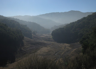
The first bit of luck was an impromptu listing for a challenging ride with a local start, leading to our club's annual appreciation luncheon for last year's ride leaders. Of course, it would make more sense to take a flat route after yesterday's long, hilly ride—and that was my original plan. But I don't have enough sense for that.
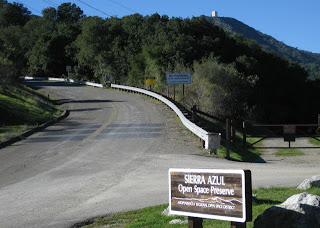
I stopped at the base of Mt. Umunhum Road to congratulate myself for another successful climb up the west side of Hicks, and that was the second piece of luck. A long, loud stream of motorcycles roared past. They couldn't have been too far behind me. There were so many of them that I was glad not to be on the road at that moment.
I had mapped out a slightly longer route to the luncheon, avoiding the direct route along a busy expressway. Among the earliest arrivals, I claimed my raffle ticket and mingled before settling down with my plate near some faces familiar from last fall's rides in the Eastern Sierras. My raffle ticket was number 726. The guy to my left? Number 727. To his left? 728. We didn't ride together, but evidently we arrived sequentially, and then ended up sitting sequentially.
What are the odds?
I was happy with my prize, a water bottle from a local bike shop filled with goodies (patches, patch kit, and various sample packets). That being the most common prize, the ride leaders at our table raised our bottles in a mutual-admiration toast to our prowess. Our sequential trio had led a total of 43 rides in 2014.
Maybe, just maybe, I burned more calories than I consumed. 27 miles with 2,060 feet of climbing doesn't sound like much. But if you've climbed Hicks Road, you understand.
January 25, 2015
January 24, 2015
At the Edge
Seeking a sunny ride on a winter's day, a trip along Calaveras Road fit the bill.
Of course, I trailed the group; but I powered right up The Wall nonetheless.
The day was so warm I peeled off my knee warmers before we started; a vest and arm warmers were all I needed. [In January?]
Heading north, it was surprisingly windy—the gusts were strong enough to knock me about. Time for more aerodynamics and less sightseeing.
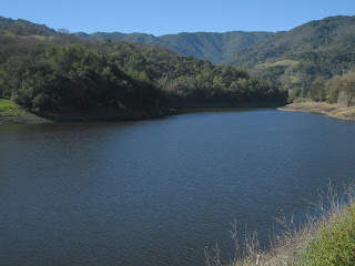
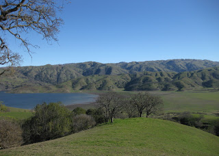
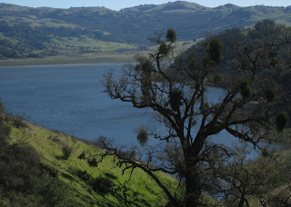
Near the southern edge of the reservoir I slowed to watch a hawk soar overhead, but there was no sign of the resident bald eagles. A little research revealed that, in recent years, they've moved their nest from atop one of the power transmission towers into nearby oak trees.
The viewing spectacle of the day was a veritable parade of recumbents—two-wheelers and trikes—heading south. One of our riders recognized the group and commented that he's probably been “excommunicated” (for the sin of riding a diamond frame?) since he hadn't seen an announcement for their outing. No small effort there, pedaling those heavy machines uphill.
After lunching in Sunol's local park, we headed back from whence we came. Now, with tailwind!
A solid day, covering some
43 miles with 2,940 feet of climbing.
At the base of the hill, I kept it under the limit—lighting up the electronic sign at 34 mph. Just right.
January 10, 2015
Ramp It Up
Number of miles biked last week: Zero.
Number of miles biked the week before that: Zero.
And the week before that? Zero.
During the first two weeks of December, I managed to bike a whopping 31 miles. [That's just not normal.]
Having been off the bike for three weeks, it would seem prudent to increase my activity level gradually.
Short on sleep, Thursday seemed unlikely. But then, I woke up at the usual time and felt adequately rested.
Friday was fine. A new co-worker was impressed; even more so when he heard how long my trip is. “You look normal,” he said. “Not like one of those emaciated 0%-body-fat types.”
Which brings us to Saturday, a sixth consecutive cycling day. The perfect day for a loosely-organized club ride with a late morning start.
The first hill hit me hard. [Payback.] The rest? Not so much.
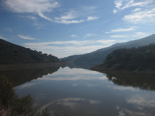
The sun broke through the clouds, there was enough water in the Chesbro Reservoir for a lone pelican, acorn woodpeckers flitted from tree to utility pole to tree, and a couple of hawks made an appearance.
For the day, 38 miles with 1,720 feet of climbing.
For the week? 3,740 feet of climbing over 148 miles.
Sunday is a day for rest.
Number of miles biked the week before that: Zero.
And the week before that? Zero.
During the first two weeks of December, I managed to bike a whopping 31 miles. [That's just not normal.]
Having been off the bike for three weeks, it would seem prudent to increase my activity level gradually.
Biking to work on Monday felt good.
So did Tuesday.
Why not Wednesday?
Friday was fine. A new co-worker was impressed; even more so when he heard how long my trip is. “You look normal,” he said. “Not like one of those emaciated 0%-body-fat types.”
[Chocolate. Dessert. Chocolate desserts.]
Which brings us to Saturday, a sixth consecutive cycling day. The perfect day for a loosely-organized club ride with a late morning start.
The first hill hit me hard. [Payback.] The rest? Not so much.
The sun broke through the clouds, there was enough water in the Chesbro Reservoir for a lone pelican, acorn woodpeckers flitted from tree to utility pole to tree, and a couple of hawks made an appearance.
For the day, 38 miles with 1,720 feet of climbing.
For the week? 3,740 feet of climbing over 148 miles.
Sunday is a day for rest.
January 5, 2015
Back to Work
Why bike to work?
My first commute of the year was chilly: 34°F when I rolled out this morning. On dark winter evenings, I close my eyes and escape with a podcast on a commuter shuttle—preferably an episode that will make me laugh and forgive the ridiculous amount of time it takes to get home. Tonight, there were a stunning 11 traffic accidents (and attendant backups) in the local area. Eleven. No mitigating circumstances, like rain or fog. Just the usual: A plague of bad drivers.
Rhinoviruses and rainy weather conspired to keep me off the bike for most of December, but 2014 was nonetheless a record year for commuting by bicycle. It was the year I found fewer and fewer excuses not to bike.
In all, I pedaled about 5,720 miles—over 3,600 miles biking to (and usually, from) the office. More than 300 incidental miles, mostly on my folding bike, traveling to and from the shuttle and between buildings on the campus. The rest? Recreational miles.
Oh, and I climbed up a few hills along the way. (241,000 feet, give or take.)
December 27, 2014
Piled High and Deep
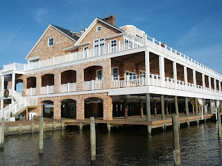
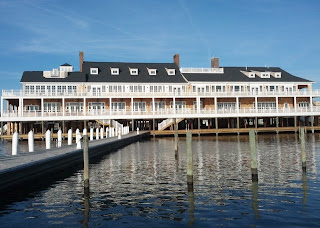
Back in the old neighborhood for the holidays, I had a chance to check out the status of the post-Sandy work on a local institution, the Bay Head Yacht Club.
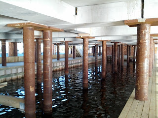
Last year, the main building had been lifted and shifted away from its foundation; pilings were slowly being pummeled down to bedrock, some 60 feet below the shallow waters of Barnegat Bay. One year later, it's open (for members) and grander than ever.
Seizing the opportunity to expand, the core of the original building was preserved and extended at both ends. An elevator supplements the staircases to ferry people between the dock level and the first floor.
The bay side has more window panes than I would want to count, which must ensure a spectacular view on days better suited to the cozy warmth of the hearth than the breezy porches.
Too bad I missed the open house, which preceded my visit. Poor planning on their part, don't you think?
December 18, 2014
Birds on the Wire
Crows are a common sight, but this pair put on an uncommon show this morning.
The crow on the right must be afflicted with something. (Mites, most likely.) The crow on the left was grooming the infested one, picking away at the back of the other bird's head.
When the helper bird turned and inched away, the itchy bird followed. Edging close, the crow bowed its head to ask for more. The helper was indulgent, for a little while longer, before winging to a higher perch.
The afflicted bird cawed noisily, in protest, before scratching and pecking under an extended wing.
We all try, in our way, to be free. But sometimes, we need a little help from our friends.
November 28, 2014
Eleven at Eleven
Do I know my fellow cyclists, or what?
The day after Thanksgiving is not for shopping; it's for burning off some of yesterday's calories. (Turkey, stuffing, gravy, mashed potatoes, veggies, pie.)
Six riders joined me for a little trip up Mt. Umunhum. We took the direct approach on Hicks Road from the west. The painful approach.
Surprisingly, it was a vest-and-arm-warmers kind of day; we're having a late (very late) November spell of warm weather. I expected little traffic on the back roads, but I was surprised to see no wildlife—especially after seeing so many deer just two weeks ago. Maybe they had the day off, too?
We reached mile 11 at 11:00 a.m., having already climbed some 1500 feet. I was especially proud at how well I'd climbed Hicks after two guys reported that they'd needed to stop on the way up. I remember trips up Hicks that required multiple stops. I remember weaving up the hill like a paperboy. I remember the first time I climbed it, when I asked a passing rider how much farther it was to the top and told him it was okay to lie to me. None of that, today; I pedaled right on up, keeping my heart rate in check. (Peaked at 178 bpm.)
Climbing Mt. Umunhum ... well, that's another story. I remembered not to be tricked by the first steep bit. There, anticipating more of the same around a sharp bend, I have often paused (prematurely). Just stay with it, the grade relents on the other side.
The next steep bit is longer—almost half a mile. I wimped out, pausing to get my heart rate back into a more comfortable zone. A passing rider encouraged me: “Good job!” he called out.
A couple of riders had been chided by a ranger for riding up to the White Line of Death. [Pshaw!] Really, there is nothing wrong with going that far—even more so now that we know that the true boundary is above it. I had expected to stop at the new boundary line today, but decided not to risk a contentious exchange with The Authorities.
I paid my respects at the line before dropping the short distance to the downhill side of the lower pair of “No trespassing” signs—shortly before said ranger reappeared. She couldn't fault us, but still felt compelled to warn us about respecting private property, the “rough” nature of the locals, etc., etc. She continued down the hill and stopped again, out of sight, evidently waiting to confirm that we were heading down (not up). She continued to hover, shadowing us to the gate and watching us leave.
We're not the vandals who spray graffiti on the pavement. We're not the criminals who cultivate weed in the hills. Hooligans in spandex, we are; riding our bikes up the crumbling pavement because ... we can.
Used about 1400 Calories climbing some 3,695 feet over thirty miles. There's another piece of apple pie with my name on it.
Subscribe to:
Posts (Atom)

