January 18, 2014

Turkeys

Cyclists on Cienega Road
Passing the Upper Ranch entrance to the Hollister Hills State Vehicular Recreation Area, I noticed a driver standing beside one of three (large) pickup trucks.

“Stay on the right side of the road!” he shouted.

Interesting, what drama did I miss?

“Don't ride in the center of the road! You almost caused an accident back there!”

Oh, he is addressing ME.

“I wasn't riding in the center of the road,” I called back. (Nor did I ride on the wrong side of the road.) With that much adrenaline flowing, I was glad he was taking it off-road.

What prompted his angry tirade?

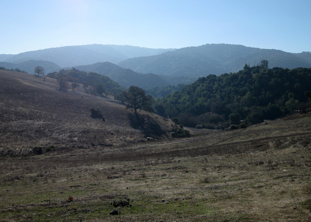
Heading uphill on a shoulder-less stretch of rural Cienega Road, I passed a cyclist standing next to his bike. Before doing so, I checked my rear-view mirror for approaching traffic. I saw the white pickup truck. There was ample distance for me to pass the cyclist before the truck would overtake us, and there was another vehicle approaching in the opposite lane, in plain sight.

The pickup driver chose to pass me as I was passing the cyclist. The oncoming driver tooted his horn.

Mr. White Pickup: I didn't almost cause an accident—YOU almost caused an accident, by passing unsafely. This maneuver saved you, what, five seconds?

What might I have done differently? I should have signaled with my left arm, instead of assuming that the driver would reasonably expect me to pass the stationary cyclist in my path. (Honestly, I doubt this would have made a difference. Nonetheless.) I suspect he was so focused on the cyclists (target fixation) that he failed to look at the opposite lane.

Something crashed through the underbrush near the road. I slowed and scanned the woods. Sure enough, a deer. The first time I biked this road, a deer sprang across the pavement in front of me. This one darted back through the trees.

Dry hills along CA 25, Airline Highway
Our destination was the Pinnacles, now a National Park (though the sign still reads National Monument). The pool at the visitor center looked so inviting (in January?), but it was closed; the high temperature for the day was 79F (in January!). I was pleased to average 12 mph on our 66-mile route, with its modest amount of climbing (2,895 feet) on a rare day with no headwind.

Saw some wild turkeys on Cienega, too.

January 11, 2014

Rattlin' Roads

We got our share of gloomy clouds, but no rain. We need rain.

Low water pulling back from an arm of Lexington Reservoir
The Lexington Reservoir has fallen to 31% of its capacity. A great egret and great blue heron joined a crowd of ducks foraging in the shallows. The retreating water leaves puddles in the mud.

Climbing through the redwoods, five deer boldly watched me from the side of the road. When I made eye contact, they turned tail and fled into the forest.

Empty beer can in bike rack tire well.
No matter how familiar the route, I always notice something new. Broken glass, remnants of flares, and melted pavement where some car recently crashed on Old Santa Cruz Highway. Power lines attached to a conveniently-situated tree. Dual-purpose bike racks. [Hipster mountain bikers.]

Landslides continue to exact their toll on the mountain roads. It took years to repair one section of Highland Way; the guardrail has already been mostly ripped away. In places, the pavement is broken into pieces that fit together like a crude jigsaw puzzle. The combined weight of me and my bicycle is enough to rattle the loose pieces as I ride over them; imagine the effect of the SUVs and trucks that frequent these roads. [Trust me, I'm lighter.]

View of Monterey Bay from Loma Prieta, overcast skies
The jackrabbits in the group headed down to the coast. I was content to admire Monterey Bay from the ridge. Forty-three miles, 3,895 feet of climbing. It was nice to come home to a hot bowl of soup.

January 4, 2014

Mines, All Mine

View toward Livermore along winding, hilly Mines Road
I started ahead of the group, knowing they would all pass me. Once I held the rear position, I had the road to myself.

The hills should be green, in winter. We need rainy days, not days with cloudless blue skies and temperatures in the mid-60s. It is January, for goodness' sake!

Might as well make the best of it by riding Mines Road to the Junction. Is a 60-mile ride unwise after being off the bike for a couple of weeks, through the holidays? Biking to work the past two days felt fine. The route is out-and-back, I could turn around at any point. [Right ...]

After passing me twice, an amiable fellow matched my pace and chatted for a few miles. He had been dropped by the rest of his group and was uneasy about riding out there alone. “You're not alone,” I pointed out. His plan was to turn around at the county line; he needed to get back into cell phone range to reserve a tennis court at noon. [Life is complicated.] The Alameda county line is around mile marker 20, I learned. Crossing into Santa Clara County, the count flips because mile marker 0 is at the summit of Mt. Hamilton.

Holiday decorations at a ranch along Mines Road
When you travel at a human pace, you take in all the sights. With bales of hay, pumpkins, corn stalks, and reindeer, this ranch had the fall harvest and Christmas covered. “Our Neck of the Woods,” the sign reads—adorned with a cowboy hat.

Arriving at the Junction, we were dismayed to find the gates leading to the café locked: Temporarily closed, under new management. Renegades that we are, we slipped around the gates and hiked up the hill to their picnic tables. Fortunately, my lunch was in my jersey pockets; but I had been looking forward to a nice chocolate cookie. [And their restroom.]

They were working on the place, and the new manager came out to chat with us. There are good things ahead! He plans to stock some things that cyclists need: bananas, oranges, energy bars, CO2 cartridges. [Yes!] With some advance notice, they would prepare barbecue—pulled pork sandwiches!

Heading back toward Livermore, I hardly noticed the early climbs as I scouted for some privacy. Barbed wire fencing. Steep drops at the edge of the road. Flat spots were always near residential access roads. Just as I climbed out of some bushes, I heard a motorbike approach, pass, round a bend ... slow down ... and return. He came back to check on me! Proof: on this remote stretch of road, you're not alone.

Back at the start, some people were chatting around a nearby car. “Nellie! What are you doing? Come back here, that's not your car!” I looked up to see a slow bulldog eying my passenger seat. Were it not for the heap of bike gear, I think she would have hopped right in.

First club ride of the year: 59 miles, 3,765 feet of climbing. My endurance endures.

January 3, 2014

Lane Spotting

Bike lane completely blocked by trash and recycling bins.
Can you spot the bike lane in this photo? (This is not a trick question.)

Improving bicycle and pedestrian safety in this corridor was a multi-year, $3.5 million project.

Last year, the city of Monte Sereno paved sidewalks along the highway—four-foot-wide sidewalks. They formed curbs and paved those sidewalks right on top of the bike lane, and erected signs citing the ordinance that forbids bicycling on sidewalks.

Four-foot-wide sidewalks. Two-foot-wide bike lanes, where we pedal alongside traffic traveling in excess of 35-45 mph.

We need fewer self-congratulatory ribbon cuttings and more municipal officials on bicycles. In the bike lane. Especially on trash collection day.

January 1, 2014

Reset

Fantasy of Lights Happy New Year display, Father Time and Baby New Year
A new year has begun: time for the traditional resetting of the bicycle computer.

Some new personal records in 2013: I covered more than 3,835 miles by bicycle, including some 1,895 miles commuting to (and usually from) work and at least 200 miles on my Strida.

The hills add up: I climbed more than 191,000 feet. (That's not a record; clearly, I'm slacking off.)

The dollars add up, too: I raised more than $300 for charity just by riding my bike (through a company-sponsored program to encourage “self-powered commuting,” and through Plus 3 Network).

In 2014, I can do better.

December 27, 2013

Raise High the Floor Boards

An overcast sky looms above the waters of Barnegat Bay
Many shades of gray, a winter's day along the bay.

Bay Head Yacht Club building supported on steel beams and stacks of wood.
This Old House has run a series on the rebuilding process at the Jersey Shore. After watching an episode where they ever-so-slowly used hydraulic jacks to lift a home above its foundation, I had the opportunity to take a close look at a similar (but grander) project.

Overall view of the Bay Head Yacht Club building, raised above ground.
The Bay Head Yacht Club building was built a long time ago, at the water's edge (naturally). Hurricane Sandy was not kind to the structure, which now must be raised. But wait, you say: that building is at least a hundred yards from the water.

Not only did they lift that massive building, with its two brick fireplaces and chimneys—they shifted it north, onto the (former) tennis courts.

Crane and drill installing pilings at the water's edge.
With an enormous crane and drill, engineers are driving helical piles into the ground to create a new (higher) footing for the clubhouse.

Man may win this battle, but one day the sea will prevail.

December 14, 2013

Hazy Shade of Winter

Pasture and distant hills viewed from top of Altamont Road
Leaves are brown, no patch of snow on the ground. No patches of ice, either, though we were on high alert—especially when crossing the occasional wet streak across the road. Some higher stretches of pavement were white, as if they had been salted. Could it be?

Atmospheric conditions have been unfavorable for air quality over the past week; today was our seventh consecutive Spare the Air Day. Wood burning is prohibited, to keep the airborne particulate count down.

A handful of riders turned out for today's adventure, which was designed to be short and not-too-challenging. My day was carefully orchestrated: bike, donate blood, and complete a bunch of holiday-related errands with adequate time to get spruced up for a holiday party in San Francisco.

The frosty air warmed quickly to a more hospitable temperature. Climbing Moody Road was less painful than I remembered, and my body did not balk when my heart rate hovered around 180 bpm for an extended spell. The real treat was Altamont, which afforded a sweeping view of a small valley from the top. Although it runs nearly parallel to Moody, the road is completely different in character.

For the day, a short 20 miles with some 2,100 feet of climbing. Just enough.