September 26, 2012

Ajaccio

There are so many beautiful places left to explore, but the time has come for us to leave Corsica for the mainland (and ultimately, to return home).

To catch the ferry in Ajaccio, the group was evenly divided between two routes. One group preferred to retrace the route that led us to Calzola; the other group relished the idea of seeing new terrain along the coast. The inland-route group was certain that the coastal route offered no less climbing. The coastal-route group shrugged.

I cast my lot with the coastal group. There, the rolling terrain would give me some downhills to compensate for my slow climbs. The inland route would start with a sustained climb; I would fall behind long before reaching the top, and the rest of my journey would be solo.

Ironically, as we wended our way toward the coast, we found the steepest climbs of our time on Corsica. "Ow," my legs protested.

The views, and the cheers, were worth the pain. Passing through small towns, we were greeted with:
Bravo!
Allez, allez, allez!
The locals are getting ready for next summer: For the first time in its history, Le Tour de France will visit Corsica, where the race will open with three stages. Banette will be an official supplier—as we all know, cyclists need their carbohydrates.

We stopped for lunch in Porticcio, my last chance to enjoy a savory galette, followed by a Nutella-choco crêpe. Here, we hoped to catch a small ferry to the harbor in Ajaccio—and thus avoid a trip on the unpleasant national road.

Alas, the ferry had shut down for the season. There was no alternative route. When the rest of the group headed straight onto the divided section of the highway, I hesitated. Now I understood the signs, and I understood the frontage road bypass. If they did not see me follow, would they worry?

I crossed my fingers, hoped for the best, and ... took the bypass. Imagine my surprise when I popped back onto the main route and saw the rest of the group ... behind me!

Despite some poor coordination, we found our leader (and our bike cases). The harbor at Ajaccio is a much less intimidating place than the port at Marseille.

We unclipped for the last time, having covered 40 miles and climbed some 2,285 feet. Now it was time to pull out the tools, to break down and pack our bicycles for the journey home.

Over the course of this adventure, I biked more than 550 miles and climbed nearly 43,000 feet. Yet, there is so much of this island that we did not see.

Corsica is a cycling paradise, as the world will soon discover when Le Tour arrives next July.

September 25, 2012

Filitosa

As we prepared to head off on our bicycles for the day, one of the other hotel guests was curious about our itinerary. Another rider was trying to explain where we had ridden yesterday. "A Aullène," I interjected. He raised his eyebrows and tilted his hand at a steep angle, acknowledging the climb. I smiled, "Oui."

The group was divided today. Rather than following our leader on an expedition to Grosseto, I opted for the mellow group that planned to stay local. We were eager to visit the prehistoric site of Filitosa, where evidence of human habitation dates back more than 8,000 years.

We turned left out of the inn, looking for a side road that we never found. Which meant, of course, some extra-credit climbing.

It was not hard to find Filitosa; the tour buses gave it away. That is one way to see a foreign land, and it beats sitting at home on the sofa. But there is so much that the pre-packaged bus riders will never experience.

Filitosa is a significant archaeological site, in private hands—embellished with a somewhat tourist-y feel. Nonetheless, it is impressive (and eerie) to amble over the same rocky fields and duck into the same rock shelters that provided cover for inhabitants during the Bronze Age. We learned about menhirs, and enjoyed the opportunity to examine the imposing, carved monoliths at close range.

Much to my surprise, I spotted a woman who had to be from the Bay Area—she was wearing a Beat the Clock bicycle jersey, which surely meant that we had a mutual friend. Was this the same woman I saw on the road yesterday, in an Alto Velo jersey? [Yes!] Chasing after my group, I was disappointed not to catch her yesterday. We chatted and posed for a picture together—which I promptly sent off to our astonished friend.

Not to be outdone, two of the other people in our little group met someone from their home town; many years ago, they had attended the same high school—a year apart.

Really, what are the odds?!

Porto Pollo is the nearest town, so we headed there for lunch before returning to the inn. For the day, we traveled a comfortable 23 miles, with 1,325 feet of climbing.

September 24, 2012

Aullène

Our designated destination was Zonza, which we understood to be a prototypical Corsican town. The route, of course, headed uphill.

After the first 14.5 miles, we were only halfway to Zonza and had already climbed 3,200 feet. This did not bode well.

There were a couple of bail-out points along this route. We faced our first decision point after crossing the Col de St. Eustache. We could see a significant descent, followed by a climb to the next town.

What terrain would we face after that, if we continued to Zonza?

One rider favored turning back at this point, but we had ascended for miles on a road that was in poor condition—the rest of us had no wish to descend it. With a chance of rain in the forecast, there was anxiety about the weather. Clouds were rolling in, and the winds were strong on the far side of the pass.

We continued to Aullène, and then agreed to bail out. I suggested that we find lunch here, since it was already 13:00, but our leader promised we would have lunch at a nice restaurant. We conferred on the route and headed downhill: D69 to N196.

Once I lost my downhill advantage, a paceline formed. I hammered along at nearly 17 mph, but the group pulled away from me; I faced the headwind alone.

I reached an unexpected turning point—the intersection of D69 and D268. Proceeding straight onto D268 seemed like the right direction. To stay on D69, I would need to turn left. An arrow for D69 pointed to Sartène. An arrow for D268 pointed to ... Sartène. I did not want to head toward Sartène, which was clearly not along the direct route toward the coast.

At this intersection, it would have been nice for the group to wait for me. Or for one person to wait for me. That is what I would have done.

I pulled out my map and studied it. Carefully. Then I studied it some more. I chose to proceed straight onto D268, and found the group at a nondescript restaurant less than a mile later—at the intersection with N196.

We ordered our lunches at the same time; everyone had finished (pizza) before I was served (salad). Their impatience was palpable.

I released them. "I will find my way back," I told them. They offered that we start together, but what would be the point of that? I would fall behind immediately.

Biking on the national road was not fun, especially when I was adjacent to fast-moving traffic on uphill sections or contending with construction zones. I pulled off the road a few times, just to get a break from the traffic. I studied the map, looking for alternatives; there were none.

Sixty miles, 4,545 feet of climbing.

On the plus side, it didn't rain.

September 23, 2012

Porto Pollo

At the end of yesterday's ride, I was completely spent. After stashing my bike, I more or less collapsed in the hallway, next to my luggage, until I learned my room number. Two women (other guests) regarded me with some disdain as they passed.

I have certainly completed longer rides. I have completed rides that entailed more climbing. For some reason, Saturday's ride took a lot out of me.

I had absolutely no intention of riding the next day.

A good night's sleep made all the difference.

In earlier times, our inn had been a mill where they pressed olive oil. We were out in the countryside; the closest town was nine miles away.

Porto Pollo, and its beach, beckoned. It helped that the road to the coast followed the river, and was essentially flat.

We had the place nearly to ourselves, even though it was a warm weekend day. It is the off-season, and the locals must be busy with the routines of daily life. We found a spot of shade near some trees, floated and splashed and swam in the sea, and had a nice lunch at a beachfront café.

In other words, we enjoyed a relaxing day, one that would be typical for many a vacationing tourist along the Mediterranean. Except that our version required 18 miles of bicycling, with a whopping 250 feet of vertical ascent.

Tomorrow, we will return to our regular vacation routine.

September 22, 2012

Calzola

To prepare for today's journey, I did my homework. I asked Google Maps for a route to our next hotel; although it was car-centric, it was also bikeable. Studying the map, the rest of the group had settled on the same route. There just aren't that many alternatives for getting from point A to point B on Corsica.

I studied my paper map and wrote out a primitive cue sheet. The signs at intersections consist of arrows labeled with the names of the nearest towns—not north/south/east/west. It is important to be familiar with the places you will see along the way.

For me, the low-stress approach would be to go it alone. I promised to call for help if I needed it. As I pedaled away, I overheard a veteran of these tours (no longer able to bike):
She is very courageous.
The road out of Porto started with a seven-mile climb; a Google Streetview car passed me here. Were the cameras rolling? Time will tell.

The road dipped back down to sea level, and then offered 20 miles of rolling hills along the coast before the next sustained climb (five miles). If the natural beauty of Les Calanche de Piana was not enough, we were distracted by the spectacle of an exotic car rally. Lots of those red cars (by Ferrari), one Ford GT, one Audi R8, some Aston Martins and Corvettes. And one vehicle that I recognized by the sound of its engine before it came into view, a Lamborghini Diablo.

After pedaling for more than three hours, I started eyeing cafés in the town of Sagone. I stopped at the third one, eager for the melon et jambon listed on their chalkboard.

Unfortunately, it was not yet noon. Apparently, the guys at the table out front were lingering after petit déjeuner. The proprietors would start serving lunch a midi, or vingt-deux minutes from now.

One does not toy with the rhythm of life in a small European town.

I could not afford the time to wait; I needed to find a place farther down the road after noon, or in the next town.

Instead of my cherished melon et jambon (12€), I found a reasonable pasta salad at the U Express supermarket for a mere 3.58€. In fact, this turned out to be the deal of the century: it was on sale, and rang up at a mere 1.79€. I stopped at a nice spot along the shoreline to enjoy my little picnic. After handing my camera to a French couple for a photo, they wished me bon appétit as they pulled away.

Navigating the outskirts of a major city was the significant challenge of this route. Riding on a national road was not bad in the countryside; getting past Ajaccio was another matter altogether. A matter of a divided highway.

I lacked the requisite knowledge to interpret the road signs. There were circular blue signs depicting bicycles and pedestrians. There were circular red, white, and black signs depicting bicycles and pedestrians. In the US, such a sign would carry a diagonal slash to indicate "prohibited."

I stopped. I studied my map. I needed to travel one kilometer on this portion of the road. Traffic was moving fast. There was no real shoulder, but there was some room to the right of a dashed line—not quite as wide as a standard bike lane.

I took a deep breath and started pedaling. The circular blue sign would have led me onto a peaceful frontage road. The bicycle sign with the red circle meant that bicycles were prohibited. The drivers must have thought I was insane. It was just one kilometer.

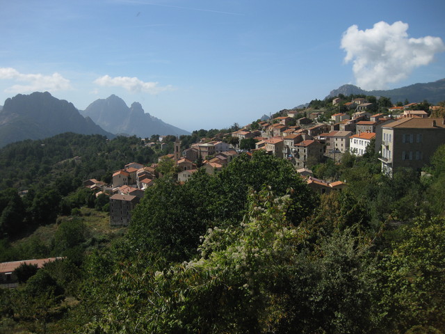
Soon, I turned onto D302—the quiet road that would take me straight to our hotel, near the hamlet of Calzola. This involved the final long climb of the day (8.5 miles). I crossed the narrow bridge over the river Tavola and turned into the inn's driveway.

I had climbed 6,235 feet over 72 miles, without a single wrong turn.

September 21, 2012

Ota Porto

Given the prospect of a long ride to our next town tomorrow, most of the group opted for a day off.

A day off the bike, that is.

In the morning, we would hike.

We returned to Ota, stopping for a close look at the Ponte Vecchiu—a bridge we had seen from the road above, yesterday.

We continued to the nearest trailhead for Tra Mare e Monti Nord, which passes into the spectacular Gorges de Spelunca. The steep, rocky trail was challenging, but why would anyone want to hurry, here?

We relaxed on the river bank at the Pont de Zaglia before retracing our steps. These stone bridges were built to serve a centuries-old route of significance—we were hiking through history.

Returning to Porto after lunch, I visited the local market to stock up for tomorrow's journey. It was also time to swap out my booted tire; my friends were concerned for my safety on the bike, and generously gave me the spare tire they had brought along. [Note to self: next time, bring a spare.]

There was even enough time for a quick cruise before dinner. It was immediately obvious that my limited vocabulary is devoid of nautical words, but the coastline needed no narration—especially in the long rays of the late afternoon sun.


September 20, 2012

Col de Vergio

Here's the thing about Corsica: The only place that is flat is the sea.

After yesterday's challenging journey, I was not convinced I would ride today. But then, what would I miss?

Our host pointed to a lake on the map; it seemed impossibly far away. "First we follow this white road, then we take this yellow road ..."

From sea level, there is nowhere to go but uphill. Take a glance at a topological map, and this will be abundantly clear.

We inundated the tiny local market in the town of Ota. Shortly thereafter, our group of eight began to shrink.

The first two riders were determined to turn back after we had climbed 2,000 feet. Methinks it can be a bad thing to have too much data.

We stopped for lunch in Évisa. I took one look at the enormous serving of pasta in front of me and pronounced it too much to eat.

I then proceeded to eat it. All of it.

Three more riders turned back. I got a short-lived head start on the remaining two (our host, and one of our most hard-core cyclists), and then settled into my own comfortable pace. We would all turn around at the summit; the distance to the lake was too great.

I was startled when a small wild boar scrambled out of the brush and ran across the road; they're fast! On the way down, I paused when I met a small group of them. Two youngsters were engaged in a circular romp in the middle of the road, while the adults foraged in the roadside grass. Like the wandering cows and sheep, they ignored me and I continued on my way.

After stopping to marvel at a spectacular gorge, I noticed a tour bus edge around a sharp bend on its way up the hill. The stretch of road between us was little more than a single lane wide, and I definitely did not want to be squeezed against the low stone wall at the edge of the gorge. I tucked into a wide spot and waited for the bus to pass. The driver was attentive and waved to me in appreciation.

With today's climb of 5,015 over 44 miles, I have climbed nearly 10,000 feet in two days. Evidently I am stronger than I thought.