Showing posts with label Cycle Greater Yellowstone. Show all posts

August 16, 2016

Whitehall

Cycle Greater Yellowstone, Day 3: Bozeman-Whitehall
More smoke today, this time from a grass fire that might require a diversion in our route. Although GPS tracks had been helpfully provided before the ride started, we were reminded to follow the road markings (and route marshals) to stay on course. Yesterday's track, for example, showed a return route from Emigrant on the highway (rather than backtracking on the quieter parallel road), a plan that had been changed.

This morning's route made us all feel supercharged: it looked flat, but was a gentle downhill. For the first two hours I averaged 17 mph. [So that's what it feels like to be a faster rider!]

A couple passed me, then slowed down. I passed them. They passed me. After a few rounds of leapfrog, the husband finally picked up the pace. I left a gap for his wife, but she didn't fall in; instead, she drafted me, I drafted him. We arrived together at the first rest stop, and I thanked him for the pull. They introduced themselves, and she said “You're amazing! You're so consistent!”

There is a lot of Lewis and Clark history along our route. In the town of Three Forks, the grounds of the Sacajawea Hotel accommodated us for a rest stop. A bicycle trail led us to (and from) lunch, and there I learned what it's like to follow a rider who is not consistent.

He would spin spin spin really fast, then coast. Spin spin spin like crazy, then coast. It was maddening. At the first opportunity to slip past him, I did.

Much of the terrain has reminded me of our rides in the Eastern Sierras, which left me pondering whether I should simply have joined that ride again this year.

But then we followed the Boulder River through a scenic canyon, and I perked up. I also couldn't resist the chance to snap some photos from a locomotive's perspective, as the tracks were right there, with plenty of visibility to spot any oncoming trains. [There were none.]

Our approach to Whitehall gave us a straight-on view of the enormous open pit hardrock Golden Sunlight mine (in particular, the waste rock filling a valley). From camp, we had a view of the back side. These mines create huge toxic hazards, with the potential for cyanide runoff and a great volume of acidic water, that will endure for years. (Centuries?)

Even though this was a 76-mile day, with only 1,160 feet of climbing it was a fast trip. I gathered my stuff at camp and looked for a shuttle to the bed-and-breakfast ranch where I'd be staying. Maybe the shuttles would start before 3 p.m., since most people were done riding.

Nope. In fact, they wouldn't start till 4 p.m. How would I get cleaned up and back to camp for dinner by 5:30 p.m.?

I was one unhappy (non)camper, hungry, overheated, and gritty with salt, sunscreen, and road grime.

The only sensible solution was to make one trip, after dinner, to the ranch. I claimed a towel, used the shower truck, washed out my bike clothes and strung them up to dry on a fence. I had been curious about the Laundry Pods, anyway; now I had the opportunity to use one. (It's a manual washing machine—think salad-spinner-for-clothes.) It worked quite well.

Of course, I was free to use all these facilities, and once clean I was considerably less grumpy.

The Iron Wheel Guest Ranch was on the outskirts of town; tomorrow, we would cycle past it. The property is the site of an old stagecoach stop on the Yellowstone Trail; what could be more fitting than running a modern-day equivalent? The proprietors took good care of us—even rising early to supply us with a hearty breakfast the following morning—and proudly gave us a tour of their taxidermy workshop.

Authentic Montana, genuine folk. Just as I'd hoped it would be.
August 15, 2016

Paradise Valley

Cycle Greater Yellowstone, Day 2: Livingston-Bozeman

There were two options for today's ride: short or long. Long, or short? Decisions, decisions ...

The prudent course would be the direct return to Bozeman, about 35 miles, conserving energy for tomorrow's long route. So of course ... I went long.

One could think of it as two rides: a 50-mile morning ride through the Paradise Valley toward Emigrant, followed by a mere 35-mile ride in the afternoon.

We headed out of Livingston on a paved path paralleling the highway for several miles. A roadside sign cautioned drivers: Watch for Wildlife on Roadway Next 51 Miles. [Okie dokie.]

The on-course support for this ride has been above and beyond my experience. Two people were stationed at one spot to divert us around a large patch of broken glass on the shoulder. The turns are marked, and route marshals keep us on course at key intersections. This makes good sense, really, because a wayward rider could be challenging to locate given that cell phone coverage is spotty. I confess that I was gleeful when I crested a hill and found the road marked “steep grade”—but, you know, that's me.

Our out-and-back route to Emigrant would follow the same route, though Headmistress Jennifer thought we should stay on the highway for the last leg into Livingston rather than take our chances playing “Frogger” to get back on the bike path. (Traffic would be light enough, as it turned out, to cross back onto the path; a welcome respite from riding the fog line next to vehicles traveling at 70+ mph.)

Sadly, too much of the West is ablaze; haze hung heavy over the hills. I left a smoky Bay Area only to find myself in a smoky Montana valley.

We passed through the communities of Pine Creek and Pray, the former of which mostly survived a wildfire four years ago that burned nearly down to the road.

A few miles from the rest stop that would be our turning point, a guy caught up to me and then sat on my wheel. [Sigh.] Honestly, I don't create much of a draft. I had the last laugh, though, dropping him in short order as soon as I got a slight downhill boost.

I stopped briefly after making the u-turn near Emigrant and was startled by two loud thuds behind me. I turned to see a pair of stout mule deer (doe and offspring) dashing across the field.

The day was heating up by the time we made it back to Livingston for lunch. And here's the thing: Although the morning wasn't a flat route, the last 35 miles presented two-thirds of the climbing. [I prefer my climbs in the morning ...]

We baked in the afternoon sun riding the ups and downs of a frontage road heading due west along I-90. It was a long, gradual uphill into a miserably strong headwind. I began to doubt that I had the ability to keep going. SAG vans passed with bikes and riders aboard. When I reached the penultimate rest stop at Grizzly Encounter, I could not incur the delay to visit the bears. Here the route turned north, and I convinced myself this would offer a break from the wind.

Our final rest stop was a one-room schoolhouse on the National Register of Historic Places, the Lower Bridger School. The building dates to 1900, and was used until 1958. Some riders refilled their bottles at the old hand pump; I stepped inside and back in time, recognizing a style of desk that was still in use at the public school I attended through grade four. (These were in much better shape.)

Another rider warned me that we would face a steep hill before we were done. Was this it, I wondered, at the first little rise? Maybe it's this one, I thought, at the second uptick. Ah, no, here it is ... at mile 79, riders were paper-boying it up a 10% grade that lasted for a tad more than a quarter mile. Admittedly, it was tough after all those miles, and with the heat. At altitude.

I was proud to finish strong: 89 miles, with 3,310 feet of climbing. In the morning haze, I failed to start both apps to track my route, so for today I can share only this image:

The hotel lobby, with its trophy elk heads and Kodiak bear (native to Alaska), was a welcome sight. This time, with my bicycle for a stress-free start tomorrow morning—another long day on the saddle.

August 14, 2016

Livingston

Cycle Greater Yellowstone, Day 1: Bozeman-Livingston
I watched enviously as a couple of the other guests at our hotel pedaled off to the park. Despite repeated phone calls, the rest of us waited 1 hour and 15 minutes for the shuttle that was supposed to pick us up around 6:00 a.m. We were not off to an auspicious beginning. Taking advantage of the hotel's free continental breakfast was a wise move; by the time we got to the starting line, most of the camp had already cleared out and been packed away.

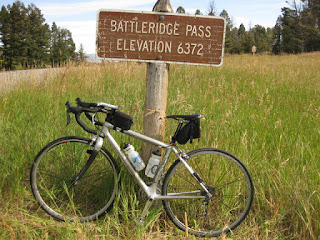
pep's bicycle at Battleridge Pass, Montana
Once we were underway, it was a nice ride; climbing very gently for the first 20 miles, past the Bridger Bowl Ski Area and cresting Battleridge Pass before heading downhill (woo-hoo!). The roads were in excellent shape, compared to our local California Bay Area roads. Montana gets weather (ice, snow), and we don't ... go figure. This being a Sunday, I wasn't surprised when local motoring enthusiasts passed us (one Ferrari, trailed by a Corvette and assorted muscle cars). Roads that are fun to bike are also fun to drive.

Rumble strips were commonly carved into the center line of the road, as well as along the fog line. Rumble strips are not friendly to bicycles, but I do appreciate that they help to keep motorists safer. The shoulder was often quite narrow—less than the width of a bike lane—and strewn with loose gravel. The fog line rumble strips, fortunately, were not continuous; when the road was clear, it was easy to dart in and out through gaps as needed.

Montana is a “personal responsibility” state. For example, there is no helmet law for motorcyclists, and many choose to ride unprotected. Personal choice is fine with me, as long as the consequences are also personal (i.e., don't count on the taxpayers to foot your medical bills).

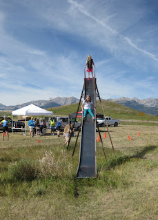
Two girls on the giant slide in Sedan, Montana
Eager Girl Scouts served snacks and refilled water bottles at our second rest stop, the community center in Sedan, an area settled in 1885. Out back was the tallest slide I've ever seen—tall enough to make helicopter parents swoon, for sure. I was tempted, but didn't risk it; I have too many miles of riding ahead.

Throughout the day, I passed people (and of course, got passed). A light cloud cover kept the temperature manageable, but as the day wore on some tricky crosswinds developed. Livingston, I'd heard, could get quite windy. Turning south offered some relief ... a headwind is easier to handle than a crosswind.

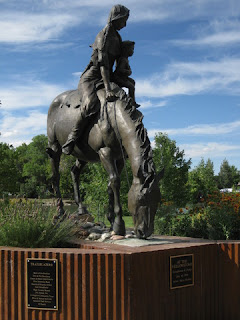
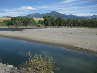
Camp was set up alongside the Yellowstone River, near a statue honoring Sacajawea “whose loyalty, courage and devotion were instrumental in the success of the Lewis and Clark expedition of 1803-1806.”

Statue of Sacajawea with her infant son on horseback, Livingston, Montana
Despite the challenging conditions, I managed to average 14.3 mph over 68 miles, with 2,300 feet of climbing.

Yellowstone River with distant mountains, Livingston, Montana

August 13, 2016

Cycle Greater Yellowstone

The Greater Yellowstone Coalition has been running a multi-day cycling tour for the past few years. They choose a different route each year, always covering some portion of the Greater Yellowstone ecosystem. The map this year showed participants from nearly every state, as well as a few international visitors.

Map of the United States marked with pins representing the home locations of participants, Cycle Greater Yellowstone 2016.
When this ride crossed my radar screen last winter, I took notice. While it was primarily arranged as a camping event, they would also run shuttles to a few chosen hotels in each town to accommodate non-camping-types (like me). Even though they offer a “tent sherpa” option, where they provide, set up, and tear down a tent for you, I expected that I would not be a happy camper. If you don't get a good night's sleep, in the morning you still have to climb onto the bike and pedal.

CGY crew setting up camp in Beall Park, Bozeman, Montana.
The gray sherpa tents were tightly packed in neat rows; good luck if your neighbors snore ...

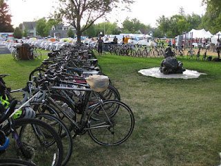
I walked over to the coalition's headquarters early enough to claim my bicycle, just as they were loading trucks to transport gear to our starting location at Beall Park. I was the first to park in the “bike corral;” later I would learn that the preferred technique is to loop the handlebars over the rope.

My bicycle parked in the bike corral, rows of gray sherpa tents beyond, Beall Park, Bozeman, Montana
There were all sorts of bicycles: road bikes, mostly, but a few mountain bikes, tandems, and full-on touring bikes with fenders. I didn't see any recumbents, but there was at least one Roundtail. A curious concept, for sure.

Roundtail bike parked next to a private tent, Beall Park, Bozeman, Montana
Our encampment was fully established, the corral packed with bicycles, by the time I returned for the first evening's festivities (dinner and announcements). Our leader, who I came to dub Headmistress Jennifer, was a stern taskmaster. Heed her directives, or else ...

Camp established, corral packed with bicycles, Beall Park, Bozeman, Montana
I sat on the fence for months before taking the leap last spring and committing to Cycle Greater Yellowstone. While the route would not entail much climbing, each day's ride would be long. If it rained, that would mean a lot of misery. We would also be riding for seven straight days without a day off. I wasn't sure I could do this.

If I didn't try, I would never know.

I signed up and navigated the logistics of booking nine reservations with the right hotels on the right nights in the right towns (including pre- and post-ride adventures). Pro tip: Track it all in a spreadsheet.

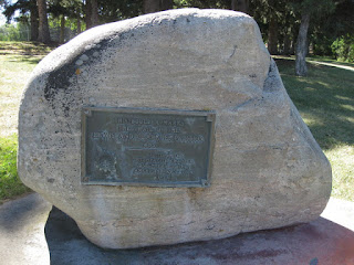
"This boulder marks the trail of the Lewis and Clark Expedition 1805." Bozemna, Montana
This rock in Lindley Park puts it all in perspective. The plaque is inscribed: “This boulder marks the trail of the Lewis and Clark Expedition 1805.” Two hundred eleven years later, I'm just here to ride a bicycle.