Commuting to work this week, no earlier than usual, I was surprised when a coyote popped out of some bushes and trotted across the road, heading in the opposite direction. It was handsome (well-fed) and not the least bit interested in me.
Then I was even more surprised when a second one popped out, following the first. I'd seen one, years ago, in the same neighborhood—but much earlier in the morning.
That was more than the usual wildlife for the week, but ... little did I know.
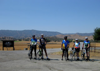
While the rest of our group today chose to head out on Calaveras Road, as far as they could (it's still closed near the dam), I chose to skip that part and head straight up Felter. If I were to combine them, I'd rather tackle Felter first—but that was not their plan.
I was thinking about the time I saw a bobcat sitting upright in a field along this road, and then ...
A bobcat darted across the road, about 20 feet in front of me! Slightly bigger than a domestic cat, with that distinctive bobbed tail—no doubt about it.
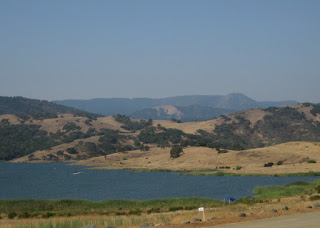
The air was clear, the cloud formations were interesting, the sun was shining. There were turkeys, quail, a snake, and one scrawny tarantula. The scenery looked like an oil painting, the way the light fell on the hills. I chatted with a guy at the summit on Sierra Road. He wondered if there were more vista points (not really). I explained that he'd see the Calaveras Reservoir if he kept driving, but warned him that the road is barely one lane wide, with many blind corners.
Descending back the way I came, I was grateful to be on one of the wider sections when a red Ferrari approached in the opposite lane. I wonder how his drive turned out? There are long stretches where two cars really cannot pass.
And there are times when a single car should not pass, like the place where I boldly took the lane and signaled, palm back, with my outstretched left arm. Because at that moment, a bunch of cyclists were coming downhill in the opposite lane. I pulled to the right when it was safe, only to be yelled at by the eco-driver in the maroon electric vehicle that I'm supposed to stay to the right. [Right.] If you can't safely pass me [3 feet, it's the law] I am going to help you understand that, by taking the lane. It's a pity that you had to wait 5 or 10 seconds to pass. [Seriously.]
A scenic 19 miles with 2,195 feet of climbing. I waved to the rest of the group when I passed them (climbing) as I descended.
Maybe I should have taken that right turn and finished Calaveras ...
September 29, 2018
September 22, 2018
Puzzle Pieces
Not too hot, not too cold, not too steep, but ... not flat at all.
It seemed like a good time to tackle the climb up Loma Prieta, via Mt. Bache. I felt defeated last time, and walked up the toughest section. Today I merely paused, and was surprised at how quickly my heart rate recovered. I've done quite a bit of cycling this week, and have not felt the tiredness I expected after donating blood last Saturday.
Slides have shrunken the roadway to a single lane in places, with no evidence that permanent repairs are planned, much less imminent. It won't take much to wash more of it away—other sections are nothing more than irregular chunks fit together like a jigsaw puzzle. Bicycling over them is enough to make them rattle in place; driving over them must only accelerate the deterioration.
We had a clear view of nearby Mt. Umunhum, but Monterey Bay was lost in the haze.
Having tackled the hard climb, we moseyed through the redwoods along Highland Way. Some stretches have fresh pavement (!), some are cracked and crumbling, and two “natural” speed humps have formed and been marked with bright pink paint and “slow!” warnings—likely by fellow cyclists.
We enjoyed 3,485 feet of climbing over 37 miles on what was likely the last hot Saturday of 2018.
September 20, 2018
Queen Quien
Without trying, it appears that I paused and took two photos today that I shot the last time I rode this set of hills. They were green, then.
We got our mechanical issues out of the way early. One rider realized that he had a loose cleat just as we approached some workers with tools. Then, having made it up the first little bump, I realized my rear tire had gone flat.
This was remedied with lightning speed by my crew [haha]. One guy had the tire partially off the rim before I pulled the tire levers out of my saddle bag. Another had reinflated the old tube and was searching for the puncture. In the process, I learned why it's helpful to shift the bike onto the small rings front and back, which means that now I will remember that I want “small-small” instead of “big-big,” rather than “it's a combination you wouldn't ride, but ... which one?“
My companions, more capable and experienced riders than I, took good care of me. They'd often ride at my pace to chat, and one would circle back to ride a stretch with me. He even made an animated warning of himself at one shady spot to ensure none of us would get caught out by the broken pavement there.
The second climb of today's route is gradual—but long. And the day was heating up (97°F by the time we were done). I loved the seemingly endless views of the golden hills, but I wasn't loving the seeming interminability of this leg. The reward for that suffering was to turn around and descend for almost five miles. My speed took the guys by surprise. “You're one of those riders who gets stronger late in a ride!” exclaimed one (when he caught up to me after a short ascent slowed me down). “No,” I laughed. “It's downhill.” I don't think he believed me.
After loading my bike into the car after finishing 35 miles and 2,950 feet of climbing, I discovered an abundance of goathead thorns embedded in the soles of my shoes. Evidently that was underfoot where I'd parked, and I'd bet that my tire had picked one up at the start of the ride. Almost certainly.
We were here, on this mid-week ride, to attend the next court hearing in the case against the driver who killed Jon in February.
The last time I rode this set of hills, so did Jon.
We will return. And we will never forget.
September 15, 2018
Reigning on Reynolds
It's not just me. Reynolds is the longest 1.2 miles known to man. Or woman. It was unanimous.
That's Ms. C summiting. We all made it, and I was definitely stronger than on my last ascent. Today, I pedaled to the top without pausing. It was hard, but not horrible.
I reserved my photo-taking for the descent. The smoke has cleared out, giving us a birds-eye view of the valley—that's downtown San Jose in the photo, with the Diablo Range in the hazy distance.
And Mt. Hamilton. The domes of the observatory beckoned (though they're likely not too visible in this photo). I need to pay another visit this season, before the weather turns too chilly.
Normally I don't stop on a downhill, but this downhill is tricky (and fast). Autumn is upon us, and the deer are out. I spotted eight of them along the way, including one standing on Reynolds. None of us wanted to be taken by surprise (hence, the caution).
The turkeys were out, too. Four had started to cross the road as we approached, but something in their pea-brains convinced them to turn back. Pro tip: You don't want to collide with a turkey, either.
Later, we stopped to study a small flock; two were perched on the fence before I startled them, hurrying across the road to snap a photo as an ill-timed truck approached.
Technology failed me today, so no map to share: 19 miles, 1,795 feet of climbing. Our group of six was well-matched; all pleased to get out for a healthy (but short) challenge.
September 8, 2018
Baked Buddies
For my 12th ride in the annual Best Buddies Hearst Castle Challenge, I considered opting for the 60-mile route instead of my traditional 100. Although repairs to the Pacific Coast Highway were completed ahead of schedule [when does that ever happen?], the organizers couldn't gamble that the road would be open before the big day. We would trace the same route we followed last year.
We made the long trek to San Simeon and visited some of the local sights after checking in. For the first time, I spotted the resident zebras grazing in the fields below the castle—I've long known about them, but not clearly seen them till now.
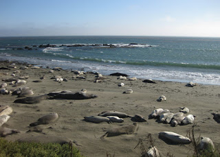
We drove a few miles north to observe the resident elephant seals. The colony was spread around the largest bull I've seen. No doubts about who's in charge.
I wasn't enthused about reprising last year's route, and I imagined that climbing Old Creek Road would be more scenic than Highway 41. I mean, the highway was sort of scenic—this is California, after all—but the back roads are more enticing. I had been similarly tempted last year, but stayed the course.
When I thanked my donors last year, I invited any of them to join me (and expected no takers). Surprise! One of my friends signed up, excited to be tackling her first century. The die was cast.
As the day drew near, I kept a close eye on the forecast. The predicted inland high temperature for Saturday kept creeping up. As we drove to San Simeon, I checked the current conditions in Paso Robles: 107°F. (Yikes.) Neither of us could handle that kind of heat. I nearly bonked at mile 60, last year—and that was not a triple-digit day.
And so it was, with some regrets, that we traded down to the 60-mile route.
There are some stunning views as we head south along Highway 1, but with riders moving fast in a pack there are few opportunities to pull aside for a photo stop.
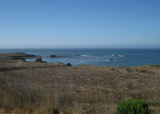
We climbed Old Creek Road from one end to the other. Along the way, there was a great view of Whale Rock Reservoir with the Pacific Ocean in the distance.
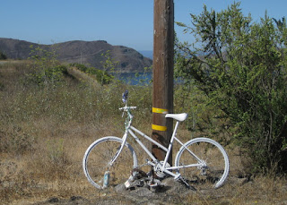
There was more traffic than I expected, with a motorcycle officer from the CHP patrolling up and down. When I saw the ghost bike, I understood.
By 10:30 a.m., it was already uncomfortably hot. Toward the top, I pedaled from one patch of shade to the next (when I could find some). I passed a cyclist immobilized with leg cramps, and others who were walking.
This year, I had no intention of climbing the wall on Santa Rosa Creek Road. The organizers heeded our pleas for mercy and offered Highway 46 as an official bypass option. [Which I would have taken, anyway.]
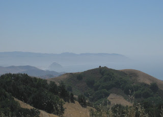
Highway 46 offers expansive views of secluded canyons, the Pacific, and Morro Rock at the mouth of the bay. My descent was especially carefree: during yesterday's drive, we witnessed Caltrans sweeping the shoulder(!). A few pockets of warm air crossed the road, and by the time I reached Highway 1 the cool headwind was welcome. A tailwind would have been even more welcome, but ... dream on.
After crossing the finish line, I enjoyed a late lunch at the beach—watching the pelicans compete for their lunch.
The shorter route (58 miles, 3,220 feet of climbing) gave us ample time to arrive at the barbecue in time for all the speeches and award presentations. And, of course, the band!
Every year we meet new Buddy Ambassadors and are inspired by their achievements: meaningful jobs, sincere friendships, and the confidence to live full lives.
Every year I am humbled by the donations I'm able to collect, and awed by the top fundraisers.
We took a short tour of Casa Grande at the after-party, where I was thrilled to get a close-up view of the resident bats in addition to the usual sights (like Mr. Hearst's office, above). Others in our party were, shall we say ... not so thrilled?
My ride buddy and I made the right call; Atascadero topped out at 101°F. Mother Nature willing, I'll return to the traditional coastal route in 2019—all 100 miles of it.
September 4, 2018
For Jon
The day was clear and although it warmed up in the hills south of Hollister, somehow there was a refreshingly cool breeze. This is how Jon would want to be remembered, we said, riding our bikes in the golden California countryside.
I rarely crossed paths with Jon; he was an accomplished long-distance cyclist, with tens of thousands of miles and 44 double centuries safely behind him. We did ride in the same group in January, when he turned up for a shorter ride (which he, of course, extended).
Before we set out on our bicycles this morning, eight of us made our way to the San Benito County courthouse to be present for the arraignment of the driver who killed Jon on February 19. The driver wasn't there, but we were. His attorney responded to the judge with a plea of “not guilty.” Of course, the man is guilty of taking Jon's life. The legal system must determine whether he is guilty of the precise charge that has been filed against him.
There is a beautiful sheen to the hills when the light strikes them just so.
We climbed Cienega Road from Hollister to Paicines and turned south onto Highway 25. Nothing stands out about the place where Jon lost his life that day. The roadway has no shoulder, but there is ample visibility: that stretch of road is razor-straight. It can be an easy place to drive very fast.
Thanks to the owner of the Paicines Ranch, we expect to place a Ghost Bike nearby, in Jon's memory.
The other riders in our group are much stronger than I am; there were at least two who have completed multiple double centuries—including one rider in the Triple Crown Hall of Fame. On our return to Hollister, I motioned that they should pass me as we approached an uphill grade on Highway 25. “No, this is fine,” they said. And I understood. On this road, on this day, they were my wingmen.
I dug deep on that hill, and managed to average 13.2 mph overall, climbing 1,560 feet over 38 miles.
Know that we will return, and that we will never forget.
September 3, 2018
Mellow Fellows
“You're doing great!” he said, as if I needed encouragement.
Where do I go, with that? I simply smiled. [You have no idea, do you?] I mean, I'm sure my fellow rider meant well.
I wanted a long-ish ride today, and opted for the only “flat” route on our club's calendar.
The riders-who-do-hills and the riders-who-do-not rarely mix it up in our club. Most of the faces were as unfamiliar to me as mine was to them.
We rode out to the Calero Reservoir, where we were approached by a confused minivan driver seeking Mt. Umunhum. [Which you could see, in the smoky distance, from where we stood.] After several cyclists gamely explained how to get there from here (with more turns than she could fathom), I said “Point your navigation system at Hicks Road, and that will take you there.”
I've been part of this movie before. These folks ride well enough, single-file, on a trail. On the road? They're all over the lane, only occasionally taking the hint that “car back” means single-up, and dashing the hopes of any motorist who planned to turn right on red at every traffic signal.
One rider gently chided me for passing him on the right. I apologized, and gently explained that it's hard to pass him on the left when he's not staying to the right. As in, about eight feet from the curb. I take that as comfort with riding two-abreast. Evidently I should not. [I gave him a wide berth, thereafter.]
Maybe I was just cranky today. When I set out, one of the first things I saw was a discarded cigarette that had burned itself out on top of a dried-up pile of needles shed by a redwood tree. How lucky are we that they didn't catch fire! How stupid do you have to be to toss a burning cigarette into the gutter? That's beyond careless.
When we stopped for a snack break, I approached a new-to-the-club rider. “Before we leave, let me help you adjust your helmet.” None of the other dozen riders in our group noticed, apparently, that her helmet was completely askew and tilted back on her head. “That feels much better!” she exclaimed.
It's the little things.
I tacked on a moderate hill climb at the end, finishing with 41 miles and 1,160 feet of climbing.
Subscribe to:
Posts (Atom)


