May 24, 2017

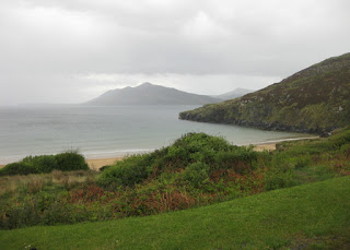
Mabie Forest

My first job was in a bookstore: as a voracious reader, they saw me so often they offered to hire me. Here we were, in “Scotland's National Book Town” (Wigtown); how could we leave without visiting any of the shops?

Front of The Book Shop, Wigtown, Scotland
The catch was that today's route would be our longest (100 km); normally we'd be rolling by 9:00 a.m., but the shops wouldn't open before that. Our guides heard our pleas: we rode into town, agreeing to rendezvous to begin our journey at 10:00 a.m.

Some years ago, I admitted that the best treatment for my book-buying habit was not to buy more bookcases. The contemporary approach is electronic, and having once run out of reading material while visiting a small town, many years ago, I appreciate the merits of the e-book. The Book Shop was well-stocked with both books and attitude.

Destroyed Kindle mounted on a plaque. Brass plate reads: Amazon Kindle, Shot by Shaun Bythell, 22nd August 2014, Near Newton Stewart
On this trip, I had brought along a paperback novel with every intention of leaving it for someone else to enjoy. I was delighted to choose another title from a hotel's community shelf, in trade. (Iris Murdoch. Why not? I haven't read any Iris Murdoch.)

It was cloudy and cool, and thankfully—dry. Despite the distance ahead of us, I was relaxed. Finally, I could feel that my fitness was ramping up. Too bad I wasn't in this shape before the trip started ...

View looking away from the ravine at Glen of the Bar, near Talnotry, Scotland
We stopped at a vista point overlooking a steep ravine at the Glen of the Bar. I was surprised to see a lot of logging, even on the steep hillsides; but evidently the trees had been planted—not native—and are dying. On this next-to-last day of riding, I finally remembered to keep my water bottle at hand, so it wouldn't get topped off prematurely (diluting my electrolyte mix).

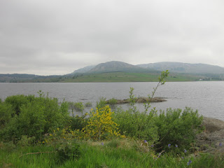
View of  Clatteringshaws Loch with distant mountains, Clatteringshaws, Scotland
We passed a few lakes today, and stopped for lunch at the Clatteringshaws Loch visitor center. The roadway was rough, in preparation for resurfacing. Our timing was either well-planned (or lucky), because the road would be closed to all traffic for two days—starting tomorrow. (Yikes.)

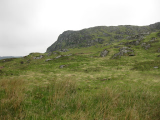
Rocky outcropping and fields, Galloway Forest Park, Scotland
As we cycled quietly through the woodlands of Galloway Forest Park, we saw cautionary signs about the red squirrel (but no actual squirrels). Some of us spotted a couple of wild goats, and were excited to sight several red kites in flight, above us.

Gas pipeline being laid through fields, Galloway, Scotland
We were managing to keep up a good pace today, with a hope of making a late-afternoon stop at a farm shop (despite our late start this morning). We passed through an area where a new gas pipeline (linking Ireland and Scotland) is being dug into the fields. We often found ourselves on one-lane rural roads, crossing paths with giant tractors. I must say that, throughout this trip, I've shared the road with polite and patient drivers. Not one toot of a horn. Not one microaggressive acceleration.

On the bike path near Newton Stewart, Scotland
We traveled a stretch of EuroVelo 1. The routes programmed into our Garmins kept us on course, though (amusingly) sometimes provided guidance like this: “Continue to Road.” [Uh-huh.]

Bike route sign for EuroVelo 1 and National Route 73, near Newton Stewart, Scotland
We paused in Laurieston at a roadside memorial to the novelist S.R. Crockett. Really, you just never know what you'll find along the way; there's nothing like a bicycle to lead to such discoveries. Curiously, the accompanying placard included an illustration of a man pedaling a large trike, with a child in front (the author, and his daughter)—evidently from his book Sweetheart Travellers.

Illustration from the book Sweetheart Travellers, by S.R. Crockett, 1895.
Conversation over dinner one night had turned to “How many bike jerseys do you have?” [Uh oh ... I don't want to answer that.] Before I fell asleep, I worked up a tally. [Um, quite a few .. and now one more.] We all had a new Wilderness Scotland jersey, but some riders were keen to add more local color to their collection, so we visited  a bike shop in Castle Douglas.

There were two things I enjoyed about our brief visit to the town. First was an electronic sign that flashed their speed at drivers exceeding the limit—but lit up with a bright green smiley face as I approached. Second was this sign in the bike shop's window, which sums things up quite nicely:

Handwritten sign in bike shop window, "You can't buy happiness but you can buy a bike and that's pretty close", Castle Douglas, Scotland
I was intrigued by another sign, promoting a specialized financing program for purchasing bicycles and related gear: Ride It Away. If money is an obstacle, you might take out a loan to buy a car; why not a bike?

Water traveling through stream-side sculpture, Loch Arthur Creamery and Farm Shop, Beeswing, Scotland
We rolled into the parking lot at the Loch Arthur Creamery and Farm Shop with ample time to relax on their patio with our cakes and cookies and pots of tea, content to know that we were a short distance (a little over seven miles) from finishing our ride.

Stained glass window depicting a woman in medieval dress on a white horse, Mabie House, Mabie Forest, Scotland
The day ended with one final climb to our hotel, and much excitement for those in the group who had just completed their first-ever 100 km ride. For me, this was the longest ride of the year to date: 100 km (62.4 miles), with a modest 2,505 feet of climbing.

Blue sky and rolling green hills, Galloway region, Scotland
If this adventure has a theme song, it was part of Sunday's road-trip playlist: The Acoustic Motorbike (Luka Bloom):
I never thought I could have come this far
Through miles of mountains, valleys, streams
This is the right stuff filling my dreams
Trees and blooming gorse on the front lawn, Mabie House, Mabie Forest, Scotland
Exactly.

May 23, 2017

Wigtown

Hawthorne bushes blooming along the coast, Giant's Causeway Coastal Route, Northern Ireland
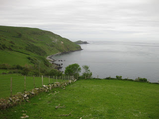
We set out along the Giant's Causeway Coastal route, pausing along the way to admire the beach and views of the chalk cliffs at White Park Bay.

Beach and chalk cliffs, facing west, White Park Bay, Northern Ireland
What's not to like about views of the sea? I do love the mountains, but if I had to choose just one, it would be the sea.

Basalt outcroppings, facing east, White Park Bay, Northern Ireland
We had our morning tea at a waterside park in Ballycastle.

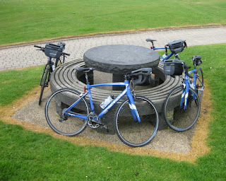
Bicycles encircling a picnic table, Ballycastle, Northern Ireland
On this cloudy day, we had the place to ourselves.

Sculpture of soaring birds, Ballycastle, Northern Ireland
When our guides joined us at the lunch table yesterday, they remarked that we seemed awfully quiet. “That's because we just reviewed the description of tomorrow's ride. Toughest cycling road in Ireland!” it says. They looked at each other.

The Torr Road. It started out gently enough.

Rollnig along the Torr Road, Northern Ireland
They're always scenic, these climbs. I declined the offer to ride in the van. It was cloudy, but not raining; and the steep section (16% grade) was short. I walked, until it leveled out a bit. Luka Bloom's lyrics played in my head:
Ah go on, get up on your bike.
The switchback ahead was steep, but I'd get there faster if I pedaled.

And if I pedaled, would I make it? My legs were as balky as yesterday. I dug deep.

The van was parked above. “It's clear, you can go wide!” shouted our guide.

Instead of walking, with great determination, I pedaled. I powered up one steep bit, at last!

I was, of course, off the back again. Fragments of Irish fiddle tunes (the soundtrack during Sunday's long drive) played in my head, and helped me keep turning the pedals. [Note to self: listen to more of those.]

View of the North Atlantic along the Torr Road, Northern Ireland
One benefit of climbing slowly is all the time you have to admire the view. And here, there were plenty of views to admire.

I drew closer to some cyclists who had stopped ahead; close enough to see that they were not part of our group.

“Are you the lady from California?” one asked. (Evidently they've met the rest of our group.)

“Near San José,” I replied. One of them pointed at his arm warmers: San Jose Bike Club. And then, things got really surprising. He noticed my club jersey ... he was wearing a different one. We are members of the same bike club. What are the odds, that we happen to be on the same remote road in Northern Ireland, on the same day, at the same time? It's been years since we've crossed paths on a ride in the Bay Area, as he's a much stronger rider than I am.

pep and Rick meet on the Torr Road, Northern Ireland
Just as I was getting back on the bike, our guide circled back to find me. With a little more climbing ahead, he gallantly offered to take my handlebar bag. “People pay money to shed that much weight from the bike.” I handed it over. “I'll try to keep up on the descent,” he joked. (My reputation has been solidly established.)

We were on the clock again today, as we had to catch the ferry that would take us to our fifth and final country, Scotland.

Rocky beach near Milton, Scotland
To reach our destination for tonight, Wigtown, we cycled 20 miles across a peninsula. Along the way, right next to the road, was the Torhouse Stone Circle.

Granite boulders of the Torhouse Stone Circle, near Wigtown, Scotland
Whenever I visit an ancient historic site by bicycle, I can't help but wonder what its people would make of us and our machines. And wonder at the labor (and the thought) that went into the creation of this monument, during a time when it would seem a luxury to do anything more than the work needed simply to survive.

Stone walls and green fields under a deep gray sky, before dusk, Wigtown, Scotland
Our longest day, so far: 52 miles, with 3,350 feet of climbing.

Black and white cat perched on stone windowsill, Wigtown, Scotland
Yet, I was not eager for this day to end.

May 22, 2017

Giant's Causeway

The sun lingers late, this far north, during the summer months.

Shoreline at dusk, Portballintrae, Northern Ireland
Which afforded us the opportunity for a bonus post-dinner excursion to a very special place—the Giant's Causeway—a UNESCO World Heritage site.

Rocky coastline with basalt columns, Giant's Causeway, Northern Ireland
Panoramic image of towering basalt columns, Giant's Causeway, Northern IrelandI saw my first volcanic basalt columns last year, when I visited Yellowstone National Park. Here, they were more varied and accessible ... and particularly striking at dusk.

Looking at the landscape now, I can't imagine the volcanic violence that formed these towering columns (about 60 million years ago).

Even more so, given that despite the work of waves and weather over the millennia, some 40,000 columns remain.

Wildflowers find their footing in the crevices and hint at the size of these rocks.

Pink and white wildflowers, and lichens, tucked into the tops of basalt columns, Giant's Causeway, Northern Ireland
The perspective is much more clear at human scale.

Two people climbing up the tiers of basalt columns, Giant's Causeway, Northern Ireland
Before it finished setting over the North Atlantic, the sun tinted sea and sky in shades of gold and pink and lavender.

Sunset colors reflected into pools and puddles, Giant's Causeway, Northern Ireland
How very fortunate were we, to bask in this place and time.

Deep shades of gold, pink, and lavender after sunset, Giant's Causeway, Northern Ireland

Portballintrae

More rain to start our day. So it goes.

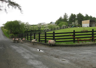
Sheep on the road, in the rain, near Buncrana, Ireland
We shared the road with a few sheep (and a lamb); they kindly kept to the left side of the road.

This was day seven of our trip, and despite our recent rest day, my legs did not want to climb. Did. Not. Want. To.

Being way off the back again, I was feeling like I should call it a day at lunchtime. The prospect of biking 48 miles was daunting.

Approaching Mamore Gap near Owenerk, Ireland
We were headed for another steep climb, up Mamore Gap. Photos never do justice to the slope—we're headed for the V-shaped notch, and around the bend the road goes more or less straight up. I recorded a grade approaching 19%, though this report suggests it maxes out at 22%. In other words, I was doomed. I took a deep breath and pedaled until I couldn't; then, I walked the steepest 4/10 of a mile. Only one rider, and our guide, pedaled the whole way up.

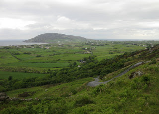
View of the North Atlantic and twisty descent from Mamore Gap, Ireland
The descent was technical, and wet, so I took it easy. If you look carefully, you will find a tiny dot of a cyclist (above the big rock) descending a twisty, steep bit. Looking back when we reached the fields below, the skies grew darker and darker: we were lucky to get through the Gap before the downpour.

Looking back up the road to Mamore Gap from the north, Ireland
Somehow, I didn't get the memo about where we would have our tea break, and the van was not visible from the road. I assumed that everyone was ahead of me; I did catch another rider at an intersection, where we decided to pause. Our guide appeared (somewhat breathless), to reel us back in. We backtracked to find the van at a parking lot for the Glenevin Waterfall. We didn't have time for a hike to see it, so we just enjoyed our tea and sweets.

Inside a McGrory's Pub, Culdaff, Ireland
The rain found us when we stopped at a pub for lunch (cycling—it's all about the food). Have I mentioned that our guides also wipe our saddles dry when we're ready to get back on the bikes? [Yes, they do that.] They talked me out of abandoning into the van at this stage; the drive would be long, and they assured me that the climbs ahead were gentle.

Clouds looming over Greencastle, Ireland
We rolled into Greencastle, where we would meet up with the boat that would take us across the edge of the North Atlantic to our fourth country, Northern Ireland. There was enough time to warm up with our favorite libations, each to his or her own: hot chocolate, tea, Guinness ... I was amused to find USB ports installed under the bar top, for patrons to charge their phones.

Bikes lashed to the back of the boat for crossing to Northern Ireland
Bikes and people were loaded onto the boat, lifejackets were donned, and tales were told by the captain: How the British army used to play rugby on the sand bar we were skirting, at low tide. How the Royal Portrush Golf Club (visible along the shore) will host a championship in 2019.

Home to Portrush boat for the 2017 Atlantic Challenge, Portrush, Northern Ireland
There was an unusual boat in the harbor at Portrush; our captain didn't think much of their maritime skills and gave them a wide berth. It was the vessel that the four-man team “Home to Portrush” plans to row in the 2017 Atlantic Challenge. [Yes, they plan to row 3,000 miles across the Atlantic Ocean.]

Cyclnig along the coast, Portrush, Northern Ireland
Having biked some 41 miles, what's another seven? [Sigh.] Not much climbing, I was promised.

It was worth it, from the coastal promenade, to the ruins of Dunluce Castle.

Remains of Dunluce Castle near Portballintrae, Northern Ireland
It's a personal foible, to imagine I'm capable of less when I really can do more. Today, for example: 48 miles, 2,940 feet of climbing.

May 21, 2017

Buncrana

There is still some land in Ireland that's farther north than we would travel today, but nonetheless we traversed an area that is not frequently visited.

Four cyclists from the Cill Chluana Wheelers refueling, near Armagh, Northern Ireland
We packed up for a long drive to our starting point, near Sheephaven Bay. Some chaps from a local cycling club (Cill Chluana Wheelers) were refueling at the same place where we stopped to refuel the van.

Amazingly, we happened to be in just the right place at just the right time to catch the start of one of the races in the Emyvale Cycling Club Grand Prix.

Car leading cyclists in the Emyvale Grand Prix, Emyvale, Ireland
Being here, I already had seven-time Irish Champion Ryan Sherlock and his wife Melanie Spath on my mind; as visitors, they have dominated a few of our Low-Key Hillclimbs. Evidently Melanie won the 2012 Emyvale Grand Prix women's race! For us, she set a new women's record on the Mt. Hamilton Low-Key Hillclimb in 2010—which she bested in 2015.

Outward view through an arched doorway, Doe Castle, Sheephaven Bay, County Donegal, Ireland
We had a chance to roam through what remains of Doe Castle, dating back to the early 16th century, before enjoying our picnic lunch on the grounds. The rain came down just as we were ready to begin our ride.

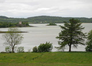
View of Doe Castle from the east side of Sheephaven Bay, County Donegal, Ireland
We found shelter in the little snack bar onsite and chatted with the family who tended it. We set their little boy off in a fit of giggles with our American and Canadian accents. [It took just one word: “cow.”]

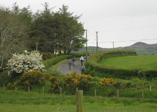
Our cycling group descending a hill flanked by stone walls and blooming hawthorne and gorse, near Ballymagany Lough, County Donegal, Ireland
Eventually we started riding up the Fanad Peninsula ... in the rain. The hills were pleasantly rolling (not steep!), and the rain came and went. A distinctive bird call spilled out of the nearby woodlands: Cuckoo! Cuckoo! Our guide schooled us in their parenting approach: Mom deposits her egg in another bird's nest and flies away. Once hatched, the interloper sometimes crowds the foster parents' own chicks out of the nest.

South of Portsalon we joined the signposted scenic drive route, which we shared with very little traffic until ... Ballymastocker Beach.

Snack break at Ballymastocker Beach, County Donegal, Ireland
There we stopped for snacks, with a view toward the lovely bit of pavement snaking along the edge of Knockalla Ridge (also known as the Devil's Backbone).

Unfortunately, some local lads were keen on time-trialing their way around the curves, tempting the devil ... in their hotrods.

I was not keen on sharing the road with them.

My blue Merida Ride 400 parked in a blue bike rack shaped like a fish, Ballymastocker Beach, County Donegal, Ireland
The lovely blue bike rack beckoned ... where better to park my shiny blue bicycle?

And then came the rain. When would I be happy to ride in the rain, ever?

Today. The rain got heavier, the road got slicker, and the boys turned tail and drove back to town.

View of Ballymastocker Bay from the road above, County Donegal, Ireland
It was a bit windy, and the rain came and went; still, it was worth pausing to take in the view of Ballymastocker Bay and the beach below.

View of the road below and Ballymastocker Beach and Bay, County Donegal, Ireland
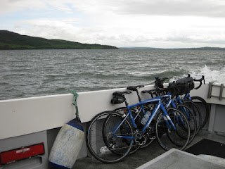
We made our way to Rathmullan, on schedule to load cyclists and bikes onto a fishing boat for a shortcut across Lough Swilly to the Inishowen Peninsula.

Bikes stowed on the Enterprise fishing boat, crossing Lough Swilly toward Inishowen, Ireland
Once across, it was a quick ride to our lodging at Buncrana. For the day, a scenic 29 miles with 1,820 feet of climbing.