November 28, 2014

Eleven at Eleven

Do I know my fellow cyclists, or what?

Dry bed of the Guadaupe Reservoir, San Jose, California
The day after Thanksgiving is not for shopping; it's for burning off some of yesterday's calories. (Turkey, stuffing, gravy, mashed potatoes, veggies, pie.)


Six riders joined me for a little trip up Mt. Umunhum. We took the direct approach on Hicks Road from the west. The painful approach.

Surprisingly, it was a vest-and-arm-warmers kind of day; we're having a late (very late) November spell of warm weather. I expected little traffic on the back roads, but I was surprised to see no wildlife—especially after seeing so many deer just two weeks ago. Maybe they had the day off, too?

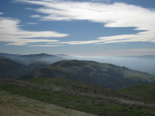
We reached mile 11 at 11:00 a.m., having already climbed some 1500 feet. I was especially proud at how well I'd climbed Hicks after two guys reported that they'd needed to stop on the way up. I remember trips up Hicks that required multiple stops. I remember weaving up the hill like a paperboy. I remember the first time I climbed it, when I asked a passing rider how much farther it was to the top and told him it was okay to lie to me. None of that, today; I pedaled right on up, keeping my heart rate in check. (Peaked at 178 bpm.)

Climbing Mt. Umunhum ... well, that's another story. I remembered not to be tricked by the first steep bit. There, anticipating more of the same around a sharp bend, I have often paused (prematurely). Just stay with it, the grade relents on the other side.

The next steep bit is longer—almost half a mile. I wimped out, pausing to get my heart rate back into a more comfortable zone. A passing rider encouraged me: “Good job!” he called out.

A couple of riders had been chided by a ranger for riding up to the White Line of Death. [Pshaw!] Really, there is nothing wrong with going that far—even more so now that we know that the true boundary is above it. I had expected to stop at the new boundary line today, but decided not to risk a contentious exchange with The Authorities.

View from the White Line of Death, Mt. Umunhum Road, Santa Clara County, California
I paid my respects at the line before dropping the short distance to the downhill side of the lower pair of “No trespassing” signs—shortly before said ranger reappeared. She couldn't fault us, but still felt compelled to warn us about respecting private property, the “rough” nature of the locals, etc., etc. She continued down the hill and stopped again, out of sight, evidently waiting to confirm that we were heading down (not up). She continued to hover, shadowing us to the gate and watching us leave.

We're not the vandals who spray graffiti on the pavement. We're not the criminals who cultivate weed in the hills. Hooligans in spandex, we are; riding our bikes up the crumbling pavement because ... we can.

Used about 1400 Calories climbing some 3,695 feet over thirty miles. There's another piece of apple pie with my name on it.

November 23, 2014

Urban Wilderness

Looking at this dreamscape, you wouldn't guess the view at your back: San Jose, the bay, all the way to San Francisco (and beyond). Following a rainy day, I expected the skies to be crystal clear—not magically misty.

Sierra Road ramps steeply at the start. Whose idea was this? [Oh, wait ... it was my idea.] It would be difficult enough without the visual intimidation factor.

We seemed to be the only cyclists climbing Sierra today; that's a first. Birds were chirping, cattle were lowing, sirens were wailing. Sirens? Evidently some emergency was unfolding in the urbanized world below us. I began to wonder if they were heading up the hill after us, they blared for such a long time.

Until you pass the summit, you don't really leave civilization behind. Roadside litter is ever present, and the scourge of graffiti is a vivid reminder: the vandals' marks have been blacked out on the pavement, so they tag the fenceposts. It was most disheartening to see the huge tree they scarred with paint.

Trails are marked at the top, now that there is a parking lot for the Sierra Vista Open Space Preserve. I snagged a brochure for a future hike. With names like “Upper Calaveras Fault Trail” and “Lower Calaveras Fault Trail,” it is easy to understand why the land is so rugged.

More than 2,100 feet of climbing over 17 miles: a tidy sum.

November 20, 2014

Stayin' Alive, Take Two

Wet Strida illuminated by my headlight (400 lumens).
The first thing I noted about riding my trusty little Strida in the rain was that the fenders were less than effective. The rear fender's mud flap was lost some time ago, but tonight I was getting sprayed from the front. [Upon later inspection, it appears that the pliable plastic fender is somewhat warped to one side.]

I regretted not biking to work yesterday, when the threatened rain never quite made it over the coastal hills. Given that the roads were wet this morning, I opted to ride the commuter shuttle instead of making a mess of the commute bike. With a 50% chance of evening rain, I took a chance and chose the Strida over striding to the bus stop.

I lost the bet. [Ah, well. Once you're wet, you're wet.] It's only 1.6 miles.

I could shave the trip to 1.2 miles, but that requires biking on a busy local thoroughfare: mostly two lanes in each direction, separated by a median. The problem with that route are all the distractions. My bike is well-lit, but I'm a small fish swimming in a sea of bright lights: signs for businesses, traffic signals, pedestrian signals, street lights, vehicle lights.

The longer route is safer: it passes mostly through residential neighborhoods. In the darkness, I stand out: reflectors on wheels, pedals, and rear rack, reflective sidewalls on my tires, a reflective stripe down the front of the bike, reflective stripes on my messenger bag. Of course, none of that counts until some light source bounces back. So, I have a blinking white light on my handlebar. Two more blazing lights will encourage you to avert your gaze: a blinking red taillight (35 lumens) mounted on the rear rack, and a powerful headlight mounted on my helmet. Motorists give me a lot of space, at night. If they see me.

I watched the car heading through the church's parking lot, toward the exit. In self-defense, I slowed my pace and focused. I was the only moving thing on the street. In the bike lane.

She's not looking.

She's not looking.

She's not going to stop.

This is how cyclists die.

The driver pulled out directly across my path, making a left turn while staring exclusively to her right. She didn't even glance to her left until she was into the street, shocked [I can only imagine] by 400 lumens in her face. At close range.

Disc brakes, in the rain, for the win. They stopped the bike.

After I took a deep breath and resumed pedaling, I heard:
I'm so sorry. I'm so sorry.
She had stopped her car down the street and lowered the window to call out an apology.

I'm sorry, too. I'm sorry that the State of California saw fit to award you a driver's license.

November 16, 2014

Girlfriends

Some people prefer to bike with their club. Some people prefer to bike with their friends. [Do both, I say!]

Four does grazing at the edge of woodland.The ride calendar offered many choices. Long rides. Fast rides. I needed a just-right ride.

I knew that one of my regular ride buddies would join me; beyond that, you never know who will show up.

Surprise! We had an unexpected five-girl outing.

“Don't wait for us, we may not go all the way to the top,” two of them cautioned. [They insist that I'm a fast rider.]

A Sunday morning ride can be especially quiet. We spotted a flock of turkeys in a field, then encountered a fine buck standing his ground in the middle of the road. He proved camera-shy when we stopped to admire him. The local does were more skittish.

Ten does, five women, 18 miles, and 1,900 feet of climbing. Everyone made it to the top, with cheers and congratulations.

November 12, 2014

101

Not the freeway (U.S. Highway 101).

Not an academic course number (though “Commuting 101” would fit).

Cyclist emerging from the fog at the far end of a bike/pedestrian bridge.
Number of trips to the office by bicycle this year, as of today: 101.

Most trips involved returning home by bicycle, but since we reverted to Standard Time I rely on a commuter shuttle for most of the evening trip. [Less than two miles in the dark, versus twenty.]

Most trips are routine, but there have been some memorable moments in those 3,500 miles.

In the past few weeks, I surprised a covey of California quail crossing a road: one ran, the others actually took flight!

I have ridden from sunshine into ground fog so thick I couldn't see either end of a bridge from its center.

Coots nibbling on breakfast alongside the trail.
When I take the scenic morning route through the park, I can expect to thread my way through a flock of coots.

I had a close call with an idiot on a heavy electric bike who rounded a corner at speed into the bike lane. He didn't even glance to his left, much less heed the stop sign. [At the next traffic light, I gave him a piece of my mind.]

My Squirrel Scare Tactic elicited a “Nice trick!” compliment from a nearby cyclist. “Tsssss!” I hiss, loudly. This reliably sends the pesky rodent running, at warp speed, in the opposite direction. [Try it!]

For those increasingly common electrified pests ... an AirZound, perhaps?

November 8, 2014

WLOD

An historic day in the annals of Bay Area cycling: With permission, our Low-Key Hillclimbers finished at the highest accessible point on Mount Umunhum—the fabled White Line Of Death.

Bicycle downhill from the White Line Of Death on Mt. Umunhum Road, Sierra Azul Open Space Preserve, Los Gatos, California
There are clear “No Trespassing” signs planted below the line, which marks a border between the Sierra Azul Open Space Preserve and private property. The “line” itself is a broad stripe across the pavement, plainly visible in satellite images. The white is aging to gray, but it's definitively edged in red.

I have climbed to the line before, but always felt uneasy about lingering. The view is better lower down, anyway. (The best view would be at the top, but we can't go there ... yet.) My volunteer post today was at the line, affording ample time for some amateur archaeology before the first cyclists arrived. Till now, I had never noticed the fading messages broadly stenciled in red on the white background.

The oldest warning was “NO TRESPASSING,” the paint now barely discernible. Subsequent additions included “NO HIKERS” and “NO BIKES,” accompanied by an image of a bicycle with a giant “X” through it. It takes some careful study to see all of that, but it's there. For now.

There is a brand-new parking lot (and pit toilets) at the trailhead for Bald Mountain, but the gate controlling access to the upper road is still in place. And locked. Except for today, when we were fortunate that a landowner opened it and granted the bicycles free passage up the road to The Line—no need for riders to dismount and thread through the narrow pedestrian opening.

It turns out that the area was recently re-surveyed, as work progresses toward opening the top of the mountain for public access, and the actual property line is a bit higher up the hill. [Bwa-ha-ha.] The signs will move, and perhaps a new white line will be painted. The original WLOD will disappear sooner (if they choose to black it out) or later (when they resurface the road, someday).

Today, it marked the finish for 119 cyclists tackling one of the toughest-rated hill climbs in the Bay Area.

November 2, 2014

Take a Hike

So many trails, so little time. Local parks, county parks, state parks, national parks, and open space preserves—oh, my! We grumble about Bay Area traffic and population density, but we are consoled with an abundance of wild land to visit. Each year, the acreage tends to expand when another generous landowner chooses preservation over development.

Trees arch over the John Nicholas Trail and a mossy boulder in Sanborn County Park.
Biking on back roads, I pass the occasional remote trailhead begging to be explored. Some sites mock the would-be hiker, offering no nearby parking. Others might have space for one or two vehicles.

A small forest sprouts from a long-fallen tree along the John Nicholas Trail in Sanborn County Park
In the company of some well-seasoned trekkers, I was introduced to one of these special places along Black Road today—the John Nicholas Trail in Sanborn County Park, including a portion of its newest segment.

Lake Ranch Reservoir in Sanborn County Park is nearly dry.
A Great Blue Heron ruled the Lake Ranch Reservoir—what was left of it, anyway. Signs that prohibit boating and swimming seemed, well ... beside the point. Above the reservoir, we climbed more switchbacks through the forest, turning back after 90 minutes to cover seven miles in our three allotted hours.

We didn't quite make it to some promised boulders and vistas. [I was slower than the main group. Big surprise.] Save it for another day.