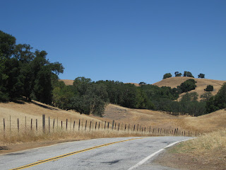
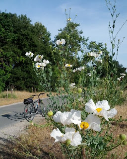
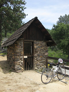
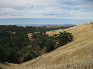
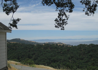
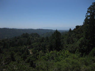
We gathered today to bid farewell to a club member who is moving back to the Pacific Northwest. There could be no better send-off than a group ride (and, of course, lunch). My ride buddies and I got a head start; the rest of the group caught us at the top of the first significant climb. Lagging behind after that, we managed to arrive in time to catch the lunch party winding down.
More often than not, I have seen deer in the brush as we pass from Sveadal into Uvas Canyon County Park. Today's encounter was exceptional: a multi-point buck and his doe stopped to study us as they crossed the road. Fortunately I have only met them while climbing this stretch.
The water level in the Chesbro Reservoir is at 4.8% of its capacity. If the people who drench their lawns with drinking water saw this, would they finally let their grass turn brown?
Fresh arrows on the road and a red silhouette of the Statue of Liberty suggested that an organized event was underway. We met three riders following the course of the Morgan Hill Freedom Fest Bike Classic. “The guy at the rest stop said this just kind of rolls,” one complained at the top of Willow Springs. I smiled and reassured them that they had ascended the easier side and could look forward to a nice downhill. (Before climbing Llagas. I didn't mention that.)
Whereas we were (not) looking forward to the stiff headwind we would face on our return to San José. It is ever so. Relentless. Eleven miles. A truck hauling tandem trailers stacked high with bales of hay briefly sucked me toward the lane of traffic as it passed, and I caught an unexpected taste as stray pieces swirled around me.
Some 51 miles with a modest 2,085 feet of climbing through the redwoods and golden hills of summer. I would not want to relocate.
June 28, 2014
June 27, 2014
Laurels
Years ago, when I was relatively new to cycling, I sought out a bike fitter to address worsening knee pain. He made the proper adjustments and asked about my riding habits. When I told him that I biked only on weekends, he explained that I was essentially starting over (fitness-wise) every week.
Not being an early bird, I could not imagine rising before the sun for a workout before heading to the office. And it would be so easy to talk myself out of an after-work ride. My best option was clear: ride my bike to work. I typically made the effort a couple of times per month, which did pay fitness dividends.
Last year I set a personal record for bicycle-commuting to work by averaging one ride per week. This year I decided to up my game.
What if ... what if my preferred method for commuting to (and from) work was bicycling? I am a fair-weather rider, but in the Bay Area we are blessed with an abundance of fair weather.
Which brings me to today: rounding out 1,825 miles of bicycle commuting with trip number 52. Halfway through the year.
Time to rest on my laurels? (I think not.)
June 21, 2014
Six-Pack
Last year, I set a new personal record for the number of times I commuted to work by bicycle. New year, new goals.
In the morning, I can bike to a shuttle bus and step off in front of my office (door-to-door, typically 60-65 minutes). Or I can simply bike the whole distance (typically 85-90 minutes). Don't get me wrong—I am extremely grateful for that shuttle. But I rather like being on my bicycle more.
In anticipation of a hard ride each Saturday, it was my habit to “save my legs” by riding the bus on Fridays. Until I reached a certain level of fitness [thanks to all that cycling], and realized that a Friday ride really didn't set me back.
A steady breeze and high thin layer of clouds made for a perfect day to head for Henry Coe State Park. I remember visiting this park for a hike many years ago, and thinking that cycling up there from the valley was crazy, or impossible, or both.
Which leads me to today: my sixth consecutive day of cycling. Up Thomas Grade. Up Dunne Avenue. Fourteen miles to the picnic table at the visitor center.
I earned that view, with some 3,400 feet of climbing over 28 miles (out and back). Wrapping up the week with 12 bike rides, covering 225 miles with 8,250 feet of climbing.
Thank you, Sada. Admiring your beloved hills from Pine Ridge does bring peace to my soul, every time.
In the morning, I can bike to a shuttle bus and step off in front of my office (door-to-door, typically 60-65 minutes). Or I can simply bike the whole distance (typically 85-90 minutes). Don't get me wrong—I am extremely grateful for that shuttle. But I rather like being on my bicycle more.
In anticipation of a hard ride each Saturday, it was my habit to “save my legs” by riding the bus on Fridays. Until I reached a certain level of fitness [thanks to all that cycling], and realized that a Friday ride really didn't set me back.
A steady breeze and high thin layer of clouds made for a perfect day to head for Henry Coe State Park. I remember visiting this park for a hike many years ago, and thinking that cycling up there from the valley was crazy, or impossible, or both.
Which leads me to today: my sixth consecutive day of cycling. Up Thomas Grade. Up Dunne Avenue. Fourteen miles to the picnic table at the visitor center.
From out of the hills would come the peace of one's soul and food for the power of thought.Sada Coe Robinson donated the ranch to Santa Clara County, for a park. A few years later, it became a state park.
I earned that view, with some 3,400 feet of climbing over 28 miles (out and back). Wrapping up the week with 12 bike rides, covering 225 miles with 8,250 feet of climbing.
Thank you, Sada. Admiring your beloved hills from Pine Ridge does bring peace to my soul, every time.
June 14, 2014
Look and Listen
Driving to the start of today's ride, I passed a pair of vagabonds pushing carts stuffed with their belongings. It was hard to imagine the route they must have followed to reach that point near the highway. A few minutes later, we were startled to see that they had continued their trek down to the highway and were heading south. On one of California's most dangerous roads.
Anticipating that this journey was likely not to end well, I was about to call the highway patrol when a motorist stopped and began to load them and their stuff into his car. The highway patrol appeared in short order, offering some measure of safety with the cruiser's flashing lights.
As our group assembled, a large bird soared overhead. A bird with a distinctive white head and tail. “Eagle,” I exclaimed. “It's a bald eagle!” People were busy chattering away. No one looked up.
We regrouped at a popular park. As one of my ride buddies sat on the ground to apply more sunscreen, a toddler came along and was transfixed. She seems to have some magical effect on men, having shared one improbable tale after another. [Talk about robbing the cradle!] Mom had to drag the little tyke away.
Climbing Rodeo Gulch, I saw a plant that I had first seen near the coast last week, a tall green stalk bearing large yellow flowers. I vowed to stop for a photo of the next one ... and, there were none. The summit afforded a view clear to Monterey Bay.
Overwhelmed, the blue-haired millennial at our lunch stop could not take our orders (much less our money) as fast as the sandwich maker could produce them. A couple of guys started asking about the history of Mountain Charlie.“We'll pass his cabin near the summit,” I explained. They didn't hear me, as they chattered about the 19th century bear fight and the plate in his head.
As we climbed along Bean Creek, I spotted a turkey perched on a fence. The bird was so still I mistook it for a statue at first. My ride companions were chattering away, but they did turn their heads in the direction I pointed.
Two unexpected sights awaited me on Mountain Charlie. As I rounded a bend, there were the vagabonds, with their dog and their carts, heading down the hill! They could never have guessed that our paths were crossing for the second time today. And at the summit, I found the whole group waiting patiently for me, despite their head start after lunch (not to mention their speediness). They were, not surprisingly, chattering away.
For the day, 51 miles with 4,520 feet of climbing, with so many sights unshared. Till now.
June 9, 2014
The Valley Formerly Known As
 Once upon a time, the fertile acres of the Santa Clara Valley were dubbed the Valley of Heart's Delight. But like so many others, it was Silicon Valley that drew me here. Our industry has transformed the world, leaving scant traces of the valley's rural past.
My bicycle has taken me through the less developed land of nearby counties: Santa Clara, Santa Cruz, Monterey, San Mateo, Alameda, Marin, Napa, Sonoma, Stanislaus, San Benito, San Luis Obispo. [I get around.]
The back roads meander through wild land, with deer and coyotes, turkeys and towering redwoods. They also cross farmland, with horses and cattle, fields of berries and grapes, lettuce and cabbage. There aren't many orchards left.
They took all the trees
Put 'em in a tree museum
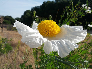
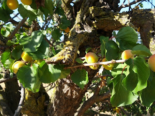
My bike route to (and from) work varies little; for the past two years, the final stretch to the office is a 4-mile segment of a multi-use trail. By now, I have passed the sights along the trail more than 150 times, and learned to identify some of the native flora. Dazzled by the trailside Matilija poppies and California flannel bushes, three or four gnarled and stubby trees were easy to overlook.
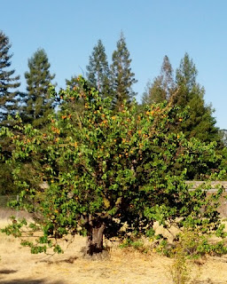
Here, between the right-of-way for high voltage transmission lines and the freeway, are the remains of an orchard. A couple of trees, abandoned and neglected for decades, are studded with tiny apricots. Intensely flavorful tiny apricots. (I couldn't resist sampling some.) There is very little flesh around the stone, unlike the (mostly flavorless) variety we find in the grocery store.
June 7, 2014
Surf's Up
The temperature started climbing today, and so did we. Like many other overheating Bay Area residents, we headed for the beach. Unlike the masses, we traveled by bicycle.
The marine layer loomed (mostly) overhead. Of course, the height of one's head factors into that equation—at the summit of the Santa Cruz mountains, our heads were high enough to get wet.
My ride buddies and I rolled out early, ahead of the main group by 30 minutes and a couple of miles, fully expecting they would overtake us. (They did not.)
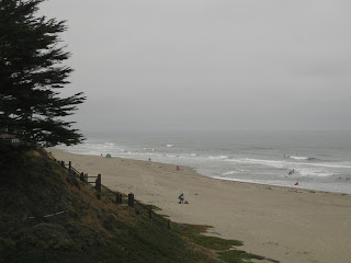
The descent to the coast was ... cold. Surfers, in their wetsuits, were enjoying some waves along Monterey Bay. The onshore wind was chilled by the cold water, encouraging us to make quick work of our sandwiches. Surely the faster riders of the group would catch us here? (They did not.)
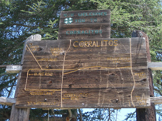
We continued on our way to Corralitos, where we would begin our return climb over the Santa Cruz Mountains. We paused at the town square, where I noticed this rustic map for the first time. The local 4-H Club welcomes us to tiny Corralitos. It's that kind of place. By now, the fastest riders from our group should start passing us. (They did not.)
The marine layer had receded as the day warmed up; the exposed segments of the climb were hot. The towering redwoods of Eureka Canyon offered intermittent shade as I picked my way around the potholes and crumbling pavement. It's a long, (mostly) gradual climb to the summit. Undoubtedly some riders from the main group would breeze by. (They did not.)
At the top, I left my ride buddies behind. It was 2:20 P.M., and I was hoping to get back to our starting point by 3:30 P.M. With 16 miles and more than 650 feet of climbing ahead, that meant a bit of a race for me. And it all but ensured that I would not see anyone from our main group of riders today.
I stopped the clock at 3:25 P.M., logging some 64 miles with 4,620 feet of climbing.
An hour later, I saw a rider from the main group as he passed through town. Finally.
May 31, 2014
Picnic in the Park
A perfect day for a social pace up the lower half of the mountain. Destination: picnic tables beneath the trees at Joseph D. Grant County Park.
For many years, this was my traditional rest stop on the way to the top of Mt. Hamilton. Situated at about the halfway point, I appreciated this spot with its running water and actual restrooms, even though the detour into the park added some distance and climbing. A stone's throw up the road is a more practical stop, a trail head with a port-a-potty—and a water spigot.
Our group today was not headed for the top, which afforded some time for exploring. I have hiked some trails in this park, but never sought out the ranch buildings. The last Grant family member to live in the house bequeathed the property to two charitable organizations. Fortunately, the county purchased the ranch in 1975 to preserve it as a public park for all to enjoy. (It seems that it narrowly escaped becoming yet another housing development.)
We put our lunches to good use by climbing to the summit on Quimby Road before returning to our starting point. I was dismayed to see road signs tagged by graffiti vandals, to the point where some have been completely obscured. In particular, the cautionary 10 mph warning at the final sharp bend has been completely blotted out; frankly, that's a safety issue. (I know that curve rather too well.)
For the day, a modest 21 miles with some 2,500 feet of climbing. Enough of the afternoon was left for me to get cleaned up and make a trip to the local Goodwill donation trailer. Progress.
Subscribe to:
Posts (Atom)
