It was time. Time for Redwood Gulch. I didn't climb it last year. Or the year before that. The first time I climbed it, my heart rate peaked at 199 beats per minute. I zigzagged across the grade and paused after each steep section to recover. At least I didn't topple over.
First order of business was our club's annual Fourth of July Pancake Breakfast. After a couple of pancakes and some fresh fruit salad, I set out with three ride buddies to climb a few hills. They were itching to climb Montebello; if I followed them, I knew that would be my only climb for the day. I wanted to explore some less-visited (for me, at least) terrain.
There was not much water in Stevens Creek; the creek bed was completely dry in places. The pavement continues beyond a gate at the end of the road. I was curious, but decided to save that for another day. Heading back down, the stop sign came into view much sooner than I expected. Was there a one-way control I overlooked as I climbed through the canyon?
No. This was it. Redwood Gulch. I shifted down and made the turn.
As another cyclist remarked at breakfast, it's as steep as ever. But I am in better shape. No need to tack across the grade. No need to stop. No risk of toppling over. And my heart rate peaked at a manageable 181 bpm. I was drenched with sweat, but happy. The familiar landmarks are undisturbed. The most curious sight was a faded plastic toy, a model of the Golden Gate Bridge, standing upright next to the road. (Too steep to stop for a photo.)
Why not tackle Sanborn, too?
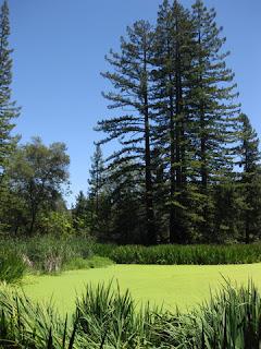
Let me tell you why. You make the turn off Highway 9 and there it is before you: straight up. I didn't climb this one last year, either. This time, I ventured past the gate and the algae-choked pond to the Youth Hostel (closed since 2010). The building (now 106 years old) appears to have been shrink-wrapped in white plastic. It is unclear what its future might be, and I'm sad that I didn't see it before they shuttered it.
I was surprised to discover that the paved road continued. Uphill, of course. San Andreas Trail, read the sign. (Yes, that San Andreas—the fault.) I turned back at the bridge over Todd Creek. The pavement was pretty sketchy by then, and the road ahead looked steeper than I might want. I wasn't far from the end at that point.
My return to civilization was abrupt. Stopped at the lower one-lane traffic control light on Highway 9, four rude motorcyclists advanced themselves to the front of the line. All the windows rolled up in the leading car, but I had no way to seal off their noxious exhaust. I could move, though. Just far enough to be ahead of them—technically, off the road. [Whew. Fresh air.]
Let me say this: I won't be visiting Highway 9 again soon. When the light turned green, I waited for the line of cars to pass. Two stragglers approached ... one got through, and the light was already red. Yikes! I had pressed the button, back at the light, which supposedly allows more time for cyclists to pass through. Now what?
I decided to go for it, and that was the right choice. The one-lane section was longer, and narrower, than I expected. But the signals were red in both directions [thanks to that button press]. The line of cars waiting to head uphill was ... long. Really long. Let me say this: I won't be visiting Highway 9 again soon.
For the day, 41 miles with a virtuous 2,670 feet of climbing. Powered by pancakes.
July 4, 2014
Subscribe to:
Post Comments (Atom)


No comments:
Post a Comment